Clark County, Wisconsin
| Clark County, Wisconsin | |
|---|---|
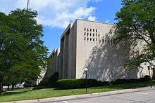 Clark County Courthouse | |
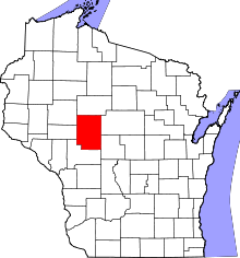 Location in the U.S. state of Wisconsin | |
 Wisconsin's location in the U.S. | |
| Founded | 1854 |
| Named for | William Clark |
| Seat | Neillsville |
| Largest city | Neillsville |
| Area | |
| • Total | 1,219 sq mi (3,157 km2) |
| • Land | 1,210 sq mi (3,134 km2) |
| • Water | 9.0 sq mi (23 km2), 0.7% |
| Population | |
| • (2010) | 34,690 |
| • Density | 29/sq mi (11/km2) |
| Congressional district | 7th |
| Time zone | Central: UTC−6/−5 |
| Website |
www |
Clark County is a county in the U.S. state of Wisconsin. As of the 2010 census, the population was 34,690.[1] Its county seat is Neillsville.[2]
History

Clark County was founded in 1853 and organized the following year.[3] It was named for A. W. Clark, an early settler,[4] or for General George Rogers Clark.[5]
Geography
According to the U.S. Census Bureau, the county has a total area of 1,219 square miles (3,160 km2), of which 1,210 square miles (3,100 km2) is land and 9.0 square miles (23 km2) (0.7%) is water.[6]
Adjacent counties
- Taylor County – north
- Marathon County – east
- Wood County – southeast
- Jackson County – south
- Eau Claire County – west
- Chippewa County – northwest
Major highways
Airport
Demographics
| Historical population | |||
|---|---|---|---|
| Census | Pop. | %± | |
| 1860 | 789 | — | |
| 1870 | 3,450 | 337.3% | |
| 1880 | 10,715 | 210.6% | |
| 1890 | 17,708 | 65.3% | |
| 1900 | 25,848 | 46.0% | |
| 1910 | 30,074 | 16.3% | |
| 1920 | 35,120 | 16.8% | |
| 1930 | 34,165 | −2.7% | |
| 1940 | 33,972 | −0.6% | |
| 1950 | 32,459 | −4.5% | |
| 1960 | 31,527 | −2.9% | |
| 1970 | 30,361 | −3.7% | |
| 1980 | 32,910 | 8.4% | |
| 1990 | 31,647 | −3.8% | |
| 2000 | 33,557 | 6.0% | |
| 2010 | 34,690 | 3.4% | |
| Est. 2016 | 34,557 | [7] | −0.4% |
| U.S. Decennial Census[8] 1790–1960[9] 1900–1990[10] 1990–2000[11] 2010–2014[1] | |||

As of the census[12] of 2000, there were 33,557 people, 12,047 households, and 8,673 families residing in the county. The population density was 28 people per square mile (11/km²). There were 13,531 housing units at an average density of 11 per square mile (4/km²). The racial makeup of the county was 98.05% White, 0.13% Black or African American, 0.48% Native American, 0.30% Asian, 0.01% Pacific Islander, 0.56% from other races, and 0.47% from two or more races. 1.20% of the population were Hispanic or Latino of any race. 54.0% were of German, 9.0% Polish, 6.2% Norwegian and 6.1% United States or American ancestry according to Census 2000. 6.62% reported speaking German, Pennsylvania German, or Dutch at home; an additional 1.34% speak Spanish.[13]
There were 12,047 households out of which 35.00% had children under the age of 18 living with them, 61.20% were married couples living together, 6.50% had a female householder with no husband present, and 28.00% were non-families. 23.80% of all households were made up of individuals and 12.60% had someone living alone who was 65 years of age or older. The average household size was 2.73 and the average family size was 3.27.
In the county, the population was spread out with 29.90% under the age of 18, 7.70% from 18 to 24, 26.20% from 25 to 44, 20.20% from 45 to 64, and 16.00% who were 65 years of age or older. The median age was 36 years. For every 100 females there were 100.50 males. For every 100 females age 18 and over, there were 98.70 males.
Communities
Cities
- Abbotsford (partly in Marathon County)
- Colby (partly in Marathon County)
- Greenwood
- Loyal
- Neillsville (county seat)
- Owen
- Thorp
- Stanley (mostly in Chippewa County)
Villages
- Curtiss
- Dorchester (partly in Marathon County)
- Granton
- Unity (mostly in Marathon County)
- Withee
Towns
Census-designated places
Unincorporated communities
Ghost towns/neighborhoods
Religion
In 2013 there were 16 Amish church districts in Clark County.[14]
Politics
| Year | Republican | Democratic | Third parties |
|---|---|---|---|
| 2016 | 63.3% 8,652 | 30.9% 4,221 | 5.9% 800 |
| 2012 | 53.7% 7,412 | 44.7% 6,172 | 1.6% 217 |
| 2008 | 45.0% 6,383 | 52.5% 7,454 | 2.5% 350 |
| 2004 | 52.7% 7,966 | 46.1% 6,966 | 1.3% 193 |
| 2000 | 52.7% 7,461 | 41.9% 5,931 | 5.4% 757 |
| 1996 | 35.9% 4,622 | 43.1% 5,540 | 21.0% 2,699 |
| 1992 | 33.4% 4,977 | 37.2% 5,540 | 29.3% 4,368 |
| 1988 | 48.3% 6,296 | 51.0% 6,642 | 0.8% 98 |
| 1984 | 58.2% 8,099 | 40.6% 5,647 | 1.2% 160 |
| 1980 | 52.7% 7,921 | 40.5% 6,091 | 6.7% 1,011 |
| 1976 | 44.4% 6,095 | 52.7% 7,238 | 3.0% 409 |
| 1972 | 56.5% 7,138 | 36.5% 4,617 | 7.0% 886 |
| 1968 | 51.2% 6,325 | 37.2% 4,601 | 11.6% 1,428 |
| 1964 | 38.6% 4,897 | 61.3% 7,781 | 0.2% 26 |
| 1960 | 55.2% 7,368 | 44.5% 5,934 | 0.3% 41 |
| 1956 | 62.3% 7,941 | 37.4% 4,765 | 0.4% 48 |
| 1952 | 71.7% 9,406 | 27.8% 3,652 | 0.4% 58 |
| 1948 | 52.7% 5,885 | 43.3% 4,840 | 4.0% 450 |
| 1944 | 62.8% 7,948 | 36.4% 4,612 | 0.8% 97 |
| 1940 | 65.9% 9,501 | 32.5% 4,683 | 1.6% 236 |
| 1936 | 39.6% 5,196 | 52.8% 6,931 | 7.7% 1,005 |
| 1932 | 26.1% 3,132 | 69.8% 8,372 | 4.1% 495 |
| 1928 | 62.5% 6,948 | 35.4% 3,938 | 2.1% 235 |
| 1924 | 31.3% 3,130 | 5.5% 552 | 63.2% 6,328 |
| 1920 | 79.7% 6,246 | 9.5% 745 | 10.8% 842 |
| 1916 | 64.8% 3,371 | 31.0% 1,614 | 4.1% 214 |
| 1912 | 45.6% 2,035 | 34.2% 1,528 | 20.2% 899 |
| 1908 | 65.7% 3,491 | 29.7% 1,576 | 4.6% 244 |
| 1904 | 75.7% 4,091 | 19.4% 1,050 | 4.9% 265 |
| 1900 | 74.8% 3,864 | 22.4% 1,157 | 2.8% 146 |
| 1896 | 69.4% 3,328 | 27.5% 1,318 | 3.1% 149 |
| 1892 | 51.5% 2,039 | 43.2% 1,711 | 5.3% 208 |
See also
References
- 1 2 "State & County QuickFacts". United States Census Bureau. Retrieved January 18, 2014.
- ↑ "Find a County". National Association of Counties. Archived from the original on 2011-05-31. Retrieved 2011-06-07.
- ↑ "Wisconsin: Individual County Chronologies". Wisconsin Atlas of Historical County Boundaries. The Newberry Library. 2007. Retrieved August 13, 2015.
- ↑ Gannett, Henry (1905). The Origin of Certain Place Names in the United States. Govt. Print. Off. p. 83.
- ↑ "Here's How Iron Got Its Name". The Rhinelander Daily News. June 16, 1932. p. 2. Retrieved August 24, 2014 – via Newspapers.com.

- ↑ "2010 Census Gazetteer Files". United States Census Bureau. August 22, 2012. Retrieved August 2, 2015.
- ↑ "Population and Housing Unit Estimates". Retrieved June 9, 2017.
- ↑ "U.S. Decennial Census". United States Census Bureau. Archived from the original on May 12, 2015. Retrieved August 2, 2015.
- ↑ "Historical Census Browser". University of Virginia Library. Retrieved August 2, 2015.
- ↑ Forstall, Richard L., ed. (March 27, 1995). "Population of Counties by Decennial Census: 1900 to 1990". United States Census Bureau. Retrieved August 2, 2015.
- ↑ "Census 2000 PHC-T-4. Ranking Tables for Counties: 1990 and 2000" (PDF). United States Census Bureau. April 2, 2001. Retrieved August 2, 2015.
- ↑ "American FactFinder". United States Census Bureau. Archived from the original on 2013-09-11. Retrieved 2011-05-14.
- ↑
- ↑ Donald B. Kraybill, Karen M. Johnson-Weiner, Steven M. Nolt: The Amish. Baltimore: Johns Hopkins University Press, 2013, p. 142.
- ↑ Leip, David. "Dave Leip's Atlas of U.S. Presidential Elections". uselectionatlas.org. Retrieved 11 April 2018.
Further reading
- Biographical History of Clark and Jackson Counties, Wisconsin. Chicago: Lewis Publishing, 1891.
- Clark County: The Garden of Wisconsin. Neillsville, Wis.: Satterlee and Tifft, 1890.
- Curtiss-Wedge, Franklyn (comp.) History of Clark County Wisconsin. Chicago: H. C. Cooper, Jr., 1918.
External links
| Wikimedia Commons has media related to Clark County, Wisconsin. |
- Clark County government website
- Clark County Economic Development Corporation
- Clark County map from the Wisconsin Department of Transportation
Places adjacent to Clark County, Wisconsin | ||||||||||
|---|---|---|---|---|---|---|---|---|---|---|
| ||||||||||
Municipalities and communities of Clark County, Wisconsin, United States | ||
|---|---|---|
| Cities | | |
| Villages | ||
| Towns | ||
| CDPs | ||
| Unincorporated communities | ||
| Ghost towns/neighborhoods | ||
| Indian reservation | ||
| Footnotes | ‡This populated place also has portions in an adjacent county or counties | |
