Ashwaubenon, Wisconsin
| Ashwaubenon, Wisconsin | |
|---|---|
| Village | |
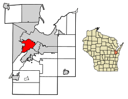 Location of Ashwaubenon in Brown County, Wisconsin. | |
| Coordinates: 44°29′N 88°5′W / 44.483°N 88.083°WCoordinates: 44°29′N 88°5′W / 44.483°N 88.083°W | |
| Country | United States |
| State | Wisconsin |
| County | Brown |
| Area[1] | |
| • Total | 12.81 sq mi (33.18 km2) |
| • Land | 12.39 sq mi (32.10 km2) |
| • Water | 0.41 sq mi (1.07 km2) |
| Elevation[2] | 607 ft (185 m) |
| Population (2010)[3] | |
| • Total | 16,963 |
| • Estimate (2016)[4] | 17,274 |
| • Density | 1,393.63/sq mi (538.07/km2) |
| Time zone | UTC−6 (Central (CST)) |
| • Summer (DST) | UTC−5 (CDT) |
| Area code(s) | 920 |
| FIPS code | 55-03425[5] |
| GNIS feature ID | 1577391[2] |
| Website |
ashwaubenon |
Ashwaubenon /æʃˈwɔːbɪnɒn/[6] is a village in Brown County in the U.S. state of Wisconsin. The population was 16,963 at the 2010 census. A suburb of Green Bay, Wisconsin, Ashwaubenon is part of the Green Bay Metropolitan Statistical Area. Part of the Oneida Nation of Wisconsin is in Ashwaubenon.
History
The U.S. military bought most of the west side of Green Bay, Wisconsin from the Sioux in the 1850s and 1860s, except the area that would later become Ashwaubenon. That land belonged to two daughters of Chief Ashwaubamy, a Sioux chief. They began selling their land to local farmers and landowners in the late 19th century.[7]
Name origin
The name Ashwaubenon is of Ojibwe origin. It is derived from ashiwabiwining "place where they watch, keep a lookout".[8] Another theory derives the name from Chief Ashwaubamy.[7] In the Menominee language, which is related to the Ojibwe language, the place is known as Es-Wāpanoh, "thither see the dawning".[9]
Geography
Ashwaubenon is located at 44°29′N 88°5′W / 44.483°N 88.083°W (44.49, −88.08).[10]
According to the United States Census Bureau, the village has a total area of 12.75 square miles (33.02 km2), of which, 12.39 square miles (32.09 km2) of it is land and 0.36 square miles (0.93 km2) is water.[11]
Demographics
| Historical population | |||
|---|---|---|---|
| Census | Pop. | %± | |
| 1980 | 14,486 | — | |
| 1990 | 16,376 | 13.0% | |
| 2000 | 17,634 | 7.7% | |
| 2010 | 16,963 | −3.8% | |
| Est. 2016 | 17,274 | [4] | 1.8% |
| U.S. Decennial Census[12] | |||
2010 census
As of the census[3] of 2010, there were 16,963 people, 7,421 households, and 4,550 families residing in the village. The population density was 1,369.1 inhabitants per square mile (528.6/km2). There were 7,797 housing units at an average density of 629.3 per square mile (243.0/km2). The racial makeup of the village was 90.6% White, 1.2% African American, 2.1% Native American, 3.1% Asian, 0.9% from other races, and 2.0% from two or more races. Hispanic or Latino of any race were 2.8% of the population.
There were 7,421 households of which 27.7% had children under the age of 18 living with them, 47.5% were married couples living together, 9.8% had a female householder with no husband present, 4.0% had a male householder with no wife present, and 38.7% were non-families. 31.5% of all households were made up of individuals and 8.8% had someone living alone who was 65 years of age or older. The average household size was 2.25 and the average family size was 2.83.
The median age in the village was 40.1 years. 21.2% of residents were under the age of 18; 9.2% were between the ages of 18 and 24; 25.8% were from 25 to 44; 29.1% were from 45 to 64; and 14.6% were 65 years of age or older. The gender makeup of the village was 48.7% male and 51.3% female.
2000 census
As of the census[5] of 2000, there were 17,634 people, 7,137 households, and 4,667 families residing in the village. The population density was 1,425.5 people per square mile (550.4/km²). There were 7,260 housing units at an average density of 586.9 per square mile (226.6/km²). The racial makeup of the village was 95.07% White, 0.65% African American, 1.25% Native American, 1.81% Asian, 0.02% Pacific Islander, 0.47% from other races, and 0.73% from two or more races. Hispanic or Latino of any race were 1.15% of the population.
There were 7,137 households out of which 33.5% had children under the age of 18 living with them, 53.9% were married couples living together, 8.3% had a female householder with no husband present, and 34.6% were non-families. 28.3% of all households were made up of individuals and 6.9% had someone living alone who was 65 years of age or older. The average household size was 2.41 and the average family size was 3.00.
In the village, the population was spread out with 25.3% under the age of 18, 9.2% from 18 to 24, 30.9% from 25 to 44, 23.6% from 45 to 64, and 11.1% who were 65 years of age or older. The median age was 36 years. For every 100 females, there were 94.2 males. For every 100 females age 18 and over, there were 90.9 males.
The median income for a household in the village was $48,353, and the median income for a family was $62,186. Males had a median income of $41,024 versus $26,070 for females. The per capita income for the village was $23,539. About 3.4% of families and 4.0% of the population were below the poverty line, including 4.5% of those under age 18 and 3.5% of those age 65 or over.
Education
The Ashwaubenon School District comprises one pre-K/kindergarten school, Cormier School; two elementary schools, Valley View and Pioneer; one middle school, Parkview; and one high school, Ashwaubenon High School (AHS). AHS offers Advanced Placement(AP) classes such as history, art history, statistics, chemistry, and U.S. government. It also offers two English courses through the nearby St. Norbert College.
Transportation
- Austin Straubel International Airport is in Ashwaubenon
- U.S. Route 41 and Wisconsin Highway 172 run through the village
- Limited transit service is provided by Green Bay Metro
Public safety
- The Ashwaubenon Public Safety Department has its full-time members triple trained, whether police officers, firefighters, EMTs or Paramedics. This is a very uncommon situation, which needed the Wisconsin legislature's approval to continue to be legal.[13]
Attractions
The village is on the border of Lambeau Field, the home stadium of the Green Bay Packers football team. The team's outdoor practice fields and the Don Hutson Center are all in Ashwaubenon. A mall, Bay Park Square serves the Green Bay metro area. In 2019 the Green Bay Bullfrogs baseball team will be renamed and move to the new Capital Credit Union Park being built in Ashwaubenon.[14]
- The National Railroad Museum
- The Resch Center, a convention center and arena
- Ashwaubomay Park features Ashwaubomay lake- a man-made lake complete with a diving platform. The park also hosts sports such as baseball and soccer.
References
- ↑ "2016 U.S. Gazetteer Files". United States Census Bureau. Retrieved Jul 19, 2017.
- 1 2 "US Board on Geographic Names". United States Geological Survey. 2007-10-25. Retrieved 2008-01-31.
- 1 2 "American FactFinder". United States Census Bureau. Retrieved 2012-11-18.
- 1 2 "Population and Housing Unit Estimates". Retrieved June 9, 2017.
- 1 2 "American FactFinder". United States Census Bureau. Archived from the original on 2013-09-11. Retrieved 2008-01-31.
- ↑ Miss Pronouncer: Hear how to pronounce; The Wisconsin pronunciation guide for cities, counties, Indians & lawmakers
- 1 2 "Archived copy". Archived from the original on 2009-06-24. Retrieved 2009-10-16.
- ↑ Verwyst, Chrysostom. 1892. "Geographical Names in Wisconsin, Minnesota, and Michigan, Having a Chippewa Origin". Collections of the State Historical Society of Wisconsin, 12: 390–398.
- ↑ Hoffman, Mike. "Menominee Place Names in Wisconsin". The Menominee Clans Story. Retrieved 2018-10-05.
- ↑ "US Gazetteer files: 2010, 2000, and 1990". United States Census Bureau. 2011-02-12. Retrieved 2011-04-23.
- ↑ "US Gazetteer files 2010". United States Census Bureau. Archived from the original on 2012-01-24. Retrieved 2012-11-18.
- ↑ "Census of Population and Housing". Census.gov. Archived from the original on May 12, 2015. Retrieved June 4, 2015.
- ↑ Ashwaubenon Public Safety Department Protected Archived March 12, 2007, at the Wayback Machine.
- ↑ "New for 2019: Capital Credit Union Park". Ballpark Digest. August Publications. July 17, 2018. Retrieved July 19, 2018.
External links
| Core city |  | |
|---|---|---|
| Largest municipalities over 10,000 in 2010 | ||
| Municipalities under 10,000 in 2010 | ||
| Counties | ||
Municipalities and communities of Brown County, Wisconsin, United States | ||
|---|---|---|
| Cities | 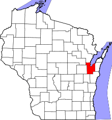 | |
| Villages | ||
| Towns | ||
| CDPs | ||
| Unincorporated communities |
| |
| Indian reservation | ||
| Ghost towns/ neighborhoods | ||
| Footnotes | ‡This populated place also has portions in an adjacent county or counties | |