Ozaukee County, Wisconsin
| Ozaukee County, Wisconsin | |
|---|---|
 Ozaukee County Courthouse in July 2009 | |
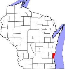 Location in the U.S. state of Wisconsin | |
 Wisconsin's location in the U.S. | |
| Founded | 1853 |
| Seat | Port Washington |
| Largest city | Mequon |
| Area | |
| • Land | 235 sq mi (609 km2) |
| Population | |
| • (2010) | 86,395 |
| • Density | 371/sq mi (143/km2) |
| Congressional district | 6th |
| Time zone | Central: UTC−6/−5 |
| Website |
www |
Ozaukee County is a county in the U.S. state of Wisconsin. As of the 2010 census, the population was 86,395.[1] Its county seat is Port Washington.[2]
Ozaukee County is included in the Milwaukee-Waukesha-West Allis, WI Metropolitan Statistical Area.
As of the 2000 Census, Ozaukee County had the 2nd lowest poverty rate of any county in the United States, at 2.6%. In terms of per capita income, it is the 25th wealthiest county in the country. Bolstered by low crime rates and school districts with high graduation rates, Forbes magazine ranked Ozaukee County #2 on its list of "America's Best Places To Raise A Family" in June, 2008.[3]
History
Ozaukee County was once part of neighboring Washington County to the west. Its name comes from the Ojibwe name for the Sacs.[4] The word probably means "people living at the mouth of a river."[4]
Geography
Ozaukee County is the smallest land area county in the State of Wisconsin, covering 235 square miles of land area.[5]
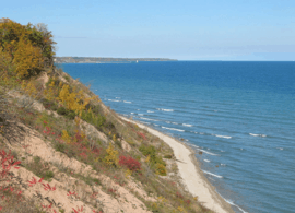
Lion's Den Gorge Nature Preserve is a large bluffland and wetland county protected area on the shore of Lake Michigan.
Major highways
Adjacent counties
- Sheboygan County - north
- Oceana County, Michigan - northeast
- Muskegon County, Michigan - east
- Milwaukee County - south
- Waukesha County - southwest
- Washington County - west
Demographics
| Historical population | |||
|---|---|---|---|
| Census | Pop. | %± | |
| 1860 | 15,682 | — | |
| 1870 | 15,564 | −0.8% | |
| 1880 | 15,461 | −0.7% | |
| 1890 | 14,943 | −3.4% | |
| 1900 | 16,363 | 9.5% | |
| 1910 | 17,123 | 4.6% | |
| 1920 | 16,335 | −4.6% | |
| 1930 | 17,394 | 6.5% | |
| 1940 | 18,985 | 9.1% | |
| 1950 | 23,361 | 23.0% | |
| 1960 | 38,441 | 64.6% | |
| 1970 | 54,421 | 41.6% | |
| 1980 | 66,981 | 23.1% | |
| 1990 | 72,831 | 8.7% | |
| 2000 | 82,317 | 13.0% | |
| 2010 | 86,395 | 5.0% | |
| Est. 2016 | 88,314 | [6] | 2.2% |
| U.S. Decennial Census[7] 1790–1960[8] 1900–1990[9] 1990–2000[10] 2010–2014[1] | |||
As of the census[11] of 2000, there were 82,317 people, 30,857 households, and 23,019 families residing in the county. The population density was 355 people per square mile (137/km²). There were 32,034 housing units at an average density of 138 per square mile (53/km²). The racial makeup of the county was 96.72% White, 0.93% Black or African American, 0.20% Native American, 1.07% Asian, 0.02% Pacific Islander, 0.34% from other races, and 0.73% from two or more races. 1.30% of the population were Hispanic or Latino of any race. 47.2% were of German, 7.3% Irish and 6.7% Polish ancestry according to Census 2000. 95.1% spoke English, 1.6% Spanish and 1.4% German as their first language.
There were 30,857 households out of which 36.00% had children under the age of 18 living with them, 65.60% were married couples living together, 6.50% had a female householder with no husband present, and 25.40% were non-families. 21.40% of all households were made up of individuals and 8.40% had someone living alone who was 65 years of age or older. The average household size was 2.61 and the average family size was 3.07.
In the county, the population was spread out with 26.60% under the age of 18, 6.80% from 18 to 24, 28.00% from 25 to 44, 25.90% from 45 to 64, and 12.60% who were 65 years of age or older. The median age was 39 years. For every 100 females there were 97.30 males. For every 100 females age 18 and over, there were 94 males.
The median income for a household in the county was $62,745, and the median income for a family was $72,547 (these figures had risen to $73,197 and $88,231 respectively as of a 2007 estimate[12]). Males had a median income of $50,044 versus $30,476 for females. The per capita income for the county was $31,947. About 1.7% of families and 2.6% of the population were below the poverty line, including 2.6% of those under age 18 and 4.1% of those age 65 or over.
Transportation
Ozaukee County has a harbor in Port Washington on Lake Michigan, though not in the lakeside communities of Mequon or Grafton due to high bluffs along the lakeshore.
The Ozaukee County Interurban Trail is a multimodal trail for pedestrians and non-motorized vehicles. It runs through Grafton and connects to Sheboygan County and Brown Deer Trails via the old Milwaukee-Sheboygan Passenger Rail line.
Public transit is provided by a commuter express bus (Route 143) to Milwaukee with stops in Port Washington, Saukville, Grafton, and Mequon. The bus operates Monday through Fridays excluding holidays, and is run jointly by Milwaukee and Ozaukee County. The county offers a daily shared taxi, with connections to Washington County Transit and Milwaukee County Routes 12, 49 and 42u.
Politics
Lyndon Johnson was the last Democrat to carry the county in a presidential election, in 1964.
| Year | Republican | Democratic | Third parties |
|---|---|---|---|
| 2016 | 55.8% 30,464 | 37.0% 20,170 | 7.2% 3,926 |
| 2012 | 64.6% 36,077 | 34.3% 19,159 | 1.0% 581 |
| 2008 | 60.3% 32,172 | 38.6% 20,579 | 1.2% 614 |
| 2004 | 65.8% 34,904 | 33.4% 17,714 | 0.8% 414 |
| 2000 | 65.2% 31,155 | 31.5% 15,030 | 3.3% 1,566 |
| 1996 | 56.7% 22,078 | 34.1% 13,269 | 9.3% 3,614 |
| 1992 | 53.2% 22,805 | 27.7% 11,879 | 19.2% 8,226 |
| 1988 | 63.9% 22,899 | 35.4% 12,661 | 0.7% 252 |
| 1984 | 68.5% 23,898 | 30.9% 10,765 | 0.7% 233 |
| 1980 | 61.0% 21,371 | 30.8% 10,779 | 8.2% 2,883 |
| 1976 | 62.2% 19,817 | 35.4% 11,271 | 2.5% 789 |
| 1972 | 61.9% 15,759 | 33.4% 8,503 | 4.7% 1,204 |
| 1968 | 58.1% 12,155 | 34.6% 7,246 | 7.3% 1,518 |
| 1964 | 47.4% 8,581 | 52.5% 9,517 | 0.1% 25 |
| 1960 | 58.9% 10,401 | 40.9% 7,228 | 0.2% 28 |
| 1956 | 69.6% 9,808 | 29.4% 4,139 | 1.0% 139 |
| 1952 | 67.0% 8,665 | 32.8% 4,241 | 0.3% 33 |
| 1948 | 52.9% 4,866 | 45.2% 4,159 | 2.0% 183 |
| 1944 | 60.7% 5,655 | 38.4% 3,579 | 1.0% 89 |
| 1940 | 56.3% 4,913 | 42.0% 3,662 | 1.7% 148 |
| 1936 | 22.5% 1,785 | 70.7% 5,594 | 6.8% 539 |
| 1932 | 16.5% 1,182 | 80.6% 5,770 | 2.9% 208 |
| 1928 | 37.2% 2,338 | 61.4% 3,864 | 1.4% 90 |
| 1924 | 20.7% 1,015 | 12.1% 592 | 67.2% 3,293 |
| 1920 | 75.6% 3,523 | 17.9% 835 | 6.5% 302 |
| 1916 | 49.4% 1,610 | 48.4% 1,577 | 2.2% 71 |
| 1912 | 25.2% 749 | 63.3% 1,878 | 11.5% 341 |
| 1908 | 38.5% 1,216 | 58.7% 1,856 | 2.8% 88 |
| 1904 | 47.5% 1,492 | 47.8% 1,501 | 4.7% 147 |
| 1900 | 38.4% 1,280 | 59.8% 1,992 | 1.8% 60 |
| 1896 | 42.8% 1,535 | 54.3% 1,947 | 2.9% 105 |
| 1892 | 23.3% 652 | 74.7% 2,094 | 2.0% 57 |
Communities
Cities
- Cedarburg
- Mequon
- Port Washington (county seat)
Villages
- Bayside (mostly in Milwaukee County)
- Belgium
- Fredonia
- Grafton
- Newburg (mostly in Washington County)
- Saukville
- Thiensville
Towns
Census-designated place
Unincorporated communities
See also
References
- 1 2 "State & County QuickFacts". United States Census Bureau. Retrieved January 22, 2014.
- ↑ "Find a County". National Association of Counties. Retrieved 2011-06-07.
- ↑ "America's Best Places To Raise A Family". Forbes. 2008-06-30.
- 1 2 "Ozaukee County". Wisconsin Historical Society. Retrieved April 10, 2018.
- ↑ "Overview of Ozaukee County | Ozaukee County, WI - Official Website". www.co.ozaukee.wi.us. Retrieved 2018-09-19.
- ↑ "Population and Housing Unit Estimates". Retrieved June 9, 2017.
- ↑ "U.S. Decennial Census". United States Census Bureau. Retrieved August 6, 2015.
- ↑ "Historical Census Browser". University of Virginia Library. Retrieved August 6, 2015.
- ↑ Forstall, Richard L., ed. (March 27, 1995). "Population of Counties by Decennial Census: 1900 to 1990". United States Census Bureau. Retrieved August 6, 2015.
- ↑ "Census 2000 PHC-T-4. Ranking Tables for Counties: 1990 and 2000" (PDF). United States Census Bureau. April 2, 2001. Retrieved August 6, 2015.
- ↑ "American FactFinder". United States Census Bureau. Retrieved 2011-05-14.
- ↑ "Ozaukee County, Wisconsin - Fact Sheet - American FactFinder". Factfinder.census.gov. Retrieved 2010-07-22.
- ↑ Leip, David. "Dave Leip's Atlas of U.S. Presidential Elections". uselectionatlas.org. Retrieved 11 April 2018.
Further reading
- History of Washington and Ozaukee Counties, Wisconsin. Chicago: Western Historical Company, 1881.
External links
- Ozaukee County website
- Ozaukee County map from the Wisconsin Department of Transportation
- Ozaukee County Transit
- Ozaukee County Interurban Trail
Places adjacent to Ozaukee County, Wisconsin | ||||||||||
|---|---|---|---|---|---|---|---|---|---|---|
| ||||||||||
| Central city | 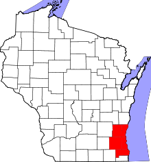 | |
|---|---|---|
| Largest municipalities (over 25,000 in 2010) | ||
| Municipalities (over 10,000 in 2010) | ||
| Smaller municipalities (under 10,000 in 2010) | ||
| Counties | ||
Municipalities and communities of Ozaukee County, Wisconsin, United States | ||
|---|---|---|
| Cities | | |
| Villages | ||
| Towns | ||
| CDP | ||
| Unincorporated communities | ||
| Footnotes | ‡This populated place also has portions in an adjacent county or counties | |

Coordinates: 43°23′55″N 87°53′37″W / 43.398475°N 87.893572°W