Portage County, Wisconsin
| Portage County, Wisconsin | |
|---|---|
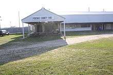
 Portage County Courthouse in Stevens Point | |
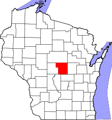 Location in the U.S. state of Wisconsin | |
 Wisconsin's location in the U.S. | |
| Founded | 1844 |
| Seat | Stevens Point |
| Largest city | Stevens Point |
| Area | |
| • Total | 823 sq mi (2,132 km2) |
| • Land | 801 sq mi (2,075 km2) |
| • Water | 22 sq mi (57 km2), 2.7% |
| Population | |
| • (2010) | 70,019 |
| • Density | 87/sq mi (34/km2) |
| Congressional district | 3rd |
| Time zone | Central: UTC−6/−5 |
| Website |
www |
Portage County is a county in the U.S. state of Wisconsin. As of the 2010 census, the population was 70,019.[1] Its county seat is Stevens Point.[2]
Portage County comprises the Stevens Point, WI Micropolitan Statistical Area and is included in the Wausau-Stevens Point-Wisconsin Rapids, WI Combined Statistical Area.
History
Portage County was created from the Wisconsin Territory in 1836 and organized in 1844.[3] Like the city of Portage, Portage County is named for the portage between the Fox and Wisconsin rivers; Portage County originally included the portage and Portage but boundary changes detached the county from its namesake.[4]
Geography
According to the U.S. Census Bureau, the county has a total area of 823 square miles (2,130 km2), of which 801 square miles (2,070 km2) is land and 22 square miles (57 km2) (2.7%) is water.[5]
Major highways
Airport
Adjacent counties
- Marathon County - north
- Shawano County - northeast
- Waupaca County - east
- Waushara County - southeast
- Adams County - southwest
- Wood County - west
Wildlife refuges
- Buena Vista Marsh
- Dewey Marsh
- Mead Wildlife Area
- Paul J. Olson Wildlife Area
Demographics
| Historical population | |||
|---|---|---|---|
| Census | Pop. | %± | |
| 1840 | 1,623 | — | |
| 1850 | 1,250 | −23.0% | |
| 1860 | 7,507 | 500.6% | |
| 1870 | 10,634 | 41.7% | |
| 1880 | 17,731 | 66.7% | |
| 1890 | 24,798 | 39.9% | |
| 1900 | 29,483 | 18.9% | |
| 1910 | 30,945 | 5.0% | |
| 1920 | 33,649 | 8.7% | |
| 1930 | 33,827 | 0.5% | |
| 1940 | 35,800 | 5.8% | |
| 1950 | 34,858 | −2.6% | |
| 1960 | 36,964 | 6.0% | |
| 1970 | 47,541 | 28.6% | |
| 1980 | 57,420 | 20.8% | |
| 1990 | 61,405 | 6.9% | |
| 2000 | 67,182 | 9.4% | |
| 2010 | 70,019 | 4.2% | |
| Est. 2016 | 70,447 | [6] | 0.6% |
| U.S. Decennial Census[7] 1790–1960[8] 1900–1990[9] 1990–2000[10] 2010–2014[1] | |||
As of the census[11] of 2000, there were 67,182 people, 25,040 households, and 16,501 families residing in the county. The population density was 83 people per square mile (32/km²). There were 26,589 housing units at an average density of 33 per square mile (13/km²). The racial makeup of the county was 95.73% White, 0.32% Black or African American, 0.36% Native American, 2.25% Asian, 0.04% Pacific Islander, 0.43% from other races, and 0.86% from two or more races. 1.44% of the population were Hispanic or Latino of any race. 32.8% were of Polish, 31.6% German, 5.4% Norwegian and 5.0% Irish ancestry according to Census 2000. 93.9% spoke English, 1.7% Spanish, 1.6% Polish and 1.3% Hmong as their first language.
There were 25,040 households out of which 32.10% had children under the age of 18 living with them, 55.10% were married couples living together, 7.30% had a female householder with no husband present, and 34.10% were non-families. 24.50% of all households were made up of individuals and 8.80% had someone living alone who was 65 years of age or older. The average household size was 2.54 and the average family size was 3.07.
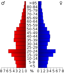
In the county, the population was spread out with 24.10% under the age of 18, 16.20% from 18 to 24, 27.70% from 25 to 44, 21.10% from 45 to 64, and 10.90% who were 65 years of age or older. The median age was 33 years. For every 100 females there were 99.40 males. For every 100 females age 18 and over, there were 96.80 males.
Communities

City
- Stevens Point (county seat)
Villages
Towns
Census-designated places
Unincorporated communities
Ghost town/neighborhood
Politics
| Year | Republican | Democratic | Third parties |
|---|---|---|---|
| 2016 | 44.8% 17,305 | 48.0% 18,529 | 7.1% 2,755 |
| 2012 | 42.2% 16,615 | 56.1% 22,075 | 1.6% 647 |
| 2008 | 35.0% 13,810 | 63.0% 24,817 | 2.0% 795 |
| 2004 | 42.5% 16,546 | 56.1% 21,861 | 1.4% 554 |
| 2000 | 39.1% 13,214 | 53.2% 17,942 | 7.7% 2,604 |
| 1996 | 32.2% 9,631 | 53.1% 15,901 | 14.7% 4,396 |
| 1992 | 32.4% 10,914 | 46.1% 15,553 | 21.5% 7,249 |
| 1988 | 42.3% 12,057 | 57.2% 16,317 | 0.6% 161 |
| 1984 | 48.3% 13,605 | 51.1% 14,399 | 0.6% 175 |
| 1980 | 34.1% 10,465 | 53.6% 16,443 | 12.4% 3,794 |
| 1976 | 36.3% 9,520 | 60.7% 15,912 | 3.1% 805 |
| 1972 | 40.0% 9,346 | 58.1% 13,564 | 1.9% 431 |
| 1968 | 36.1% 6,180 | 58.5% 10,014 | 5.4% 927 |
| 1964 | 27.8% 4,579 | 72.1% 11,887 | 0.2% 32 |
| 1960 | 37.9% 6,436 | 62.0% 10,516 | 0.1% 20 |
| 1956 | 54.1% 8,320 | 45.6% 7,010 | 0.4% 56 |
| 1952 | 52.8% 8,499 | 46.9% 7,537 | 0.3% 51 |
| 1948 | 39.3% 5,424 | 59.1% 8,154 | 1.5% 213 |
| 1944 | 38.3% 5,405 | 61.4% 8,678 | 0.3% 42 |
| 1940 | 35.6% 5,670 | 63.8% 10,148 | 0.6% 94 |
| 1936 | 26.7% 3,969 | 71.3% 10,576 | 2.0% 299 |
| 1932 | 26.8% 3,434 | 71.7% 9,195 | 1.5% 191 |
| 1928 | 43.0% 5,161 | 56.4% 6,764 | 0.6% 70 |
| 1924 | 27.8% 2,854 | 19.6% 2,010 | 52.7% 5,416 |
| 1920 | 65.4% 5,527 | 31.4% 2,656 | 3.2% 269 |
| 1916 | 44.5% 2,520 | 53.0% 3,000 | 2.5% 140 |
| 1912 | 36.4% 1,932 | 43.3% 2,301 | 20.3% 1,079 |
| 1908 | 56.4% 3,269 | 40.8% 2,362 | 2.8% 163 |
| 1904 | 61.1% 3,633 | 36.5% 2,168 | 2.5% 146 |
| 1900 | 54.6% 3,285 | 43.8% 2,633 | 1.6% 98 |
| 1896 | 53.8% 3,537 | 44.0% 2,890 | 2.2% 146 |
| 1892 | 44.8% 2,291 | 50.2% 2,570 | 5.0% 258 |
See also
References
- 1 2 "State & County QuickFacts". United States Census Bureau. Retrieved January 23, 2014.
- ↑ "Find a County". National Association of Counties. Retrieved 2011-06-07.
- ↑ "Wisconsin: Individual County Chronologies". Wisconsin Atlas of Historical County Boundaries. The Newberry Library. 2007. Retrieved August 15, 2015.
- ↑ "Wisconsin: Individual County Chronologies". The Newberry Library. Retrieved 19 April 2013.
- ↑ "2010 Census Gazetteer Files". United States Census Bureau. August 22, 2012. Retrieved August 8, 2015.
- ↑ "Population and Housing Unit Estimates". Retrieved June 9, 2017.
- ↑ "U.S. Decennial Census". United States Census Bureau. Retrieved August 8, 2015.
- ↑ "Historical Census Browser". University of Virginia Library. Retrieved August 8, 2015.
- ↑ Forstall, Richard L., ed. (March 27, 1995). "Population of Counties by Decennial Census: 1900 to 1990". United States Census Bureau. Retrieved August 8, 2015.
- ↑ "Census 2000 PHC-T-4. Ranking Tables for Counties: 1990 and 2000" (PDF). United States Census Bureau. April 2, 2001. Retrieved August 8, 2015.
- ↑ "American FactFinder". United States Census Bureau. Retrieved 2011-05-14.
- ↑ Leip, David. "Dave Leip's Atlas of U.S. Presidential Elections". uselectionatlas.org. Retrieved 9 April 2018.
Further reading
- Commemorative Biographical Record of the Upper Wisconsin Counties of Waupaca, Portage, Wood, Marathon, Lincoln, Oneida, Vilas, Langlade and Shawano. Chicago: J. H. Beers, 1895.
- Rosholt, Malcolm. Our County, Our Story: Portage County, Wisconsin. Stevens Point: Portage County Board of Supervisors, 1959.
- A Standard History of Portage County, Wisconsin. Chicago: Lewis Publishing Company, 1919.
External links
| Wikimedia Commons has media related to Portage County, Wisconsin. |
- Portage County government website
- Portage County map from the Wisconsin Department of Transportation
- Portage County Business Council, Inc.
- Portage County Historical Society
Places adjacent to Portage County, Wisconsin | ||||||||||
|---|---|---|---|---|---|---|---|---|---|---|
| ||||||||||
Municipalities and communities of Portage County, Wisconsin, United States | ||
|---|---|---|
| City | | |
| Villages | ||
| Towns | ||
| CDPs | ||
| Unincorporated communities | ||
| Ghost town/neighborhood | ||
| Footnotes | ‡This populated place also has portions in an adjacent county or counties | |
