Menasha, Wisconsin
| Menasha, Wisconsin | |
|---|---|
| City | |
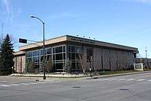
 Downtown Menasha, a historic district | |
 Location of Menasha in Calumet County, Wisconsin. | |
| Coordinates: 44°13′N 88°26′W / 44.217°N 88.433°WCoordinates: 44°13′N 88°26′W / 44.217°N 88.433°W | |
| Country | United States |
| State | Wisconsin |
| Counties | Winnebago, Calumet |
| Government | |
| • Mayor | Don Merkes |
| Area[1] | |
| • Total | 7.52 sq mi (19.48 km2) |
| • Land | 6.03 sq mi (15.62 km2) |
| • Water | 1.49 sq mi (3.86 km2) |
| Elevation[2] | 755 ft (230 m) |
| Population (2010)[3] | |
| • Total | 17,353 |
| • Estimate (2016)[4] | 17,856 |
| • Density | 2,877.8/sq mi (1,111.1/km2) |
| Time zone | UTC−6 (Central (CST)) |
| • Summer (DST) | UTC−5 (CDT) |
| Area code | 920 |
| FIPS code | 55-50825[5] |
| GNIS feature ID | 1569330[2] |
| Website | cityofmenasha-wi.gov |
Menasha is a city in Calumet and Winnebago counties in the U.S. state of Wisconsin. The population was 17,353 at the 2010 census. Of this, 15,144 were in Winnebago County, and 2,209 were in Calumet County. The city is located mostly in Winnebago County; only a small portion is in the Town of Harrison in Calumet County. Doty Island is located partially in Menasha. The city's name comes from the Winnebago word meaning "thorn" or "island".[6] In the Menominee language, it is known as Menāēhsaeh, meaning "little island".[7] Menasha is home to the Barlow Planetarium and Weis Earth Science Museum, both housed at the University of Wisconsin-Fox Valley.
Geography
Menasha is located at 44°13′N 88°26′W / 44.217°N 88.433°W (44.2129, −88.4362).[8] According to the United States Census Bureau, the city has a total area of 7.52 square miles (19.48 km2), of which, 6.03 square miles (15.62 km2) is land and 1.49 square miles (3.86 km2) is water.[1]
Demographics
| Historical population | |||
|---|---|---|---|
| Census | Pop. | %± | |
| 1860 | 1,436 | — | |
| 1870 | 2,484 | 73.0% | |
| 1880 | 3,144 | 26.6% | |
| 1890 | 4,581 | 45.7% | |
| 1900 | 5,589 | 22.0% | |
| 1910 | 6,081 | 8.8% | |
| 1920 | 7,214 | 18.6% | |
| 1930 | 9,062 | 25.6% | |
| 1940 | 10,481 | 15.7% | |
| 1950 | 12,385 | 18.2% | |
| 1960 | 14,647 | 18.3% | |
| 1970 | 14,836 | 1.3% | |
| 1980 | 14,728 | −0.7% | |
| 1990 | 14,711 | −0.1% | |
| 2000 | 16,331 | 11.0% | |
| 2010 | 17,353 | 6.3% | |
| Est. 2016 | 17,856 | [4] | 2.9% |
| U.S. Decennial Census[9] | |||
2010 census
As of the census[3] of 2010, there were 17,353 people, 7,405 households, and 4,415 families residing in the city. The population density was 2,877.8 inhabitants per square mile (1,111.1/km2). There were 7,973 housing units at an average density of 1,322.2 per square mile (510.5/km2). The racial makeup of the city was 90.8% White, 1.2% African American, 0.7% Native American, 2.2% Asian, 0.1% Pacific Islander, 3.0% from other races, and 2.1% from two or more races. Hispanic or Latino of any race were 6.9% of the population.
There were 7,405 households of which 30.7% had children under the age of 18 living with them, 43.6% were married couples living together, 10.9% had a female householder with no husband present, 5.1% had a male householder with no wife present, and 40.4% were non-families. 32.2% of all households were made up of individuals and 9.9% had someone living alone who was 65 years of age or older. The average household size was 2.32 and the average family size was 2.95.
The median age in the city was 36 years. 24.8% of residents were under the age of 18; 8.2% were between the ages of 18 and 24; 29.1% were from 25 to 44; 26.4% were from 45 to 64; and 11.6% were 65 years of age or older. The gender makeup of the city was 49.4% male and 50.6% female.
2000 census
As of the census[5] of 2000, there were 16,331 people, 6,951 households, and 4,233 families residing in the city. The population density was 3,106.9 people per square mile (1,198.8/km²). There were 7,271 housing units at an average density of 1,383.3 per square mile (533.7/km²). The racial makeup of the city was 94.80% White, 0.54% African American, 0.61% Native American, 1.62% Asian, 0.02% Pacific Islander, 1.38% from other races, and 1.04% from two or more races. Hispanic or Latino of any race were 3.61% of the population.
There were 6,951 households out of which 31.7% had children under the age of 18 living with them, 46.1% were married couples living together, 10.8% had a female householder with no husband present, and 39.1% were non-families. 31.8% of all households were made up of individuals and 10.0% had someone living alone who was 65 years of age or older. The average household size was 2.35 and the average family size was 2.99.
In the city, the age distribution of the population shows 25.6% under the age of 18, 9.6% from 18 to 24, 33.6% from 25 to 44, 19.4% from 45 to 64, and 11.8% who were 65 years of age or older. The median age was 34 years. For every 100 females, there were 96.7 males. For every 100 females age 18 and over, there were 93.4 males.
The median income for a household in the city was $39,936, and the median income for a family was $47,401. Males had a median income of $36,705 versus $25,176 for females. The per capita income for the city was $20,743. About 5.4% of families and 6.5% of the population were below the poverty line, including 8.5% of those under age 18 and 8.2% of those age 65 or over.
Government
The city of Menasha has a city council-mayor system of government. There are eight districts in the city, each represented by an aldermen. The council meets weekly with the mayor, Don Merkes.
Religion
The Wisconsin Evangelical Lutheran Synod (WELS) has two churches in Menasha: Bethel Lutheran Church[10] and Mount Calvary Lutheran Church.[11]
Education

- Elementary schools
- Clovis Grove Elementary School
- Gegan Elementary School
- Nicolet Elementary School
- Jefferson Elementary School
- Banta Elementary School
- Butte des Morts Elementary School
- Trinity Lutheran School
- Bethel Lutheran School
- St. Mary Catholic Elementary School
- Junior high/middle schools
- Maplewood Middle School
- Seton Catholic Middle School
- Trinity Lutheran School
- Bethel Lutheran School
- High schools
- Menasha High School
- Fox Valley Alternative School
- Colleges and universities
Notable people
- Joseph H. Anderson, legislator
- John A. Bryan, U.S. diplomat
- Silas Bullard, jurist and legislator
- Elmer J. Burr, Medal of Honor recipient
- Arnold J. Cane, jurist and legislator
- Connie Clausen, television and Broadway actress, literary agent, and author of "I Love You Honey but The Season's Over", a memoir about Menasha
- Jean Pond Miner Coburn, sculptor
- Samuel A. Cook, U.S. Representative
- William Duchman, legislator and sawmill operator
- A. D. Eldridge, legislator and businessman
- William P. Grimes, legislator and businessman
- Eric Hinske, hitting coach for the Los Angeles Angels and former American League Rookie of the Year.
- Joan Jaykoski, baseball player
- James C. Kerwin, Wisconsin Supreme Court
- Dave Koslo, MLB player for the New York Giants, Baltimore Orioles, and the Milwaukee Braves
- Jean Kraft, opera singer
- Publius Virgilius Lawson, six-term mayor, historian, manufacturer, lawyer
- George Liberace, musician and television performer, older brother of Liberace
- Jeff Loomis, heavy metal guitarist
- Thomas J. O'Malley, Lieutenant Governor of Wisconsin
- Curtis Reed, mayor of Menasha, businessman
- Richard J. Steffens, legislator
- Leslie J. Westberg, U.S. Air Force brigadier general
References
- 1 2 "US Gazetteer files 2010". United States Census Bureau. Archived from the original on 2012-07-14. Retrieved 2012-11-18.
- 1 2 "US Board on Geographic Names". United States Geological Survey. 2007-10-25. Retrieved 2008-01-31.
- 1 2 "American FactFinder". United States Census Bureau. Retrieved 2012-11-18.
- 1 2 "Population and Housing Unit Estimates". Retrieved June 9, 2017.
- 1 2 "American FactFinder". United States Census Bureau. Retrieved 2008-01-31.
- ↑ Chicago and North Western Railway Company (1908). A History of the Origin of the Place Names Connected with the Chicago & North Western and Chicago, St. Paul, Minneapolis & Omaha Railways. p. 101.
- ↑ Hoffman, Mike. "Menominee Place Names in Wisconsin". The Menominee Clans Story. Retrieved 2018-10-05.
- ↑ "US Gazetteer files: 2010, 2000, and 1990". United States Census Bureau. 2011-02-12. Retrieved 2011-04-23.
- ↑ "Census of Population and Housing". Census.gov. Retrieved June 4, 2015.
- ↑ "Bethel Lutheran Church".
- ↑ "Mount Calvary Lutheran Church (WELS)".
External links
| Wikimedia Commons has media related to Menasha, Wisconsin. |
- City of Menasha

| Core cities |  | |
|---|---|---|
| Largest municipalities over 10,000 in 2010 | ||
| Municipalities under 10,000 in 2010 |
| |
| Counties | ||
| ||
Municipalities and communities of Calumet County, Wisconsin, United States | ||
|---|---|---|
| Cities | 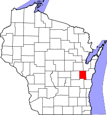 | |
| Villages | ||
| Towns | ||
| CDP | ||
| Unincorporated communities | ||
| Ghost town/neighborhood | ||
| Footnotes | ‡This populated place also has portions in an adjacent county or counties | |
Municipalities and communities of Winnebago County, Wisconsin, United States | ||
|---|---|---|
| Cities | 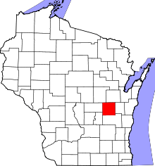 | |
| Villages | ||
| Towns | ||
| CDPs | ||
| Unincorporated communities |
| |
| Ghost towns/neighborhoods | ||
| Footnotes | ‡This populated place also has portions in an adjacent county or counties | |