Dodge County, Wisconsin
| Dodge County, Wisconsin | |
|---|---|
 Dodge County Administration building | |
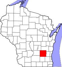 Location in the U.S. state of Wisconsin | |
 Wisconsin's location in the U.S. | |
| Founded | 1844 |
| Seat | Juneau |
| Largest city | Beaver Dam |
| Area | |
| • Total | 907 sq mi (2,349 km2) |
| • Land | 876 sq mi (2,269 km2) |
| • Water | 31 sq mi (80 km2), 3.5% |
| Population | |
| • (2010) | 88,759 |
| • Density | 101/sq mi (39/km2) |
| Congressional districts | 5th, 6th |
| Time zone | Central: UTC−6/−5 |
| Website |
www |
Dodge County is a county located in the U.S. state of Wisconsin. As of the 2010 census, the population was 88,759.[1] Its county seat is Juneau.[2] The county was created from the Wisconsin Territory in 1836 and organized in 1844.[3]
Dodge County comprises the Beaver Dam, WI Micropolitan Statistical Area, which is included in the Milwaukee-Racine-Waukesha, WI Combined Statistical Area.
Geography
According to the U.S. Census Bureau, the county has a total area of 907 square miles (2,350 km2), of which 876 square miles (2,270 km2) is land and 31 square miles (80 km2) (3.5%) is water.[4]
The 6,718 acre Beaver Dam Lake and the 2,713 acre Fox Lake are found within the county.
Adjacent counties
- Fond du Lac County – northeast
- Washington County – east
- Waukesha County – southeast
- Jefferson County – south
- Dane County – southwest
- Columbia County – west
- Green Lake County – northwest
National protected area
Demographics
| Historical population | |||
|---|---|---|---|
| Census | Pop. | %± | |
| 1840 | 67 | — | |
| 1850 | 19,138 | 28,464.2% | |
| 1860 | 42,818 | 123.7% | |
| 1870 | 47,035 | 9.8% | |
| 1880 | 45,931 | −2.3% | |
| 1890 | 44,984 | −2.1% | |
| 1900 | 46,631 | 3.7% | |
| 1910 | 47,436 | 1.7% | |
| 1920 | 49,742 | 4.9% | |
| 1930 | 52,092 | 4.7% | |
| 1940 | 54,280 | 4.2% | |
| 1950 | 57,611 | 6.1% | |
| 1960 | 63,170 | 9.6% | |
| 1970 | 69,004 | 9.2% | |
| 1980 | 75,064 | 8.8% | |
| 1990 | 76,559 | 2.0% | |
| 2000 | 85,897 | 12.2% | |
| 2010 | 88,759 | 3.3% | |
| Est. 2016 | 88,068 | [5] | −0.8% |
| U.S. Decennial Census[6] 1790–1960[7] 1900–1990[8] 1990–2000[9] 2010–2014[1] | |||


As of the census[10] of 2000, there were 85,897 people, 31,417 households, and 22,313 families residing in the county. The population density was 97 people per square mile (38/km²). There were 33,672 housing units at an average density of 38 per square mile (15/km²). The racial makeup of the county was 95.28% White, 2.49% Black or African American, 0.40% Native American, 0.34% Asian, 0.03% Pacific Islander, 0.87% from other races, and 0.58% from two or more races. 2.55% of the population were Hispanic or Latino of any race. According to Census 2000, 56.2% were of German, 8.7% Irish and 5.0% English 4.2% Norwegian and 3.9% selected "United States or American" ancestry. 95.4% spoke English, 2.2% Spanish and 2.0% other Indo-European languages as their language spoken at home.[11]
There were 31,417 households out of which 33.90% had children under the age of 18 living with them, 59.60% were married couples living together, 7.50% had a female householder with no husband present, and 29.00% were non-families. 24.10% of all households were made up of individuals and 10.80% had someone living alone who was 65 years of age or older. The average household size was 2.56 and the average family size was 3.05.[11]
In the county, the population was spread out with 24.80% under the age of 18, 8.30% from 18 to 24, 31.20% from 25 to 44, 21.90% from 45 to 64, and 14.00% who were 65 years of age or older. The median age was 37 years. For every 100 females there were 109.70 males. For every 100 females age 18 and over, there were 110.80 males.
Transportation
Major highways
Airport
- Dodge County Airport (KUNU) serves the county and surrounding communities.
Communities
Cities
- Beaver Dam
- Columbus (mostly in Columbia County)
- Fox Lake
- Hartford (part; mostly in Washington County)
- Horicon
- Juneau (county seat)
- Mayville
- Watertown (mostly in Jefferson County)
- Waupun (partly in Fond du Lac County)
Villages
Towns
Census-designated places
Unincorporated communities
- Alderley
- Astico
- Atwater
- Beaver Edge
- Clyman Junction
- Danville
- Delbern Acres
- East Waupun
- Farmersville
- Fox Lake Junction
- Herman Center
- Huilsburg
- Knowles
- LeRoy
- Leipsig
- Lost Lake
- Lyndon Dale
- Minnesota Junction
- Nasbro
- Neda
- North Lowell
- Oak Grove
- Old Ashippun
- Old Lebanon
- Portland (partial)
- Richwood
- Rolling Prairie
- Rubicon
- Saylesville
- South Beaver Dam
- South Randolph
- Sugar Island
- Sunset Beach
- Woodland
Ghost town
Politics
The last Democratic presidential candidate to carry the county was Lyndon B. Johnson in 1964.
| Year | Republican | Democratic | Third Parties |
|---|---|---|---|
| 2016 | 61.8% 26,635 | 32.4% 13,968 | 5.7% 2,475 |
| 2012 | 56.7% 25,211 | 42.2% 18,762 | 1.2% 515 |
| 2008 | 53.7% 23,015 | 44.8% 19,183 | 1.5% 625 |
| 2004 | 61.4% 27,201 | 37.6% 16,690 | 1.0% 445 |
| 2000 | 57.5% 21,684 | 38.7% 14,580 | 3.8% 1,437 |
| 1996 | 43.8% 12,890 | 42.9% 12,625 | 13.3% 3,907 |
| 1992 | 41.9% 14,971 | 32.0% 11,438 | 26.0% 9,300 |
| 1988 | 56.8% 17,003 | 42.3% 12,663 | 0.9% 261 |
| 1984 | 64.4% 20,458 | 34.8% 11,052 | 0.8% 251 |
| 1980 | 57.7% 19,435 | 35.5% 11,966 | 6.8% 2,281 |
| 1976 | 54.8% 17,335 | 43.1% 13,643 | 2.1% 663 |
| 1972 | 61.5% 17,068 | 35.7% 9,898 | 2.8% 771 |
| 1968 | 57.9% 14,909 | 34.7% 8,948 | 7.4% 1,901 |
| 1964 | 41.0% 10,772 | 58.9% 15,497 | 0.2% 39 |
| 1960 | 62.8% 17,152 | 37.1% 10,113 | 0.1% 30 |
| 1956 | 72.1% 17,569 | 27.5% 6,704 | 0.4% 93 |
| 1952 | 73.3% 19,298 | 26.6% 7,001 | 0.1% 37 |
| 1948 | 56.2% 10,831 | 42.6% 8,212 | 1.3% 245 |
| 1944 | 64.4% 14,102 | 35.0% 7,667 | 0.5% 114 |
| 1940 | 61.4% 14,651 | 37.5% 8,948 | 1.1% 260 |
| 1936 | 30.2% 6,829 | 65.4% 14,782 | 4.4% 988 |
| 1932 | 23.3% 4,936 | 75.1% 15,874 | 1.6% 338 |
| 1928 | 49.7% 9,660 | 49.1% 9,536 | 1.2% 238 |
| 1924 | 30.5% 5,167 | 11.9% 2,019 | 57.7% 9,785 |
| 1920 | 77.5% 11,354 | 15.6% 2,293 | 6.9% 1,011 |
| 1916 | 50.7% 4,887 | 46.9% 4,519 | 2.5% 240 |
| 1912 | 29.3% 2,559 | 60.0% 5,246 | 10.8% 942 |
| 1908 | 39.7% 4,015 | 58.1% 5,883 | 2.2% 225 |
| 1904 | 44.9% 4,248 | 52.9% 5,005 | 2.2% 206 |
| 1900 | 44.4% 4,780 | 53.9% 5,813 | 1.7% 185 |
| 1896 | 51.6% 5,610 | 45.0% 4,900 | 3.4% 372 |
| 1892 | 27.3% 2,653 | 70.1% 6,810 | 2.5% 246 |
See also
References
- 1 2 "State & County QuickFacts". United States Census Bureau. Archived from the original on July 9, 2011. Retrieved January 18, 2014.
- ↑ "Find a County". National Association of Counties. Archived from the original on 2011-05-31. Retrieved 2011-06-07.
- ↑ "Wisconsin: Individual County Chronologies". Wisconsin Atlas of Historical County Boundaries. The Newberry Library. 2007. Retrieved August 13, 2015.
- ↑ "2010 Census Gazetteer Files". United States Census Bureau. August 22, 2012. Retrieved August 4, 2015.
- ↑ "Population and Housing Unit Estimates". Retrieved June 9, 2017.
- ↑ "U.S. Decennial Census". United States Census Bureau. Archived from the original on May 12, 2015. Retrieved August 4, 2015.
- ↑ "Historical Census Browser". University of Virginia Library. Retrieved August 4, 2015.
- ↑ Forstall, Richard L., ed. (March 27, 1995). "Population of Counties by Decennial Census: 1900 to 1990". United States Census Bureau. Retrieved August 4, 2015.
- ↑ "Census 2000 PHC-T-4. Ranking Tables for Counties: 1990 and 2000" (PDF). United States Census Bureau. April 2, 2001. Retrieved August 4, 2015.
- ↑ "American FactFinder". United States Census Bureau. Archived from the original on 2013-09-11. Retrieved 2011-05-14.
- 1 2 "Dodge County, Wisconsin Demographics tables DP-1, DP-2 Profile of Selected Social Characteristics: 2000" (PDF). US Census. 2000.
- ↑ Leip, David. "Dave Leip's Atlas of U.S. Presidential Elections". uselectionatlas.org. Retrieved 2018-05-07.
Further reading
- Hubbell, Homer Bishop. Dodge County, Wisconsin: Past and Present. Chicago: S. J. Clarke, 1913.
External links
- Dodge County official website
- Dodge County map from the Wisconsin Department of Transportation
- Dodge County Tourism Association
Places adjacent to Dodge County, Wisconsin | ||||||||||
|---|---|---|---|---|---|---|---|---|---|---|
| ||||||||||
Municipalities and communities of Dodge County, Wisconsin, United States | ||
|---|---|---|
| Cities | | |
| Villages | ||
| Towns | ||
| CDPs | ||
| Unincorporated communities |
| |
| Ghost towns | ||
| Footnotes | ‡This populated place also has portions in an adjacent county or counties | |
