Madhyamgram
| Madhyamgram | |
|---|---|
| Kolkata Metropolitan | |
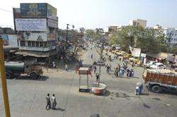 Madhyamgram Crossing (Chowmatha) on Jessore Road | |
 Madhyamgram Location in West Bengal, India | |
| Coordinates: 22°42′N 88°27′E / 22.70°N 88.45°ECoordinates: 22°42′N 88°27′E / 22.70°N 88.45°E | |
| Country | India |
| State | West Bengal |
| Government | |
| • Municipality Chairman | Rathin Ghosh[1] |
| Elevation | 15 m (49 ft) |
| Population (2011) | |
| • Total | 196,127 |
| • Rank | 298 |
| Languages | |
| • Official | Bengali, English |
| Time zone | UTC+5:30 (IST) |
| PIN | 700129/700130/155 |
| Telephone code | 91 33 |
| Vehicle registration | WB 26 |
| Lok Sabha constituency | Barasat |
| Vidhan Sabha constituency | Madhyamgram |
Madhyamgram is a neighborhood in Kolkata, in the Indian state of West Bengal. Administratively it is in Barasat Sadar subdivision of North 24 Parganas district[2]in West Bengal, India. It is a part of Kolkata Urban Agglomeration.
History
Madhyamgram was in the Kingdom of Raja Protapaditya Roy, one of the twelve feudal provinces of Bengal, and Ruler of Jessore during the Mughal regime.
On December 20, 1757 Mirzafar, the Nawab of Bengal, presented twenty-four parganas to the East India Company as dowry which also included Madhyamgram, under Anwarpur Pargana, adjacent to Barasat.
The first railway line from Madhyamgram to Duttapukur was commissioned in 1882, and the station was called Chandipur. Madhyamgram was then named as Majher Gaon, probably because the area was situated between Badu (Chakradharpur Mouza) and Sajirhat (Guchuria Mouza).
The present narrow Noai Canal, now acting as a dividing border line between New Barrackpore and Madhyamgram, stretching from the South of Ganganagar to Sajirhat in the West used to be a wide river, once called Labanyabati, which through colloquial transformation became the Noai River, and after years of silt depositions, turned into Noai Canal.
At that time, Anwarpur Pargana was famous for its tobacco trade and a special sweet-smelling blended tobacco was manufactured in Madhyamgram.
Madhyamgram was also a big paddy growing area, and the Labanya River was a medium of navigation for the exportation of those products. Madhyamgram was also famous for its fine embroidery works that attracted appreciation from Delhi and Mumbai. Many Muslim families maintained a livelihood through those works.
Geography
Police station
Madhyamgram police station serves a population of 198,964. It has jurisdiction over Madhyamgram municipal area and Barasat II CD Block.[3]
Climate
The climate is tropical, like the rest of the Gangetic West Bengal. The hallmark season is the Monsoon—which occurs from early June to mid September. The weather remains dry during the winter (mid-November to mid-February) and humid during summer.
Temperature: 41 °C in May (max) and 8.3 °C in January (min)
Demographics
Population
As per the 2011 Census of India, Madhyamgram had a total population of 196,127, of which 98,864 (50%) were males and 97,263 (50%) were females. Population below 6 years was 16,351. The total number of literates in Madhyamgram was 161,087 (89.60% of the population over 6 years).[4]
As of the 2001 Indian census,[5] Madhyamgram had a population of 198,964. Males constitute 51% of the population and females 49%. Madhyamgram has an average literacy rate of 76%, higher than the national average of 59.5%: male literacy is 80%, and female literacy is 71%. In Madhyamgram, 10% of the population is under 6 years of age.
Kolkata Urban Agglomeration
The following Municipalities and Census Town in Barasat Sadar subdivision were part of Kolkata Urban Agglomeration in the 2011 census: Barasat (M), Madhyamgram (M), Rajarhat Gopalpur (M) (made part of Bidhannagar Municipal Corporation in 2015) and Raigachhi (CT).[6]
Economy

Industry
There is a major textile mill and a rubber factory in this area.
KMDA
Madhyamgramgram municipality is included in the Kolkata Metropolitan Area for which the KMDA is the statutory planning and development authority.[7][8]
Transport
The neighbourhood is characterised by its close proximity to an airport (around 15 minutes). Madhyamgram also has good transportation facilities, with good roadways and a local railway section. There are bus routes from Madhyamgram to various parts of Kolkata and to many other towns and villages.
The primary station is Madhyamgram railway station. Taxi services are one of the most popular forms of transportion to reach nearby towns like Sodepur, New Barrackpur and Barasat. Rickshaws, three-wheeled pedalled vans, and battery-operated e-rickshaws ("toto" vans) are also used for short distances. A railway connection links Madhyamgram to major areas and to the rest of Kolkata.
Other regular transport services, like private and governmental public transport buses, taxis, and rented car services are also available in Madhyamgram.
Education
Madhyamgram has two graduate colleges: Vivekananda College and Acharya Prafulla Chandra College. The latter, though territorially in the New Barrackpur municipality, has a close relationship with Madhyamgram, especially in student composition. The engineering college Camellia Institute of Technology and the management college Camellia School Of Business Management are also located here. It also has number of secondary and higher secondary schools, including: Madhyamgram High School, Madhyamgram Girls High School, Acharya Prafulla Chandra Girls High School, Acharya Prafulla Chandra Boys High School, and Acharya Prafulla Chandra Vidyayatan. English medium schools include: Julien Day School in Ganganagar, Sudhir Memorial Institute near Doltala, and St. Judes Higher Secondary School at Basu Nagar.
Sports
Madhyamgram High School has won the Subroto Cup, an all-India inter-school soccer competition, seven times, which includes a hat-trick (in the years 1981, 1982, and 1983).[9]
References
- ↑ Official District Administration site Archived January 15, 2007, at the Wayback Machine.
- ↑ District-wise list of statutory towns, Archived March 19, 2005, at the Wayback Machine.
- ↑ "North 24 Parganas Dist. Police". Know Your Police Station. District Police. Retrieved 4 June 2018.
- ↑ "2011 Census – Primary Census Abstract Data Tables". West Bengal – District-wise. Registrar General and Census Commissioner, India. Retrieved 29 May 2018.
- ↑ "Census of India 2001: Data from the 2001 Census, including cities, villages and towns (Provisional)". Census Commission of India. Archived from the original on 2004-06-16. Retrieved 2008-11-01.
- ↑ "Provisional Population Totals, Census of India 2011" (PDF). Constituents of Urban Agglomeration Having Population Above 1 Lakh. Census of India 2011. Retrieved 30 May 2018.
- ↑ "Kolkata Metropolitan Development Authoity, Annual Report 2010-11". 1/1 Kolkata Metropolitan Area Map. KMDA. Retrieved 4 June 2018.
- ↑ "Kolkata Metropolitan Development Authority, Annual Report 2010-11". 1 / 2 Role of KMDA. KMDA. Retrieved 4 June 2018.
- ↑ Marmar Mukhopadhyay (21 July 2005). Total Quality Management in Education. SAGE Publications. p. 157. ISBN 978-0-7619-3368-7.
External links
