Habra
| Habra | |
|---|---|
| City | |
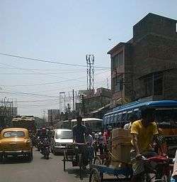 Habra Jessore Road traffic | |
 Habra Location in West Bengal, India | |
| Coordinates: 22°50′N 88°38′E / 22.83°N 88.63°ECoordinates: 22°50′N 88°38′E / 22.83°N 88.63°E | |
| Country |
|
| State | West Bengal |
| District | North 24 Parganas |
| Government | |
| • Municipality Chairman | Nilimesh Das[1] |
| • MLA | Jyotipriyo Mullick, Minister of State, Food and distribution Govt. of WB |
| Area | |
| • Total | 21.8 km2 (8.4 sq mi) |
| Elevation | 13 m (43 ft) |
| Population (2011) | |
| • Total | 3,04,584(UA) |
| Languages | |
| • Official | Bengali, English |
| Time zone | UTC+5:30 (IST) |
| Telephone code | +91 3216 |
| Lok Sabha constituency | Barasat |
| Vidhan Sabha constituency | Habra |
| Website |
Official Website
www |
Habra is a city and a police station under Barasat sadar subdivision[2] in North 24 Parganas district of the Indian state of West Bengal. Habra is situated on the Jessore Road between Kolkata and the Bangladesh border at Petrapole. Its location makes it an important town for export and import of goods between India and Bangladesh.
Geography
Habra is located at 22°50′N 88°38′E / 22.83°N 88.63°E.[3] It has an average elevation of 13 metres (42 feet).
Demographics
As per the 2011 Census of India, Habra had a total population of 147,221, of which 74,592 (51%) were males and 72,629 (49%) were females. Population below 6 years was 11,696. The total number of literates in Habra was 121,952 (89.98% of the population over 6 years). [4]
As per the 2011 Census of India, Habra Urban Agglomeration had a total population of 304,584, of which 154,863 (51%) were males and 149,723 (49%) were females. Population below 6 years was 23,023. The total number of literates in Habra UA was 256,313 (91.03% of the population over 6 years).[5]The constituents of Habra Urban Agglomeration were Habra (M), Ashoknagar Kalyangarh (M), Bara Bamonia (CT), Guma (CT), Anarbaria (CT) and Khorddabamonia (CT).[6]
As of 2001 India census, [7] Habra had a population of 127,695. Males constitute 51% of the population and females 49%. Habra has an average literacy rate of 79%, higher than the national average of 59.5%: male literacy is 83%, and female literacy is 74%. In Habra, 10% of the population is under 6 years of age.
Administration
Municipality
Habra Municipality is responsible for the well being of its residence. Habra Municipality recently installed tower lights from the fund of member of Vidhan Sabha Jyotipriyo Mullick has changed the environment of the night of Habra.
Police station
Habra police station is one of the most important police stations in North 24 Parganas District. It has jurisdiction over Habra municipality, Gobardanga municipality and Habra I CD Block.[8]
Mainak Bandopadhya is the Inspector in Charge of the PS. Since his joining at criminal activity have fallen dramatically and Police public relation has improved a lot . Murder, extortion, dacoity, robbery was the common crimes under this PS.
Others
Habra I (community development block) is headquartered at Prafulla Nagar, Habra. Habra Telephone Exchange is also headquartered at Habra. Habra is one of the 100 selected cities in India which will be developed as a smart city within 2022 though this has been in question recently when Govt of India published an updated list and Habra did not appear in that apparently.[9]
Transport
Railway System

It is 45 km from Sealdah Station and 25 km from Barasat on the Sealdah-Bangaon branch line of Eastern Railway.[10] It is part of the Kolkata Suburban Railway system. Habra, Gobordanga and Bangaon local connects this town to Sealdah Station and other stations of the Sealdah-Bangaon branch line. Habra Station Road is directly connected on NH 35 (Jessore Road).It is a major railway station between bangaon and barasat railway station
Road
Habra is situated on the Jessore Road between Kolkata and the Bangladesh border at Petrapole. Habra-Naihati road connects this town to Naihati. Habra is also connected to National Highway 34 (India) by Habra-Naihati road connecting this town to Krishnanagar, Kalyani and other towns and cities. Habra hosts an important depot of Habra Division of the West Bengal Transport Corporation. Buses of WBTC connects Habra to other towns and cities of West Bengal. Buses from Habra Bus Terminal are directly connected to Naihati, Maslandapur, Madhyamgram, Bangaon, Barasat, Nagarukhra, Kalyani, Basirhat, Kolkata, Bagdah, Chakdah, Barrackpore Bagjola, Digha, Durgapur, Bandel, krishnanagar, Barasat, Alampur, Dattaphulia, Nimta, Sodepur, Duttapukur, Jagulia, Baduria, Thakurnagar, Medinipur, Haldia, Tarapith
Govt. Bus Routes
West Bengal Transport Corporation Bus Routes (WBTC)
ACT3 Habra—Santragachi(SPECIAL)
ACT8 Habra—Digha(AC)
C42 Habra—Howrah
C43 Habra—Garia
D2 Habra—Naihati
D7/1 Bagdah—Howrah Station
D9 Barasat—Hakimpur
D18 Thakurnagar—Howrah
D22 Jaleswar—Esplanade
E19 Habra—Digha
E19/1 Habra—Digha
E25 Habra—Esplanade(Via Nagarukhra/Jaguli)
E33 Habra—Anthpur
E36 Habra—Nabanna—Santragachi
E36A Habra—Santragachi
E41 Habra—Asansol
South Bengal State Transport Corporation Bus Routes(SBSTC)
- Habra-Digha
- Habra-Haldia
- Habra-Medinipur
- Habra-Tarapith(Via Krishnanagar)
- Habra-Durgapur
- Habra-Purulia
North Bengal State Transport Corporation Bus Routes(NBSTC)
- Habra-Coochbehar(Via Awalsiddhi Chowmatha,Krishnanagar, Baharampore, Maldah, Gajole, Raiganj, Itahar, Dhupguri, Maynaguri, Jalpaiguri, Siliguri)
Private Bus Route
- DN44 Bangaon-Dakshineswar
- DN35 Balti-Barasat(Simanta Express)
- MN6 Berigopalpur-Barasat
- MM5 Habra-Barrackpore Court
- DN12/1 Habra-Nazat
Buses Without Number
- Habra-Ranaghat
- Habra-Shyambazar(R.G KAR)
- Boyra-Karunamoyee (Via Salt Lake)
Education
There are many Schools, Colleges and Engineering Institutes in Habra. There are too many Educational Institution(44) in Habra. Habra enjoys the highest density of graduates(no. of graduates per square kilometer) in the world.
Schools
Schools of Govt. of India
- Jawahar Navodaya Vidyalaya (Banipur)[11]
State Govt. School
- Habra High School (H.S)
- Habra High School for Girls (H.S),
- Habra Kamini Kumar Girls' High School (H.S)
- Habra Model High School (H.S),
- Banipur Baniniketan High school (H.S)
- Banipur Baniniketan Girls’ High school (H.S)
- Banipur S.W. Home School
- Dakshwin Habra High School (H.S)
- Hatthuba Adarsha Bidyapith (H.S)
- Kalibala Kanya Vidhyapith(H.S)
- Joygachi Adarsha Valika Vidyalaya
- Joygachi Shayamaprasad High School (H.S)
- KAMARTHUBA NIVEDITA BALIKA VIDYALAYA(H.S.)
- Kamarthuba Vivekananda Vidyapith (H.S),
- Prafullanagar Vidya Mandir (H.S)
- Prafullanagar Balika Vidyalaya (H.S)
- Purbanchal High School
- Saptapalli Deshbandhu Balika Vidyalaya
- Sisu Vidyamandir High School(H.S.)
- Sreema Vidyamandir
- Govt. Basic cum Multipurpose School
- K.M.R Institution
- Atulia Netaji Adarsha Vidyapith High School
- Janaphul High school(H.S.)
Saktigarh A.D.P. Siksha Niketan
ICSE affiliated schools
- Stratford Day School(wb339)
- St.Stephens School(wb348)
Colleges
- Banipur Janata College
- Banipur Mahila Mahavidyalaya
- Gandhi Centenary B.T College
- Sree Chaitanya College
- Sree Chaitanya Mahavidyalaya,(Shree Chaitanya College of Commerce)
Engineering Colleges
- Techno India, Banipur
Others Colleges
- Govt. College of Education (Banipur)
- Habra Bio-Chemic Medical College & Hospital
- Post Graduate Physical Training College
Joint coaching Institutes
- All India Joint Entrance Examination Coaching(AIJEEC)
Others Institutes
- Pathfinder Coaching Center(Habra)
- Asha Computer Academy (Behind Habra Girls' High School)
- Banipur Home (Orphans House)
- Banipur Youth Computer Training Centre
- B.K.Kar Paramadical Institution
- Dr. B. R. Ambedkar Sports School ( Banipur)
- Habra Youth Computer center
- Industrial Training Institute (ITI) Banipur
- Junior Basic Training College (JBT)
- Skynet Systems
- Srijan Graphics (South Habra)
- Juba Skills Academy( Near- Rupkatha Cinema Hall)
Social
Banipur Loka Utsav is held at Banipur, Habra starting on 1st Sunday of February every year, for 8 days. It acquired approx. 18 to 20 bighas of land. After the Poush Mela of Shantiniketan, Habra Banipur Lok Utsav is the largest fair of West Bengal.
Economy
Habra Bazar is one of the largest hubs for business and one of the local goods supplier to Kolkata. Habra Bazar supplies Rice, Green vegetables, Milk, Fish, Chicken, Garments, Jewellery, Jute to Kolkata and other parts of India. Export and import businesses (mainly with Bangladesh) are also noteworthy. Various type of women hand bag are produced near Habra (Uchu amtola). Paper board cutting machine are also there. Habra Bazar is the second largest business hub (Bazar) in West Bengal next to Burrabazar, Kolkata.Many shopping malls like Style Bazaar,Kolkata Mart,Pantaloons have opened here.
Entertainment
Multiple Cinema Halls are present here...
- Rupkatha Cinema Hall (AC with Dolby Sound) at 1.no Rail Gate Habra.
- Kalika Cinema Hall at near Nagarukhra More.
Food
If you are a food lover then Habra is the ideal place for you.Here you can find every type of dish from Indian to Italian, Mexican, continental etc.There are many restaurants in Habra with excellent quality. Habra is famous for their sweet dish too.
Some of Habra's finest restaurants are Rajnandini Restaurant cum Bar, Dragon Chinese Point etc.
Bank / Financial Institutions
There are several banks and non banking financial institutions present at Habra.
- Syndicate Bank
- Indian Overseas Bank
- IDBI Bank
- Andhra Bank
- Bandhan Bank
- Bank of Baroda
- Canara Bank
- UCO Bank
- Axis Bank
- Indian Bank
- Bank of India
- Central Bank of India
- HDFC Bank
- ICICI Bank
- State Bank of India
- Allahabad Bank
- Punjab National Bank
- Union Bank of India
- United Bank of India
- Life Insurance Corporation of India
See also
- Habra I CD Block
- Habra II CD Block
- Map of Habra I CD Block on Page 289 of District Census Handbook. It also shows the location of Habra.[12]
References
- ↑ Official District Administration site Archived 2007-01-15 at the Wayback Machine.
- ↑ District-wise list of statutory towns Archived 2011-07-21 at the Wayback Machine.
- ↑ Falling Rain Genomics, Inc - Habra
- ↑ "2011 Census – Primary Census Abstract Data Tables". West Bengal – District-wise. Registrar General and Census Commissioner, India. Retrieved 29 May 2018.
- ↑ "Urban Agglomeration/ Cities having population above 1 lakh" (PDF). Provisional Population Totals, Census of India, 2011. Government of India. Retrieved 3 June 2018.
- ↑ "Constituents of Urban Agglomeration having population of 1 lakh and bove" (PDF). Provisional Population Totals, Census of India, 2011. Government of India. Retrieved 3 June 2018.
- ↑ "Census of India 2001: Data from the 2001 Census, including cities, villages and towns (Provisional)". Census Commission of India. Archived from the original on 2004-06-16. Retrieved 2008-11-01.
- ↑ "North 24 Parganas Dist. Police". Know Your Police Station. District Police. Retrieved 3 June 2018.
- ↑ Reference
- ↑ Eastern Railway time table
- ↑ http://jnv24pargana.bih.nic.in/
- ↑ "District Census Handbook North Twenty Four Parganas, Census of India 2011, Series 20, Part XII A" (PDF). Page 289 -Map of Habra I CD Block. Directorate of Census Operations, West Bengal. Retrieved 1 June 2018.