Pujali
| Pujali | |
|---|---|
| Neighbourhood in Kolkata (Calcutta) | |
 Pujali Municipality | |
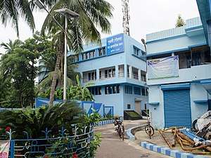
 Pujali Location in West Bengal, India  Pujali Pujali (India) | |
| Coordinates: 22°27′36″N 88°08′02″E / 22.4601°N 88.1340°ECoordinates: 22°27′36″N 88°08′02″E / 22.4601°N 88.1340°E | |
| Country |
|
| State | West Bengal |
| Division | Presidency |
| District | South 24 Parganas |
| City | Kolkata |
| Established | 1996 |
| Government | |
| • Type | Chairman–Council |
| • Body | Pujali Municipality |
| Area | |
| • Total | 8.32 km2 (3.21 sq mi) |
| Elevation | 9 m (30 ft) |
| Population (2011) | |
| • Total | 37,047 |
| • Density | 4,500/km2 (12,000/sq mi) |
| Languages | |
| • Official | Bengali, Hindi, English |
| Time zone | UTC+5:30 (IST) |
| PIN | 700138 |
| Telephone code | +91 33 |
| Vehicle registration | WB-01 to WB-10, WB-19, WB-20, WB-22, WB-22U |
| Lok Sabha constituency | Diamond Harbour |
| Vidhan Sabha constituency | Budge Budge |
| Website |
www |
Pujali is a city and a municipality of South 24 Parganas district in the Indian State of West Bengal.[1] It is a neighbourhood in South West Kolkata. It is a part of the area covered by Kolkata Metropolitan Development Authority (KMDA).[2]
Geography
Pujali city is located at 22°27′36″N 88°08′02″E / 22.4601°N 88.1340°E.[3] It has an average elevation of 9 metres (30 ft).
Demographics
As per 2011 Census of India, Pujali city had a total population of 37,047, of which 18,940 (51%) were males and 18,107 (49%) were females. Population below 6 years was 4,316. The total number of literates was 25,791 (78.80% of the population over 6 years).[4]
As of 2001 Census of India,[5] Pujali city had a total population of 33,863. Males constitute 52% of the population and females 48%. It has an average literacy rate of 61%, higher than the national average of 59.5%: male literacy is 68%, and female literacy is 55%. 13% of the population is under 6 years of age.
Civic Administration
There is a Pujali Municipality. Currently, the All India Trinamool Congress is in power in it. Rita Pal is the current Chairman of the municipality. Fazlul Haque is the current vice chair person of the municipality. He is in power ever since the area has been registered as under municipality in 1996.
References
- ↑ "Census of India". District-wise list of stautory towns. Directorate of census operations, West Bengal. Archived from the original on 2007-08-09. Retrieved 2007-09-02.
- ↑ "Base Map of Kolkata Metropolitan area". Kolkata Metropolitan Development Authority. Archived from the original on 2007-09-28. Retrieved 2007-09-03.
- ↑ Falling Rain Genomics, Inc - Pujali
- ↑ "2011 Census – Primary Census Abstract Data Tables". West Bengal – District-wise. Registrar General and Census Commissioner, India. Retrieved 27 April 2016.
- ↑ "Census of India 2001: Data from the 2001 Census, including cities, villages and towns (Provisional)". Census Commission of India. Archived from the original on 2004-06-16. Retrieved 2008-11-01.
Cities, towns and locations in South 24 Parganas district | |||||||||||
|---|---|---|---|---|---|---|---|---|---|---|---|
| Cities, municipal and census towns |
| ||||||||||
| Locations other than cities and towns | |||||||||||
| Related topics |
| ||||||||||