Jagatdal
| Jagatdal Jagaddal | |
|---|---|
| Town | |
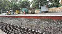
.jpg) Jagaddal railway station | |
| Nickname(s): জগদ্দল | |
 Jagatdal Location in West Bengal, India | |
| Coordinates: 22°51′45″N 88°23′10″E / 22.8625°N 88.3861°ECoordinates: 22°51′45″N 88°23′10″E / 22.8625°N 88.3861°E | |
| Country |
|
| State | West Bengal |
| District | North 24 Parganas |
| Elevation | 15 m (49 ft) |
| Languages | |
| • Official | Bengali, English |
| Time zone | UTC+5:30 (IST) |
| PIN | 743125 (Jagatdal) |
| Lok Sabha constituency | Barrackpore |
| Vidhan Sabha constituency | Jagatdal |
| Website |
north24parganas |
Jagatdal (also known as Jagaddal) is a neighbourhood with a police station in Bhatpara municipality in Barrackpore subdivision[1] of North 24 Parganas district in the state of West Bengal, India.
History
We can find the name of jagaddal as a village as long as 460 years ago in written records but the place is thought to be more 100 to 150 years older or maybe even much more than that. Bipradas Pipalai (1545 AD) in his work "Manasha Mangal" tells us through his protagonist character "Chand Sadagar" about Jagatdal. Chand Saudagar mentions in his "Kabi Kankan Chandi", Jagaddal as one of the places passed by him in his voyage down the Bhagirathi (the Hooghly) and where he saw many palatial buildings built by Brahmins and Kayasthas. Haldars were the most prominent Brahmins the others being Chakrabarties and Pakrasis.. Deys were the most renowned Kayastha family while Sarkars was the same amongst Mahisyas."
Pratapaditya (1561–1611 CE), The kayastha king and zamindar of Jessore made a couple of trenches and a fort at Jagatdal along with Mulajore, present day Shyamnagar as his military establishment against Muslim invaders.
According to Bengal District Gazetteers: 24-Parganas, circa 1914 "In Jagatdal the lines of two moats and two large tanks are reputed to be the remains of a fort erected by Pratapaditya in the sixteenth century".
Geography
 |
| Cities and towns in the northern portion of Barrackpore subdivision in North 24 Parganas district M: municipal city/ town, CT: census town, N: neighbourhood, OG: outgrowth Owing to space constraints in the small map, the actual locations in a larger map may vary slightly |
Location
Jagatdal is located at 22°51′N 88°23′E / 22.85°N 88.38°E.[2] It has an average elevation of 15 metres (49 feet).
Situated on the eastern banks of the river Ganges, the town has many jute mills. The town has an Indian Army base workshop (No-507).
96% of the population of Barrackpore subdivision (partly presented in the map alongside; all places marked on the map are linked in the full-screen map) lives in urban areas. In 2011, it had a density of population of 10,967 per km2 The subdivision has 16 municipalities and 24 census towns.[3]
For most of the cities/ towns information regarding density of population is available in the Infobox. Population data is not available for neighbourhoods. It is available for the entire municipal area and thereafter ward-wise.
Police station
Jagaddal police station under Barrackpore Police Commissionerate has jurisdiction over Bhatpara municipal area.[4][5]
Post Office
Jagatdal has a delivery sub post office, with PIN 743125 in the North Presidency Division of North 24 Parganas district in Calcutta region. Other post offices with the same PIN are Golghat and Gupter Bagan.[6]
Demographics
Migrants
The Jute Mills drew in a large labour force from the neighbouring states of Bihar and Orissa, as well as eastern Uttar Pradesh, quite often forming an overwhelming majority of the population in the area, living in shanty towns and bustees dotting the mill area.[7]
Kolkata Urban Agglomeration
The following Municipalities, Census Towns and other locations in Barrackpore subdivision were part of Kolkata Urban Agglomeration in the 2011 census: Kanchrapara (M), Jetia (CT), Halisahar (M), Balibhara (CT), Naihati (M), Bhatpara (M), Kaugachhi (CT), Garshyamnagar (CT), Garulia (M), Ichhapur Defence Estate (CT), North Barrackpur (M), Barrackpur Cantonment (CB), Barrackpore (M), Jafarpur (CT), Ruiya (CT), Titagarh (M), Khardaha (M), Bandipur (CT), Panihati (M), Muragachha (CT) New Barrackpore (M), Chandpur (CT), Talbandha (CT), Patulia (CT), Kamarhati (M), Baranagar (M), South Dumdum (M), North Dumdum (M), Dum Dum (M), Noapara (CT), Babanpur (CT), Teghari (CT), Nanna (OG), Chakla (OG), Srotribati (OG) and Panpur (OG).[8]
Transport
Jagaddal is 34 km from Sealdah Station and 4 km from Naihati Junction on the Sealdah-Naihati branch line of Eastern Railway.[9] It is part of the Kolkata Suburban Railway system.
Culture
Durga Puja is the main festival when thousands of Hindu devotees follow the traditional rituals and enjoy the festive mood.
It is pilgrimage centre for the shrine of the Sufi Syed Diwana Shah Warsi situated at Golghar area. A well known NGO Warsi Baitulmal situated at Circus More, Jagatdal, which is registered under West Bengal Societies Registration Act, 1961 is run by member of Warsi Baitulmal under the presidentship of Nehal Ahmad Quraishi.
Healthcare
North 24 Parganas district has been identified as one of the areas where ground water is affected by arsenic contamination.[10]
Gallery

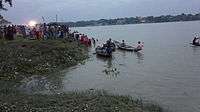
.jpg)
References
- ↑ District-wise list of statutory towns Archived 2009-04-25 at the Wayback Machine.
- ↑ Falling Rain Genomics, Inc - Jagatdal
- ↑ "District Statistical Handbook". North 24 Parganas 2013, Tables 2.1, 2.2, 2.4b. Department of Statistics and Programme Implementation, Government of West Bengal. Retrieved 2 May 2018.
- ↑ "District Statistical Handbook". North 24 Parganas 2013, Tables 2.1, 2.2, 2.4b. Department of Statistics and Programme Implementation, Government of West Bengal. Retrieved 11 June 2018.
- ↑ "Barrackpore Police Commissionerate". List of Police Stations with telephone numbers. West Bengal Police. Retrieved 11 June 2018.
- ↑ "Jagatdal PIN Code". pincodezip.in. Retrieved 11 July 2018.
- ↑ Goswami, Onkar, Calcutta’s Economy 1918-1970 The fall from Grace in Calcutta, the Living City, Vol II, edited by Sukanta Chaudhuri, p 90, Oxford University Press, ISBN 0-19-563697-X
- ↑ "Provisional Population Totals, Census of India 2011" (PDF). Constituents of Urban Agglomeration Having Population Above 1 Lakh. Census of India 2011. Retrieved 30 May 2018.
- ↑ Eastern Railway time table.
- ↑ "Groundwater Arsenic contamination in West Bengal-India (19 years study )". Groundwater arsenic contamination status of North 24-Parganas district, one of the nine arsenic affected districts of West Bengal-India. SOES. Retrieved 2007-08-24.
External links
