Diamond Harbour
| Diamond Harbour | |
|---|---|
| City | |
 Diamond Harbour Municipality | |
 Diamond Harbour Location in West Bengal, India  Diamond Harbour Diamond Harbour (India) | |
| Coordinates: 22°11′55″N 88°12′08″E / 22.1987°N 88.2023°ECoordinates: 22°11′55″N 88°12′08″E / 22.1987°N 88.2023°E | |
| Country |
|
| State | West Bengal |
| Division | Presidency |
| District | South 24 Parganas |
| Established | 1982 |
| Government | |
| • Type | Chairman–Council |
| • Body | Diamond Harbour Municipality |
| Area | |
| • Total | 10.36 km2 (4.00 sq mi) |
| Elevation | 8 m (26 ft) |
| Population (2011) | |
| • Total | 41,802 |
| • Density | 4,000/km2 (10,000/sq mi) |
| Languages | |
| • Official | Bengali, English |
| Time zone | UTC+5:30 (IST) |
| PIN | 743331 |
| Telephone code | +91 3174 255/256/257 |
| Vehicle registration | WB-19, WB-20, WB-22, WB-22U, WB-97, WB-98 |
| Lok Sabha constituency | Diamond Harbour |
| Vidhan Sabha constituency | Diamond Harbour |
| Website |
www |
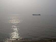
Diamond Harbour is a city and a municipality of South 24 Parganas district in the Indian State of West Bengal. It is situated on the eastern banks of the Hooghly River where the river meets the Bay of Bengal. It is the headquarters of the Diamond Harbour subdivision and also the seat for the district's Sub-Divisional Court. The Diamond Harbour Police District is responsible for law enforcement in the city.
History
Earlier known as Hajipur, this locality was named Diamond Harbour by the British although currently there are no piers or jetties in this locality, except as part of the ruins of a fort. It used to be considered a safe resting spot for oceangoing ships and had views of the river. After the Rupnarayan River joins the Hooghli River, the river bends south and widens out to a form a huge expanse of water. A little further down, the Haldi River joins it.
In earlier days Diamond Harbour was a stronghold of Portuguese pirates. The ruins of the fort of Chingrikhali (locally known as Purano Kella) can still be seen. There is an old lighthouse nearby.
Diamond Harbour Municipality was established in 1982.
Geography
Diamond Harbour city is located at 22°11′55″N 88°12′08″E / 22.1987°N 88.2023°E. It has an average elevation of 8 metres (26 ft).
Demographics
As per 2011 Census of India, Diamond Harbour city had a total population of 41,802, of which 21,050 (50%) were males and 20,752 (50%) were females. Population below 6 years was 3,688. The total number of literates was 32,753 (85.93% of the population over 6 years).[1]
As of 2001 Census of India,[2] Diamond Harbour city had a total population of 37,238. Males constitute 51% of the population and females 49%. It has an average literacy rate of 72%, higher than the national average of 59.5%: male literacy is 77% and, female literacy is 67%. 10% of the population is under 6 years of age.
Nearby places
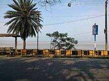
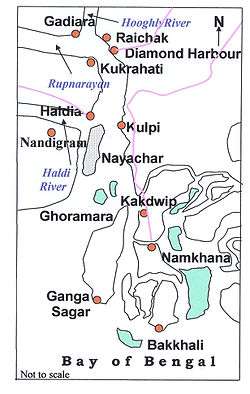
This city with a picturesque setting is the gateway to the south-western part of the district leading to such places as Gangasagar, Kakdwip, Namkhana and Bakkhali. Gangasagar is a Hindu pilgrimage site where Hindus perform ablutions to wash away their sins. Bakkhali is gaining in popularity as a beach resort. There is a five star hotel with a panoramic view of the river at Raichak. Jetties at Diamond Harbour city, Raichak and Nurpur provide steamer service to the other bank of the wide river estuary. There are few heritage places like Village Bolshiddhi's Shiv Temple i.e. 3 kilometres (1.9 mi) away from Diamond Harbour city.
Port development
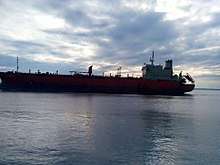
The area being in the proximity of the Bay of Bengal, there is scope for development of ports and shipping activity. The special economic zone at Falta is one of the eight such zones of the Government of India. It has container-handling jetty. The Government of West Bengal proposes to construct a minor port at Kulpi with facilities for handling containers.
As large oceangoing ships with full load of goods cannot enter the river ports at Kolkata and Haldia, the need for a seaport in the area has been felt for a long time. Such a future port would obviously be located at south of Diamond Harbour city but would enhance the importance of the place as a base for the port.
Kolkata Port Trust is considering construction of cargo handling jetties at Diamond Harbour city.[3]
Visitor attractions
- Chingrikhali Fort (Purano Kella)
- Lighthouse
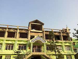
- South Bengal Museum at Noongola nearby Diamond Harbour Girls' High School.
- Famous Fish Market (Nagendra Bazar)
- Naval Camp.
- Swiss Gate.
- S.D.O. Ground
- River Side
- Choto nodir paar
- College ground
- Harindanga Kaali temple
- Station bazar Market
- LAL-POLE: A steel-structure bridge made in British era.
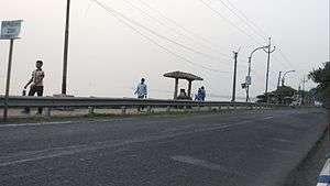
Transport
NH–117 and Sealdah–Diamond Harbour line passes through Diamond Harbour city. The entire area of this city is served by the Diamond Harbour railway station.
References
- ↑ "2011 Census – Primary Census Abstract Data Tables". West Bengal – District-wise. Registrar General and Census Commissioner, India. Retrieved 27 April 2016.
- ↑ "Census of India 2001: Data from the 2001 Census, including cities, villages and towns (Provisional)". Census Commission of India. Archived from the original on 16 June 2004. Retrieved 1 November 2008.
- ↑ The Statesman 1 October 2006
External links

Cities, towns and locations in South 24 Parganas district | |||||||||||
|---|---|---|---|---|---|---|---|---|---|---|---|
| Cities, municipal and census towns |
| ||||||||||
| Locations other than cities and towns | |||||||||||
| Related topics |
| ||||||||||