Chak Kanthalia
| Chak Kanthalia | |
|---|---|
| Census Town | |
 Chak Kanthalia Location in West Bengal, India  Chak Kanthalia Chak Kanthalia (India) | |
| Coordinates: 22°45′17″N 88°23′44″E / 22.754694°N 88.395694°ECoordinates: 22°45′17″N 88°23′44″E / 22.754694°N 88.395694°E | |
| Country |
|
| State | West Bengal |
| District | North 24 Parganas |
| Area | |
| • Total | 0.7108 km2 (0.2744 sq mi) |
| Population (2011) | |
| • Total | 11,108 |
| • Density | 16,000/km2 (40,000/sq mi) |
| Languages | |
| • Official | Bengali, English |
| Time zone | UTC+5:30 (IST) |
| Telephone/STD code | 033 |
| Lok Sabha constituency | Dum Dum |
| Vidhan Sabha constituency | Khardaha |
| Website |
north24parganas |
Chak Kanthalia is a census town in Barrackpore II CD Block in Barrackpore subdivision of North 24 Parganas district in the state of West Bengal, India.
Geography
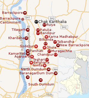 |
| Cities and towns in the southern portion of Barrackpore subdivision in North 24 Parganas district M: municipal city/ town, CT: census town, N: neighbourhood/ administrative location Owing to space constraints in the small map, the actual locations in a larger map may vary slightly |
Location
Chak Kanthalia, Ruiya, Patulia and Bandipur form a cluster of census towns around Titagarh/ Khardaha. Karna Madhabpur, with the CD Block headquarters, is also located nearby.[1]
96% of the population of Barrackpore subdivision (partly presented in the map alongside, all places marked on the map are linked in the full screen map) lives in urban areas. In 2011, it had a density of population of 10,967 per km2 The subdivision has 16 municipalities and 24 census towns.[2]
For most of the cities/ towns information regarding density of population is available in the Infobox. Population data is not available for neighbourhoods. It is available for the entire municipal area and thereafter ward-wise.
Police station
Khardaha police station under Barrackpore Police Commissionerate has jurisdiction over Khardaha municipal area and Barrackpore II CD Block.[3][4]
Demographics
As per the 2011 Census of India, Chak Kanthalia had a total population of 11,108, of which 5,704 (51%) were males and 5,404 (49%) were females. Population below 6 years was 1,023. The total number of literates in Chak Kanthalia was 8,722 (86.48% of the population over 6 years).[5]
Infrastructure
As per the District Census Handbook 2011, Chak Kanthalia covered an area of 0.7108 km2. Amongst the medical facilities it had were 7 medicine shops. Amongst the medical facilities it had were 1 primary school and 1 middle school. The nearest secondary and senior secondary schools were available 3 km away at Senri.[6]
Transport
Chak Kanthalia is off Kalyani Expressway[7]
The railway station at Barrackpore/ Titagarh on the Sealdah-Ranaghat line are located nearby.[8][7]
Education
Regent Education and Research Foundation at Bara Kanthalia, established in 2012, offers degree and diploma courses in engineering, as well MBA and computer application courses.[9]
P.N. Das College at Palta is located nearby.[10][11][7]
Healthcare
Block Primary Health Centre at Bandipur is located nearby.[12][7]
References
- ↑ "District Census Handbook North Twenty Four Parganas, Census of India 2011, Series 20, Part XII A" (PDF). Map of Barrackpore II CD Block on Page 379. Directorate of Census Operations, West Bengal. Retrieved 15 June 2018.
- ↑ "District Statistical Handbook". North 24 Parganas 2013, Tables 2.1, 2.2, 2.4b. Department of Statistics and Programme Implementation, Government of West Bengal. Retrieved 2 May 2018.
- ↑ "District Statistical Handbook". North 24 Parganas 2013, Table 2.1. Department of Statistics and Programme Implementation, Government of West Bengal. Retrieved 15 June 2018.
- ↑ "Barrackpore Police Commissionerate". List of Police Stations with telephone numbers. West Bengal Police. Retrieved 15 June 2018.
- ↑ "C.D. Block Wise Primary Census Abstract Data(PCA)". West Bengal – District-wise CD Blocks. Registrar General and Census Commissioner, India. Retrieved 15 June 2018.
- ↑ "District Census Handbook North Twenty Four Parganas, Census of India 2011, Series 20, Part XII A" (PDF). Section II Town Directory, Pages 781-783 Statement I: Growth History, Pages 799-803; Statement II: Physical Aspects and Location of Towns, Pages 791-794; Statement III: Civic and other Amenities, Pages 795-796; Statement IV: Medical Facilities 2009, Pages 803-805 Section: Educational, Recreational and Cultural Facilities. Directorate of Census Operations V, West Bengal. Retrieved 19 June 2018.
- 1 2 3 4 Google maps
- ↑ "31311 Sealdah-Kalyani Simanta Local". Time Table. indiarailinfo. Retrieved 15 June 2018.
- ↑ "Regent Education and Research Foundation Bara Kanthalia". besonline.in. Retrieved 7 July 2018.
- ↑ "P.N.Das College". PNDC. Retrieved 8 May 2018.
- ↑ "PN Das College". College Admission. Retrieved 8 May 2018.
- ↑ "Health & Family Welfare Department". Health Statistics. Government of West Bengal. Retrieved 15 June 2018.