Maheshtala
| Maheshtala | |
|---|---|
| Neighbourhood in Kolkata (Calcutta) | |
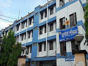 Maheshtala Municipality | |
 Maheshtala Location in West Bengal, India  Maheshtala Maheshtala (India) | |
| Coordinates: 22°30′43″N 88°15′04″E / 22.5120°N 88.2510°ECoordinates: 22°30′43″N 88°15′04″E / 22.5120°N 88.2510°E | |
| Country |
|
| State | West Bengal |
| Division | Presidency |
| District | South 24 Parganas |
| City | Kolkata |
| Established | 1993 |
| Government | |
| • Type | Chairman–Council |
| • Body | Maheshtala Municipality |
| Area | |
| • Total | 44.18 km2 (17.06 sq mi) |
| Elevation | 9 m (30 ft) |
| Population (2011) | |
| • Total | 448,317 |
| • Density | 10,000/km2 (26,000/sq mi) |
| Languages | |
| • Official | Bengali, English |
| Time zone | UTC+5:30 (IST) |
| PIN | 700018, 700066, 700139, 700140, 700141, 700142, 700143 |
| Telephone code | +91 33 |
| Vehicle registration | WB-01 to WB-10, WB-19, WB-20, WB-22, WB-22U |
| Lok Sabha constituency | Diamond Harbour |
| Vidhan Sabha constituency | Maheshtala |
| Website |
www |
Maheshtala is a city and a municipality of South 24 Parganas district in the Indian State of West Bengal. It is a neighbourhood in South West Kolkata. It is a part of the area covered by Kolkata Metropolitan Development Authority (KMDA)[1].
Geography
Maheshtala city is located at 22°30′43″N 88°15′04″E / 22.5120°N 88.2510°E. It has an average elevation of 9 metres (30 ft).
Demographics
As per 2011 Census of India, Maheshtala city had a total population of 448,317, of which 229,693 (51%) were males and 218,624 (49%) were females. Population below 6 years was 46,247. The total number of literates was 329,813 (82.03% of the population over 6 years).[2]
As of 2001 Census of India,[3] Maheshtala city had a total population of 389,214. Males constitute 53% of the population and females 47%. It has an average literacy rate of 69%, higher than the national average of 59.5%: male literacy is 74%, and female literacy is 63%. 11% of the population is under 6 years of age.
Economy
A London-based company has joined hands with a Bengali NRI to develop a mini township known as the Maheshtala project as a joint venture with the Maheshtala Municipality, for which 21.22 acres (85,900 m2) have been acquired near Nungi station. There will be 2,240 middle income group flats in 44 buildings. The company will improve the road infrastructure in the area.[4]
Transport
Train
The Kolkata Suburban Railway are connecting Sealdah with Budge Budge, along with Santoshpur, Akra and Nungi. Sealdah–Budge Budge line is under the jurisdiction of Eastern Railway zone.
References
- ↑ "Census of India". District-wise list of stautory towns. Directorate of census operations, West Bengal. Archived from the original on 2007-08-09. Retrieved 2007-09-02.
- ↑ "2011 Census – Primary Census Abstract Data Tables". West Bengal – District-wise. Registrar General and Census Commissioner, India. Retrieved 27 April 2016.
- ↑ "Census of India 2001: Data from the 2001 Census, including cities, villages and towns (Provisional)". Census Commission of India. Archived from the original on 2004-06-16. Retrieved 2008-11-01.
- ↑ "London-NRI route to mini townships". The Statesman, 18 May 2007. Archived from the original on 29 September 2007. Retrieved 2007-09-03.
Cities, towns and locations in South 24 Parganas district | |||||||||||
|---|---|---|---|---|---|---|---|---|---|---|---|
| Cities, municipal and census towns |
| ||||||||||
| Locations other than cities and towns | |||||||||||
| Related topics |
| ||||||||||