Gobardanga
| Gobardanga | |
|---|---|
| Town | |
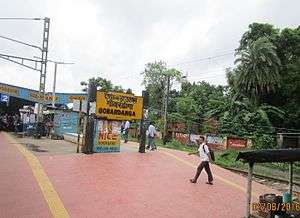 Gobardanga railway station | |
 Gobardanga Location in West Bengal, India | |
| Coordinates: 22°52′N 88°46′E / 22.87°N 88.76°ECoordinates: 22°52′N 88°46′E / 22.87°N 88.76°E[1] | |
| Country | India |
| State | West Bengal |
| District | North 24 Parganas |
| Government | |
| • Municipality Chairman | Subhash Datta[2] |
| Area | |
| • Total | 13.5 km2 (5.2 sq mi) |
| Elevation | 6 m (20 ft) |
| Population (2011) | |
| • Total | 45,377 |
| • Density | 3,400/km2 (8,700/sq mi) |
| Languages | |
| • Official | Bengali and English |
| Time zone | UTC+5:30 (IST) |
| ISO 3166 code | IN-WB |
| Lok Sabha constituency | Bangaon |
| Vidhan Sabha constituency | Gaighata |
| Website |
north24parganas |
Gobardanga is a town and a municipality under Habra police station of Barasat Sadar subdivision[3] in North 24 Parganas district in the Indian state of West Bengal. It is one of the oldest municipality of West Bengal.
Geography
Gobardanga is situated on the banks of the river Jamuna.
Transport
Gobardanga railway station is 58 km from Sealdah railway station on the Sealdah–Bangaon branch line of Eastern Railway. From Sealdah it is next to Maslandapur railway station and before Thakurnagar railway station. It is near about 25 km from Bongaon on road.
Demographics
As per the 2011 Census of India, Gobardanga had a total population of 45,377, of which 23,025 (51%) were males and 22,352 (49%) were females. Population below 6 years was 3,481. The total number of literates in Gobardanga was 38,461 (91.80% of the population over 6 years).[4]
As of 2001 India census,[5] Gobardanga had a population of 41,618. Males constitute 51% of the population and females 49%. Gobardanga has an average literacy rate of 80%, higher than the national average of 59.5%: male literacy is 84%, and female literacy is 75%. In Gobardanga, 9% of the population is under 6 years of age.
Education
Higher education
Gobardanga has a college named Gobardanga Hindu College which is affiliated with West Bengal State University.[6] There is also a NGO named Central Board of Computer & Technical Education (CBCTE) for computer & technical education.
School Education
- Angel Day School
- Subhash Vidyamandir FP School
- Sri Ramakrishna Vidyabhawan
- Gobardanga Collegiate High School (HS)
- Gobardanga Girls High School
- Netaji Vidyapith
- Gobardanga Khantura High School
- Khantura Girls' High School (HS)
- Gobardanga Sri Chaitanya Vidyalaya (High)
- Khantura Pritilata Shikha Niketan for Boys
- Khantura Pritilata Shikha Niketan for Girls
- DPB Deshbandhu Prathamik Vidyalaya
- Nibedita Sishu Tirtha
- Sishubhuban Renaisance Vidyapith
Healthcare
North 24 Parganas district has been identified as one of the areas where ground water is affected by arsenic contamination.[7]
See also
Map of Habra I CD Block on Page 289 of District Census Handbook. It also shows the location of Gobardanga.[8]
References
- ↑ "Maps, Weather, and Airports for Gobardanga, India". fallingrain.com.
- ↑ Official District Administration site Archived 15 January 2007 at the Wayback Machine.
- ↑ District-wise list of statutory towns Archived 27 September 2007 at the Wayback Machine.
- ↑ "2011 Census – Primary Census Abstract Data Tables". West Bengal – District-wise. Registrar General and Census Commissioner, India. Retrieved 29 May 2018.
- ↑ "Census of India 2001: Data from the 2001 Census, including cities, villages and towns (Provisional)". Census Commission of India. Archived from the original on 2004-06-16. Retrieved 2008-11-01.
- ↑ "Affiliated College of West Bengal State University". Archived from the original on 29 October 2012. Retrieved 10 November 2012.
- ↑ "Groundwater Arsenic contamination in West Bengal-India (19 years study)". Groundwater arsenic contamination status of North 24-Parganas district, one of the nine arsenic affected districts of West Bengal-India. SOES. Retrieved 2007-08-24.
- ↑ "District Census Handbook North Twenty Four Parganas, Census of India 2011, Series 20, Part XII A" (PDF). Page 289 -Map of Habra I CD Block. Directorate of Census Operations, West Bengal. Retrieved 1 June 2018.