Siliguri
| Siliguri | |
|---|---|
| City | |
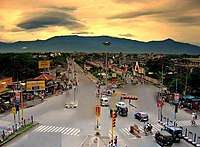 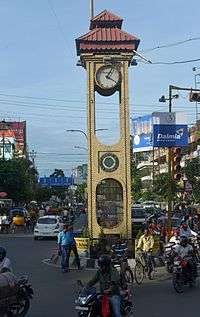 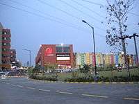  Top to bottom : Old view of Siliguri, Lions Clock Tower, City Centre Cosmos Mall | |
| Nickname(s): The Gateway of North East India | |
 Siliguri Location of Siliguri in West Bengal  Siliguri Siliguri (India) | |
| Coordinates: 26°43′N 88°26′E / 26.71°N 88.43°ECoordinates: 26°43′N 88°26′E / 26.71°N 88.43°E | |
| Country | India |
| State | West Bengal |
| District | Darjeeling (62%), Jalpaiguri (38%) |
| Government | |
| • Type | Municipal Corporation |
| • Body | Siliguri Municipal Corporation |
| • Mayor | Ashok Bhattacharya(CPI(M)) |
| • ADM / SDO | P Harishanker (IAS) |
| Area[1] | |
| • City | 41.90 km2 (16.18 sq mi) |
| • Metro | 260 km2 (100 sq mi) |
| Area rank | 2nd in West Bengal |
| Highest elevation | 140 m (460 ft) |
| Lowest elevation | 114 m (374 ft) |
| Population (2011 census)[2] | |
| • City | 513,264 |
| • Density | 12,000/km2 (32,000/sq mi) |
| • Metro[3] | 705,579 |
| Languages | |
| • Official | Bengali, English |
| Time zone | UTC+5:30 (IST) |
| PIN | 734 001-734 015 (city limits), 734 401-734 434(suburbs) |
| Telephone code | 0353, 0354 |
| Vehicle registration | WB 73/74 |
| Lok Sabha constituency | Darjeeling, Jalpaiguri |
| Vidhan Sabha constituency | Siliguri, Dabgram-Phulbari, Matigara-Naxalbari, Phansidewa |
| Website |
www |
|
1The coordinates given here are in metric system and based upon the Microsoft Encarta Reference Library Map Center 2005 2 The Vehicle Code given here based upon the Siliguri Sub Divisional Court, Darjeeling District Court and Jalpaiguri District Court documentations. | |
Siliguri (![]()
Demographics
Based on Census data of 2011, the city has a population of 705,579, while the population of Siliguri UA/Metropolitan is 1,057,438.[2][3] Males constitute 51% of the population and females 49%. In Siliguri, 10% of the population is under six years of age.
Due to the city's booming economy, it has drawn people from Bihar, Jharkhand, North Bengal, North-East, Sikkim and other parts of India in search of livelihood. Siliguri also has a large population of Tibetans and a notable number of Bhutanese permanently settled in the city.[5]
History
Siliguri, the gateway of North East India,[6] gained municipal status in 1949 and grew into Municipal Corporation in 1994. It is one of the most rapidly developing and growing metropolis of the state and also of the country. It is situated in both Darjeeling and Jalpaiguri district.
Some of the oldest sites (British period, since 1880's) in Siliguri are, Hill Cart road, Siliguri Town railway station, Mahabirsthan market.
Siliguri also known for its '4T': Tea, Timber, Tourism and Transport.[6]
Transport
Rail
A+ category railway station, New Jalpaiguri Junction railway station under Katihar railway division of Northeast Frontier Railway zone serves the city. Two other stations, Siliguri Junction railway station and Siliguri Town railway station, also serve the city.[6]
The New Jalpaiguri Junction railway station, also known as NJP, was opened in 1964 as a greenfield project. The Darjeeling Himalayan Railway Toy Train is the main attraction of this station.
Air
Bagdogra Airport is the airport serving Siliguri city. It is an important airport in the region with flights connecting to Kolkata, Guwahati, New Delhi, Mumbai, Bengaluru and Chennai.[6] It is also connected to international destinations in Bhutan, Nepal and Thailand.
Bus
Tenzing Norgay Bus Terminus is the most important bus station in Siliguri and serves nearby towns and some neighbouring countries.
Education
Siliguri's schools are either government sponsored or run by private organisations. Bengali and English are the primary languages of instruction; Hindi and Nepali are also used. Schools in Siliguri follow the "10+2+3" plan. After completing their secondary education, students typically enroll in schools that have a higher secondary facility and are affiliated with the West Bengal Council of Higher Secondary Education, the ICSE, or the CBSE.
Government sponsored institutions in Siliguri: premier institutions are, University of North Bengal (1962), a state university and North Bengal Medical College and Hospital (1968), a state medical college and other institutions are, Siliguri College, Siliguri College of Commerce, Surya Sen Mahavidyalaya, Acharya Prafulla Chandra Roy Government College, Kalipada Ghosh Tarai Mahavidyalaya, Siliguri Government Polytechnic, Siliguri Boys' High School, Jagadish Chandra Vidyapith etc.
Some private institutions in Siliguri are: Salesian College, Siliguri Institute of Technology, Nepali Kalyan High School, Gyan Jyoti College etc.
Climate
| Climate data for Silguri | |||||||||||||
|---|---|---|---|---|---|---|---|---|---|---|---|---|---|
| Month | Jan | Feb | Mar | Apr | May | Jun | Jul | Aug | Sep | Oct | Nov | Dec | Year |
| Average high °C (°F) | 20 (68) |
22 (72) |
25 (77) |
30 (86) |
36 (97) |
38 (100) |
37 (99) |
36 (97) |
30 (86) |
28 (82) |
27 (81) |
21 (70) |
29 (85) |
| Average low °C (°F) | 8 (46) |
10 (50) |
14 (57) |
22 (72) |
24 (75) |
25 (77) |
26 (79) |
25 (77) |
23 (73) |
23 (73) |
16 (61) |
14 (57) |
19 (66) |
| Average precipitation mm (inches) | 8 (0.31) |
18 (0.71) |
33 (1.3) |
94 (3.7) |
300 (11.81) |
658 (25.91) |
818 (32.2) |
643 (25.31) |
538 (21.18) |
142 (5.59) |
13 (0.51) |
5 (0.2) |
3,266 (128.58) |
References
- ↑ "West Bengal Govt. Department of Municipal Affairs".
- 1 2 "Census Of India".
- 1 2 "Siliguri Metropolitan Urban Region Population 2011 Census". census2011.co.in. Retrieved 25 July 2016.
- ↑ http://www.census2011.co.in/census/city/192-siliguri.html
- ↑ "Bangla immigrants to be pushed back". The Times Of India. 5 November 2001.
- 1 2 3 4 http://www.siliguri.gov.in/about.html
External links
Cities, towns and locations in Darjeeling District | |||||||||
|---|---|---|---|---|---|---|---|---|---|
| Cities, municipal and census towns |
| ||||||||
| Locations other than cities and towns | |||||||||
| See also |
| ||||||||
Cities, towns and locations in Jalpaiguri district | |||||||
|---|---|---|---|---|---|---|---|
| Cities, municipal and census towns |
| ||||||
| Locations other than cities and towns | |||||||
| Related Topics |
| ||||||