Sawbill Landing, Minnesota
| Sawbill Landing, Minnesota | |
|---|---|
| Unincorporated community | |
 Sawbill Landing, Minnesota Location of the community of Sawbill Landing within Lake County  Sawbill Landing, Minnesota Sawbill Landing, Minnesota (the US) | |
| Coordinates: 47°42′55″N 91°16′05″W / 47.71528°N 91.26806°WCoordinates: 47°42′55″N 91°16′05″W / 47.71528°N 91.26806°W | |
| Country | United States |
| State | Minnesota |
| County | Lake |
| Elevation | 1,693 ft (516 m) |
| Time zone | UTC-6 (Central (CST)) |
| • Summer (DST) | UTC-5 (CDT) |
| Area code(s) | 218 |
| GNIS feature ID | 658170[1] |
Sawbill Landing is an unincorporated community in Lake County, Minnesota, United States; located 10 miles northeast of Isabella.
The center of Sawbill Landing is generally considered at the intersection of Sawbill Landing Road and Dumbbell Road; which is also near the boundary line between Crystal Bay Township and Stony River Township.
Forest Roads 173, 174, and 369 intersect at Sawbill Landing. Sylvania Lake is in the vicinity.
Sawbill Landing is located within the Superior National Forest.
References
Municipalities and communities of Lake County, Minnesota, United States | ||
|---|---|---|
| Cities | 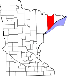 | |
| Townships | ||
| CDP | ||
| Unincorporated communities | ||
| Unorganized territories | ||
| Ghost town | ||
This article is issued from
Wikipedia.
The text is licensed under Creative Commons - Attribution - Sharealike.
Additional terms may apply for the media files.