Castle Danger, Minnesota
| Castle Danger, Minnesota | |
|---|---|
| Unincorporated community | |
 Signpost for Castle Danger | |
 Castle Danger, Minnesota Location of the community of Castle Danger within Silver Creek Township, Lake County  Castle Danger, Minnesota Castle Danger, Minnesota (the US) | |
| Coordinates: 47°07′15″N 91°30′12″W / 47.12083°N 91.50333°WCoordinates: 47°07′15″N 91°30′12″W / 47.12083°N 91.50333°W | |
| Country | United States |
| State | Minnesota |
| County | Lake |
| Elevation | 627 ft (191 m) |
| Population | |
| • Total | 30 |
| Time zone | UTC-6 (Central (CST)) |
| • Summer (DST) | UTC-5 (CDT) |
| ZIP code | 55616 |
| Area code(s) | 218 |
| GNIS feature ID | 640967[1] |
Castle Danger is an unincorporated community in Silver Creek Township, Lake County, Minnesota, United States.
The community is located between Two Harbors and Beaver Bay on Minnesota Highway 61, on the North Shore of Lake Superior.
Castle Danger is located 11 miles northeast of the city of Two Harbors. Gooseberry Falls State Park is nearby.
History
Castle Danger was settled in 1890, by three Norwegian fishermen, although the site was already occupied by lumber companies. The exact origin of the name is unknown, although it might have come from the cliffs on the shore resembling a castle; from a boat named Castle that grounded here;[2] or from the Walter Scott novel Castle Dangerous (1831).
References
- ↑ "Castle Danger, Minnesota". Geographic Names Information System. United States Geological Survey.
- ↑ Minnesota Place Names. Minnesota Historical Society. Retrieved on 2009-6-02
Municipalities and communities of Lake County, Minnesota, United States | ||
|---|---|---|
| Cities | 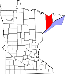 | |
| Townships | ||
| CDP | ||
| Unincorporated communities | ||
| Unorganized territories | ||
| Ghost town | ||
This article is issued from
Wikipedia.
The text is licensed under Creative Commons - Attribution - Sharealike.
Additional terms may apply for the media files.