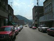
Harlan County, Kentucky
| Harlan County, Kentucky | |
|---|---|
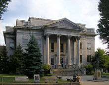 Harlan County courthouse in Harlan | |
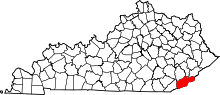 Location in the U.S. state of Kentucky | |
 Kentucky's location in the U.S. | |
| Founded | 1819 |
| Named for | Silas Harlan |
| Seat | Harlan |
| Largest city | Harlan |
| Area | |
| • Total | 468 sq mi (1,212 km2) |
| • Land | 466 sq mi (1,207 km2) |
| • Water | 2.3 sq mi (6 km2), 0.5% |
| Population | |
| • (2010) | 29,278 |
| • Density | 63/sq mi (24/km2) |
| Congressional district | 5th |
| Time zone | Eastern: UTC−5/−4 |
| Website |
www |
Harlan County is a county located in southeastern Kentucky. As of the 2010 census, the population was 29,278.[1] Its county seat is Harlan.[2]
With regard to the sale of alcohol, it is classified as a moist county—a county in which alcohol sales are prohibited (a dry county), but containing a "wet" city, in this case Cumberland, where package alcohol sales are allowed. In the city of Harlan, restaurants seating 100+ may serve alcoholic beverages.[3]
Harlan County is well-known in folk and country music, having produced many prominent musicians. During the 20th century it was often a center of labor strife between coal mine owners and workers, especially in the Harlan County War of the 1930s. The coal mining industry began to decline in the 1950s and was accompanied by a steadily declining population and depressed economy. Harlan became one of the poorest counties in the United States.
Kentucky's highest natural point, Black Mountain (4,145 feet (1,263 m)), is in Harlan County.
History
The area presently bounded by Kentucky state lines was a part of the U.S. State of Virginia, and was established as Kentucky County by the Virginia legislature in 1776, before the British colonies separated themselves in the American Revolutionary War. In 1780, the Virginia legislature divided Kentucky County into three counties: Fayette, Jefferson, and Lincoln.
In 1791 the previous Kentucky County was incorporated into the new nation as a separate state, Kentucky. This change became official on 1 June 1792. In 1799, part of Lincoln County was divided off to create Knox County.
Harlan County was formed in 1819 from a part of Knox County.[4] It is named after Silas Harlan.[5] A pioneer, he was born on 17 March 1753 in Berkeley County, West Virginia (when it was still part of Virginia), the son of George and Ann (Hunt) Harlan. Journeying to Kentucky as a young man with James Harrod in 1774, Harlan served as scout, hunter, and held the rank of Major in the Continental Army. Harlan assisted Harrod's party in Harrodsburg to deliver gunpowder to settlers in Kentucky, and to assist them against the British in the Revolutionary War.
With the help of his uncle Jacob and his brother James, Harlan built a log stockade near Danville known as "Harlan's Station". He served under George Rogers Clark in the Illinois campaign of 1778–79 against the British. He commanded a company in John Bowman's raid on Old Chillicothe in 1779, and assisted Clark in establishing Fort Jefferson at the mouth of the Ohio River in 1780.
Silas Harlan died leading the advance party at the Battle of Blue Licks on 19 August 1782. At the time of his death, Harlan was engaged to Sarah Caldwell, who later married his brother James and was the grandmother of U.S. Supreme Court Justice John Marshall Harlan.[6][7]
The county was reduced in size when Letcher County was formed in 1842 using a part of Harlan's territory; it was further reduced when Bell County was formed on 1 August 1867, from parts of it and Knox County.[8] Its present size was attained in 1878 when its northwestern part was partitioned to form Leslie County.
The county has been the site of repeated attempts to organize labor and gain better deals from owners, beginning in the early 20th century, primarily related to the coal mining industry. What was called the Harlan County War in the 1930s consisted of violent confrontations among strikers, strikebreakers, mine company security forces and law enforcement. These events led to the county's being called "Bloody Harlan." After the Battle of Evarts, 5 May 1931, Kentucky governor Flem D. Sampson called in the National Guard to restore order. Ballads sung on the picket line at the Brookside mine in Harlan County were captured on film by documentarian John Gaventa.[9] The county was the subject of the film Harlan County, USA (1976), which documented strikes and organizing during a second major period of labor unrest in the 1970s.
My daddy was a miner
And I'm a miner's son
And I'll stick with the union
Till every battle's won
They say in Harlan County
There are no neutrals there
You'll either be a union man
Or a thug for J.H. Blair
In 1924, Conda Uless (Ulysses) "Condy" Dabney[10] was convicted in the county of murdering a person who was later found alive.[11]
From the late eighteenth through the mid-nineteenth century, Harlan County and nearby counties were settled by numerous persons of multiracial descent, with African, European and often Native American ancestors. Descendants, some of whose members have been called Melungeon, have documented the racial heritage of Harlan's early settlers through 19th-century photographs, DNA analysis and historic records. In 2007, the Ridgetop Shawnee Tribe of Indians formed as a non-profit to work on improving the lives of multiracial families and preserving Native American heritage. It established the Kentucky Native American Data Bank, which has the names of 1,000 people of documented Native American descent related to this region; it is accessible for free on Rootsweb.
Geography
.jpg)
According to the U.S. Census Bureau, the county has a total area of 468 square miles (1,210 km2), of which 466 square miles (1,210 km2) is land and 2.3 square miles (6.0 km2) (0.5%) is water.[12]
Features
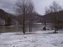
The headwaters of the Cumberland River are located in Harlan County: Poor Fork (extending from the city of Harlan east past the city of Cumberland and into Letcher County), Clover Fork extending East from above Evarts, and Martins Fork (extending through the city of Harlan west). The confluence is located in Baxter.
Black Mountain, located east of Lynch, is Kentucky's highest point, with an elevation of 4,145 feet (1,263 m) above sea level.
Major highways
Adjacent counties
- Perry County (north)
- Letcher County (northeast)
- Wise County, Virginia (east)
- Lee County, Virginia (southeast)
- Bell County (southwest)
- Leslie County (northwest)
National protected areas
Demographics
| Historical population | |||
|---|---|---|---|
| Census | Pop. | %± | |
| 1820 | 1,961 | — | |
| 1830 | 2,929 | 49.4% | |
| 1840 | 3,015 | 2.9% | |
| 1850 | 4,268 | 41.6% | |
| 1860 | 5,494 | 28.7% | |
| 1870 | 4,415 | −19.6% | |
| 1880 | 5,278 | 19.5% | |
| 1890 | 6,197 | 17.4% | |
| 1900 | 9,838 | 58.8% | |
| 1910 | 10,566 | 7.4% | |
| 1920 | 31,546 | 198.6% | |
| 1930 | 64,557 | 104.6% | |
| 1940 | 75,275 | 16.6% | |
| 1950 | 71,751 | −4.7% | |
| 1960 | 51,107 | −28.8% | |
| 1970 | 37,370 | −26.9% | |
| 1980 | 41,889 | 12.1% | |
| 1990 | 36,574 | −12.7% | |
| 2000 | 33,202 | −9.2% | |
| 2010 | 29,278 | −11.8% | |
| Est. 2016 | 27,168 | [13] | −7.2% |
| U.S. Decennial Census[14] 1790–1960[15] 1900–1990[16] 1990–2000[17] 2010–2013[1] | |||
2000 census
As of the census[18] of 2000, there were 33,202 people, 13,291 households, and 9,449 families residing in the county. The population density was 71 per square mile (27/km2). There were 15,017 housing units at an average density of 32 per square mile (12/km2). The racial makeup of the county was 95.56% White, 2.62% African American, 0.48% Native American, 0.29% Asian, 0.02% Pacific Islander, 0.08% from other races, and 0.95% from two or more races. 0.65% of the population were Hispanics or Latinos of any race.
There were 13,291 households out of which 32.20% had children under the age of 18 living with them, 54.30% were married couples living together, 13.20% had a female householder with no husband present, and 28.90% were non-families. 27.00% of all households were made up of individuals and 12.60% had someone living alone who was 65 years of age or older. The average household size was 2.47 and the average family size was 3.00.
The age distribution was 25.00% under the age of 18, 8.50% from 18 to 24, 27.50% from 25 to 44, 25.20% from 45 to 64, and 13.90% who were 65 years of age or older. The median age was 38 years. For every 100 females there were 91.80 males. For every 100 females age 18 and over, there were 87.80 males.
The median income for a household in the county was $18,665, and the median income for a family was $23,536. Males had a median income of $29,148 versus $19,288 for females. The per capita income for the county was $11,585. About 29.10% of families and 32.50% of the population were below the poverty line, including 40.10% of those under age 18 and 21.00% of those age 65 or over.
Life expectancy
Of 3,142 counties in the United States in 2013, Harlan County ranked 3,139 in the longevity of both male and female residents. Males in Harlan County lived an average of 66.5 years and females lived an average of 73.1 years compared to the national average for longevity of 76.5 for males and 81.2 for females. Moreover, the average longevity in Harlan County declined by 0.6 years for males and 2.6 years for females between 1985 and 2013 compared to a national average for the same period of an increased life span of 5.5 years for men and 3.1 years for women. High rates of smoking and obesity and a low level of physical activity appear to be contributing factors to the lowered longevity for both sexes.[19]
Economy
For 100 years, the economy of Harlan County and other counties in eastern Kentucky was based on coal mining. The latter-twentieth-century decline of coal production and employment has led to widespread poverty and high unemployment.
Although coal mining began much earlier, the first shipment of coal by railroad from Harlan County occurred in 1911 and coal production boomed thereafter. Mining employment in Harlan County rose to 13,619 in 1950.[20] The number of employed miners had declined to 764 by June 2016.[21] During the same period, the population of Harlan County declined from 71,000 to less than 28,000. Unemployment has been as high as 20 percent (September 1995) and has consistently been higher than the U.S national average. Unemployment in December 2016 was 9.5 percent, compared to 4.8 percent in the nation as a whole.[22] Harlan County ranked in the highest 10 percent of all United States counties in the prevalence of poverty among its residents.[23]
Annual per capita personal income in Harlan County was $27,425 in 2014 compared to a national average of $48,112.[24]
As of 2018 new jobs are being located in the county as Teleworks USA has opened a hub in the city of Harlan. This has provided over 200 new jobs as of April 2018 [25] SEKRI, located in the Blair community near the city of Cumberland, also announced expansions and added an additional 100 jobs in March 2018.[26]
Politics
Harlan County's political history resembles West Virginia's. Under the Third and Fourth Party Systems it was a Republican county: except when supporting Theodore Roosevelt's "Bull Moose" Party in 1912 it voted Republican in every election from 1880 to 1932.[27] However, with increasing unionization in the coal industry, it became a Democratic stronghold for six decades. With the exception of Dwight D. Eisenhower's victories in 1952 and 1956 and Richard Nixon's landslide re-election in 1972 (in which it gave 59.4% of its votes to the Republican incumbent Nixon and 39.6% of its votes to Democratic Presidential Nominee George McGovern), it voted blue in every election from 1936 to 2000.[27] Even in Ronald Reagan's landslide re-election of 1984, Harlan County voted 51.9% for Democratic Presidential Nominee Walter Mondale, while the Republican incumbent Reagan received 47.1% of the vote. In the 2004 Presidential Election, Harlan County voted for the Republican Presidential Nominee for the first time in 32 years; Republican incumbent George W. Bush received 60.2% of the vote, while the Democratic Presidential Nominee John Kerry received 39.1% of the vote. This rightward trend continued in 2008, when Republican Presidential Candidate John McCain received 72.3% of the vote, while Democratic Presidential Nominee Barack Obama received 26.1% of the vote. In 2012, the Republican gap was even larger, as the Republican Presidential Nominee Mitt Romney won the county over the Democratic incumbent Obama by a 64% margin (81.2% to 17.2%). Then even wider in the 2016 election when Republican Nominee Donald Trump dominated Democratic Nominee Hillary Clinton by 72.12% margin (84.87 to 12.75).[28]
| Year | Republican | Democratic | Third parties |
|---|---|---|---|
| 2016 | 84.9% 9,129 | 12.8% 1,372 | 2.4% 256 |
| 2012 | 81.2% 8,652 | 17.2% 1,830 | 1.6% 175 |
| 2008 | 72.3% 7,165 | 26.1% 2,586 | 1.6% 163 |
| 2004 | 60.2% 6,659 | 39.1% 4,332 | 0.7% 79 |
| 2000 | 47.3% 4,980 | 50.9% 5,365 | 1.8% 190 |
| 1996 | 33.0% 3,337 | 58.0% 5,874 | 9.1% 916 |
| 1992 | 32.5% 3,970 | 55.7% 6,796 | 11.8% 1,437 |
| 1988 | 41.1% 5,166 | 58.4% 7,341 | 0.6% 69 |
| 1984 | 47.1% 6,959 | 51.9% 7,663 | 1.0% 140 |
| 1980 | 37.8% 5,460 | 60.9% 8,798 | 1.4% 199 |
| 1976 | 38.5% 4,624 | 60.8% 7,300 | 0.7% 82 |
| 1972 | 59.4% 6,527 | 39.6% 4,349 | 1.0% 109 |
| 1968 | 35.0% 4,572 | 48.9% 6,389 | 16.2% 2,116 |
| 1964 | 30.0% 4,025 | 70.0% 9,394 | 0.1% 9 |
| 1960 | 44.8% 7,485 | 55.2% 9,211 | 0.0% 0 |
| 1956 | 56.0% 8,820 | 43.9% 6,915 | 0.2% 26 |
| 1952 | 57.9% 10,025 | 42.0% 7,284 | 0.1% 21 |
| 1948 | 31.8% 4,402 | 66.1% 9,158 | 2.2% 300 |
| 1944 | 42.0% 5,815 | 57.8% 8,000 | 0.2% 23 |
| 1940 | 35.6% 5,859 | 64.2% 10,582 | 0.3% 42 |
| 1936 | 40.4% 7,510 | 59.6% 11,060 | 0.0% 0 |
| 1932 | 54.9% 11,118 | 44.9% 9,091 | 0.2% 45 |
| 1928 | 75.4% 12,251 | 24.4% 3,958 | 0.2% 37 |
| 1924 | 72.9% 9,634 | 16.2% 2,133 | 10.9% 1,441 |
| 1920 | 80.1% 7,493 | 19.3% 1,805 | 0.6% 53 |
| 1916 | 77.7% 2,670 | 20.1% 690 | 2.2% 75 |
| 1912 | 34.2% 612 | 19.3% 345 | 46.5% 831 |
Education
Higher education
The county's only higher education institution is Southeast Kentucky Community and Technical College (formerly known as Southeast Community College), a part of the Kentucky Community and Technical College System, with its main campus in Cumberland.
K–12 public schools
The county has two K–12 public school districts.
Harlan County Public Schools
Harlan County Public Schools covers all of Harlan County, except for the city of Harlan and some small unincorporated communities adjacent to the city. The district operates one high school, Harlan County High School, which opened in August 2008. The school nickname is Black Bears, reflecting the area's increasing black bear population. The new high school, located in the rural community of Rosspoint east of Harlan, replaced three other high schools:
- Cumberland High School, Cumberland,[29] served students from the cities of Cumberland, Benham, Lynch, and near the Letcher County border.
- Evarts High School, Evarts,[30] served the area from the Harlan City limits to the Virginia border.
- James A. Cawood High School, Harlan,[31] served students in central Harlan County.
The district operates the following K–8 schools:
- Black Mountain Elementary
- Cawood Elementary
- Cumberland Elementary
- Evarts Elementary
- Green Hills Elementary
- James A. Cawood Elementary
- Rosspoint Elementary
- Wallins Elementary
Harlan Independent Schools
Harlan Independent Schools is a separate district covering the city of Harlan and operating the following schools:
- Harlan High School
- Mascot: Green Dragons[32]
- Harlan Middle School
- Harlan Elementary School
K–12 private schools
There are two private schools in the county:
Economy
Coal companies in Harlan County
- Alpha Natural Resources[35]
- Harlan-Cumberland Coal Company
- James River Coal Company[36]
- US Coal[37]
Area attractions
- Black Mountain Off-Road Adventure Area: This off-road park has been voted number one all-terrain vehicle (ATV) destination by ATV Pathfinder[38] for two years running. It consists of more than 7,000 acres (28 km2) set aside for quads and 4WD vehicle recreation. Harlan County also holds the Guinness World Record for the largest ATV parade.[39]
- Cranks Creek Lake
- Kentucky Coal Mining Museum
- Kingdom Come State Park; Elevation: 2,700 feet (820 m); Size: 1,283 acres (5.19 km2); Location: On the outskirts of the city of Cumberland, and is connected to the Little Shepherd Trail. This state park was named after the popular Civil War novel, The Little Shepherd of Kingdom Come, by Kentucky author John Fox, Jr. The park contains a picnic area, hiking trails, a fishing lake, a cave amphitheater, several lookouts and natural rock formations, including Log Rock and Raven Rock. It is the site of the annual Kentucky Black Bear Festival.
- Martins Fork Lake
- Pine Mountain Settlement School[40]
Communities
Cities
Census-designated places
Other unincorporated communities
Notable people
- Bernie Bickerstaff, NBA coach
- Rebecca Caudill, author of children's books[41]
- Jerry Chesnut, Country Music songwriter
- Carl H. Dodd, Korean War soldier and Medal of Honor recipient
- Wah Wah Jones, NBA player
- Nick Lachey, singer, actor
- Cawood Ledford, University of Kentucky basketball and football announcer
- George Ella Lyon, author and poet
- Florence Reece, songwriter
- Louise Slaughter, Congresswoman
- Jordan Smith, winner of NBC's The Voice, 2015
In popular culture
Prose
Elmore Leonard's novels Pronto, Riding the Rap, and "Raylan" feature Raylan Givens, a Harlan County native, and his short story "Fire in the Hole" has Givens returning to Harlan.
In the James Jones novel "From Here to Eternity", Robert E. Lee Prewitt, a bugler in the Army and a main character, is from Harlan County.
Music
Harlan County is mentioned in many versions of the 18th century folk song "Shady Grove". The famous labor song, "Which Side Are You On?", was written by Florence Reece in 1931 in and about Harlan. It has been covered by many artists from Pete Seeger and the Almanac Singers to Billy Bragg, the Dropkick Murphys, and Natalie Merchant. Harlan is mentioned in the Aaron Watson song "Kentucky Coal Miner's Prayer".
It is mentioned in Robert Mitchum's recording "Ballad of Thunder Road" as a stop along a moonshine route. It is the subject of the Darrell Scott song "You'll Never Leave Harlan Alive", which has been covered by Brad Paisley, Dave Alvin, Kathy Mattea, and Patti Loveless, among others, and has been heard in several versions on the TV drama Justified.[42]
Dierks Bentley's song "Down in the Mine", on his Up on the Ridge album, mentions Harlan. The band Spear of Destiny included the song "Harlan County", on their 1985 album World Service. Harlan County is mentioned in the Merle Travis song Nine Pound Hammer which he wrote in 1939; it has been covered by many bluegrass artists including Doc Watson.
Wayne Kemp wrote and recorded a song called "Harlan County." Harlan County is also the name of the first album by Jim Ford, 1969, as well as a song bearing the same name. The Dave Alvin song "Harlan County Line" take place around the area of Harlan. Singer/Songwriter Loudon Wainwright III included a song titled "Harlan County" on his 2014 album I Haven't Got The Blues (Yet). Harlan County is mentioned as the setting of the David Allan Coe song "Daddy Was A God Fearin' Man" in his 1977 album Tattoo.
Steve Earle wrote and recorded "Harlan Man" included on the 1999 Grammy-nominated album " The Mountain" recorded with the Del McCoury Band.
Films
- Harlan County, USA (1976). Documentary film directed by Barbara Kopple depicting the Eastover/Brookside coal miners' strike, which won the Academy Award for Best Documentary Feature.
- Harlan County War (2000). Dramatic film based on the Eastover/Brookside strike. Directed by Tony Bill and starring Holly Hunter.
- Thunder Road (film) (1958). Dramatic film about moonshiners based in Harlan County and starring Robert Mitchum.
Television
- The FX television series Justified, created by Graham Yost and based on Elmore Leonard's Raylan Givens novels and short story,[43] is set in the U.S. federal district of Eastern Kentucky and prominently in Harlan County. The show is filmed in California, however, not in Kentucky.
- William Lewis (played by Pablo Schreiber), the suspect in the Law & Order: Special Victims Unit episode "Her Negotiation" (season 14, episode 24), was born and allegedly committed his first offense in Harlan County.
- Kentucky Justice, a reality TV show on National Geographic Channel, is set in Harlan County and follows Sheriff Marvin J. Lipfird & his department.
See also
- Justified, a TV series set in and around Harlan County
- National Register of Historic Places listings in Harlan County, Kentucky
References
- 1 2 "State & County QuickFacts". United States Census Bureau. Archived from the original on 11 July 2011. Retrieved 8 March 2014.
- ↑ "Find a County". National Association of Counties. Archived from the original on 31 May 2011. Retrieved 7 June 2011.
- ↑ "Wet & Dry Counties in Kentucky" (PDF). Kentucky Office of Alcoholic Beverage Control. Archived from the original (PDF) on 15 March 2007. Retrieved 21 March 2007.
- ↑ "Find A County". Naco.org. Archived from the original on 31 May 2011. Retrieved 16 April 2013.
- ↑ Rennick, Robert M. (1987). Kentucky Place Names. University Press of Kentucky. p. 131. Retrieved 28 April 2013.
- ↑ Green III, James S. (1964). Major Silas Harlan: His Life and Times. Baxter KY. p. 83.
- ↑ Harlan, Alpheus Hibben (1914). History and Genealogy of the Harlan Family; and Particularly of the Descendants of George and Michael Harlan Who Settled in Chester County PA, 1687. Baltimore.
- ↑ "Bell County, Kentucky" Genealogy Inc. Retrieved 6 July 2010.
- ↑ Tom Hansell, Patricia Beaver and Angela Wiley, "Keep Your Eye upon the Scale,"
- ↑ U.S. World War I Draft Registration Card: Conda Uless Dabney, accessed March 2017
- ↑ Convicting the Innocent - Errors in Criminal Justice: Condy Danny, accessed March 2017
- ↑ "2010 Census Gazetteer Files". United States Census Bureau. 22 August 2012. Archived from the original on 12 August 2014. Retrieved 16 August 2014.
- ↑ "Population and Housing Unit Estimates". Retrieved 9 June 2017.
- ↑ "U.S. Decennial Census". United States Census Bureau. Archived from the original on 12 May 2015. Retrieved 16 August 2014.
- ↑ "Historical Census Browser". University of Virginia Library. Retrieved 16 August 2014.
- ↑ "Population of Counties by Decennial Census: 1900 to 1990". United States Census Bureau. Retrieved 16 August 2014.
- ↑ "Census 2000 PHC-T-4. Ranking Tables for Counties: 1990 and 2000" (PDF). United States Census Bureau. Retrieved 16 August 2014.
- ↑ "American FactFinder". United States Census Bureau. Archived from the original on 11 September 2013. Retrieved 31 January 2008.
- ↑ "Harlan County, Kentucky", "Archived copy" (PDF). Archived from the original (PDF) on 12 April 2016. Retrieved 12 October 2016. , accessed 12 October 2016
- ↑ "100 years of Coal Mining in Harlan County", Lexington Herald-Leader, accessed 15 February 2017
- ↑ Kentucky Quarterly Coal Report, April to June 2016, accessed 15 February 2017
- ↑ "Unemployment rate in Harlan County, Kentucky accessed 15 February 2017
- ↑ "County Profile: Harlan County, Kentucky", "Archived copy" (PDF). Archived from the original (PDF) on 12 April 2016. Retrieved 12 October 2016. , accessed 15 February 2017
- ↑ "Per Capita Personal Income in Harlan County, Kentucky" accessed 15 February 2017
- ↑ Harlan Daily Enterprise (17 April 2018)
- ↑ Harlan Daily Enterprise (15 May 2018)
- 1 2 The Political Graveyard; Harlan County, Kentucky
- 1 2 Leip, David. "Dave Leip's Atlas of U.S. Presidential Elections". uselectionatlas.org. Retrieved 7 April 2018.
- ↑ "Cumberland High School". Web.archive.org. 14 October 2008. Archived from the original on 14 October 2008. Retrieved 10 July 2013.
- ↑ "Evarts High School". Web.archive.org. 23 January 2011. Archived from the original on 23 January 2011. Retrieved 10 July 2013.
- ↑ "James A. Cawood High School". Web.archive.org. 25 December 2008. Archived from the original on 25 December 2008. Retrieved 10 July 2013.
- ↑ "Harlan Independent Schools". Harlan-ind.k12.ky.us. Retrieved 10 July 2013.
- ↑ "車査定で高値を引き出すコツ!知らなきゃ損する中古車買取の秘訣". Hccs-warriors.com. Archived from the original on 3 June 2013. Retrieved 10 July 2013.
- ↑ "Home – Victory Road Christian Academy". Victoryroadchristianacademy.webs.com. Archived from the original on 15 May 2013. Retrieved 10 July 2013.
- ↑ Alpha Natural Resources - 2012 Kentucky Operations
- ↑ "James River Coal Company – Bledsoe". www.jamesrivercoal.com. Retrieved 7 April 2018.
- ↑ "uscoalinc.com". uscoalinc.com. Archived from the original on 2 January 2016.
- ↑ "atvpathfinder.com". atvpathfinder.com.
- ↑ Lee-Sherman, Deanna (16 September 2006). "County breaks ATV world record". The Harlan Daily Enterprise.
- ↑ "Pine Mountain Settlement School". Pine Mountain Settlement School. Retrieved 10 July 2013.
- ↑ Rebecca Caudill Young Readers' Book Award: About the Award. Rebeccacaudill.org (2 October 1985). Retrieved 13 March 2011.
- ↑ Bianculli, David (15 April 2015). "'Justified' Ends With An Unpredictable, Poetic And Memorable Finale". Fresh Air. NPR. Retrieved 16 April 2018.
- ↑ Zogbi, Marina (1 December 2009). "'Justified' on FX Premiering in March". AOL. Retrieved 13 December 2009.
Further reading
- Portelli, Alessandro (2011). They Say in Harlan County: An Oral History. Oxford: Oxford University Press. ISBN 978-0-19-973568-6.
- Tom Hansell, Patricia Beaver and Angela Wiley, "Keep Your Eye upon the Scale,"
- G. C. Jones, "Growing up Hard in Harlan County," published by University Press of Kentucky, ISBN 978-0-8131-9080-8
External links
| Wikimedia Commons has media related to Harlan County, Kentucky. |
- Harlan County Clerk Office
- Harlan County Chamber of Commerce
- Black Mountain Rec Park – Harlan County's Tourism
- Harlan Daily Enterprise newspaper
- The Pine Mountain Settlement School
- The Kentucky Highlands Project
- Harlan County History and Genealogy
