Nelson County, Kentucky
| Nelson County, Kentucky | |
|---|---|
| County | |
| County of Nelson | |
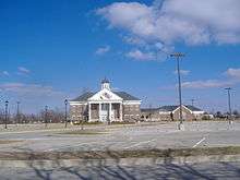 Nelson County Courthouse, Bardstown | |
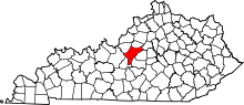 Location in the U.S. state of Kentucky | |
 Kentucky's location in the U.S. | |
| Founded | November 29, 1784 |
| Named for | Thomas Nelson, Jr. |
| Seat | Bardstown |
| Largest city | Bardstown |
| Area | |
| • Total | 424 sq mi (1,098 km2) |
| • Land | 418 sq mi (1,083 km2) |
| • Water | 6.6 sq mi (17 km2), 1.5% |
| Population | |
| • (2010) | 43,437 |
| • Density | 104/sq mi (40/km2) |
| Congressional district | 2nd |
| Time zone | Eastern: UTC−5/−4 |
| Website |
www |
Nelson County is a county located in the U.S. state of Kentucky. As of the 2010 census, the population was 43,437.[1] Its county seat is Bardstown.[2]
Nelson County comprises the Bardstown, KY Micropolitan Statistical Area, which is also included in the Louisville/Jefferson County-Elizabethtown-Madison, KY-IN Combined Statistical Area.
History
The fourth county created in what is now Kentucky, it was formed from Jefferson County, Virginia in 1784, shortly after the Revolutionary War.[3][4] The county was named for Thomas Nelson, Jr., a Virginia Governor who signed the Declaration of Independence.[5] In 1807, after Kentucky had become a state, a newly created Virginia county was named in his honor.
Geography
According to the U.S. Census Bureau, the county has a total area of 424 square miles (1,100 km2), of which 418 square miles (1,080 km2) is land and 6.6 square miles (17 km2) (1.5%) is water.[6]
Adjacent counties
- Spencer County (north)
- Anderson County (northeast)
- Washington County (east)
- Marion County (southeast)
- LaRue County (south)
- Hardin County (west)
- Bullitt County (northwest)
Demographics
| Historical population | |||
|---|---|---|---|
| Census | Pop. | %± | |
| 1790 | 11,315 | — | |
| 1800 | 9,866 | −12.8% | |
| 1810 | 14,078 | 42.7% | |
| 1820 | 16,273 | 15.6% | |
| 1830 | 14,932 | −8.2% | |
| 1840 | 13,637 | −8.7% | |
| 1850 | 14,789 | 8.4% | |
| 1860 | 15,799 | 6.8% | |
| 1870 | 14,804 | −6.3% | |
| 1880 | 16,609 | 12.2% | |
| 1890 | 16,417 | −1.2% | |
| 1900 | 16,587 | 1.0% | |
| 1910 | 16,830 | 1.5% | |
| 1920 | 16,137 | −4.1% | |
| 1930 | 16,551 | 2.6% | |
| 1940 | 18,004 | 8.8% | |
| 1950 | 19,521 | 8.4% | |
| 1960 | 22,168 | 13.6% | |
| 1970 | 23,477 | 5.9% | |
| 1980 | 27,584 | 17.5% | |
| 1990 | 29,710 | 7.7% | |
| 2000 | 37,477 | 26.1% | |
| 2010 | 43,437 | 15.9% | |
| Est. 2016 | 45,559 | [7] | 4.9% |
| U.S. Decennial Census[8] 1790-1960[9] 1900-1990[10] 1990-2000[11] 2010-2013[1] | |||
As of the census[12] of 2010, there were 43,437 people and 18,075 housing units in the county.[13] The population density was 102.4 per square mile (39.5/km2). There were 18,075 housing units at an average density of 42.6 per square mile (16.4/km2). The racial makeup of the county was 93.48% White (90.93% non-Hispanic), 5.03% Black or African American, 0.12% Native American, 0.50% Asian, 0.02% Pacific Islander, 0.78% from other races, and 1.62% from two or more races. 2.04% of the population were Hispanics or Latinos of any race.
There were 16,826 households out of which 36.60% had children under the age of 18 living with them, 52.09% were married couples living together, 13.19% had a female householder with no husband present, 5.35% had a male householder with no wife present, and 29.37% were non-families. 24.41% of all households were made up of individuals and 8.09% had someone living alone who was 65 years of age or older. The average household size was 2.55 and the average family size was 3.01.
The age distribution was 25.98% under 18, 7.98% from 18 to 24, 26.47% from 25 to 44, 27.84% from 45 to 64, and 11.73% who were 65 or older. The median age was 37.7 years. For every 100 females, there were 96.80 males. For every 100 females age 18 and over, there were 93.60 males.
Income data for Kentucky locations from the 2010 Census has not yet been released. As of the 2000 census, the median income for a household in the county was $39,010, and the median income for a family was $44,600. Males had a median income of $32,015 versus $21,838 for females. The per capita income for the county was $18,120. About 10.00% of families and 12.20% of the population were below the poverty line, including 15.70% of those under age 18 and 17.40% of those age 65 or over.
Attractions and events
There are many attractions and events in Bardstown. Following are attractions and events outside the county seat:
- Rooster Run is a general store located on Kentucky Route 245 halfway between Bardstown and Clermont, well known for baseball caps featuring its logo and a 13.5-foot (4.1 m)-tall fiberglass rooster statue standing in front of the store. According to The Kentucky Encyclopedia, it is "one of the best-known general stores in the country and one of Kentucky's best-known unincorporated businesses".[14]
Education
Two public school districts operate in the county:
- The Nelson County School District serves K-12 students throughout the county, with the exception of most of the city of Bardstown and developed areas near the city limits. The district operates two K-8 schools, two elementary schools, two middle schools, an alternative school, a vocational-technical school, and two high schools.
- The Bardstown City Schools serve students in most of the city of Bardstown, as well as much of the developed area immediately adjacent to the city limits. However, some areas of the city are instead served by the Nelson County district, and some of the Nelson County schools are physically within the Bardstown district. The district operates a preschool, an ungraded primary school (K-2), one elementary school, one middle school, and one high school. The preschool and primary school occupy separate buildings on adjacent plots of land in the north of the city, and the other schools are adjacent to one another near downtown.
Several private schools also operate in the county. The Roman Catholic Archdiocese of Louisville operates five schools in all—three K-8 schools, a fourth that educates grades 1 through 8, and one high school. Several Protestant-affiliated schools also exist.
Politics
| Year | Republican | Democratic | Third parties |
|---|---|---|---|
| 2016 | 64.6% 13,431 | 30.9% 6,434 | 4.5% 937 |
| 2012 | 57.6% 10,673 | 41.1% 7,611 | 1.3% 249 |
| 2008 | 55.9% 10,139 | 42.2% 7,654 | 2.0% 353 |
| 2004 | 60.3% 10,161 | 38.7% 6,524 | 0.9% 159 |
| 2000 | 57.2% 7,714 | 40.6% 5,481 | 2.2% 293 |
| 1996 | 41.6% 4,645 | 48.3% 5,392 | 10.1% 1,122 |
| 1992 | 38.5% 4,495 | 46.6% 5,437 | 14.9% 1,740 |
| 1988 | 51.9% 5,283 | 47.0% 4,788 | 1.1% 108 |
| 1984 | 58.6% 6,044 | 40.7% 4,199 | 0.7% 76 |
| 1980 | 36.8% 3,349 | 60.5% 5,514 | 2.8% 251 |
| 1976 | 37.4% 2,804 | 59.4% 4,454 | 3.3% 246 |
| 1972 | 53.5% 3,495 | 43.3% 2,828 | 3.1% 205 |
| 1968 | 34.3% 2,373 | 49.5% 3,420 | 16.2% 1,123 |
| 1964 | 23.1% 1,683 | 76.6% 5,586 | 0.4% 27 |
| 1960 | 39.1% 3,021 | 60.9% 4,713 | 0.0% 0 |
| 1956 | 55.8% 4,107 | 44.0% 3,240 | 0.2% 18 |
| 1952 | 47.2% 3,064 | 52.6% 3,417 | 0.2% 13 |
| 1948 | 31.8% 1,715 | 65.8% 3,556 | 2.4% 130 |
| 1944 | 36.8% 2,136 | 62.8% 3,648 | 0.5% 27 |
| 1940 | 33.4% 2,109 | 66.5% 4,193 | 0.1% 8 |
| 1936 | 30.1% 1,913 | 66.6% 4,234 | 3.3% 211 |
| 1932 | 28.4% 2,100 | 71.2% 5,272 | 0.4% 29 |
| 1928 | 42.0% 2,926 | 57.9% 4,031 | 0.0% 3 |
| 1924 | 34.6% 2,082 | 64.1% 3,863 | 1.3% 79 |
| 1920 | 36.7% 2,945 | 63.0% 5,061 | 0.3% 27 |
| 1916 | 36.6% 1,546 | 62.5% 2,639 | 0.8% 35 |
| 1912 | 19.9% 751 | 60.1% 2,275 | 20.0% 758 |
Communities
Cities
- Bardstown (county seat)
- Bloomfield
- Fairfield
- New Haven
Census-designated places
Other unincorporated places
- Balltown
- Cedar Creek
- Coxs Creek
- Culvertown
- Deatsville
- Highgrove
- Howardstown
- Icetown
- Lenore
- Nazareth
- Samuels
- Trappist
- Woodlawn
See also
References
- 1 2 "State & County QuickFacts". United States Census Bureau. Archived from the original on July 15, 2011. Retrieved March 6, 2014.
- ↑ "Find a County". National Association of Counties. Retrieved 2011-06-07.
- ↑ "Nelson County". The Kentucky Encyclopedia. 2000. Retrieved August 23, 2014.
- ↑ Collins, Lewis (1882). Collins' Historical Sketches of Kentucky: History of Kentucky, Volume 2. Collins & Company. p. 26.
- ↑ The Register of the Kentucky State Historical Society, Volume 1. Kentucky State Historical Society. 1903. p. 36.
- ↑ "2010 Census Gazetteer Files". United States Census Bureau. August 22, 2012. Archived from the original on August 12, 2014. Retrieved August 19, 2014.
- ↑ "Population and Housing Unit Estimates". Retrieved June 9, 2017.
- ↑ "U.S. Decennial Census". United States Census Bureau. Retrieved August 19, 2014.
- ↑ "Historical Census Browser". University of Virginia Library. Retrieved August 19, 2014.
- ↑ "Population of Counties by Decennial Census: 1900 to 1990". United States Census Bureau. Retrieved August 19, 2014.
- ↑ "Census 2000 PHC-T-4. Ranking Tables for Counties: 1990 and 2000" (PDF). United States Census Bureau. Retrieved August 19, 2014.
- ↑ "American FactFinder". United States Census Bureau. Retrieved 2011-05-14.
- ↑ "2010 Demographic Profile Data: Nelson County, Kentucky". United States Census Bureau. Retrieved May 13, 2011.
- ↑ Delong, Hettie (1992). "Rooster Run". In Kleber, John E. The Kentucky Encyclopedia. Associate editors: Thomas D. Clark, Lowell H. Harrison, and James C. Klotter. Lexington, Kentucky: The University Press of Kentucky. ISBN 0-8131-1772-0. Retrieved July 17, 2015.
- ↑ Leip, David. "Dave Leip's Atlas of U.S. Presidential Elections". uselectionatlas.org. Retrieved 2018-07-05.
Further reading
- Davis, William C., ed. (1990). Diary of a Confederate Soldier: John S. Jackman of the Orphan Brigade. American Military History. Columbia, South Carolina: University of South Carolina Press. pp. 12–17, 169. ISBN 0-87249-695-3. LCCN 90012431. OCLC 906557161.
External links
| Wikimedia Commons has media related to Nelson County, Kentucky. |
- Government
- General information
- Bardstown-Nelson County Chamber of Commerce

- Nelson County Public Library
Municipalities and communities of Nelson County, Kentucky, United States | ||
|---|---|---|
| Cities | | |
| CDPs | ||
| Other unincorporated communities | ||
