Union County, Kentucky
| Union County, Kentucky | |
|---|---|
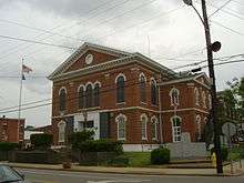 Union County Courthouse in Morganfield | |
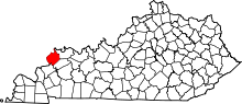 Location in the U.S. state of Kentucky | |
 Kentucky's location in the U.S. | |
| Founded | January 15, 1811 |
| Seat | Morganfield |
| Largest city | Morganfield |
| Area | |
| • Total | 363 sq mi (940 km2) |
| • Land | 343 sq mi (888 km2) |
| • Water | 21 sq mi (54 km2), 5.6% |
| Population | |
| • (2010) | 15,007 |
| • Density | 44/sq mi (17/km2) |
| Congressional district | 1st |
| Time zone | Central: UTC−6/−5 |
| Website |
www |
Union County is a county located in the U.S. state of Kentucky. As of the 2010 census, the population was 15,007.[1] Its county seat is Morganfield.[2] The county was formed on January 15, 1811.
The county is located on the Ohio River opposite the mouth of the Wabash River. Union County, along with neighboring Posey County, Indiana, and Gallatin County, Illinois, form the tri-point of the Illinois-Indiana-Kentucky Tri-State Area.
Geography
According to the U.S. Census Bureau, the county has a total area of 363 square miles (940 km2), of which 343 square miles (890 km2) is land and 21 square miles (54 km2) (5.6%) is water.[3] Union County is part of the Western Coal Fields region of Kentucky. The county's northwestern border with Illinois and Indiana is formed by the Ohio River.
Adjacent counties
- Posey County, Indiana (north)
- Henderson County (northeast)
- Webster County (southeast)
- Crittenden County (south)
- Hardin County, Illinois (west)
- Gallatin County, Illinois (northwest)
Demographics
| Historical population | |||
|---|---|---|---|
| Census | Pop. | %± | |
| 1820 | 3,470 | — | |
| 1830 | 4,764 | 37.3% | |
| 1840 | 6,673 | 40.1% | |
| 1850 | 9,012 | 35.1% | |
| 1860 | 12,791 | 41.9% | |
| 1870 | 13,640 | 6.6% | |
| 1880 | 17,809 | 30.6% | |
| 1890 | 18,229 | 2.4% | |
| 1900 | 21,326 | 17.0% | |
| 1910 | 19,886 | −6.8% | |
| 1920 | 18,040 | −9.3% | |
| 1930 | 17,053 | −5.5% | |
| 1940 | 17,411 | 2.1% | |
| 1950 | 14,893 | −14.5% | |
| 1960 | 14,537 | −2.4% | |
| 1970 | 15,882 | 9.3% | |
| 1980 | 17,821 | 12.2% | |
| 1990 | 16,557 | −7.1% | |
| 2000 | 15,637 | −5.6% | |
| 2010 | 15,007 | −4.0% | |
| Est. 2016 | 14,880 | [4] | −0.8% |
| U.S. Decennial Census[5] 1790-1960[6] 1900-1990[7] 1990-2000[8] 2010-2013[1] | |||
As of the 2010 Census, the population was 15,007. Of this, 85.45% were White, 12.05% were Black or African American, 1.49% were two or more races, 0.44% were some other race, 0.34% were Asian, 0.19% were American Indian or Alaska Native, 0.05% were Native Hawaiian or other Pacific Islander. Hispanic or Latino (of any race) were 1.62% of the population[9]
As of the census[10] of 2000, there were 15,637 people, 5,710 households, and 4,082 families residing in the county. The population density was 45 per square mile (17/km2). There were 6,234 housing units at an average density of 18 per square mile (6.9/km2). The racial makeup of the county was 85.04% White, 12.89% Black or African American, 0.17% Native American, 0.15% Asian, 0.39% from other races, and 1.37% from two or more races. 1.56% of the population were Hispanic or Latino of any race.
There were 5,710 households out of which 32.10% had children under the age of 18 living with them, 56.50% were married couples living together, 11.40% had a female householder with no husband present, and 28.50% were non-families. 26.10% of all households were made up of individuals and 12.40% had someone living alone who was 65 years of age or older. The average household size was 2.50 and the average family size was 2.99.
25.30% of the population was under the age of 18, 13.80% from 18 to 24, 25.50% from 25 to 44, 22.50% from 45 to 64, and 12.90% who were 65 years of age or older. The median age was 34 years. For every 100 females there were 101.80 males. For every 100 females age 18 and over, there were 99.30 males.
The median income for a household in the county was $35,018, and the median income for a family was $43,103. Males had a median income of $30,244 versus $20,817 for females. The per capita income for the county was $17,465. About 9.30% of families and 17.70% of the population were below the poverty line, including 18.30% of those under age 18 and 11.70% of those age 65 or over.
Education
Public schools are managed by Union County Public Schools. The three public elementary schools in the county are located in Morganfield, Sturgis, and Uniontown. The county has one public middle school and one public high school, Union County High School. Located near Morganfield, Kentucky, it is known for its wrestling program. St. Ann School, the only private school in the county, is located in Morganfield—it teaches preschool, elementary, and middle school classes.
Transportation
These are the major highway routes through Union County:
The John T. Myers Locks and Dam, once known as Uniontown Locks and Dam, is located on the Ohio River 3½ miles downstream from Uniontown. It straddles the river between Union County and Posey County Indiana. Construction of the dam was begun in 1965 by the U.S. Army Corps of Engineers and completed in 1977. It was renamed to honor retired Indiana congressman John T. Myers.[11]
Communities
Cities
Census-designated place
Other unincorporated places
- Bordley
- Boxville
- Caseyville
- Curlew
- Dekoven
- Grangertown
- Grove Center
- Henshaw
- Pride
- Spring Grove
- Sullivan
- The Rocks
Politics
| Year | Republican | Democratic | Third parties |
|---|---|---|---|
| 2016 | 75.7% 4,701 | 21.4% 1,331 | 2.9% 179 |
| 2012 | 66.2% 3,955 | 32.5% 1,942 | 1.4% 82 |
| 2008 | 51.7% 3,120 | 46.5% 2,804 | 1.8% 110 |
| 2004 | 59.1% 3,534 | 40.1% 2,398 | 0.8% 45 |
| 2000 | 51.2% 2,749 | 47.5% 2,547 | 1.3% 72 |
| 1996 | 30.6% 1,554 | 57.3% 2,913 | 12.1% 617 |
| 1992 | 28.0% 1,605 | 57.9% 3,325 | 14.1% 809 |
| 1988 | 40.7% 2,292 | 58.9% 3,316 | 0.4% 20 |
| 1984 | 44.8% 2,524 | 54.8% 3,090 | 0.4% 23 |
| 1980 | 34.0% 1,847 | 64.0% 3,479 | 2.0% 111 |
| 1976 | 32.3% 1,716 | 66.6% 3,540 | 1.1% 56 |
| 1972 | 58.7% 2,701 | 40.3% 1,855 | 1.0% 48 |
| 1968 | 23.7% 1,371 | 45.2% 2,616 | 31.2% 1,807 |
| 1964 | 23.6% 1,220 | 75.9% 3,934 | 0.5% 27 |
| 1960 | 34.1% 1,789 | 65.9% 3,457 | 0.0% 0 |
| 1956 | 37.7% 1,956 | 55.1% 2,863 | 7.2% 374 |
| 1952 | 36.3% 1,967 | 63.5% 3,445 | 0.2% 10 |
| 1948 | 16.7% 744 | 80.9% 3,607 | 2.5% 110 |
| 1944 | 21.1% 935 | 78.7% 3,489 | 0.3% 12 |
| 1940 | 20.3% 1,111 | 79.6% 4,355 | 0.2% 8 |
| 1936 | 16.7% 965 | 81.5% 4,713 | 1.9% 107 |
| 1932 | 17.7% 1,063 | 81.7% 4,892 | 0.6% 36 |
| 1928 | 37.6% 2,350 | 62.2% 3,884 | 0.1% 9 |
| 1924 | 32.1% 1,778 | 63.0% 3,493 | 5.0% 276 |
| 1920 | 28.0% 1,943 | 70.8% 4,919 | 1.2% 85 |
| 1916 | 29.7% 1,184 | 69.0% 2,754 | 1.4% 54 |
| 1912 | 19.2% 642 | 64.9% 2,168 | 15.9% 530 |
Notable people
- Isaiah L. Potts (1784?-after 1843), tavern keeper of the notorious Potts Tavern who, allegedly, ran a gang of highwaymen and murderers on the Illinois frontier
- Ben M. Bogard, lived as a child in Union County. Became a Baptist preacher and involved with the Landmarkism movement.
See also
- National Register of Historic Places listings in Union County, Kentucky
- Ben M. Bogard, Baptist clergyman, reared in Union County in the 1870s[13]
References
- 1 2 "State & County QuickFacts". United States Census Bureau. Retrieved March 6, 2014.
- ↑ "Find a County". National Association of Counties. Retrieved 2011-06-07.
- ↑ "2010 Census Gazetteer Files". United States Census Bureau. August 22, 2012. Archived from the original on August 12, 2014. Retrieved August 20, 2014.
- ↑ "Population and Housing Unit Estimates". Retrieved June 9, 2017.
- ↑ "U.S. Decennial Census". United States Census Bureau. Retrieved August 20, 2014.
- ↑ "Historical Census Browser". University of Virginia Library. Retrieved August 20, 2014.
- ↑ "Population of Counties by Decennial Census: 1900 to 1990". United States Census Bureau. Retrieved August 20, 2014.
- ↑ "Census 2000 PHC-T-4. Ranking Tables for Counties: 1990 and 2000" (PDF). United States Census Bureau. Retrieved August 20, 2014.
- ↑ "2010 Census Population of Union County, Kentucky - CensusViewer". censusviewer.com.
- ↑ "American FactFinder". United States Census Bureau. Retrieved 2008-01-31.
- ↑ "Myers Dam". Locks and Dams Project Office, U.S. Army Corps of Engineers, Louisville District. Archived from the original on January 9, 2009. Retrieved 2009-06-08.
- ↑ Leip, David. "Dave Leip's Atlas of U.S. Presidential Elections". uselectionatlas.org.
- ↑ "Benjamin Marcus Bogard (1868–1951)". encyclopediaofarkansas.net. Retrieved August 4, 2013.
External links
| Wikimedia Commons has media related to Union County, Kentucky. |
Places adjacent to Union County, Kentucky | ||||||||||
|---|---|---|---|---|---|---|---|---|---|---|
| ||||||||||
Municipalities and communities of Union County, Kentucky, United States | ||
|---|---|---|
| Cities | | |
| CDP | ||
| Unincoporated communities | ||
