Perry County, Kentucky
| Perry County, Kentucky | |
|---|---|
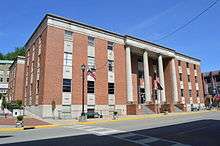 County courthouse in Hazard | |
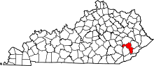 Location in the U.S. state of Kentucky | |
 Kentucky's location in the U.S. | |
| Founded | 2 November, 1820 |
| Named for | Oliver Hazard Perry |
| Seat | Hazard |
| Largest city | Hazard |
| Area | |
| • Total | 343 sq mi (888 km2) |
| • Land | 340 sq mi (881 km2) |
| • Water | 2.9 sq mi (8 km2), 0.9% |
| Population | |
| • (2010) | 28,712 |
| • Density | 85/sq mi (33/km2) |
| Congressional district | 5th |
| Time zone | Eastern: UTC−5/−4 |
| Website |
www |
Perry County is a county located in the U.S. state of Kentucky. As of the 2010 census, the population was 28,712.[1] Its county seat is Hazard.[2] The county was founded in 1820.[3] Both the county and county seat are named for Commodore Oliver Hazard Perry, a naval hero in the War of 1812.[4]
History
The area presently bounded by Kentucky state lines was a part of the U.S. State of Virginia, known as Kentucky County when the British colonies separated themselves in the American Revolutionary War. In 1780, Kentucky County was divided into three counties: Fayette, Jefferson, and Lincoln. In 1791, this area was separated into the State of Kentucky; it became effective on 1 June 1792. From that time, the original three counties were divided several times. By 1820, the present Perry County was formed from portions of Floyd and Clay counties. In 1824 the first post office was built on the north fork of the Kentucky River, and was called the Perry Post Office. The first settlers around this area were Elijah Combs and his seven brothers.
The county's economy has long been based on logging and mining coal.
Perry County is home to Hazard Community and Technical College. It is also home to the Hazard ARH Regional Medical Center, a not-for-profit health system operating 10 hospitals, multi-specialty physician practices, home health agencies, HomeCare Stores and retail pharmacies. It is the largest provider of care and single largest employer in southeastern Kentucky and the third largest private employer in southern West Virginia.[5]
Geography
According to the U.S. Census Bureau, the county has a total area of 343 square miles (890 km2), of which 340 square miles (880 km2) is land and 2.9 square miles (7.5 km2) (0.9%) is water.[6]
Adjacent counties
- Breathitt County (north)
- Knott County (northeast)
- Letcher County (southeast)
- Harlan County (south)
- Leslie County (west)
- Clay County (northwest)
- Owsley County (northwest)
Demographics
| Historical population | |||
|---|---|---|---|
| Census | Pop. | %± | |
| 1830 | 3,330 | — | |
| 1840 | 3,089 | −7.2% | |
| 1850 | 3,092 | 0.1% | |
| 1860 | 3,950 | 27.7% | |
| 1870 | 4,274 | 8.2% | |
| 1880 | 5,607 | 31.2% | |
| 1890 | 6,331 | 12.9% | |
| 1900 | 8,276 | 30.7% | |
| 1910 | 11,255 | 36.0% | |
| 1920 | 26,042 | 131.4% | |
| 1930 | 42,186 | 62.0% | |
| 1940 | 47,828 | 13.4% | |
| 1950 | 46,566 | −2.6% | |
| 1960 | 34,961 | −24.9% | |
| 1970 | 26,259 | −24.9% | |
| 1980 | 33,763 | 28.6% | |
| 1990 | 30,283 | −10.3% | |
| 2000 | 29,390 | −2.9% | |
| 2010 | 28,712 | −2.3% | |
| Est. 2016 | 27,343 | [7] | −4.8% |
| U.S. Decennial Census[8] 1790-1960[9] 1900-1990[10] 1990-2000[11] 2010-2013[1] | |||
As of the census[12] of 2000, there were 29,390 people, 11,460 households, and 8,491 families residing in the county. The population density was 86 per square mile (33/km2). There were 12,741 housing units at an average density of 37 per square mile (14/km2). The racial makeup of the county was 97.34% White, 1.64% Black or African American, 0.05% Native American, 0.49% Asian, 0.01% Pacific Islander, 0.04% from other races, and 0.43% from two or more races. 0.52% of the population were Hispanic or Latino of any race.
There were 11,460 households out of which 34.20% had children under the age of 18 living with them, 56.70% were married couples living together, 13.20% had a female householder with no husband present, and 25.90% were non-families. 23.30% of all households were made up of individuals and 9.30% had someone living alone who was 65 years of age or older. The average household size was 2.53 and the average family size was 2.98.
In the county, the population was spread out with 24.40% under the age of 18, 9.10% from 18 to 24, 30.70% from 25 to 44, 24.60% from 45 to 64, and 11.20% who were 65 years of age or older. The median age was 36 years. For every 100 females there were 94.60 males. For every 100 females age 18 and over, there were 91.30 males.
The median income for a household in the county was $22,089, and the median income for a family was $26,718. Males had a median income of $31,702 versus $20,502 for females. The per capita income for the county was $12,224. About 26.10% of families and 29.10% of the population were below the poverty line, including 36.00% of those under age 18 and 20.60% of those age 65 or over.
Life expectancy
Of 3,142 counties in the United States in 2013, Perry County ranked 3,140 in the life expectancy of both male and female residents. Males in Perry County lived an average of 66.5 years and females lived an average of 73.1 years compared to the national average for longevity of 76.5 for males and 81.2 for females. Moreover, the average longevity in Perry County declined by 0.1 years for males and 2.4 years for females between 1985 and 2013 compared to a national average for the same period of an increased life span of 5.5 years for men and 3.1 years for women. High rates of smoking and obesity and a low level of physical activity appear to be contributing factors to the lowered longevity for both sexes.[13]
Politics
| Year | Republican | Democratic | Third parties |
|---|---|---|---|
| 2016 | 77.2% 8,158 | 20.2% 2,136 | 2.6% 278 |
| 2012 | 78.5% 8,040 | 20.0% 2,047 | 1.5% 154 |
| 2008 | 65.2% 6,762 | 33.2% 3,444 | 1.6% 169 |
| 2004 | 53.1% 6,187 | 46.3% 5,400 | 0.6% 68 |
| 2000 | 48.2% 5,300 | 50.1% 5,514 | 1.7% 186 |
| 1996 | 32.8% 3,382 | 58.3% 6,015 | 9.0% 926 |
| 1992 | 34.1% 4,128 | 54.7% 6,619 | 11.2% 1,356 |
| 1988 | 47.9% 5,154 | 51.6% 5,557 | 0.6% 61 |
| 1984 | 49.5% 5,218 | 49.9% 5,258 | 0.6% 61 |
| 1980 | 40.8% 4,226 | 58.2% 6,031 | 1.1% 110 |
| 1976 | 43.8% 4,434 | 55.7% 5,633 | 0.5% 49 |
| 1972 | 59.4% 5,373 | 39.8% 3,601 | 0.8% 76 |
| 1968 | 41.9% 3,993 | 47.8% 4,562 | 10.3% 986 |
| 1964 | 32.3% 3,211 | 67.6% 6,728 | 0.1% 8 |
| 1960 | 53.7% 5,754 | 46.4% 4,971 | 0.0% 0 |
| 1956 | 59.1% 6,591 | 40.7% 4,545 | 0.2% 25 |
| 1952 | 48.4% 5,210 | 51.5% 5,538 | 0.1% 14 |
| 1948 | 39.4% 3,755 | 58.9% 5,614 | 1.8% 168 |
| 1944 | 43.9% 4,333 | 56.0% 5,527 | 0.0% 2 |
| 1940 | 40.6% 4,693 | 59.3% 6,852 | 0.2% 18 |
| 1936 | 40.5% 4,595 | 59.5% 6,753 | 0.1% 11 |
| 1932 | 45.0% 5,240 | 54.9% 6,393 | 0.2% 22 |
| 1928 | 61.4% 6,099 | 38.4% 3,814 | 0.1% 14 |
| 1924 | 59.1% 4,357 | 36.1% 2,658 | 4.9% 359 |
| 1920 | 66.1% 4,345 | 33.5% 2,203 | 0.4% 25 |
| 1916 | 69.3% 2,217 | 28.3% 904 | 2.5% 79 |
| 1912 | 60.3% 1,023 | 33.0% 560 | 6.8% 115 |
Education
Public
The county has two school districts:
Perry County Schools
This district covers the entire county except for the city of Hazard.
- Buckhorn Elementary School
- Buckhorn High School
- East Perry Elementary School
- Leatherwood Elementary School
- Perry County Central High School
- Robinson Elementary School
- R.W. Combs Elementary School
- West Perry Elementary School
- Viper Elementary School
Hazard Independent Schools
This district essentially encompasses the city of Hazard. See this link for a more accurate map of the Hazard district boundary.
- Hazard High School
- Hazard Middle School
- Roy G. Eversole Elementary School
Private
- Wabaco Christian Academy
- Hazard Christian Academy
Economy
Coal companies in Perry County
Media
Television
- WYMT-TV
- WKHA-TV, a satellite station of Kentucky Educational Television
Radio
Newspapers
Infrastructure
Transportation
Public transportation is provided by LKLP Community Action Partnership with demand-response service and scheduled service in Hazard, and connecting to Hindman, Hyden, and Whitesburg.[19]
Communities
Cities
Census-designated places
Other unincorporated places
- Allais
- Allock
- Ary
- Avawam
- Beehive
- Blue Diamond
- Boat
- Bonnyman
- Bulan
- Busy
- Butterfly
- Chavies
- Christopher
- Clemons
- Combs
- Cornettsville
- Curly Fork
- Daisy
- Darfork
- Defiance
- Delphia
- Dice
- Doorway
- Dow
- Dunraven
- Dwarf
- Eversole
- Farler
- Fourseam
- Fusonia
- Gays Creek
- Glomawr
- Grigsby
- Happy
- Happy Valley
- Hardburly
- Harveyton
- Hilton
- Hiner
- Hurricane
- Johnson
- Jones
- Kodak
- Krypton
- Lamont
- Leatherwood
- Lead Branch
- Little Beech
- Lothair
- Middle Fork
- Miller
- Mudlick
- Napfor
- Olivers
- Otter Creek
- Red Hill
- Rock Fork
- Saul
- Scuddy
- Sixteen
- Slemp
- Stacy
- Tenmile
- Tilford
- Tribbey
- Typo
- Upper Pidgeonroost
- Vicco
- Viper
- Wentz
- Whitaker
- Whitsett
- Woodland Park
- Yerkes
Ghost Towns
Notable residents
- Shelby Lee Adams - American photographer
- Jean Ritchie - Folk singer [20]
See also
References
- 1 2 "State & County QuickFacts". United States Census Bureau. Archived from the original on 16 July 2011. Retrieved 6 March 2014.
- ↑ "Find a County". National Association of Counties. Retrieved 7 June 2011.
- ↑ "Perry County". The Kentucky Encyclopedia. 2000. Retrieved 23 August 2014.
- ↑ Bergstrom, Bill (11 December 1984). "Origins of place names are traced". Kentucky New Era. p. 2B. Retrieved 29 April 2015.
- ↑ About Perry County
- ↑ "2010 Census Gazetteer Files". United States Census Bureau. 22 August 2012. Archived from the original on 12 August 2014. Retrieved 19 August 2012.
- ↑ "Population and Housing Unit Estimates". Retrieved 9 June 2017.
- ↑ "U.S. Decennial Census". United States Census Bureau. Retrieved 19 August 2014.
- ↑ "Historical Census Browser". University of Virginia Library. Retrieved 19 August 2014.
- ↑ "Population of Counties by Decennial Census: 1900 to 1990". United States Census Bureau. Retrieved 19 August 2014.
- ↑ "Census 2000 PHC-T-4. Ranking Tables for Counties: 1990 and 2000" (PDF). United States Census Bureau. Retrieved 19 August 2014.
- ↑ "American FactFinder". United States Census Bureau. Retrieved 31 January 2008.
- ↑ "Perry County, Kentucky" accessed 12 October 2016
- ↑ Leip, David. "Dave Leip's Atlas of U.S. Presidential Elections". uselectionatlas.org. Retrieved 5 July 2018.
- ↑ Arch Coal - Hazard Complex Archived 10 September 2013 at the Wayback Machine.
- ↑ James River Coal Company – Leeco complex
- ↑ James River Coal Company – Blue Diamond complex
- ↑ Perry - TECO Coal Archived 8 January 2014 at the Wayback Machine.
- ↑ "LKLP Community Action Council, Inc. > Programs > Public Transportation". Retrieved 19 May 2015.
- ↑ "Jean Ritchie Pickow". Hall of Distinguished Alumni. UK Alumni Association. Retrieved 9 August 2017.
External links
- Hazard/Perry County Tourism
- Hazard Kentucky and Perry County: A Photographic History
- Hazard Kentucky and Perry County History & Ancestry
