Menifee County, Kentucky
| Menifee County, Kentucky | |
|---|---|
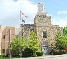 Menifee County courthouse in Frenchburg | |
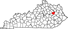 Location in the U.S. state of Kentucky | |
 Kentucky's location in the U.S. | |
| Founded | 1869 |
| Named for | Richard H. Menefee |
| Seat | Frenchburg |
| Largest city | Frenchburg |
| Area | |
| • Total | 206 sq mi (534 km2) |
| • Land | 204 sq mi (528 km2) |
| • Water | 2.3 sq mi (6 km2), 1.1% |
| Population | |
| • (2010) | 6,306 |
| • Density | 31/sq mi (12/km2) |
| Congressional district | 6th |
| Time zone | Eastern: UTC−5/−4 |
| Website |
www |
Menifee County is a county located in the U.S. state of Kentucky. As of the 2010 census, the population was 6,306,[1] making it the fifth-least populous county in Kentucky. Its county seat is Frenchburg.[2] The county is named for Richard Hickman Menefee, U.S. Congressman, although the spelling has changed.[3] It is a prohibition or dry county.
Menifee County is part of the Mount Sterling, KY Micropolitan Statistical Area, which is also included in the Lexington-Fayette-Richmond-Frankfort, KY Combined Statistical Area. It is located in the foothills of the Cumberland Plateau.[4]
History
Menifee County was formed on May 29, 1869, from portions of Bath, Montgomery, Morgan, Powell, and Wolfe counties.[4][5]
In the 2008 Presidential Election Menifee County was one of eight in the state of Kentucky where the majority of voters voted for Barack Obama.[6]
On March 2, 2012 an EF3 tornado hit Menifee county and several other surrounding counties.[7] Many were injured, and three were killed.[8]
Geography
According to the U.S. Census Bureau, the county has a total area of 206 square miles (530 km2), of which 204 square miles (530 km2) is land and 2.3 square miles (6.0 km2) (1.1%) is water.[9]
Menifee County is mountainous and heavily forested. Much of the land is within Daniel Boone National Forest. Only about 10% of the county's land is in cultivated farms, and the county ranks 102nd of Kentucky's 120 counties in agricultural revenue.[4]
Adjacent counties
- Bath County (north)
- Rowan County (northeast)
- Morgan County (east)
- Wolfe County (south)
- Powell County (southwest)
- Montgomery County (west)
National protected area
- Daniel Boone National Forest (part)
Arts & Culture
Menifee County is home to the Menifee Community Theatre Group, a small-town local and regional arts organization that has produced 17 theatrical productions to date. The group has over 40 members and hosts an annual locally-written theatrical and film presentation, taking place at the Menifee Mountain Memories Festival and centering on local and Appalachian stories collected from local citizens.
Demographics
| Historical population | |||
|---|---|---|---|
| Census | Pop. | %± | |
| 1870 | 1,986 | — | |
| 1880 | 3,755 | 89.1% | |
| 1890 | 4,666 | 24.3% | |
| 1900 | 6,818 | 46.1% | |
| 1910 | 6,153 | −9.8% | |
| 1920 | 5,779 | −6.1% | |
| 1930 | 4,958 | −14.2% | |
| 1940 | 5,691 | 14.8% | |
| 1950 | 4,798 | −15.7% | |
| 1960 | 4,276 | −10.9% | |
| 1970 | 4,050 | −5.3% | |
| 1980 | 5,117 | 26.3% | |
| 1990 | 5,092 | −0.5% | |
| 2000 | 6,556 | 28.8% | |
| 2010 | 6,306 | −3.8% | |
| Est. 2016 | 6,408 | [10] | 1.6% |
| U.S. Decennial Census[11] 1790-1960[12] 1900-1990[13] 1990-2000[14] 2010-2013[1] | |||
As of the census[15] of 2000, there were 6,556 people, 2,537 households, and 1,900 families residing in the county. The population density was 32 per square mile (12/km2). There were 3,710 housing units at an average density of 18 per square mile (6.9/km2). The racial makeup of the county was 97.64% White, 1.37% Black or African American, 0.12% Native American, 0.03% Asian, 0.02% Pacific Islander, 0.14% from other races, and 0.69% from two or more races. 1.11% of the population were Hispanic or Latino of any race.
There were 2,537 households out of which 32.00% had children under the age of 18 living with them, 62.40% were married couples living together, 8.80% had a female householder with no husband present, and 25.10% were non-families. 22.10% of all households were made up of individuals and 9.10% had someone living alone who was 65 years of age or older. The average household size was 2.49 and the average family size was 2.88.
In the county, the population was spread out with 24.90% under the age of 18, 10.10% from 18 to 24, 28.10% from 25 to 44, 25.20% from 45 to 64, and 11.80% who were 65 years of age or older. The median age was 36 years. For every 100 females, there were 101.80 males. For every 100 females age 18 and over, there were 98.10 males.
The median income for a household in the county was $22,064, and the median income for a family was $26,325. Males had a median income of $25,670 versus $17,014 for females. The per capita income for the county was $11,399. About 23.40% of families and 29.60% of the population were below the poverty line, including 38.50% of those under age 18 and 23.40% of those age 65 or over.
Politics
| Year | Republican | Democratic | Third parties |
|---|---|---|---|
| 2016 | 72.3% 2,010 | 25.2% 700 | 2.5% 69 |
| 2012 | 57.1% 1,484 | 40.3% 1,048 | 2.5% 66 |
| 2008 | 46.4% 1,155 | 51.3% 1,276 | 2.3% 58 |
| 2004 | 48.1% 1,215 | 50.8% 1,284 | 1.2% 29 |
| 2000 | 52.0% 1,170 | 46.2% 1,038 | 1.8% 41 |
| 1996 | 34.1% 608 | 55.0% 979 | 10.9% 194 |
| 1992 | 26.0% 557 | 61.1% 1,311 | 12.9% 277 |
| 1988 | 37.5% 670 | 61.3% 1,096 | 1.2% 22 |
| 1984 | 44.4% 785 | 54.0% 956 | 1.6% 29 |
| 1980 | 35.5% 547 | 62.6% 966 | 1.9% 30 |
| 1976 | 22.4% 304 | 76.8% 1,041 | 0.8% 11 |
| 1972 | 43.9% 596 | 53.9% 732 | 2.2% 30 |
| 1968 | 38.7% 509 | 42.1% 554 | 19.3% 254 |
| 1964 | 22.7% 318 | 76.8% 1,076 | 0.5% 7 |
| 1960 | 45.2% 817 | 54.8% 989 | 0.0% 0 |
| 1956 | 40.3% 799 | 59.7% 1,185 | 0.1% 1 |
| 1952 | 34.3% 638 | 65.4% 1,219 | 0.3% 6 |
| 1948 | 27.5% 435 | 70.3% 1,112 | 2.2% 34 |
| 1944 | 36.7% 568 | 63.1% 976 | 0.2% 3 |
| 1940 | 30.2% 511 | 69.5% 1,176 | 0.3% 5 |
| 1936 | 33.2% 559 | 66.6% 1,123 | 0.2% 4 |
| 1932 | 24.8% 474 | 74.6% 1,425 | 0.6% 11 |
| 1928 | 50.2% 732 | 49.8% 725 | 0.0% 0 |
| 1924 | 33.5% 450 | 65.0% 873 | 1.6% 21 |
| 1920 | 33.3% 581 | 65.8% 1,149 | 0.9% 16 |
| 1916 | 33.6% 369 | 66.4% 730 | 0.1% 1 |
| 1912 | 24.7% 254 | 62.4% 643 | 12.9% 133 |
Communities
- Denniston
- Frenchburg (county seat)
- Korea
- Mariba
- Means
- Pomeroyton
- Scranton
- Sudith
- Wellington
See also
References
- 1 2 "State & County QuickFacts". United States Census Bureau. Archived from the original on July 14, 2011. Retrieved March 6, 2014.
- ↑ "Find a County". National Association of Counties. Retrieved 2011-06-07.
- ↑ The Register of the Kentucky State Historical Society, Volume 1. Kentucky State Historical Society. 1903. p. 36.
- 1 2 3 Bryant, Ron D. (1992). "Menifee County". In Kleber, John. Encyclopedia of Kentucky. p. 625.
- ↑ Collins, Lewis (1877). History of Kentucky. p. 601.
- ↑ Officials in 4 Appalachian counties proud their residents supported Obama Lexington Herald-Leader, Nov 6, 2008.
- ↑ Deadly Tornado Cut 60-Mile Path In Eastern Kentucky Archived 2012-03-13 at the Wayback Machine. The Associated Press, Mar 5, 2012.
- ↑ WAVE News, Mar 5, 2012.
- ↑ "2010 Census Gazetteer Files". United States Census Bureau. August 22, 2012. Archived from the original on August 12, 2014. Retrieved August 17, 2014.
- ↑ "Population and Housing Unit Estimates". Retrieved June 9, 2017.
- ↑ "U.S. Decennial Census". United States Census Bureau. Retrieved August 17, 2014.
- ↑ "Historical Census Browser". University of Virginia Library. Retrieved August 17, 2014.
- ↑ "Population of Counties by Decennial Census: 1900 to 1990". United States Census Bureau. Retrieved August 17, 2014.
- ↑ "Census 2000 PHC-T-4. Ranking Tables for Counties: 1990 and 2000" (PDF). United States Census Bureau. Retrieved August 17, 2014.
- ↑ "American FactFinder". United States Census Bureau. Retrieved 2008-01-31.
- ↑ Leip, David. "Dave Leip's Atlas of U.S. Presidential Elections". uselectionatlas.org. Retrieved 2018-07-04.
External links
Municipalities and communities of Menifee County, Kentucky, United States | ||
|---|---|---|
| City | | |
| Unincorporated communities | ||
