Breckinridge County, Kentucky
| Breckinridge County, Kentucky | |
|---|---|
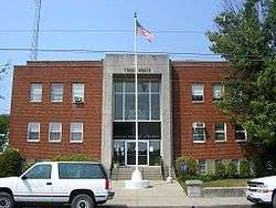 Breckinridge County, Kentucky courthouse in Hardinsburg | |
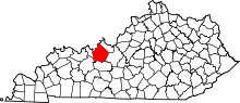 Location in the U.S. state of Kentucky | |
 Kentucky's location in the U.S. | |
| Founded | 1799 |
| Named for | John Breckinridge |
| Seat | Hardinsburg |
| Largest city | Hardinsburg |
| Area | |
| • Total | 586 sq mi (1,518 km2) |
| • Land | 567 sq mi (1,469 km2) |
| • Water | 18 sq mi (47 km2), 3.2% |
| Population | |
| • (2010) | 20,059 |
| • Density | 35/sq mi (14/km2) |
| Congressional district | 2nd |
| Time zone | Central: UTC−6/−5 |
| Website |
www |
Breckinridge County is a county located in the Commonwealth of Kentucky. As of the 2010 census, the population was 20,059.[1] Its county seat is Hardinsburg, Kentucky.[2] The county was named for John Breckinridge (1760–1806), a Kentucky Attorney General, state legislator, United States Senator, and United States Attorney General.[3][4] It was the 38th Kentucky county in order of formation.[5]
Breckinridge County is now a wet county, following a local option election on 29 January 2013, but it had been a dry county for the previous 105 years.
History
The area presently bounded by Kentucky state lines was a part of the U.S. State of Virginia, known as Kentucky County when the British colonies separated themselves in the American Revolutionary War. In 1780, the Virginia legislature divided the previous Kentucky County into three smaller units: Fayette, Jefferson, and Lincoln. In 1791, this area was separated into the State of Kentucky; it became effective on 1 June 1792. From that time, the original three counties were divided several times. A portion of Jefferson County was split off as Nelson County in 1784; a portion of Nelson was split off as Hardin County in 1792; the present Breckinridge County was split off from Hardin in 1799.
In August 1779, Sinclair Hardin (first cousin of Captain William Hardin, the founder of Hardin's Fort), was killed by Shawnee Indians while taking a drink at Big Springs. He was the first white settler in Breckinridge County to be killed by Native Americans.[6][7] The Indian threat continued for several years. However, the only sizable expedition against the Native Americans that Breckenridge County settlers took part in culminated in the Battle of Saline Creek in August 1786, in Illinois.[6][7] The battle only lasted a few minutes, with fierce hand-to-hand combat. Between 18 and 30 Shawnee warriors were killed, with six more wounded. The remainder of the Shawnee fled. Captain William Hardin had commanded the Kentucky volunteers, many of whom also were killed or wounded. Hardin's militia brought home 16 Shawnee scalps, nine captured horses, 17 muskets, and "a mighty nice sword".[7]
The Judge-Executive of Breckinridge County from 1801 to 1805 was William Comstock. Jo Allen was the county clerk, and Ben Huff was the sheriff.[8]
When Abraham Lincoln's father, Thomas Lincoln, moved from the Knob Creek Farm, his last Kentucky home, after 11 November 1816, he traveled through Breckinridge County, working at odd jobs for several weeks.[9] Thomas Lincoln took his family from the Knob Creek Farm (Abraham Lincoln's birthplace in present-day Hodgenville) to Elizabethtown.[10] After visiting the Brumfield family, the Lincolns traveled about twelve miles west, passing the First Regular Baptist Church of Mill Creek. The Lincolns followed the old pioneer trail (established in 1802) through Vine Grove (Viney Grove), and after crossing Otter Creek, they traveled through what is now Flaherty (Breckinridge County) to the town of Big Spring.[9] Their journey from Flaherty passed the Woolfork brick house at Jackey's Grove, then on to Big Spring. Big Spring is located where the boundaries of Hardin, Meade (established 1823), and Breckinridge counties meet. The Lincolns next passed Hopkins Otey Wale's farm in the area between Harned and Garfield in Breckinridge County, which until the Civil War, was known as the Prince of Wales.[9] Wales owned about 2,000 acres of land on both sides of U.S. Route 60, and was centered about where "Dead Man's Curve" is now. Thomas Lincoln, at the time, was almost destitute. They spent the night at the inn, for which Lincoln paid his way by splitting wood. At that time, Abraham Lincoln was 7 years of age. There was no room for him at the supper table, so he was sent to the kitchen to eat with the slaves. However, the slaves would not sit with that "poor white trash", he was obliged to sit in a corner alone.[9]
The Lincolns followed the trace of the old pioneer Salt Lick Trail through Vine Grove, Flaherty, and Big Spring to U.S. Route 60 near Harned's Station. The Lincolns followed the most direct route by way of the Lost Run Road to Harned, and from Harned, the Lincoln family pursued a straight course over what is now Federal Highway 60 to the town of Hardinsburg. Colonel David R. Murray was the first person in Breckinridge County who came in contact with Thomas Lincoln's family as they migrated westward in their ox-cart. Colonel Murray talked to the Lincolns, and being well informed concerning the surrounding country, he directed them to a vacant log cabin, where they might secure rest and shelter.[10] Murray's slave Minerva, after seeing the condition of the children, went back into the house, and came back immediately with a plate heaped with slices of homemade bread covered with butter, a pitcher of milk, and some cups. She seated the children on the steps of Murray's house and fed the Lincoln children.[10]
Thomas Lincoln and his family spent two or three weeks in Hardinsburg and occupied a small cabin near the southern edge of town, what is now the Kentucky FFA Leadership Training Camp in Hardinsburg.[11] Local residents gave them food and a cow for milk.[12] From Hardinsburg, the Lincoln family took the Yellow Banks Road to Cloversport. In Cloversport (then Joesville, named after Joe Huston), Thomas Lincoln, Nancy, Sarah, and 7-year-old Abraham Lincoln spent one night in the home of Mrs. Kittie Monroe's father in Cloverport above Clover Creek.[10] Mrs. Kittie Monroe was the wife of James Monroe.
The Lincolns left Kentucky by crossing the Ohio River at Cloverport[13] on a log ferry operated by Jacob Weatherholt,[14] from above the mouth of Clover Creek,[10] through Thompson's Ferry,[9] which operated on the Ohio River near Anderson Creek, to Tobinsport, Indiana. The next day, the Lincoln family made their way down to Rock Island (Indiana), and camped at "Lafayette Spring"
named so because that is where the Mechanic, the steamboat Marquis de Lafayette was on, wrecked on 8–9 May 1825. The next day (December 1816), the Lincoln family stopped at Troy, and then moved on toward their new home to take up a Federal Land Claim near Little Pigeon Creek (within the Little Pigeon Creek Community) in what was then Perry County and is now Spencer County, Indiana.[9][10]
During the American Civil War, raiding Kentucky Confederate cavalry burned the courthouse, as it was being used by Union troops as a barracks, though most of the records were saved. On 12 March 1865, Jerome Clarke, a well known Confederate guerrilla, claimed by some to have been Sue Munday, was captured near the Breckinridge–Meade County line.[15] He was hanged three days later in Louisville.[16] Afterward, his trial drew heavy criticism.
During the nineteenth century, the Victoria Coal Mines, named in honor of British Queen Victoria, were the first to produce coal oil, and Cloverport exported it to Great Britain, where it was used to light Buckingham Palace.
United States Supreme Court Justice Wiley Blount Rutledge, Jr., who served on the High Court from 1943 to 1949, was born at Tar Springs in 1894, when his father was pastor of Cloverport Baptist Church.
On 6 June 1932, at Hardinsburg, Sam Jennings became the penultimate person to be publicly executed in the United States.
In the 1950s, Rough River Dam State Resort Park was developed at the southern border of the county.
A third courthouse fire nearly destroyed county records in 1958.
Breckinridge County High School won the 1965 and 1995 Kentucky High School Athletic Association's Boys' Basketball tournaments.
The Breckinridge County Archives, formed in 1984, was the first state-funded archival repository in the history of the United States and is known across the nation as an excellent resource for genealogical and historical research.
Geography
According to the U.S. Census Bureau, the county has a total area of 586 square miles (1,520 km2), of which 567 square miles (1,470 km2) is land and 18 square miles (47 km2) (3.2%) is water.[17]
Adjacent counties
- Perry County, Indiana (northwest)
- Meade County (northeast/EST Border)
- Hardin County (east/EST Border)
- Grayson County (south)
- Ohio County (southwest)
- Hancock County (west)
Demographics
| Historical population | |||
|---|---|---|---|
| Census | Pop. | %± | |
| 1810 | 3,430 | — | |
| 1820 | 7,485 | 118.2% | |
| 1830 | 7,345 | −1.9% | |
| 1840 | 8,944 | 21.8% | |
| 1850 | 10,593 | 18.4% | |
| 1860 | 13,236 | 25.0% | |
| 1870 | 13,440 | 1.5% | |
| 1880 | 17,486 | 30.1% | |
| 1890 | 21,034 | 20.3% | |
| 1900 | 20,534 | −2.4% | |
| 1910 | 21,034 | 2.4% | |
| 1920 | 19,652 | −6.6% | |
| 1930 | 17,368 | −11.6% | |
| 1940 | 17,744 | 2.2% | |
| 1950 | 15,528 | −12.5% | |
| 1960 | 14,734 | −5.1% | |
| 1970 | 14,789 | 0.4% | |
| 1980 | 16,861 | 14.0% | |
| 1990 | 16,312 | −3.3% | |
| 2000 | 18,648 | 14.3% | |
| 2010 | 20,059 | 7.6% | |
| Est. 2016 | 19,961 | [18] | −0.5% |
| U.S. Decennial Census[19] 1790-1960[20] 1900-1990[21] 1990-2000[22] 2010-2013[1] | |||
As of the census[23] of 2000, there were 18,648 people, 7,324 households, and 5,309 families residing in the county. The population density was 33 per square mile (13/km2). There were 9,890 housing units at an average density of 17 per square mile (6.6/km2). The racial makeup of the county was 95.84% White, 2.86% Black or African American, 0.23% Native American, 0.08% Asian, 0.02% Pacific Islander, 0.09% from other races, and 0.90% from two or more races. 0.72% of the population were Hispanic or Latino of any race.
There were 7,324 households out of which 31.00% had children under the age of 18 living with them, 59.60% were married couples living together, 8.90% had a female householder with no husband present, and 27.50% were non-families. 24.60% of all households were made up of individuals and 11.60% had someone living alone who was 65 years of age or older. The average household size was 2.51 and the average family size was 2.97.
In the county, the population was spread out with 24.90% under the age of 18, 8.20% from 18 to 24, 26.70% from 25 to 44, 26.00% from 45 to 64, and 14.20% who were 65 years of age or older. The median age was 38 years. For every 100 females there were 98.60 males. For every 100 females age 18 and over, there were 96.30 males.
The median income for a household in the county was $30,554, and the median income for a family was $36,575. Males had a median income of $31,004 versus $19,371 for females. The per capita income for the county was $15,402. About 11.80% of families and 15.80% of the population were below the poverty line, including 16.60% of those under age 18 and 19.00% of those age 65 or over.
Education
Breckinridge County has three school systems:
- Breckinridge County Public Schools
- Cloverport Independent Schools
- Saint Romuald Interparochial School
Library
Breckinridge County Public Library is located at 112 South Main Street in Hardinsburg, Kentucky.
Communities
Incorporated Communities
- Cloverport
- Hardinsburg (county seat)
- Irvington
Unincorporated Communities A–L
- Addison
- Axtel
- Bewleyville
- Big Spring (partially)
- Cannons Point
- Clifton Mills
- Constantine
- Custer
- Dyer
- Fairfield
- Falls of Rough
- Fisher
- Frymire
- Garfield
- Glen Dean
- Harned
- Hinton Hills
- Hites Run
- Holt
- Hudson
- Kingswood
- Kirk
- Locust Hill
- Lodiburg
Unincorporated Communities M–Z
Notable natives
- Alfred "Butch" Beard - professional basketball player and coach
- David "Big Dave" DeJernett - professional basketball player
- Philip Leget Edwards - American educator
- Joseph Holt - Judge Advocate General of the United States Army, Attorney General - Secretary of War, Commissioner of Patents, and Postmaster General.
- Bobbi Jordan - American actress
- John Alexander McClernand - Union General during the American Civil War
- Charles Harwood Moorman—Judge of the Kentucky Court of Appeals, Judge of the United States District Court for the Western District of Kentucky, and Judge of the United States Court of Appeals for the Sixth Circuit
- George W. Swink - businessman
- Tera Wray - pornographic actress
Politics
| Year | Republican | Democratic | Third parties |
|---|---|---|---|
| 2016 | 73.9% 6,484 | 22.3% 1,960 | 3.8% 330 |
| 2012 | 63.1% 5,025 | 35.5% 2,825 | 1.5% 119 |
| 2008 | 62.0% 5,281 | 36.5% 3,110 | 1.5% 131 |
| 2004 | 65.5% 5,580 | 33.9% 2,884 | 0.7% 56 |
| 2000 | 63.9% 4,763 | 34.8% 2,595 | 1.3% 95 |
| 1996 | 46.4% 3,151 | 43.5% 2,956 | 10.2% 690 |
| 1992 | 41.9% 2,941 | 44.4% 3,113 | 13.7% 959 |
| 1988 | 58.0% 3,841 | 41.8% 2,765 | 0.3% 17 |
| 1984 | 62.1% 4,432 | 37.4% 2,669 | 0.4% 31 |
| 1980 | 52.7% 3,629 | 45.9% 3,163 | 1.4% 99 |
| 1976 | 44.2% 2,698 | 54.8% 3,347 | 1.1% 66 |
| 1972 | 64.3% 3,574 | 34.5% 1,921 | 1.2% 68 |
| 1968 | 47.3% 2,779 | 34.5% 2,024 | 18.2% 1,070 |
| 1964 | 36.7% 2,167 | 63.2% 3,733 | 0.2% 11 |
| 1960 | 55.9% 3,979 | 44.1% 3,136 | 0.0% 0 |
| 1956 | 56.7% 3,784 | 43.0% 2,867 | 0.3% 20 |
| 1952 | 52.0% 3,078 | 47.8% 2,828 | 0.3% 16 |
| 1948 | 46.4% 2,407 | 50.5% 2,623 | 3.1% 160 |
| 1944 | 52.9% 3,292 | 46.5% 2,889 | 0.6% 37 |
| 1940 | 49.4% 3,258 | 50.0% 3,296 | 0.6% 37 |
| 1936 | 46.6% 2,898 | 51.9% 3,233 | 1.5% 94 |
| 1932 | 45.7% 3,237 | 53.8% 3,814 | 0.5% 34 |
| 1928 | 61.5% 4,783 | 38.4% 2,987 | 0.0% 3 |
| 1924 | 53.4% 3,832 | 45.0% 3,230 | 1.6% 118 |
| 1920 | 53.9% 4,368 | 45.7% 3,702 | 0.4% 29 |
| 1916 | 53.2% 2,549 | 45.4% 2,172 | 1.4% 68 |
| 1912 | 25.9% 1,163 | 43.8% 1,967 | 30.3% 1,359 |
See also
References
- 1 2 "State & County QuickFacts". United States Census Bureau. Retrieved 5 March 2014.
- ↑ "Find a County". National Association of Counties. Archived from the original on 15 June 2011. Retrieved 7 June 2011.
- ↑ The Register of the Kentucky State Historical Society, Vol. 1. Kentucky State Historical Society. 1903. p. 34.
- ↑ "Brekinridge County". The Kentucky Encyclopedia. 2000. Retrieved 20 August 2014.
- ↑ Collins, Lewis (1882). Collins' Historical Sketches of Kentucky: History of Kentucky, Vol. 2. Collins & Co. p. 26.
- 1 2 Jolly, Henry C. 25 April 1902. "Interesting History of Indian Bill Hardin". The Breckinridge Democrat.
- 1 2 3 Perrin, W.H. 1885. A History of the State of Kentucky. pp. 1039–1042; 1081, 1082. Retrieved from and
- ↑ Breckinridge Bicentennial Committee Program. Accessed from Breckinridge Historical Archives.
- 1 2 3 4 5 6 Gregory, Edward. (1938). "At the End of the Trail: The Story of the Journey of Thomas Lincoln and His Family Through Hardin and Breckinridge Counties, Kentucky, to Indiana in 1816." Retrieved 27 November 2014 from .
- 1 2 3 4 5 6 McMurtry, R. Gerald. (1937, December). The Lincoln Migration from Kentucky to Indiana. Indiana Magazine of History, Volume 33, Issue 4, pp. 385–421. Retrieved from .
- ↑ Kentucky Historical Marker No. 1003.
- ↑ Kentucky Historical Marker No. 1003, Thompson, William, History and Legend of Breckinridge County, Kentucky.
- ↑ Kentucky Historical Marker No. 73.
- ↑ Affidavits in support of Kentucky Historical Marker No. 1003, on file with the Kentucky Historical Society
- ↑ Kentucky Historical Marker No. 536.
- ↑ Kentucky Historical Marker No. 540.
- ↑ "2010 Census Gazetteer Files". United States Census Bureau. 22 August 2012. Archived from the original on 12 August 2014. Retrieved 12 August 2014.
- ↑ "Population and Housing Unit Estimates". Retrieved 9 June 2017.
- ↑ "U.S. Decennial Census". United States Census Bureau. Archived from the original on 12 May 2015. Retrieved 12 August 2014.
- ↑ "Historical Census Browser". University of Virginia Library. Retrieved 12 August 2014.
- ↑ "Population of Counties by Decennial Census: 1900 to 1990". United States Census Bureau. Retrieved 12 August 2014.
- ↑ "Census 2000 PHC-T-4. Ranking Tables for Counties: 1990 and 2000" (PDF). United States Census Bureau. Retrieved 12 August 2014.
- ↑ "American FactFinder". United States Census Bureau. Archived from the original on 11 September 2013. Retrieved 31 January 2008.
- ↑ Leip, David. "Dave Leip's Atlas of U.S. Presidential Elections". uselectionatlas.org. Retrieved 29 June 2018.
| Wikimedia Commons has media related to Breckinridge County, Kentucky. |
Municipalities and communities of Breckinridge County, Kentucky, United States | ||
|---|---|---|
| Cities | | |
| Unincorporated communities | ||
| Footnotes | ‡This populated place also has portions in an adjacent county or counties | |
