Hopkins County, Kentucky
| Hopkins County, Kentucky | |
|---|---|
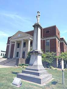 Hopkins County Courthouse in Madisonville | |
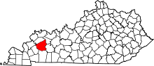 Location in the U.S. state of Kentucky | |
 Kentucky's location in the U.S. | |
| Founded | 1806 |
| Named for | Samuel Hopkins |
| Seat | Madisonville |
| Largest city | Madisonville |
| Area | |
| • Total | 554 sq mi (1,435 km2) |
| • Land | 542 sq mi (1,404 km2) |
| • Water | 12 sq mi (31 km2), 2.2% |
| Population | |
| • (2010) | 46,920 |
| • Density | 87/sq mi (34/km2) |
| Congressional district | 1st |
| Time zone | Central: UTC−6/−5 |
| Website |
hopkinscounty |
Hopkins County is a county located in the U.S. state of Kentucky. As of the 2010 census, the population was 46,920.[1] Its county seat is Madisonville.[2] The county was formed in 1806 and named for General Samuel Hopkins, an officer in both the American Revolutionary War and War of 1812, and later a Kentucky legislator and U.S. Congressman.[3]
The Madisonville, Kentucky Micropolitan Statistical Area includes all of Hopkins County.
The topography ranges from flatlands along the broad river valleys of the Pond River, Tradewater River, and Green River, to hilly and rolling land in the southern and central parts of the county. Coal mines operate in the southern part of Hopkins County and agriculture is a mainstay in the northern part. Major crops are soybeans, corn, and tobacco. Along with coal, resources include oil and natural gas.
History
The earliest inhabitants were prehistoric Native Americans who lived, hunted, and farmed in the region. One of their settlements was a rough stone structure on Fort Ridge, which has since been destroyed by strip mining for coal. Some of the early settlers were Revolutionary War veterans who received land grants for their service from Virginia in the area southwest of the Green River. Among these was Baron Von Steuben, a Prussian officer who had trained George Washington's Continental Army at Valley Forge during the winter of 1776-77. He had received a grant of several thousand acres in the northwest part of the county. According to tradition, Von Steuben was wounded in an Indian attack on his first visit to Kentucky. He then quit-claimed his property. Nevertheless, a salt spring on his grant came to be known as Steuben's Lick. By the 1880s, the community that grew up around the lick was known as Manitou.
Roads in the county often followed animal trails that led to salt and mineral springs. The major traces were those which connected the county seat at Madisonville with Henderson to the north, Hopkinsville to the south, and Russellville to the southeast. Numerous other trails led to the mills and ferries on the Pond and Tradewater Rivers and their tributaries.
On January 3, 1829, Ashbyburg in the northeastern part of the county was incorporated. Located on the Green River, it thrived as a steamboat landing during the 19th century. Other antebellum communities included Nebo, Kentucky, northwest of Madisonville, and Charleston, Kentucky, named after "Free Charles," a black freedman who operated a tavern in the southwest part of the county.
Hopkins County was divided by the American Civil War. Union supporters joined the 35th Kentucky Infantry (Mounted), a regiment recruited locally in late 1863 by James M. Shackelford, while in 1862 Adam Rankin Johnson had recruited Confederate troops for his 10th Kentucky Cavalry Regiment. The courthouse in Madisonville was burned by Kentucky Confederates led by Gen. Hylan Benton Lyon on December 17, 1864, as they passed through western Kentucky, since it was being used to house Union soldiers. However, the harsh policies imposed by the occupying Union armies caused much more resentment and served to increase the sympathy for the Confederate cause. Ever since then, local politics have been heavily dominated by the Democratic party.
Farming was the major occupation in Hopkins County for most of the 19th century, with tobacco the leading crop. Around 1837 local blacksmith James Woolfolk found an outcropping of coal on his land. John Bayless Earle, for whom the town of Earlington, Kentucky was named, opened the first coal mine in the county in 1869. Mining did not become a major industry until the Louisville & Nashville Railroad pushed its line southward from Henderson through Madisonville and toward Nashville in 1870. Two years later, the Elizabethtown and Paducah Railroad (now Paducah and Louisville Railway) entered the county from the east. Many communities grew quickly as railroad stops, including Mortons Gap, Kentucky, Hanson, Kentucky, Nortonville, Kentucky, and White Plains, Kentucky. Dawson Springs, Kentucky, in the southwestern part of the county, began to thrive in the 1880s as a health resort, but its popularity had faded by the time of the Great Depression of the 1930s.
By 1970 Hopkins County was the second largest producer of coal in the Western Coal Field, after Muhlenberg County, and the third-largest coal producer in the entire state after Muhlenberg and Pike County. In 1971 the county also ranked fifth in Kentucky in oil production. Coal and oil-related businesses were major county employers by 1990. Development of resources was aided by the construction of the north-south Pennyrile Parkway and the east-west Western Kentucky Parkway through the county by the early 1970s. In 1987 farms occupied 41 percent of the land area, with 72 percent of farmland under cultivation.[4]
Geography
According to the U.S. Census Bureau, the county has a total area of 554 square miles (1,430 km2), of which 542 square miles (1,400 km2) is land and 12 square miles (31 km2) (2.2%) is water.[5]
Adjacent counties
- Webster County (northwest)
- McLean County (northeast)
- Muhlenberg County (southeast)
- Christian County (south)
- Caldwell County (southwest)
The USA eclipse will fall directly over Hopkinsville, Ky on August 21, 2017 17:16
Demographics
| Historical population | |||
|---|---|---|---|
| Census | Pop. | %± | |
| 1810 | 2,964 | — | |
| 1820 | 5,322 | 79.6% | |
| 1830 | 6,763 | 27.1% | |
| 1840 | 9,171 | 35.6% | |
| 1850 | 12,441 | 35.7% | |
| 1860 | 11,875 | −4.5% | |
| 1870 | 13,827 | 16.4% | |
| 1880 | 19,122 | 38.3% | |
| 1890 | 23,505 | 22.9% | |
| 1900 | 30,995 | 31.9% | |
| 1910 | 34,291 | 10.6% | |
| 1920 | 34,133 | −0.5% | |
| 1930 | 37,449 | 9.7% | |
| 1940 | 37,789 | 0.9% | |
| 1950 | 38,815 | 2.7% | |
| 1960 | 38,458 | −0.9% | |
| 1970 | 38,167 | −0.8% | |
| 1980 | 46,174 | 21.0% | |
| 1990 | 46,126 | −0.1% | |
| 2000 | 46,519 | 0.9% | |
| 2010 | 46,920 | 0.9% | |
| Est. 2016 | 45,904 | [6] | −2.2% |
| U.S. Decennial Census[7] 1790-1960[8] 1900-1990[9] 1990-2000[10] 2010-2013[1] | |||
As of the census[11] of 2000, there were 46,519 people, 18,820 households, and 13,399 families residing in the county. The population density was 84 per square mile (32/km2). There were 20,668 housing units at an average density of 38 per square mile (15/km2). The racial makeup of the county was 92.02% White, 6.21% Black or African American, 0.19% Native American, 0.34% Asian, 0.02% Pacific Islander, 0.37% from other races, and 0.86% from two or more races. 0.91% of the population were Hispanic or Latino of any race.
There were 18,820 households out of which 31.60% had children under the age of 18 living with them, 56.30% were married couples living together, 11.90% had a female householder with no husband present, and 28.80% were non-families. 25.80% of all households were made up of individuals and 11.50% had someone living alone who was 65 years of age or older. The average household size was 2.43 and the average family size was 2.91.
In the county, the population was spread out with 24.20% under the age of 18, 8.30% from 18 to 24, 28.20% from 25 to 44, 24.60% from 45 to 64, and 14.70% who were 65 years of age or older. The median age was 38 years. For every 100 females there were 91.00 males. For every 100 females age 18 and over, there were 87.70 males.
The median income for a household in the county was $30,868, and the median income for a family was $36,794. Males had a median income of $31,400 versus $20,014 for females. The per capita income for the county was $17,382. About 13.60% of families and 16.50% of the population were below the poverty line, including 24.40% of those under age 18 and 10.50% of those age 65 or over.
Education
Two public school districts operate in the county. Hopkins County Schools serves most of the county, except for the city of Dawson Springs, which is covered by the Dawson Springs Independent School District. The Dawson Springs district operates a single K-12 facility, Dawson Springs Community School.
As of July 2017, Hopkins County Schools' adopted a tobacco-free policy that stated that all tobacco products, including alternative nicotine products and vapor products were prohibited for use by anyone, anywhere on district grounds. The ban extends to outdoor events and inside vehicles on district grounds. The policy also applies to community groups that use school facilities and to field trips and any school-sponsored activity.[12]
Elementary schools
- Earlington Elementary
- Grapevine Elementary
- Hanson Elementary
- Jesse Stuart Elementary
- Pride Elementary
- Southside Elementary
- West Broadway Elementary
- West Hopkins School
- Dawson Springs Community School
- Christ The King Elementary
Middle schools
- Browning Springs Middle School
- James Madison Middle School
- South Hopkins Middle School
- West Hopkins School
- Dawson Springs Community School
High schools
- Hopkins County Central High School
- Madisonville North Hopkins High School
- Dawson Springs Community School
- Grace Baptist
Community College
Media
- The Madisonville Messenger, established in 1917, is the daily newspaper (Tues-Sun) and website (the-messenger.com) serving Hopkins, Webster and Muhlenberg counties.
- SurfKY News Group, Inc. was established in 2008, this online news service (surfky.com) serves Hopkins County and Western Kentucky.
Communities
Cities
Census-designated place
Other unincorporated places
Politics
| Year | Republican | Democratic | Third parties |
|---|---|---|---|
| 2016 | 75.1% 15,277 | 21.2% 4,310 | 3.7% 758 |
| 2012 | 69.2% 13,681 | 29.3% 5,789 | 1.5% 297 |
| 2008 | 61.6% 11,916 | 36.7% 7,104 | 1.7% 328 |
| 2004 | 65.4% 12,314 | 34.1% 6,420 | 0.6% 109 |
| 2000 | 57.6% 9,490 | 40.8% 6,734 | 1.6% 265 |
| 1996 | 41.9% 6,363 | 47.7% 7,239 | 10.5% 1,588 |
| 1992 | 34.4% 6,032 | 50.7% 8,881 | 14.9% 2,618 |
| 1988 | 51.5% 7,979 | 48.1% 7,453 | 0.5% 73 |
| 1984 | 58.0% 9,368 | 41.7% 6,743 | 0.3% 55 |
| 1980 | 40.6% 6,238 | 57.4% 8,810 | 2.0% 307 |
| 1976 | 39.4% 5,115 | 59.7% 7,749 | 1.0% 126 |
| 1972 | 68.7% 7,133 | 30.1% 3,129 | 1.2% 126 |
| 1968 | 31.9% 3,791 | 37.0% 4,391 | 31.1% 3,687 |
| 1964 | 29.5% 3,328 | 70.4% 7,954 | 0.1% 15 |
| 1960 | 46.4% 5,574 | 53.6% 6,436 | 0.0% 0 |
| 1956 | 44.5% 5,300 | 54.8% 6,535 | 0.7% 82 |
| 1952 | 37.4% 4,285 | 62.4% 7,157 | 0.2% 27 |
| 1948 | 26.2% 2,608 | 61.6% 6,149 | 12.2% 1,218 |
| 1944 | 34.0% 3,795 | 65.8% 7,352 | 0.2% 27 |
| 1940 | 30.8% 3,884 | 69.0% 8,695 | 0.2% 30 |
| 1936 | 30.4% 3,602 | 69.2% 8,193 | 0.4% 42 |
| 1932 | 29.2% 3,817 | 70.0% 9,158 | 0.9% 113 |
| 1928 | 48.7% 6,330 | 51.1% 6,640 | 0.2% 30 |
| 1924 | 44.6% 5,292 | 49.5% 5,864 | 5.9% 698 |
| 1920 | 45.4% 6,732 | 52.8% 7,829 | 1.9% 275 |
| 1916 | 48.2% 3,615 | 50.1% 3,757 | 1.8% 133 |
| 1912 | 20.9% 1,357 | 48.4% 3,147 | 30.7% 1,998 |
See also
References
- 1 2 "State & County QuickFacts". United States Census Bureau. Archived from the original on July 11, 2011. Retrieved March 8, 2014.
- ↑ "Find a County". National Association of Counties. Archived from the original on 2011-05-31. Retrieved 2011-06-07.
- ↑ "Hopkins County". The Kentucky Encyclopedia. 2000. Retrieved August 22, 2014.
- ↑ "Hopkins County, Kentucky Facts, Genealogy, Records & Links :: Genealogy Inc". Genealogy Inc. Retrieved 2012-05-31.
- ↑ "2010 Census Gazetteer Files". United States Census Bureau. August 22, 2012. Archived from the original on August 12, 2014. Retrieved August 16, 2014.
- ↑ "Population and Housing Unit Estimates". Retrieved June 9, 2017.
- ↑ "U.S. Decennial Census". United States Census Bureau. Archived from the original on May 12, 2015. Retrieved August 16, 2014.
- ↑ "Historical Census Browser". University of Virginia Library. Retrieved August 16, 2014.
- ↑ "Population of Counties by Decennial Census: 1900 to 1990". United States Census Bureau. Retrieved August 16, 2014.
- ↑ "Census 2000 PHC-T-4. Ranking Tables for Counties: 1990 and 2000" (PDF). United States Census Bureau. Retrieved August 16, 2014.
- ↑ "American FactFinder". United States Census Bureau. Retrieved 2008-01-31.
- ↑ lharvey@the-messenger.com, Laura Harvey Lead Reporter. "Hopkins County Schools now tobacco-free". The Messenger. Retrieved 2017-07-10.
- ↑ Leip, David. "Dave Leip's Atlas of U.S. Presidential Elections". uselectionatlas.org. Retrieved 10 April 2018.
External links
- Hopkins County Schools
- Dawson Springs Independent School District
- Hopkins County Sheriff's Office
- Historical Society of Hopkins County
Municipalities and communities of Hopkins County, Kentucky, United States | ||
|---|---|---|
| Cities | | |
| CDP | ||
| Other unincorporated communities | ||
| Footnotes | ‡This populated place also has portions in an adjacent county or counties | |
