Knott County, Kentucky
| Knott County, Kentucky | |
|---|---|
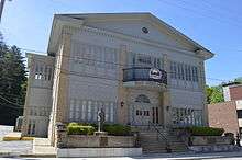 Knott County Courthouse | |
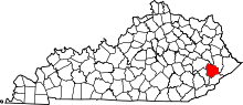 Location in the U.S. state of Kentucky | |
 Kentucky's location in the U.S. | |
| Founded | 1884 |
| Named for | James Proctor Knott |
| Seat | Hindman |
| Largest city | Hindman |
| Area | |
| • Total | 353 sq mi (914 km2) |
| • Land | 352 sq mi (912 km2) |
| • Water | 1.3 sq mi (3 km2), 0.4% |
| Population | |
| • (2010) | 16,346 |
| • Density | 47/sq mi (18/km2) |
| Congressional district | 5th |
| Time zone | Eastern: UTC−5/−4 |
| Website |
www |
Knott County is a county located in the U.S. state of Kentucky. As of the 2010 census, the population was 16,346.[1] Its county seat is Hindman.[2] The county was formed in 1884 and is named for James Proctor Knott, Governor of Kentucky (1883–1887).[3] It is a prohibition or dry county. Its county seat is home to the Hindman Settlement School, founded as America's first settlement school.
The Knott County town of Pippa Passes is home to Alice Lloyd College.
History
Knott County was established in 1884 from land given by Breathitt, Floyd, Letcher, and Perry counties. The 1890s-era courthouse, the second to serve the county, burned in 1929.[4]
Geography
According to the U.S. Census Bureau, the county has a total area of 353 square miles (910 km2), of which 352 square miles (910 km2) is land and 1.3 square miles (3.4 km2) (0.4%) is water.[5]
Adjacent counties
- Magoffin County (north)
- Floyd County (northeast)
- Pike County (east)
- Letcher County (south)
- Perry County (southwest)
- Breathitt County (northwest)
Summits
Big Lovely Mountain, 1,401 feet (427 m)
Demographics
| Historical population | |||
|---|---|---|---|
| Census | Pop. | %± | |
| 1890 | 5,438 | — | |
| 1900 | 8,704 | 60.1% | |
| 1910 | 10,791 | 24.0% | |
| 1920 | 11,655 | 8.0% | |
| 1930 | 15,230 | 30.7% | |
| 1940 | 20,007 | 31.4% | |
| 1950 | 20,320 | 1.6% | |
| 1960 | 17,362 | −14.6% | |
| 1970 | 14,698 | −15.3% | |
| 1980 | 17,940 | 22.1% | |
| 1990 | 17,906 | −0.2% | |
| 2000 | 17,649 | −1.4% | |
| 2010 | 16,346 | −7.4% | |
| Est. 2016 | 15,544 | [6] | −4.9% |
| U.S. Decennial Census[7] 1790-1960[8] 1900-1990[9] 1990-2000[10] 2010-2013[1] | |||
As of the census[11] of 2000, there were 17,649 people, 6,717 households, and 4,990 families residing in the county. The population density was 50 per square mile (19/km2). There were 7,579 housing units at an average density of 22 per square mile (8.5/km2). The racial makeup of the county was 98.27% White, 0.73% Black or African American, 0.11% Native American, 0.15% Asian, 0.01% Pacific Islander, 0.12% from other races, and 0.60% from two or more races. 0.63% of the population were Hispanic or Latino of any race.
There were 6,717 households out of which 34.40% had children under the age of 18 living with them, 57.60% were married couples living together, 12.60% had a female householder with no husband present, and 25.70% were non-families. 23.60% of all households were made up of individuals and 9.30% had someone living alone who was 65 years of age or older. The average household size was 2.54 and the average family size was 3.00.
In the county, the population was spread out with 24.50% under the age of 18, 10.80% from 18 to 24, 29.00% from 25 to 44, 24.30% from 45 to 64, and 11.40% who were 65 years of age or older. The median age was 36 years. For every 100 females there were 97.30 males. For every 100 females age 18 and over, there were 94.10 males.
The median income for a household in the county was $20,373, and the median income for a family was $24,930. Males had a median income of $29,471 versus $21,240 for females. The per capita income for the county was $11,297. About 26.20% of families and 31.10% of the population were below the poverty line, including 39.80% of those under age 18 and 23.10% of those age 65 or over.
Education
Knott County Schools
- Knott County Central High School
- Knott County Area Technology Center
- Beaver Creek Elementary
- Carr Creek Elementary
- Cordia School
- Emmalena Elementary
- Hindman Elementary
- Jones Fork Elementary
Private schools
- Bethel Christian Academy
- Hindman Settlement School
- June Buchanan School
Higher education
- Knott County Campus of Hazard Community and Technical College
- Alice Lloyd College
Politics
Knott County has historically voted very strongly for the Democratic Party. In 1992, 75% of Knott County residents voted for Democrat Bill Clinton for US President, the highest percentage for Clinton of any county in the state. However, in recent years, Knott County has voted more favorably for the Republican Party. In the 2008 presidential election, Republican John McCain became the first Republican to win Knott County in a presidential election by winning 55% of the vote to Barack Obama's 44%.[12]
| Year | Republican | Democratic | Third parties |
|---|---|---|---|
| 2016 | 75.6% 4,357 | 21.6% 1,245 | 2.8% 161 |
| 2012 | 72.6% 4,130 | 24.9% 1,420 | 2.5% 143 |
| 2008 | 52.8% 3,070 | 44.9% 2,612 | 2.4% 138 |
| 2004 | 35.8% 2,648 | 63.4% 4,685 | 0.8% 61 |
| 2000 | 31.4% 2,029 | 67.3% 4,349 | 1.2% 80 |
| 1996 | 18.2% 1,201 | 73.3% 4,842 | 8.5% 564 |
| 1992 | 17.0% 1,243 | 75.1% 5,500 | 8.0% 585 |
| 1988 | 24.4% 1,691 | 74.9% 5,185 | 0.7% 50 |
| 1984 | 27.7% 1,728 | 71.8% 4,487 | 0.5% 33 |
| 1980 | 22.7% 1,602 | 76.5% 5,405 | 0.8% 58 |
| 1976 | 16.7% 962 | 82.4% 4,762 | 1.0% 55 |
| 1972 | 34.5% 1,479 | 64.7% 2,774 | 0.8% 34 |
| 1968 | 22.6% 1,098 | 68.5% 3,335 | 8.9% 434 |
| 1964 | 9.2% 482 | 90.6% 4,739 | 0.2% 9 |
| 1960 | 26.3% 1,412 | 73.7% 3,957 | 0.0% 0 |
| 1956 | 30.0% 1,715 | 69.8% 3,987 | 0.2% 10 |
| 1952 | 20.1% 1,124 | 79.5% 4,437 | 0.4% 21 |
| 1948 | 13.9% 754 | 86.1% 4,660 | 0.0% 0 |
| 1944 | 17.2% 803 | 82.8% 3,867 | 0.0% 0 |
| 1940 | 14.6% 759 | 85.4% 4,434 | 0.0% 0 |
| 1936 | 19.9% 865 | 80.1% 3,488 | 0.0% 0 |
| 1932 | 14.4% 747 | 85.6% 4,443 | 0.0% 0 |
| 1928 | 26.2% 1,004 | 73.8% 2,822 | 0.0% 0 |
| 1924 | 27.8% 886 | 71.6% 2,286 | 0.7% 21 |
| 1920 | 25.8% 802 | 73.8% 2,295 | 0.4% 11 |
| 1916 | 28.1% 571 | 71.7% 1,454 | 0.2% 4 |
| 1912 | 23.7% 387 | 68.3% 1,114 | 7.9% 129 |
When Governor Ernie Fletcher appointed Republican Randy Thompson as County Judge Executive in 2005, it was the first time the county ever had a Republican Judge Executive. Thompson won re-election in 2006 and again in 2010, making him the first Republican to win election in a Knott County office. Congressman Hal Rogers has also won Knott County's vote in recent years. Thompson was removed from office in 2013 after being convicted of misusing public funds.[14]
Economy
Coal companies in Knott County
- Alpha Natural Resources[15]
- James River Coal Company[16]
Areas of interest
Tourism is increasing in the county, especially the popularity of elk viewing. Knott County and its surrounding counties are home to 5,700 free ranging elk, the largest elk herd east of the Mississippi River.[17] There is an ATV Training Center dedicated to the safety of ATV usage amongst riders and the Knott County Sportsplex, a sports complex which has indoor basketball courts, outside baseball fields, a soccer field, and a fitness center.
Media
Television
Hometown24
Radio
Newspapers
Communities
Cities
- Hindman (county seat)
- Pippa Passes
- Vicco[18] (part)
Unincorporated communities
Infrastructure
Transportation
Public transportation is provided by LKLP Community Action Partnership with demand-response service and scheduled service from Hindman to Hazard.[19]
Notable residents
- Rebecca Gayheart, actress and model
- Carl Dewey Perkins (October 15, 1912 - August 3, 1984), politician and member of the United States House of Representatives. He was a Democrat. Perkins was born in Hindman, Kentucky. He attended the Knott County grade schools, Hindman High School, and Caney Junior College (now Alice Lloyd College).
- James Still, author
- Zack Hall, Reality TV Producer/Camera Operator (Deadliest Catch, Man at Arms, Kentucky Justice)
- David Tolliver, musician; member of country band Halfway to Hazard
In popular culture
- 20th Century Fox filmed several scenes in the county for a nationally released movie Fire Down Below
See also
References
- 1 2 "State & County QuickFacts". United States Census Bureau. Archived from the original on July 13, 2011. Retrieved March 8, 2014.
- ↑ "Find a County". National Association of Counties. Archived from the original on 2011-05-31. Retrieved 2011-06-07.
- ↑ The Register of the Kentucky State Historical Society, Volume 1. Kentucky State Historical Society. 1903. p. 35.
- ↑ Hogan, Roseann Reinemuth (1992). Kentucky Ancestry: A Guide to Genealogical and Historical Research. Ancestry Publishing. p. 263. Retrieved 26 July 2013.
- ↑ "2010 Census Gazetteer Files". United States Census Bureau. August 22, 2012. Archived from the original on August 12, 2014. Retrieved August 17, 2014.
- ↑ "Population and Housing Unit Estimates". Retrieved June 9, 2017.
- ↑ "U.S. Decennial Census". United States Census Bureau. Archived from the original on May 12, 2015. Retrieved August 17, 2014.
- ↑ "Historical Census Browser". University of Virginia Library. Retrieved August 17, 2014.
- ↑ "Population of Counties by Decennial Census: 1900 to 1990". United States Census Bureau. Retrieved August 17, 2014.
- ↑ "Census 2000 PHC-T-4. Ranking Tables for Counties: 1990 and 2000" (PDF). United States Census Bureau. Retrieved August 17, 2014.
- ↑ "American FactFinder". United States Census Bureau. Retrieved 2008-01-31.
- ↑ "Presidential Election Results Map". The New York Times. 2008.
- ↑ Leip, David. "Dave Leip's Atlas of U.S. Presidential Elections". uselectionatlas.org. Retrieved 2018-07-03.
- ↑ Judge-Executive Randy Thompson removed from office
- ↑ [Alpha Natural Resources - 2012 Kentucky Operations]
- ↑ James River Coal Company – Leeco complex
- ↑ "All About Elk in Kentucky". kentuckytourism.com. Retrieved 2017-09-24.
- ↑ Kentucky Department of State - Office of Land Management - Map
- ↑ "LKLP Community Action Council, Inc. > Programs > Public Transportation". Retrieved 2015-05-19.
Further reading
- Estep, Bill; Cheeves, John (June 16, 2013). "Coal jobs gone, perhaps for good". Lexington Herald-Leader.
- Cheeves, John; Estep, Bill (June 22, 2013). "Bombs and bullets in Clear Creek: Knott County's evolution from mining resistance to pro-coal epicenter". Lexington Herald-Leader.
- Estep, Bill; Cheeves, John (June 29, 2013). "How a Kentucky school teacher stopped a 756-acre surface mine — for now". Lexington Herald-Leader.
- Estep, Bill; Cheeves, John (July 6, 2013). "Pain remains more than 30 years after mine blast killed 8 on Potato Branch". Lexington Herald-Leader.
- Cheeves, John; Estep, Bill (July 13, 2013). "How Eastern Kentucky's future chained to coal despite millions spent on diversification". Lexington Herald-Leader.
External links
Municipalities and communities of Knott County, Kentucky, United States | ||
|---|---|---|
| Cities | | |
| Unincorporated communities | ||
| Footnotes | ‡This populated place also has portions in an adjacent county or counties. | |
