Allegheny County, Pennsylvania
| Allegheny County, Pennsylvania | |||
|---|---|---|---|
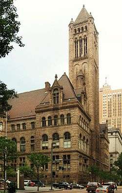 Allegheny County Courthouse | |||
| |||
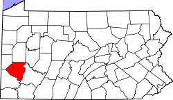 Location in the U.S. state of Pennsylvania | |||
 Pennsylvania's location in the U.S. | |||
| Founded | September 24, 1788 | ||
| Named for | Allegheny River | ||
| Seat | Pittsburgh | ||
| Largest city | Pittsburgh | ||
| Area | |||
| • Total | 745 sq mi (1,930 km2) | ||
| • Land | 730 sq mi (1,891 km2) | ||
| • Water | 14 sq mi (36 km2), 1.9% | ||
| Population (est.) | |||
| • (2017) | 1,223,048 | ||
| • Density | 1,675/sq mi (647/km2) | ||
| Congressional districts | 12th, 14th, 18th | ||
| Time zone | Eastern | ||
| Website |
www | ||
|
Footnotes: | |||
| Designated | December 30, 1982[1] | ||
Allegheny County (/ælɪˈɡeɪni/) is a county in the southwest of the U.S. state of Pennsylvania. As of 2017 the population was 1,223,048, making it the state's second-most populous county, following Philadelphia County. The county seat is Pittsburgh.[2] Allegheny County is included in the Pittsburgh, PA Metropolitan Statistical Area, and in the Pittsburgh Designated Market Area.
Allegheny was Pennsylvania's first to bear a Native American name, being named after the Allegheny River. The word "Allegheny" is of Lenape origin, with uncertain meaning. It is usually said to mean "fine river", but sometimes said to refer to an ancient mythical tribe called "Allegewi" that lived along the river before being destroyed by the Lenape.[3]
History
Little is known of the region's inhabitants prior to European contact. During the colonial era, various native groups claimed or settled in the area, resulting in a multi-ethnic mix that included Iroquois, Lenape, Shawnee, and Mingo. European fur traders such as Peter Chartier established trading posts in the region in the early eighteenth century.
In 1749, Captain Pierre Joseph Céloron de Blainville claimed the Ohio Valley and all of western Pennsylvania for Louis XV of France. The captain traveled along the Ohio and Allegheny rivers inserting lead plates in the ground to mark the land for France.
Since most of the towns during that era were developed along waterways, both the French and the British desired control over the local rivers. Therefore, the British sent Major George Washington to expel the French from their posts, with no success. Failing in this objective, he nearly drowned in the ice-filled Allegheny River while returning. The English tried in 1754 to again enter the area. They sent 41 Virginians to build Fort Prince George. The French learned of the plan and sent an army to capture the fort, which they then resumed building with increased fortification, renaming it Fort Duquesne.
The loss cost the English dearly because Fort Duquesne became a focal point of the French and Indian War. The first attempt to retake the fort, the Braddock Expedition, failed miserably.[4] It was recaptured in 1758 by English forces under General John Forbes; he had it destroyed after its capture. They then built a new fort on the site, including a moat, and named it Fort Pitt. The site is now Pittsburgh's Point State Park.
Both Pennsylvania and Virginia claimed the region that is now Allegheny County. Pennsylvania administered most of the region as part of its Westmoreland County. Virginia considered everything south of the Ohio River and east of the Allegheny River to be part of its Yohogania County and governed it from Fort Dunmore. In addition, parts of the county were located in the proposed British colony of Vandalia and the proposed U.S. state of Westsylvania. The overlapping boundaries, multiple governments, and confused deed claims soon proved unworkable. In 1780 Pennsylvania and Virginia agreed to extend the Mason–Dixon line westward, and the region became part of Pennsylvania. From 1781 until 1788, much of what had been claimed as part of Yohogania County, Virginia, was administered as a part of the newly created Washington County, Pennsylvania.
Allegheny County was officially created on September 24, 1788, from parts of Washington and Westmoreland counties. It was formed due to pressure from settlers living in the area around Pittsburgh, which became the county seat in 1791. The county originally extended north to the shores of Lake Erie; it was reduced to its current borders by 1800.

In the 1790s, a whiskey excise tax was imposed by the United States federal government. This started the so-called Whiskey Rebellion when the farmers who depended on whiskey income refused to pay and drove off tax collector John Neville. After a series of demonstrations by farmers, President George Washington sent troops to stop the rebellion.
The area developed rapidly in the 1800s to become the nation's prime steel producer; Pittsburgh gained the label "Steel Capital of the World".
In 1913 the County's 125th anniversary was celebrated with a week long chain of events, the final day 27 September was marked with a steamboat parade consisting of 30 paddle wheelers which sailed from Monongahela Wharf down the Ohio to the Davis Island Dam. The boats in line were the Steel City (formerly the Pittsburgh and Cincinnati packet Virginia), the flag ship; City of Parkersburg, Charles Brown, Alice Brown, Exporter, Sam Brown, Boaz, Raymond Horner, Swan, Sunshine, I. C. Woodward, Cruiser, Volunteer, A. R. Budd, J. C. Risher, Clyde, Rival, Voyager, Jim Brown, Rover, Charlie Clarke, Robt. J. Jenkins, Slipper, Bertha, Midland Sam Barnum, Cadet, Twilight, and Troubadour.[5]
Geography
According to the U.S. Census Bureau, the county has a total area of 745 square miles (1,930 km2), of which 730 square miles (1,900 km2) is land and 14 square miles (36 km2) (1.9%) is water.[6]
Three majors traverse Allegheny County: the Allegheny River and the Monongahela River converge at Downtown Pittsburgh to form the Ohio River. The Youghiogheny River flows into the Monongahela River at McKeesport, 10 miles (16 km) southeast. There are several islands in these courses. The rivers drain into the Gulf of Mexico via the Mississippi River. Although the county's industrial growth caused the clearcutting of the area's forests, a significant woodland remains.
Adjacent counties
- Butler County (north)
- Armstrong County (northeast)
- Beaver County (northwest)
- Westmoreland County (east and south)
- Washington County (southwest)
Major Highways
Law and government
Until 1 January 2000, Allegheny County's government was defined under Pennsylvania's Second Class County Code. The county government was charged with all local activities, including elections, prisons, airports, public health, and city planning. All public offices were headed by elected citizens. There were three elected county commissioners.
On 1 January 2000 the Home-Rule Charter went into effect. It replaced the three elected commissioners with an elected chief officer (the County Executive), a county council with 15 members (13 elected by district, two elected county-wide), and an appointed county manager. The changes were intended to maintain a separation of powers between the executive and legislative branches while providing greater citizen control.
The county has 130 self-governing municipalities, the most in the state (Luzerne is second with 76).[7] The county has one Second Class City (Pittsburgh) and three Third Class Cities (Clairton, Duquesne, and McKeesport).
A 2004 study found the county would be better served by consolidating the southeastern portion of the county (which includes many small communities with modest economies) into a large municipality ("Rivers City") with a combined population of approximately 250,000.[8]
State relations
Under the Onorato administration, Allegheny County paid $10,000 per month to Robert Ewanco, of Greenlee Partners, to lobby the Pennsylvania General Assembly.[9][10] County officials credit him with a "20-fold" return in the form of appropriations for a widening project on Pennsylvania Route 28, as well as a footbridge and security cameras at Duquesne University.[10]
County Executive
- Rich Fitzgerald, Democrat
County Council
- John DeFazio, President, At-large, Democrat
- Tom Baker, District 1, Republican
- Cindy Kirk, District 2, Republican
- Anita Prizio, District 3, Democrat
- Patrick Catena, District 4, Democrat
- Sue Means, District 5, Republican
- John F. Palmiere, District 6, Democrat
- Nicholas Futules, District 7, Democrat
- Dr. Charles Martoni, District 8, Democrat
- Robert J. Macey, District 9, Democrat
- DeWitt Walton, District 10, Democrat
- Paul Klein, District 11, Democrat
- Robert Palmosina, District 12, Democrat
- Denise Ranalli-Russell, District 13, Democrat
- Samuel DeMarco, III, At-large, Republican
Other elected county offices
- Controller, Chelsa Wagner, Democrat
- District Attorney, Stephen A. Zappala Jr., Democrat
- Sheriff, William P. Mullen, Democrat
- Treasurer, John K. Weinstein, Democrat
Politics
| Year | Republican | Democratic | Third Parties |
|---|---|---|---|
| 2016 | 39.5% 259,480 | 55.9% 367,617 | 4.6% 30,092 |
| 2012 | 42.0% 262,039 | 56.5% 352,687 | 1.5% 9,101 |
| 2008 | 41.6% 272,347 | 57.1% 373,153 | 1.3% 8,539 |
| 2004 | 42.1% 271,925 | 57.2% 368,912 | 0.7% 4,632 |
| 2000 | 40.4% 235,361 | 56.7% 329,963 | 3.0% 17,154 |
| 1996 | 37.9% 204,067 | 52.8% 284,480 | 9.3% 50,068 |
| 1992 | 29.8% 183,035 | 52.8% 324,004 | 17.5% 107,148 |
| 1988 | 39.4% 231,137 | 59.5% 348,814 | 1.1% 6,200 |
| 1984 | 42.8% 284,692 | 56.0% 372,576 | 1.3% 8,480 |
| 1980 | 43.8% 271,850 | 47.9% 297,464 | 8.4% 52,104 |
| 1976 | 46.8% 303,127 | 50.7% 328,343 | 2.5% 16,387 |
| 1972 | 55.6% 371,737 | 42.3% 282,496 | 2.1% 14,302 |
| 1968 | 37.1% 264,790 | 51.1% 364,906 | 11.8% 84,121 |
| 1964 | 33.6% 241,707 | 66.0% 475,207 | 0.4% 2,811 |
| 1960 | 42.8% 320,970 | 57.1% 428,455 | 0.2% 1,293 |
| 1956 | 54.8% 384,939 | 45.0% 315,989 | 0.2% 1,102 |
| 1952 | 49.0% 359,224 | 50.6% 370,945 | 0.4% 2,903 |
| 1948 | 42.6% 253,272 | 54.9% 326,303 | 2.5% 14,931 |
| 1944 | 42.5% 261,218 | 57.1% 350,690 | 0.4% 2,393 |
| 1940 | 41.5% 263,285 | 58.0% 367,926 | 0.5% 2,987 |
| 1936 | 31.4% 176,224 | 65.2% 366,593 | 3.5% 19,377 |
| 1932 | 42.4% 152,326 | 52.9% 189,839 | 4.7% 16,838 |
| 1928 | 56.9% 215,626 | 42.4% 160,733 | 0.8% 2,850 |
| 1924 | 59.0% 149,296 | 8.7% 21,984 | 32.3% 81,733 |
| 1920 | 69.2% 138,908 | 20.1% 40,278 | 10.7% 21,530 |
| 1916 | 55.2% 77,483 | 37.7% 52,833 | 7.1% 9,948 |
| 1912 | 18.9% 23,822 | 24.9% 31,417 | 56.3% 71,147 |
| 1908 | 60.8% 74,080 | 29.3% 35,655 | 10.0% 12,170 |
| 1904 | 76.5% 90,594 | 18.2% 21,541 | 5.3% 6,270 |
| 1900 | 69.9% 71,780 | 26.6% 27,311 | 3.4% 3,533 |
| 1896 | 70.9% 76,691 | 27.6% 29,809 | 1.6% 1,674 |
| 1892 | 58.3% 45,788 | 39.3% 30,867 | 2.4% 1,849 |
| 1888 | 63.6% 45,118 | 34.8% 24,710 | 1.6% 1,138 |
Voter Registration
As of November 7, 2017, there were 921,861 registered voters in the county; a majority were Democrats. There were 536,248 registered Democrats, 258,340 registered Republicans, 120,994 voters registered to other parties, 4,929 to the Libertarian Party and 1,350 voters registered to the Green Party.[12]
Chart of Voter Registration
| Voter registration and party enrollment | |||||
|---|---|---|---|---|---|
| Party | Number of voters | Percentage | |||
| Democratic | 536,248 | 58.17 | |||
| Republican | 258,340 | 28.02 | |||
| Others | 120,994 | 13.12 | |||
| Libertarian | 4,929 | 0.53 | |||
| Green | 1,350 | 0.15 | |||
| Total | 921,861 | 100% | |||
The Republican Party had been historically dominant in county-level politics in the 19th and early 20th centuries; prior to the Great Depression, Pittsburgh and Allegheny County had been majority Republican. Since the Great Depression on the state and national levels, the Democratic Party has been dominant in county-level politics and is the Democratic stronghold of western Pennsylvania. In 2000, Democrat Al Gore won 56% of the vote and Republican George W. Bush won 41%. In 2004, Democrat John Kerry received 57% of the vote and Republican Bush received 42%. In 2006, Democrats Governor Ed Rendell and Senator Bob Casey, Jr. won 59% and 65% of the vote in Allegheny County, respectively. In 2008, Democrat Barack Obama received 57% of the vote, John McCain received 41%, and each of the three state-row office winners (Rob McCord for Treasurer, Jack Wagner for Auditor General, and Tom Corbett for Attorney General) also carried Allegheny.
State Representatives
- Robert F. Matzie, Democratic, 16th district
- Jake Wheatley Jr., Democratic, 19th district
- Adam Ravenstahl, Democratic, 20th district
- Dom Costa, Democratic, 21st district
- Dan Frankel, Democratic, 23rd district
- Ed Gainey, Democratic, 24th district
- Joseph F. Markosek, Democratic, 25th district
- Daniel J. Deasy, Democratic, 27th district
- Mike Turzai, Republican, 28th district
- Harold English, Republican, 30th district
- Anthony M. DeLuca, Democratic, 32nd district
- Frank Dermody, Democratic, 33rd district
- Paul Costa, Democratic, 34th district
- Austin Davis, Democratic, 35th district
- Harry Readshaw, Democratic, 36th district
- William C. Kortz II, Democratic, 38th district
- Rick Saccone, Republican, 39th district
- John Maher, Republican, 40th district
- Dan L. Miller, Democratic, 42nd district
- Mark Mustio, Republican, 44th district
- Anita Astorino Kulik, Democratic, 45th district
- Jason Ortitay, Republican, 46th district
- Eli Evankovich, Republican, 54th district
State senators
- Guy Reschenthaler, Republican, 37th district
- Randy Vulakovich, Republican, 38th district
- Wayne D. Fontana, Democrat, 42nd district
- Jay Costa, Democrat, 43rd district
- James Brewster, Democrat, 45th district
U.S. representatives
- Keith Rothfus, Republican, 12th district
- Michael F. Doyle, Democrat, 14th district
- Connor Lamb, Democrat, - 18th district
Demographics
| Historical population | |||
|---|---|---|---|
| Census | Pop. | %± | |
| 1790 | 10,203 | — | |
| 1800 | 15,087 | 47.9% | |
| 1810 | 25,317 | 67.8% | |
| 1820 | 34,921 | 37.9% | |
| 1830 | 50,552 | 44.8% | |
| 1840 | 81,235 | 60.7% | |
| 1850 | 138,290 | 70.2% | |
| 1860 | 178,831 | 29.3% | |
| 1870 | 262,204 | 46.6% | |
| 1880 | 355,869 | 35.7% | |
| 1890 | 551,959 | 55.1% | |
| 1900 | 775,058 | 40.4% | |
| 1910 | 1,018,463 | 31.4% | |
| 1920 | 1,185,808 | 16.4% | |
| 1930 | 1,374,410 | 15.9% | |
| 1940 | 1,411,539 | 2.7% | |
| 1950 | 1,515,237 | 7.3% | |
| 1960 | 1,628,587 | 7.5% | |
| 1970 | 1,605,016 | −1.4% | |
| 1980 | 1,450,085 | −9.7% | |
| 1990 | 1,336,449 | −7.8% | |
| 2000 | 1,281,666 | −4.1% | |
| 2010 | 1,223,348 | −4.6% | |
| Est. 2017 | 1,223,048 | [13] | 0.0% |
| U.S. Decennial Census[14] 1790–1960[15] 1900–1990[16] 1990–2000[17] 2010–2017[18] | |||
As of the 2010 census, there were 1,223,348 people residing in the county. The population density was 1676 people per square mile (647/km²). The racial makeup of the county was 82.87% White, 14.39% Black or African American, 2.94% Asian, 0.03% Pacific Islander, 0.37% from other races, and 1.40% from two or more races. About 1.31% of the population were Hispanic or Latino of any race.
At the census[19] of 2000, there were 1,281,666 people, 537,150 households, and 332,495 families residing in the county. The population density was 1,755 people per square mile (678/km²). There were 583,646 housing units at an average density of 799 per square mile (309/km²). The racial makeup of the county was 84.33% White, 12.41% Black or African American, 0.12% Native American, 1.69% Asian, 0.03% Pacific Islander, 0.34% from other races, and 1.07% from two or more races. About 0.87% of the population were Hispanic or Latino of any race. 20.0% were of German, 15.0% Italian, 12.7% Irish, 7.5% Polish and 5.1% English ancestry according to Census 2000. 93.5% spoke English and 1.3% Spanish as their first language.
There were 537,150 households out of which 26.40% had children under the age of 18 living with them, 46.10% were married couples living together, 12.40% had a female householder with no husband present, and 38.10% were non-families. Some 32.70% of all households were made up of individuals and 13.20% had someone living alone who was 65 years of age or older. The average household size was 2.31 and the average family size was 2.96.
The age distribution of the population shows 21.90% under the age of 18, 8.50% from 18 to 24, 28.30% from 25 to 44, 23.40% from 45 to 64, and 17.80% who were 65 years of age or older. The median age was 40. For every 100 females, there were 90.00 males; for every 100 females age 18 and over, there were 86.20 males.
Economy
In the late 18th century farming played a critical role in the growth of the area. There was a surplus of grain due to transportation difficulties in linking with the eastern portion of the state. As a result, the farmers distilled the grain into whiskey, which significantly helped the farmers financially.
.svg.png)
The area quickly became a key manufacturing area in the young nation. Coupled with deposits of iron and coal, and the easy access to waterways for barge traffic, the city quickly became one of the most important steel producing areas in the world. Based on 2007 data from the US Army Corps of Engineers, Pittsburgh is the second (after Laredo, Texas) busiest inland port in the nation.
US steel production declined late in the 20th century, and Allegheny County's economy began a shift to other industries. It is presently known for its hospitals, universities, and industrial centers. Despite the decline of heavy industry, Pittsburgh is home to a number of major companies and is ranked in the top ten among US cities hosting headquarters of Fortune 500 corporations, including U.S. Steel Corporation, PNC Financial Services Group, PPG Industries, and H. J. Heinz Company.
The county leads the state in number of defense contractors supplying the U.S. military.[20]
Regions
Education
Colleges and universities
- The Art Institute of Pittsburgh
- Byzantine Catholic Seminary of SS. Cyril and Methodius
- Carlow University
- Carnegie Mellon University
- Chatham University
- DeVry University
- Duquesne University
- La Roche College
- Penn State Greater Allegheny
- Pittsburgh Theological Seminary
- Point Park University
- Reformed Presbyterian Theological Seminary
- Robert Morris University
- University of Pittsburgh
Community, junior and technical colleges
- Job Corps
- Bidwell Training Center
- Bradford School
- Career Training Academy
- Community College of Allegheny County
- Dean Institute of Technology
- Duff's Business Institute
- ICM School of Business and Medical Careers
- International Academy of Design and Technology
- ITT Technical Institute
- Le Cordon Bleu Institute of Culinary Arts in Pittsburgh
- Median School of Allied Health Careers
- Pittsburgh Beauty Academy
- Pittsburgh Institute of Aeronautics
- Pittsburgh Institute of Mortuary Science
- Pittsburgh Technical Institute
- Rosedale Technical Institute
- Triangle Tech
- Western School of Health and Business Careers
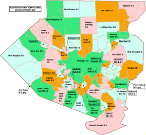
Public school districts
Approved private schools
The Commonwealth of Pennsylvania has 36 Approved Private Schools including the Charter Schools for the Blind and Deaf. The private schools are licensed by the State Board of Private Academic Schools. They provide a free appropriate special education for students with severe disabilities. The cost of tuition for these schools is paid 60% by the state and 40% by the local school district where the student is a resident. Pennsylvania currently has four PA chartered and 30 non-charter APSs for which the Department approves funding. These schools provide a program of special education for over 4,000 day and residential students. Parents are not charged for the services at the school.[21] In 2009, the Pennsylvania Department of Education budgeted $98 million for tuition of children in approved private schools and $36.8 million for students attending the charter schools for the deaf and blind.[22] The majority of these schools are located in the southeastern region and southwestern region of Pennsylvania.
- ACLD Tillotson School, Pittsburgh – Tuition rate $38,804
- The Day School at The Children's Institute, Pittsburgh – Tuition rate $55,217
- DePaul School for Hearing and Speech, Pittsburgh – Tuition rate $36,892
- Easter Seal Society of Western Pennsylvania – Tuition rate $60,891.97
- The Education Center at the Watson Institute, Sewickley – Tuition rate $42,242
- Pace School, Pittsburgh – Tuition rate – $37,635
- Pressley Ridge Day School, Pittsburgh – Tuition rate – $51,177
- Pressley Ridge School for the Deaf, Pittsburgh – Tuition rate – $66,022, residential $128,376
- The Watson Institute Friendship Academy, Pittsburgh – Tuition rate – $38,211
- Wesley Spectrum Highland Services, Pittsburgh – Tuition rate – $39,031
- Western Pennsylvania School for Blind Children, Pittsburgh – Tuition rate – $82,500, residential $120,100
- Western Pennsylvania School for the Deaf, Pittsburgh – Tuition rate – $61,051, residential – $99,919
Private high schools
- Bishop Canevin High School
- Central Catholic High School
- Cornerstone Christian Preparatory Academy
- Eden Christian Academy
- The Ellis School
- Hillcrest Christian Academy
- Harvest Baptist Academy
- Oakland Catholic High School
- Our Lady of the Sacred Heart High School
- Serra Catholic High School
- Seton-La Salle Catholic High School
- Sewickley Academy
- Shady Side Academy
- St. Joseph High School
- Vincentian Academy
21st Century Community Learning Centers
These are state-designated before- and after-school program providers. They receive state funding through grants. CCLCs provide academic, artistic and cultural enhancement activities to students and their families when school is not in session.[23]
- Boys & Girls Clubs of Western PA – 2010 Grant – $261,748
- Cornell School District – 2010 Grant – $526,800
- Human Services Center Corporation – 2010 Grant- $550,000
- McKeesport Area School District – 2010 Grant – $468,000
- Penn Hills School District – 2010 Grant – $360,000
- The Hill House/One Small Step −2010 Grant – $675,000
- Wireless Neighborhoods – 2010 Grant – $612,000
Transportation
Allegheny County's public transportation provider is the Port Authority of Allegheny County. The Allegheny County Department of Public Works oversees infrastructure, maintenance and engineering services in the county.
The Three Rivers Heritage Trail provides uninterrupted bicycle and pedestrian connections along the three rivers in the city, and the Great Allegheny Passage trail runs from downtown Pittsburgh to Washington, D.C.
Major roadways
.svg.png)
.svg.png)
.svg.png)
.svg.png)
.svg.png)


For information about major state roads, see list of State Routes in Allegheny County, Pennsylvania and Allegheny County Belt System.
Parks and recreation
There are two Pennsylvania state parks in Allegheny County. Point State Park is at the confluence of the Allegheny and Monongahela rivers in Downtown Pittsburgh, and Allegheny Islands State Park is in the Allegheny River in Harmar Township and is undeveloped as of August 2010.
Pennsylvania State Game Lands Number 203 is also located in Allegheny County providing hunting and other activities.
Sports
- Pittsburgh Steelers, football team
- Pittsburgh Penguins, ice hockey team
- Pittsburgh Pirates, baseball team
- Pittsburgh Riverhounds, soccer team
Communities
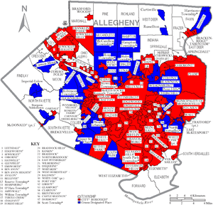
Under Pennsylvania law, there are four types of incorporated municipalities: cities, boroughs, townships, and (in one case) a town. The following municipalities are in Allegheny County:
Cities
- Clairton
- Duquesne
- McKeesport
- Pittsburgh (county seat)
Boroughs
- Aspinwall
- Avalon
- Baldwin
- Bell Acres
- Bellevue
- Ben Avon
- Ben Avon Heights
- Bethel Park
- Blawnox
- Brackenridge
- Braddock
- Braddock Hills
- Bradford Woods
- Brentwood
- Bridgeville
- Carnegie
- Castle Shannon
- Chalfant
- Cheswick
- Churchill
- Coraopolis
- Crafton
- Dormont
- Dravosburg
- East McKeesport
- East Pittsburgh
- Edgewood
- Edgeworth
- Elizabeth
- Emsworth
- Etna
- Forest Hills
- Fox Chapel
- Franklin Park
- Glassport
- Glen Osborne
- Glenfield
- Green Tree
- Haysville
- Heidelberg
- Homestead
- Ingram
- Jefferson Hills
- Leetsdale
- Liberty
- Lincoln
- McDonald (mostly in Washington County)
- McKees Rocks
- Millvale
- Monroeville
- Mount Oliver
- Munhall
- North Braddock
- Oakdale
- Oakmont
- Pennsbury Village
- Pitcairn
- Pleasant Hills
- Plum
- Port Vue
- Rankin
- Rosslyn Farms
- Sewickley
- Sewickley Heights
- Sewickley Hills
- Sharpsburg
- Springdale
- Swissvale
- Tarentum
- Thornburg
- Trafford (mostly in Westmoreland County)
- Turtle Creek
- Verona
- Versailles
- Wall
- West Elizabeth
- West Homestead
- West Mifflin
- West View
- Whitaker
- White Oak
- Whitehall
- Wilkinsburg
- Wilmerding
Townships
- Aleppo
- Baldwin
- Collier
- Crescent
- East Deer
- Elizabeth
- Fawn
- Findlay
- Forward
- Frazer
- Hampton
- Harmar
- Harrison
- Indiana
- Kennedy
- Kilbuck
- Leet
- Marshall
- McCandless
- Moon
- Mt. Lebanon
- Neville
- North Fayette
- North Versailles
- O'Hara
- Ohio
- Penn Hills
- Pine
- Reserve
- Richland
- Robinson
- Ross
- Scott
- Shaler
- South Fayette
- South Park
- South Versailles
- Springdale
- Stowe
- Upper Saint Clair
- West Deer
- Wilkins
Census-designated places
Census-designated places are geographical areas designated by the US Census Bureau for the purposes of compiling demographic data. They are not actual jurisdictions under Pennsylvania law. Other unincorporated communities, such as villages, may be listed here as well.
Unincorporated communities
- Acmetonia
- Alpsville
- Blackridge
- Blanchard
- Broughton
- Bruceton
- Creighton
- Cubbage Hill[24]
- Cuddy[25]
- Dorseyville
- Ewingsville[24]
- Harmarville
- Hickory Heights
- Ingomar
- Karns
- Keown Station
- Kirwan Heights[24]
- Library
- McKnight
- Mount Vernon
- Natrona
- Natrona Heights
- Nevillewood[24]
- Presto[24]
- Regent Square
- Sheraden[26]
- Treveskyn
- Warrendale
- Wexford
- Wildwood
Former places
Many political subdivisions of Allegheny County have come and gone through subdivision or annexation through the years. These include:
- Allegheny City – the area that is now the North Shore (or North Side) of the City of Pittsburgh, north of the Allegheny River.
- Allentown Borough – now the neighborhood of Allentown in Pittsburgh.
- Birmingham Borough – what is now Pittsburgh's South Side.
- Brushton Borough
- Carrick Borough – now the neighborhood of Carrick. Formed out of Baldwin Township in 1904, this borough existed until it was annexed by Pittsburgh in 1927. It was named for Carrick-on-Suir, Ireland. Some of the area's manhole covers still bear the Carrick Borough name.
- Chartier Township – existed at the time of the 1860 U.S. Federal Census.[27]
- Collins Township – in what is now the northeast part of the City of Pittsburgh, east of Lawrenceville and north of Penn Avenue.
- Knoxville Borough
- Lawrenceville Borough
- McClure Township – McClure was formed in 1858 from the section of Ross Township adjacent to Allegheny City. In 1867 McClure, along with sections of Reserve Township, was incorporated into Allegheny City. The McClure section of this annexation became Wards 9 (Woods Run Area) and 11 (present day Brighton Heights) in the City of Pittsburgh.
- Mifflin Township- comprised the modern day communities of Whitaker, West Mifflin, West Homestead, West Elizabeth, Pleasant Hills, Munhall, Lincoln Place, Jefferson Hills, Homestead, Hays, Duquesne, Dravosburg, Clairton and part of Baldwin.[28]
- Patton Township – was in east central part of the county, north of North Versailles Township, east of Wilkins and Penn Townships, and south of Plum Township. In U.S. census for 1860–1880. In 1951 it became incorporated as the borough of Monroeville.
- Northern Liberties Borough – in what is now the Strip District of Pittsburgh. The borough was annexed to Pittsburgh in 1837 as the first addition to the city's original territory.
- Peebles Township – included most of what is now the eastern part of the city of Pittsburgh from the Monongahela River in the south (today's Hazelwood) to the Allegheny River in the north. It was subdivided into Collins and Liberty townships, all of which were incorporated into Pittsburgh in 1868.
- Pitt Township
- St. Clair Township – stretched from the Monongahela River south to the Washington County line. It divided into Lower St. Clair, which eventually became part of the City of Pittsburgh, Dormont, Mount Lebanon, and Upper St. Clair.
- Snowden – now known as South Park Township.
- Sterrett Township
- Temperanceville – what is now Pittsburgh's West End.
- Union Borough – the area surrounding Temperanceville.
- West Liberty Borough – now the neighborhoods of Brookline and Beechview in Pittsburgh.
Population ranking
The population ranking of the following table is based on the 2010 census of Allegheny County.[29]
† county seat
| Rank | City/Town/etc. | Population (2010 Census) | Municipal type | Incorporated |
|---|---|---|---|---|
| 1 | † Pittsburgh | 305,704 | City | 1794 (borough) 1816 (city) |
| 2 | Penn Hills | 42,329 | Municipality | 1851 (Penn Twp.) 1958 (Penn Hills Twp.) 1976 (municipality) |
| 3 | Mt. Lebanon | 33,137 | Municipality | 1912 (township) 1975 (municipality) |
| 4 | Bethel Park | 32,313 | Municipality | 1949 (borough) 1978 (municipality) |
| 5 | Monroeville | 28,386 | Municipality | 1951 |
| 6 | Plum | 27,126 | Borough | 1788 (township) 1956 (borough) |
| 7 | Allison Park | 21,552 | CDP | |
| 8 | West Mifflin | 20,313 | Borough | 1942 |
| 9 | Baldwin | 19,767 | Borough | 1950 |
| 10 | McKeesport | 19,731 | City | 1842 (borough) 1891 (city) |
| 11 | Wilkinsburg | 15,930 | Borough | 1871 (Sterrett Twp.) 1887 (borough) |
| 12 | Whitehall | 13,944 | Borough | 1948 |
| 13 | Franklin Park | 13,470 | Borough | |
| 14 | Munhall | 11,406 | Borough | |
| 15 | Carnot-Moon | 11,372 | CDP | |
| 16 | Jefferson Hills | 10,619 | Borough | |
| 17 | Brentwood | 9,643 | Borough | 1916 |
| 18 | Swissvale | 8,983 | Borough | |
| 19 | Glenshaw | 8,981 | CDP | |
| 20 | Dormont | 8,593 | Borough | 1909 |
| 21 | Bellevue | 8,370 | Borough | 1867 |
| 22 | Castle Shannon | 8,316 | Borough | 1919 |
| 23 | Pleasant Hills | 8,268 | Borough | |
| 24 | Carnegie | 7,972 | Borough | 1894 |
| 25 | White Oak | 7,862 | Borough | |
| 26 | Clairton | 6,796 | City | 1903 (borough) 1922 (city) |
| 27 | West View | 6,771 | Borough | |
| 28 | Forest Hills | 6,518 | Borough | 1919 |
| 29 | Oakmont | 6,303 | Borough | 1889 |
| 30 | McKees Rocks | 6,104 | Borough | 1892 |
| 31 | Crafton | 5,951 | Borough | |
| 32 | Coraopolis | 5,677 | Borough | 1886 |
| 33 | Duquesne | 5,565 | City | 1891 (borough) 1918 (city) |
| 34 | Fox Chapel | 5,388 | Borough | |
| 35 | Turtle Creek | 5,349 | Borough | |
| 36 | Bridgeville | 5,148 | Borough | 1901 |
| 37 | North Braddock | 4,857 | Borough | |
| 38 | Avalon | 4,705 | Borough | 1874 |
| 39 | Tarentum | 4,530 | Borough | 1842 |
| 40 | Glassport | 4,483 | Borough | |
| 41 | Green Tree | 4,432 | Borough | 1885 |
| 42 | Sewickley | 3,827 | Borough | |
| 43 | Port Vue | 3,798 | Borough | |
| 44 | Millvale | 3,744 | Borough | |
| 45 | Pitcairn | 3,689 | Borough | |
| 46 | Etna | 3,451 | Borough | |
| 47 | Sharpsburg | 3,446 | Borough | |
| 48 | Springdale | 3,405 | Borough | |
| 49 | Mount Oliver | 3,403 | Borough | |
| 50 | Ingram | 3,330 | Borough | |
| 51 | Brackenridge | 3,260 | Borough | 1901 |
| 52 | Trafford (mostly in Westmoreland County) | 3,174 | Borough | 1904 |
| 53 | Homestead | 3,165 | Borough | |
| 54 | Edgewood | 3,118 | Borough | 1888 |
| 55 | Churchill | 3,011 | Borough | |
| 56 | Aspinwall | 2,801 | Borough | 1892 |
| 57 | Gibsonia | 2,733 | CDP | |
| 58 | Liberty | 2,551 | Borough | |
| 59 | Imperial | 2,541 | CDP | |
| 60 | Verona | 2,474 | Borough | 1871 |
| 61 | Emsworth | 2,449 | Borough | |
| 62 | Greenock | 2,195 | CDP | |
| 63 | Wilmerding | 2,190 | Borough | |
| 64 | Braddock | 2,159 | Borough | 1867 |
| 65 | McDonald (mostly in Washington County) | 2,149 | Borough | 1889 |
| 66 | East McKeesport | 2,126 | Borough | |
| 67 | Rankin | 2,122 | Borough | |
| 68 | West Homestead | 1,929 | Borough | |
| 69 | Braddock Hills | 1,880 | Borough | 1946 |
| 70 | East Pittsburgh | 1,822 | Borough | |
| 71 | Dravosburg | 1,792 | Borough | |
| 72 | Ben Avon | 1,781 | Borough | 1891 |
| 73 | Bakerstown | 1,761 | CDP | |
| 74 | Cheswick | 1,746 | Borough | |
| 75 | Sturgeon | 1,710 | CDP | |
| 76 | Edgeworth | 1,680 | Borough | |
| 77 | Versailles | 1,515 | Borough | |
| 78 | Elizabeth | 1,493 | Borough | |
| 79 | Oakdale | 1,459 | Borough | |
| 80 | Russellton | 1,440 | CDP | |
| 81 | Blawnox | 1,432 | Borough | 1925 |
| 82 | Bell Acres | 1,388 | Borough | 1960 |
| 83 | Whitaker | 1,271 | Borough | |
| 84 | Heidelberg | 1,244 | Borough | |
| 85 | Leetsdale | 1,218 | Borough | |
| 86 | Bradford Woods | 1,171 | Borough | 1915 |
| 87 | Rennerdale | 1,150 | CDP | |
| 88 | Lincoln | 1,072 | Borough | |
| 89 | Curtisville | 1,064 | CDP | |
| 90 | Enlow | 1,013 | CDP | |
| 91 | Harwick | 899 | CDP | |
| 92 | Sewickley Heights | 810 | Borough | |
| 93 | Chalfant | 800 | Borough | |
| 94 | Bairdford | 698 | CDP | |
| 95 | Pennsbury Village | 661 | Borough | |
| 96 | Sewickley Hills | 639 | Borough | |
| 97 | Wall | 580 | Borough | |
| 98 | Noblestown | 575 | CDP | |
| 99 | Glen Osborne | 547 | Borough | |
| 100 | Boston | 545 | CDP | |
| 101 | West Elizabeth | 518 | Borough | |
| 102 | Thornburg | 455 | Borough | |
| 103 | Clinton | 434 | CDP | |
| 104 | Rosslyn Farms | 427 | Borough | |
| 105 | Ben Avon Heights | 371 | Borough | 1913 |
| 106 | Glenfield | 205 | Borough | |
| 107 | Haysville | 70 | Borough |
Notable people
See also
References
- ↑ "PHMC Historical Markers Search" (Searchable database). Pennsylvania Historical and Museum Commission. Commonwealth of Pennsylvania. Retrieved January 25, 2014.
- ↑ "Find a County". National Association of Counties. Archived from the original on May 31, 2011. Retrieved June 7, 2011.
- ↑ Stewart, George R. (1967) [1945]. Names on the Land: A Historical Account of Place-Naming in the United States (Sentry edition (3rd) ed.). Houghton Mifflin. pp. 8, 193. ISBN 1-59017-273-6.
- ↑ Fiske, John (1902). New France and New England, pp. 290–92. Houghton Mifflin Company.
- ↑ Kussart, Mrs. S. (24 Apr 1930). "Navigation on the Monongahela River". The Daily Republican (Monongahela, Pennsylvania). p. 3. Retrieved 10 August 2018.
- ↑ "2010 Census Gazetteer Files". United States Census Bureau. August 22, 2012. Retrieved March 4, 2015.
- ↑ "Pennsylvania Municipalities Information". Pamunicipalitiesinfo.com. Retrieved August 16, 2012.
- ↑ Cohan, Jeffrey (June 20, 2004). "Can 39 towns be turned into one?". Pittsburgh Post-Gazette. Retrieved August 16, 2012.
- ↑ "Lobbyist Profile – Ewanco, Robert J." Pennsylvania Lobbyist Database. Pennsylvania General Assembly. Archived from the original (database) on December 1, 2009.
- 1 2 Bumsted, Brad; Mike Wereschagin (November 29, 2009). "Lobbyist expenses wasteful, critics say". Pittsburgh Tribune Review. Archived from the original on November 30, 2009.
- ↑ Leip, David. "Dave Leip's Atlas of U.S. Presidential Elections". uselectionatlas.org.
- ↑ http://www.dos.pa.gov/VotingElections/CandidatesCommittees/RunningforOffice/Documents/2017%20Election%20VR%20Stats.pdf
- ↑ "Population and Housing Unit Estimates". Retrieved June 9, 2017.
- ↑ "U.S. Decennial Census". United States Census Bureau. Archived from the original on May 12, 2015. Retrieved March 4, 2015.
- ↑ "Historical Census Browser". University of Virginia Library. Retrieved March 4, 2015.
- ↑ Forstall, Richard L., ed. (March 27, 1995). "Population of Counties by Decennial Census: 1900 to 1990". United States Census Bureau. Retrieved March 4, 2015.
- ↑ "Census 2000 PHC-T-4. Ranking Tables for Counties: 1990 and 2000" (PDF). United States Census Bureau. April 2, 2001. Retrieved March 4, 2015.
- ↑ "State & County QuickFacts". United States Census Bureau. Archived from the original on July 6, 2011. Retrieved November 16, 2013.
- ↑ "American FactFinder". United States Census Bureau. Archived from the original on September 11, 2013. Retrieved January 31, 2008.
- ↑ "Automatic defense cuts would affect some contractors in Pittsburgh region". Pittsburgh Post-Gazette. July 3, 2012. Retrieved August 16, 2012.
- ↑ Approved Private Schools and Chartered Schools for the Deaf and the Blind, Pennsylvania Department of Education website, accessed April 2010.
- ↑ Tommasini, John, Assistant Secretary of Education, Testimony before the Pennsylvania Senate Education Committee Hearing on SB982 of 2010. given April 14, 2010.
- ↑ Pennsylvania Awards $29.9 Million to Support 21st Century Community Learning Centers, Pennsylvania Department of Education Press Release, April 7, 2010
- 1 2 3 4 5 6 Schmitz, Jon (July 23, 2012). "Kirwan Heights loses Interstate 79 designation". Pittsburgh Post-Gazette. Retrieved May 15, 2016.
- ↑ "Profile: Cuddy, Pennsylvania". Mapquest. Retrieved May 15, 2016.
- ↑ "Profile: Sheraden, Pennsylvania". U.S. Geological Survey. Retrieved May 15, 2016.
- ↑ 1860 United States Federal Census - Chartier Township, accessed April 2018 via ancestry.com paid subscription site.
- ↑ "Mifflin Township Historical Society Attraction Details". ExplorePAhistory.com.
- ↑ Center for New Media and Promotions(C2PO). "2010 Census". United States Census Bureau. Archived from the original on December 21, 2013.
External links
| Wikivoyage has a travel guide for Allegheny County. |
| Wikimedia Commons has media related to Allegheny County, Pennsylvania. |
- Allegheny County official website
- Allegheny County Quest
- County Map by Municipality
- Historic Pittsburgh Map Collection
- Southwestern Pennsylvania Commission
Places adjacent to Allegheny County, Pennsylvania | ||||||||||
|---|---|---|---|---|---|---|---|---|---|---|
| ||||||||||

.svg.png)