Thornburg, Pennsylvania
| Thornburg | |
|---|---|
| Borough | |
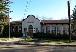 Community Center | |
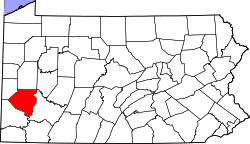
 Location in Allegheny County and the U.S. state of Pennsylvania. | |
| Coordinates: 40°26′01″N 80°04′59″W / 40.433568°N 80.083165°WCoordinates: 40°26′01″N 80°04′59″W / 40.433568°N 80.083165°W | |
| Country | United States |
| State | Pennsylvania |
| County | Allegheny |
| Government | |
| • Mayor | Thomas Mackin (D) |
| Area[1] | |
| • Total | 0.43 sq mi (1.13 km2) |
| • Land | 0.43 sq mi (1.13 km2) |
| • Water | 0.00 sq mi (0.00 km2) |
| Population (2010) | |
| • Total | 455 |
| • Estimate (2016)[2] | 452 |
| • Density | 1,039.08/sq mi (401.10/km2) |
| Time zone | UTC-5 (Eastern (EST)) |
| • Summer (DST) | UTC-4 (EDT) |
| ZIP code | 15205 |
| FIPS code | 42-76560 |
| Website | http://www.thornburg-pa.gov/ |
Thornburg is a borough in Allegheny County in the U.S. state of Pennsylvania. The population was 455 at the 2010 census.[3]
Geography
Thornburg is located at 40°26′01″N 80°04′59″W / 40.433568°N 80.083165°W (40.433568, -80.083165).[4] According to the United States Census Bureau, the borough has a total area of 0.4 square miles (1.0 km2), all of it land.
Education
Thornburg is served by the Montour School District.
Government and Politics
| Year | Republican | Democratic | Third Parties |
|---|---|---|---|
| 2016 | 49% 156 | 51% 162 | 1% 1 |
| 2012 | 59% 193 | 40% 130 | 1% 3 |
Demographics
| Historical population | |||
|---|---|---|---|
| Census | Pop. | %± | |
| 1910 | 230 | — | |
| 1920 | 300 | 30.4% | |
| 1930 | 327 | 9.0% | |
| 1940 | 284 | −13.1% | |
| 1950 | 335 | 18.0% | |
| 1960 | 391 | 16.7% | |
| 1970 | 617 | 57.8% | |
| 1980 | 526 | −14.7% | |
| 1990 | 461 | −12.4% | |
| 2000 | 468 | 1.5% | |
| 2010 | 455 | −2.8% | |
| Est. 2016 | 452 | [2] | −0.7% |
| Sources:[7][8][9][10][11] | |||
As of the census[10] of 2000, there were 468 people, 177 households, and 138 families residing in the borough. The population density was 1,060.8 people per square mile (410.7/km2). There were 182 housing units at an average density of 412.5 per square mile (159.7/km2). The racial makeup of the borough was 96.79% White, 0.85% Asian, 0.21% from other races, and 2.14% from two or more races. Hispanic or Latino of any race were 1.50% of the population.
There were 177 households, out of which 33.9% had children under the age of 18 living with them, 69.5% were married couples living together, 6.8% had a female householder with no husband present, and 22.0% were non-families. 16.9% of all households were made up of individuals, and 7.9% had someone living alone who was 65 years of age or older. The average household size was 2.64 and the average family size was 3.01.
In the borough the population was spread out, with 27.1% under the age of 18, 3.2% from 18 to 24, 21.6% from 25 to 44, 33.5% from 45 to 64, and 14.5% who were 65 years of age or older. The median age was 44 years. For every 100 females there were 95.0 males. For every 100 females age 18 and over, there were 94.9 males.
The median income for a household in the borough was $83,264, and the median income for a family was $84,114. Males had a median income of $80,000 versus $39,063 for females. The per capita income for the borough was $57,674. None of the families and 1.3% of the population were living below the poverty line, including no under eighteens and none of those over 64.
Surrounding and adjacent neighborhoods
Thornburg has only one land border with Robinson Township to the north and west. Across Chartiers Creek to the south and east, Thornburg runs adjacent with Crafton.
See also
References
- ↑ "2016 U.S. Gazetteer Files". United States Census Bureau. Retrieved Aug 13, 2017.
- 1 2 "Population and Housing Unit Estimates". Retrieved June 9, 2017.
- ↑ "Race, Hispanic or Latino, Age, and Housing Occupancy: 2010 Census Redistricting Data (Public Law 94-171) Summary File (QT-PL), Thornburg borough, Pennsylvania". U.S. Census Bureau, American FactFinder 2. Retrieved September 23, 2011.
- ↑ "US Gazetteer files: 2010, 2000, and 1990". United States Census Bureau. 2011-02-12. Retrieved 2011-04-23.
- ↑ EL. "2012 Allegheny County election". Pittsburgh Tribune-Review. Retrieved 15 October 2017.
- ↑ EL. "2016 Pennsylvani general election..." Pittsburgh Post-Gazette. Retrieved 15 October 2017.
- ↑ "Number and Distribution of Inhabitants:Pennsylvania-Tennessee" (PDF). Fifteenth Census. U.S. Census Bureau.
- ↑ "Number of Inhabitants: Pennsylvania" (PDF). 18th Census of the United States. U.S. Census Bureau. Retrieved 22 November 2013.
- ↑ "Pennsylvania: Population and Housing Unit Counts" (PDF). U.S. Census Bureau. Retrieved 22 November 2013.
- 1 2 "American FactFinder". United States Census Bureau. Retrieved 2008-01-31.
- ↑ "Annual Estimates of the Resident Population". U.S. Census Bureau. Archived from the original on 19 October 2013. Retrieved 22 November 2013.
External links
| Counties |  Map of the Pittsburgh Tri-State with green counties in the metropolitan area and yellow counties in the combined area. | |
|---|---|---|
| Major cities | ||
| Cities and towns 15k-50k (in 2010) | ||
| Airports | ||
| Topics | ||
| ||