Robinson Township, Allegheny County, Pennsylvania
| Robinson Township | |
|---|---|
| Township | |
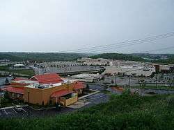 View of The Mall at Robinson | |
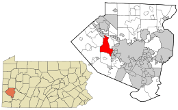 Location in Allegheny County and state of Pennsylvania | |
| Coordinates: 40°27′29″N 80°7′42″W / 40.45806°N 80.12833°WCoordinates: 40°27′29″N 80°7′42″W / 40.45806°N 80.12833°W | |
| Country | United States |
| State | Pennsylvania |
| County | Allegheny |
| Area[1] | |
| • Total | 15.34 sq mi (39.72 km2) |
| • Land | 15.22 sq mi (39.42 km2) |
| • Water | 0.12 sq mi (0.31 km2) |
| Population (2010) | |
| • Total | 13,354 |
| • Estimate (2016)[2] | 13,719 |
| • Density | 901.44/sq mi (348.06/km2) |
| Time zone | UTC-5 (Eastern (EST)) |
| • Summer (DST) | UTC-4 (EDT) |
| FIPS code | 42-003-65352 |
Robinson Township is a township in Allegheny County, Pennsylvania, United States approximately 12 miles (19 km) west of Pittsburgh. The population was 13,354 at the 2010 census.
Geography
Robinson Township is located at 40°27′28″N 80°7′41″W / 40.45778°N 80.12806°W (40.458008, -80.128259).[3]
According to the United States Census Bureau, the township has a total area of 14.9 square miles (39 km2), of which 14.8 square miles (38 km2) is land and 0.2 square miles (0.52 km2), or 1.21%, is water.
Education
Robinson Township is served by the Montour School District.
Taxes
School tax millage rate- The Montour SD (shared with four other municipalities) in 2017 was 17.96. This ranked 38th highest/most expensive out of Allegheny County's 45 school districts, between North Hills SD (37th highest) and Duquesne SD (39th highest).[4]
Surrounding and adjacent neighborhoods
Robinson Township has nine land borders, including Kennedy Township and the Pittsburgh neighborhood of Fairywood to the east, Thornburg, Rosslyn Farms, and Carnegie to the southeast, Collier Township to the south, and North Fayette Township, Moon Township, and Coraopolis to the west. Across the back channel of the Ohio River, Robinson Township runs adjacent with Neville Township. Robinson Township also completely surrounds Pennsbury Village in the southeast.
Economy
Robinson Township is known in the area as a retail hub. The Mall at Robinson is located in the township, as well as the open-air Settlers Ridge and several smaller plazas. Bayer USA is based in Robinson Township as well.
Twin Hi-Way Drive-In
The Twin Hi-Way Drive-In was a drive-in theater located in Robinson Township on Pennsylvania Route 60.[5][6] It was owned by the Salnoris family, being Jerry, Jerry, Karla, and Karen, during its second life. It originally opened in 1950 and closed in 1996. In 2007, it was reborn by the aforementioned Salnoris family. It was rewarded Best of the Burgh twice and won several battles for the land. In Early 2016, however, it was shut down to Sheetz making a large offer to the landlord and being accepted.[7] It closed with a 3.5 star rating on Google.
Demographics
| Historical population | |||
|---|---|---|---|
| Census | Pop. | %± | |
| 2010 | 13,354 | — | |
| Est. 2016 | 13,719 | [2] | 2.7% |
| U.S. Decennial Census[8] | |||
As of the census[9] of 2000, there were 12,289 people, 4,828 households, and 3,312 families residing in the township. The population density was 833.2 people per square mile (321.7/km²). There were 5,158 housing units at an average density of 349.7/sq mi (135.0/km²). The racial makeup of the township was 95.25% White, 1.90% African American, 0.06% Native American, 2.04% Asian, 0.02% Pacific Islander, 0.14% from other races, and 0.59% from two or more races. Hispanic or Latino of any race were 0.73% of the population.
There were 4,828 households, out of which 30.1% had children under the age of 18 living with them, 58.2% were married couples living together, 7.7% had a female householder with no husband present, and 31.4% were non-families. 27.0% of all households were made up of individuals, and 7.9% had someone living alone who was 65 years of age or older. The average household size was 2.45 and the average family size was 3.01.
In the township the population was spread out, with 22.8% under the age of 18, 5.9% from 18 to 24, 31.4% from 25 to 44, 26.0% from 45 to 64, and 13.8% who were 65 years of age or older. The median age was 40 years. For every 100 females, there were 96.8 males. For every 100 females age 18 and over, there were 93.2 males.
The median income for a household in the township was $55,263, and the median income for a family was $66,807. Males had a median income of $46,750 versus $30,605 for females. The per capita income for the township was $26,802. About 4.8% of families and 6.6% of the population were below the poverty line, including 8.2% of those under age 18 and 6.0% of those age 65 or over.
Government and politics
| Year | Republican | Democratic | Third Parties |
|---|---|---|---|
| 2016 | 55% 4,129 | 44% 3,336 | 1% 56 |
| 2012 | 57% 3,929 | 43% 2,955 | 0% 59 |
References
- ↑ "2016 U.S. Gazetteer Files". United States Census Bureau. Retrieved Aug 13, 2017.
- 1 2 "Population and Housing Unit Estimates". Retrieved June 9, 2017.
- ↑ "US Gazetteer files: 2010, 2000, and 1990". United States Census Bureau. 2011-02-12. Retrieved 2011-04-23.
- ↑ EL. "Allegheny County Treasurer". Retrieved 1 September 2017.
- ↑ "In Robinson, end of an era as drive-in closes". Retrieved 15 August 2017.
- ↑ "Supporters plead for Twin Hi-Way Drive-in's survival". Retrieved 15 August 2017.
- ↑ D'Antonio, Christine. "One Of Area's Last Drive-In Theaters Officially Closes". Retrieved 15 August 2017.
- ↑ "Census of Population and Housing". Census.gov. Retrieved June 4, 2016.
- ↑ "American FactFinder". United States Census Bureau. Retrieved 2008-01-31.
- ↑ EL. "2012 Allegheny County election". Pittsburgh Tribune-Review. Retrieved 15 October 2017.
- ↑ EL. "2016 Pennsylvani general election..." Pittsburgh Post-Gazette. Retrieved 15 October 2017.
External links
| Wikimedia Commons has media related to Robinson Township, Allegheny County, Pennsylvania. |
| Counties |  Map of the Pittsburgh Tri-State with green counties in the metropolitan area and yellow counties in the combined area. | |
|---|---|---|
| Major cities | ||
| Cities and towns 15k-50k (in 2010) | ||
| Airports | ||
| Topics | ||
| ||