Crescent Township, Allegheny County, Pennsylvania
| Crescent Township | |
|---|---|
| Township | |
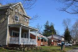 Houses on Front Street in Glenwillard | |
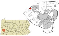 Location in Allegheny County and state of Pennsylvania | |
| Coordinates: 40°34′0″N 80°13′47″W / 40.56667°N 80.22972°WCoordinates: 40°34′0″N 80°13′47″W / 40.56667°N 80.22972°W | |
| Country | United States |
| State | Pennsylvania |
| County | Allegheny |
| Government | |
| • Type | Board of Commissioners |
| • President | Joseph Sabol (R) |
| Area[1] | |
| • Total | 2.31 sq mi (5.98 km2) |
| • Land | 2.10 sq mi (5.43 km2) |
| • Water | 0.21 sq mi (0.55 km2) |
| Population (2010) | |
| • Total | 2,640 |
| • Estimate (2016)[2] | 2,583 |
| • Density | 1,231.17/sq mi (475.46/km2) |
| Time zone | UTC-5 (Eastern (EST)) |
| • Summer (DST) | UTC-4 (EDT) |
| FIPS code | 42-003-17048 |
| Website | Official website |
Crescent Township is a township in Allegheny County, Pennsylvania, United States and is part of the Pittsburgh Metro Area. The population was 2,640 at the 2010 census.[3]
The township was created in 1855 and was given the name Crescent because it was formed from a portion of Moon Township. Crescent Township has been assigned the ZIP code 15046.
Crescent Township has two unincorporated villages:
- Glenwillard
- Wireton
Crescent is part of the Pittsburgh Metropolitan Statistical Area.
Education
Students living in Crescent Township attend the Moon Area School District.
Government and Politics
| Year | Republican | Democratic | Third Parties |
|---|---|---|---|
| 2016 | 55% 720 | 44% 529 | 4% 54 |
| 2012 | 56% 685 | 44% 539 | 0% 9 |
Geography
According to the United States Census Bureau, the township has a total area of 2.3 square miles (6.0 km2), of which 2.1 square miles (5.4 km2) is land and 0.2 square miles (0.52 km2), or 10.78%, is water.
Surrounding and adjacent neighborhoods
Crescent Township has three land borders, including Moon Township to the south, southeast and southwest and the Beaver County neighborhoods of South Heights to the north and Hopewell Township to the northwest. Across the Ohio River to the northeast, Crescent Township runs adjacent with Leetsdale.
Education
Crescent Township is served by the Moon Area School District.
Taxes
School tax millage rate- The Moon Area School District (shared with Moon Township and Crescent Township) in 2017 was 20.30. This ranked 24th highest/most expensive out of Allegheny County's 45 school districts [between Allegheny Valley SD (23rd highest) and Plum Borough SD (25th highest)].[6]
Demographics
| Historical population | |||
|---|---|---|---|
| Census | Pop. | %± | |
| 1860 | 324 | — | |
| 1870 | 364 | 12.3% | |
| 1880 | 419 | 15.1% | |
| 1890 | 785 | 87.4% | |
| 1900 | 622 | −20.8% | |
| 1910 | 893 | 43.6% | |
| 1920 | 980 | 9.7% | |
| 1930 | 1,107 | 13.0% | |
| 1940 | 1,482 | 33.9% | |
| 1950 | 1,867 | 26.0% | |
| 1960 | 2,603 | 39.4% | |
| 1970 | 2,918 | 12.1% | |
| 1980 | 2,862 | −1.9% | |
| 1990 | 2,490 | −13.0% | |
| 2000 | 2,314 | −7.1% | |
| 2010 | 2,640 | 14.1% | |
| Est. 2016 | 2,583 | [2] | −2.2% |
| Sources:[7][8][9][10][11][12][13][14] | |||
As of the census[13] of 2000, there were 2,314 people, 886 households, and 658 families residing in the township. The population density was 1,115.8 people per square mile (431.6/km²). There were 920 housing units at an average density of 443.6/sq mi (171.6/km²). The racial makeup of the township was 97.23% White, 1.25% African American, 0.30% Native American, 0.91% Asian, 0.04% Pacific Islander, and 0.26% from two or more races. Hispanic or Latino of any race were 0.78% of the population.
There were 886 households, out of which 32.6% had children under the age of 18 living with them, 61.7% were married couples living together, 9.7% had a female householder with no husband present, and 25.7% were non-families. 21.2% of all households were made up of individuals, and 9.5% had someone living alone who was 65 years of age or older. The average household size was 2.60 and the average family size was 3.05.
In the township the population was spread out, with 23.9% under the age of 18, 6.7% from 18 to 24, 31.0% from 25 to 44, 23.4% from 45 to 64, and 14.9% who were 65 years of age or older. The median age was 38 years. For every 100 females, there were 93.6 males. For every 100 females age 18 and over, there were 93.2 males.
The median income for a household in the township was $49,500, and the median income for a family was $52,267. Males had a median income of $35,661 versus $25,076 for females. The per capita income for the township was $19,472. About 3.2% of families and 5.1% of the population were below the poverty line, including 6.4% of those under age 18 and 5.6% of those age 65 or over.
Trivia
Some scenes in the movie The Silence of the Lambs were filmed in the Glenwillard section of Crescent Township.
Notable residents
- Lou Christie, famous singer/songwriter, grew up in the Glenwillard section of Crescent and attended Moon High School.
- NCAA men's basketball coach John Calipari lived in Crescent when he was an assistant coach at the University of Pittsburgh under Paul Evans.
References
- ↑ "2016 U.S. Gazetteer Files". United States Census Bureau. Retrieved Aug 13, 2017.
- 1 2 "Population and Housing Unit Estimates". Retrieved June 9, 2017.
- ↑ "Race, Hispanic or Latino, Age, and Housing Occupancy: 2010 Census Redistricting Data (Public Law 94-171) Summary File (QT-PL), Crescent township, Allegheny County, Pennsylvania". U.S. Census Bureau, American FactFinder 2. Archived from the original on September 11, 2013. Retrieved September 27, 2011.
- ↑ EL. "2012 Allegheny County election". Pittsburgh Tribune-Review. Retrieved 15 October 2017.
- ↑ EL. "2016 Pennsylvani general election..." Pittsburgh Post-Gazette. Retrieved 15 October 2017.
- ↑ EL. "Allegheny County Treasurer". Retrieved 1 September 2017.
- ↑ "Population of Civil Divisions Less than Counties" (PDF). 1870 United States Census. U.S. Census Bureau. Retrieved 25 November 2013.
- ↑ "Population of Civil Divisions Less than Counties" (PDF). 1880 United States Census. U.S. Census Bureau. Retrieved 24 November 2013.
- ↑ "Population-Pennsylvania" (PDF). U.S. Census 1910. U.S. Census Bureau. Retrieved 22 November 2013.
- ↑ "Number and Distribution of Inhabitants:Pennsylvania-Tennessee" (PDF). Fifteenth Census. U.S. Census Bureau.
- ↑ "Number of Inhabitants: Pennsylvania" (PDF). 18th Census of the United States. U.S. Census Bureau. Retrieved 22 November 2013.
- ↑ "Pennsylvania: Population and Housing Unit Counts" (PDF). U.S. Census Bureau. Retrieved 22 November 2013.
- 1 2 "American FactFinder". United States Census Bureau. Archived from the original on 2013-09-11. Retrieved 2008-01-31.
- ↑ "Incorporated Places and Minor Civil Divisions Datasets: Subcounty Population Estimates: April 1, 2010 to July 1, 2012". U.S. Census Bureau. Archived from the original on 17 June 2013. Retrieved 25 November 2013.
External links
| Counties |  Map of the Pittsburgh Tri-State with green counties in the metropolitan area and yellow counties in the combined area. | |
|---|---|---|
| Major cities | ||
| Cities and towns 15k-50k (in 2010) | ||
| Airports | ||
| Topics | ||
| ||