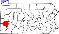
West Mifflin, Pennsylvania
| West Mifflin, Pennsylvania | |
|---|---|
| Borough | |
| Borough of West Mifflin | |
 | |
 Location in Allegheny County and the U.S. state of Pennsylvania. | |
| Coordinates: 40°22′5″N 79°53′51″W / 40.36806°N 79.89750°WCoordinates: 40°22′5″N 79°53′51″W / 40.36806°N 79.89750°W | |
| Country |
|
| State |
|
| County |
|
| Incorporated | 1788 (Mifflin Township) |
| Dec. 11, 1942[1] (Borough) | |
| Government | |
| • Mayor | Chris Kelly |
| • Council |
John Inglis Karen Santoro Frank Stupar Robert Kostelnik Joyce Kushner Steve Marone Scott Stephenson |
| • Borough Manager | Brian Kamauf |
| • Police Chief | (Acting Chief) Lt. Michael Ragan |
| • IT Coordinator | Andy Quayle |
| Area[2] | |
| • Total | 14.51 sq mi (37.57 km2) |
| • Land | 14.21 sq mi (36.81 km2) |
| • Water | 0.29 sq mi (0.76 km2) 1.8% |
| Population (2010) | |
| • Total | 20,313 |
| • Estimate (2016)[3] | 19,921 |
| • Density | 1,401.70/sq mi (541.19/km2) |
| Time zone | UTC-5 (EST) |
| • Summer (DST) | UTC-4 (EDT) |
| FIPS code | 42-83512 |
| Website |
www |
West Mifflin is a borough in Allegheny County, Pennsylvania, United States, located southeast of downtown Pittsburgh. The population was 20,313 at the 2010 census.[4] It is named after Thomas Mifflin, 1st Governor of Pennsylvania, signer of the United States Constitution, and 1st Quartermaster General of the United States Army.[5]
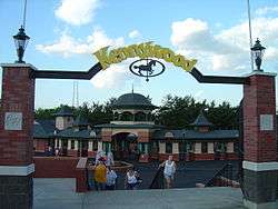
Although the borough is heavily residential, it is home to one of America's oldest traditional amusement parks, Kennywood Park. Other employers include advanced naval nuclear propulsion technology research and development facility, Bettis Atomic Power Laboratory; monorail manufacturer Bombardier; US Steel's Mon Valley Works–Irvin Plant; Community College of Allegheny County's South Campus; and the Allegheny County Airport.[6]
Geography
According to the United States Census Bureau, the borough has a total area of 14.4 square miles (37 km2), of which 14.2 square miles (37 km2) is land and 0.3 square miles (0.78 km2), or 1.80%, is water. The landscape is largely hilly and wooded, and the borough's eastern boundary is contiguous with the Monongahela River three separate times. Much of the original landscape has been altered as a result of the historic dumping of steel mill byproducts such as slag and fly ash.
Environmental monitoring
Coal mining has also affected the flow and water quality of small streams. Land developers have produced more level ground by clean-filling ravines and other small parcels of land to improve the land usage. Toxic waste dump areas[7][8] are monitored with water quality improvement with bioremediation successfully implemented. West Mifflin operates its own sewage treatment facility. The Environmental Protection agency regulates 78 facilities for environmental compliance.[9] Asbestos waste and radioactive waste and controls were addressed in 1991.[10]
Surrounding and adjacent neighborhoods
West Mifflin has nine land borders, including the Pittsburgh neighborhoods of Lincoln Place and Hays as well as Munhall and Whitaker, to the north, Duquesne to the east, Dravosburg to the southeast, Jefferson Hills and Pleasant Hills to the south, and Baldwin to the west.
Three segments of West Mifflin run along the Monongahela River. Adjacent to these areas across the river are Braddock, North Braddock, McKeesport and Glassport.
Demographics
| Historical population | |||
|---|---|---|---|
| Census | Pop. | %± | |
| 1940 | 8,694 | — | |
| 1950 | 17,985 | 106.9% | |
| 1960 | 27,289 | 51.7% | |
| 1970 | 28,070 | 2.9% | |
| 1980 | 26,322 | −6.2% | |
| 1990 | 23,644 | −10.2% | |
| 2000 | 22,464 | −5.0% | |
| 2010 | 20,313 | −9.6% | |
| Est. 2016 | 19,921 | [3] | −1.9% |
| Sources:[11][12][13][14] | |||
As of the census[15] of 2000, there were 22,464 people, 9,509 households, and 6,475 families residing in the borough. The population density was 1,586.2 people per square mile (612.5/km²). There were 9,966 housing units at an average density of 703.7 per square mile (271.7/km²). The racial makeup of the borough was 89.64% White, 8.85% African American, 0.12% Native American, 0.25% Asian, 0.06% Pacific Islander, 0.25% from other races, and 0.84% from two or more races. Hispanic or Latino of any race were 0.57% of the population.
There were 9,509 households, out of which 26.8% had children under the age of 18 living with them, 50.6% were married couples living together, 13.7% had a female householder with no husband present, and 31.9% were non-families. 29.0% of all households were made up of individuals, and 15.3% had someone living alone who was 65 years of age or older. The average household size was 2.35 and the average family size was 2.89.
In the borough the population was spread out, with 21.5% under the age of 18, 6.9% from 18 to 24, 26.2% from 25 to 44, 23.8% from 45 to 64, and 21.6% who were 65 years of age or older. The median age was 42 years. For every 100 females, there were 89.4 males. For every 100 females age 18 and over, there were 84.3 males.
The median income for a household in the borough was $36,130, and the median income for a family was $46,192. Males had a median income of $36,984 versus $26,529 for females. The per capita income for the borough was $18,140. About 8.8% of families and 10.2% of the population were below the poverty line, including 16.6% of those under age 18 and 9.1% of those age 65 or over. The unemployment rate is just over 6%.[16]
Government and Politics
| Year | Republican | Democratic | Third Parties |
|---|---|---|---|
| 2016 | 49% 4,896 | 50% 4,930 | 1% 117 |
| 2012 | 42% 4,171 | 56% 5,568 | 2% 120 |
Schools
Eleven schools exist in West Mifflin: 5 public schools and 4 private schools. West Mifflin public schools belong to one district-West Mifflin Area School District. School students in the neighboring boroughs of Whitaker and Duquesne also attend school in the West Mifflin School District.
There are68 West Mifflin elementary schools, 4 West Mifflin middle schools, 2 West Mifflin high schools and 13 West Mifflin preschools.
| Name | Grade level | Address | Enrollment | Type |
|---|---|---|---|---|
| Calvary Baptist Preschool & Kindergarten | Day Care through K | 120 Anborn Drive | 7 | Private |
| Clara Barton Elementary School | K-5 | 764 Beverly Drive | 222 | Public |
| Cornerstone Christian Preparatory Academy | Pre-K–12 | 1900 Clairton Road | 251 | Private |
| Homeville Elementary School | K-5 | 4315 Eliza Street | 395 | Public |
| New Emerson Elementary School | K-5 | 1922 Pennsylvania Avenue | 287 | Public |
| Saint Agnes School | Pre-K–8 | 653 Saint Agnes Lane | 119 | Private |
| Walnut Grove Christian School | Pre-K-6 | 44 Adams Avenue | 251 | Private |
| West Mifflin Middle School | 6–8 | 91 Commonwealth Avenue | 641 | Public |
| West Mifflin Area High School | 9–12 | 91 Commonwealth Avenue | 1162 | Public[19][20] |
New England Elementary has been closed since June 2012.
Prior to July 2016, Wilson Christian Academy existed at 1900 Clairton Road. It was merged into Cornerstone Christian Preparatory Academy which is currently at that location.
West Mifflin school administrators' use of school credit cards for meals has been called into question.[21] The West Mifflin School District charges tuition for nearby Duquesne students to attend.[22]
All-State Career School has a campus in West Mifflin. Class A CDL licenses have been in-demand in the area with the rise of fracking.[23]
Community College of Allegheny County also has its South Campus in the borough at 1750 Clairton Road.
References
- ↑ "Allegheny County - 2nd class" (PDF). Pennsylvania Historical and Museum Commission. Retrieved 2007-05-24.
- ↑ "2016 U.S. Gazetteer Files". United States Census Bureau. Retrieved Aug 13, 2017.
- 1 2 "Population and Housing Unit Estimates". Retrieved June 9, 2017.
- ↑ "Race, Hispanic or Latino, Age, and Housing Occupancy: 2010 Census Redistricting Data (Public Law 94-171) Summary File (QT-PL), West Mifflin borough, Pennsylvania". U.S.Census Bureau, American FactFinder 2. Retrieved September 26, 2011.
- ↑ Ackerman, Jan (May 10, 1984). "Town names carry bit of history". Pittsburgh Post-Gazette. p. 6. Retrieved 31 October 2015.
- ↑ "West Mifflin". Triposo. Retrieved 2015-06-13.
- ↑ http://www.bmpc.com/environmental/BettisEnvironmentalMonitoringReport.pdf
- ↑ http://www.epa.gov/reg3wcmd/ca/pa/hhpdf/hh_pad982576258.pdf
- ↑ "West Mifflin, Pennsylvania EPA Regulated Facilities". Find The Data. Retrieved 2015-06-13.
- ↑ http://www.gao.gov/assets/160/151009.pdf
- ↑ "Number of Inhabitants: Pennsylvania" (PDF). 18th Census of the United States. U.S. Census Bureau. Retrieved 22 November 2013.
- ↑ "Pennsylvania: Population and Housing Unit Counts" (PDF). U.S. Census Bureau. Retrieved 22 November 2013.
- ↑ "American FactFinder". United States Census Bureau. Retrieved 2008-01-31.
- ↑ "Annual Estimates of the Resident Population". U.S. Census Bureau. Retrieved 22 November 2013.
- ↑ "US Gazetteer files: 2010, 2000, and 1990". United States Census Bureau. 2011-02-12. Retrieved 2011-04-23.
- ↑ "4413 Everlawn St, West Mifflin, PA, 15122". Real Estate Trac. Retrieved 2015-06-13.
- ↑ EL. "2012 Allegheny County election". Pittsburgh Tribune-Review. Retrieved 15 October 2017.
- ↑ EL. "2016 Pennsylvani general election..." Pittsburgh Post-Gazette. Retrieved 15 October 2017.
- ↑ "West Mifflin Schools". Education.com. Retrieved 2015-06-13.
- ↑ "West Mifflin Area High School in WEST MIFFLIN, PA". US News. Retrieved 2015-06-13.
- ↑ "West Mifflin school officials' meal costs questioned". Pittsburgh Post-Gazette. December 12, 2014. Retrieved 2015-06-13.
- ↑ "West Mifflin school board authorizes legal action against state, former administrator". Pittsburgh Post-Gazette. Retrieved 2015-06-13.
- ↑ "Marcellus Shale: Creating Job Opportunities for Class A CDL Drivers". All-State Career School. Retrieved October 30, 2012.
Further reading
- D. R. Connors, Westinghouse Electric Corporation, Bettis Atomic Power Laboratory, West Mifflin, Pennsylvania, letter to R. L Pearson, Oak Ridge National Laboratory, Oak Ridge, Tennessee, "Update of Idaho Naval Reactor Facilities Miscellaneous Waste Inventory for the 1992 Integrated Data Base Report," dated May 5, 1992.
External links
- Borough of West Mifflin official website
- West Mifflin Borough on Facebook
- West Mifflin Borough Recreation official website
- West Mifflin Borough Recreation on Facebook
- West Mifflin Borough Police Department official website
- West Mifflin Borough Police Department on Facebook
- West Mifflin Community Website
- History of West Mifflin
- West Mifflin Area School District
- West Mifflin Sanitary Sewer Municipal Authority
| Counties |  Map of the Pittsburgh Tri-State with green counties in the metropolitan area and yellow counties in the combined area. | |
|---|---|---|
| Major cities | ||
| Cities and towns 15k-50k (in 2010) | ||
| Airports | ||
| Topics | ||
| ||