Avalon, Pennsylvania
| Avalon | |
|---|---|
| Borough | |
| Borough of Avalon | |
 Greenstone United Methodist Church located at 939 California Avenue | |
| Etymology: Mythical island in legend of King Arthur | |
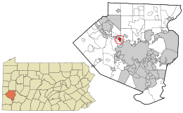
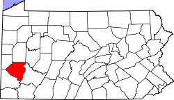
 Location in Allegheny County and the U.S. state of Pennsylvania | |
.svg.png) Location of Pennsylvania in the United States | |
| Coordinates: 40°30′4″N 80°4′7″W / 40.50111°N 80.06861°WCoordinates: 40°30′4″N 80°4′7″W / 40.50111°N 80.06861°W | |
| Country | United States |
| State | Pennsylvania |
| County | Allegheny |
| Settled | c. 1800 |
| Incorporated | April 7, 1875 |
| Government | |
| • Mayor | David Haslett (D) |
| Area[1] | |
| • Total | 0.69 sq mi (1.79 km2) |
| • Land | 0.62 sq mi (1.60 km2) |
| • Water | 0.07 sq mi (0.19 km2) |
| Elevation | 932 ft (284 m) |
| Population (2010) | |
| • Total | 4,705 |
| • Estimate (2016)[2] | 4,599 |
| • Density | 7,453.81/sq mi (2,879.41/km2) |
| Time zone | UTC-5 (EST) |
| • Summer (DST) | UTC-4 (EDT) |
| ZIP code | 15202 |
| Area code(s) | 412 |
| FIPS code | 42-03608 |
| School District | Northgate |
| Website | http://www.boroughofavalon.org/ |
Avalon is a borough in Allegheny County, Pennsylvania, United States, along the Ohio River, 6 miles (10 km) downstream from Pittsburgh. It is a largely residential borough with a few small stores. The population was 4,705 at the 2010 census.[3]
Education
The borough is located in the Northgate School District.
Taxes
School tax millage rate- The Northgate School District (shared with Bellvue Borough) in 2017 was 24.79. This ranked 9th highest/most expensive out of Allegheny County's 45 school districts [between Upper Saint Clair SD (8th highest) and South Park SD (10thth highest)].[4]
Geography
Avalon is located at 40°30′4″N 80°4′7″W / 40.50111°N 80.06861°W.[5]
According to the United States Census Bureau, the borough has a total area of 0.7 square miles (1.8 km2), of which 0.6 square miles (1.6 km2) is land and 0.1 square miles (0.26 km2) is water. Its average elevation is 932 feet (284 m) above sea level.[6]
Surrounding and adjacent communities
Avalon has four land borders, including Ben Avon Heights to the north, Kilbuck Township to the north, northeast and northwestern corner, Bellevue to the east, and Ben Avon to the west. Across the Ohio River to the south, Avalon runs adjacent with the eastern end of Neville Island (Neville Township) as well as the Davis Island Lock and Dam Site in which its location is designated as in Avalon.
History
On Dec. 9, 1874, a group of 29 property owners met and decided they wanted to separate from Kilbuck Township which itself split from Pine Township in 1869. They petitioned the Court of Quarter Sessions of Pennsylvania for incorporation papers. The petition was drawn up by Noah Shafer , who eventually became West Bellevue's first solicitor. The group was notified that it first had to hold an election so officials of the petitioning body could make the request for incorporation. The first election was held Dec. 26, 1874. James Semple was elected the first burgess, a position he held three different times. When the petition was submitted the second time, the court was in recess. The court met again in April and April 7, 1875, approved the petition and West Bellevue's right to incorporation.[7] It was named after the legendary island of Avalon ("land of apples") on account of there being several orchards in the area.[8] The streetcar reached Avalon around 1900, and in later years the borough was served by Pittsburgh Railways route 14 Avalon and then route 6/14 Brighton Avalon. The service ended on Apr 30, 1966[9] when many of the West End lines were abandoned by the Port Authority of Allegheny County, in preparation for bridge replacements over the Allegheny River.
Government and politics
| Year | Republican | Democratic | Third Parties |
|---|---|---|---|
| 2016 | 36% 868 | 59% 1,425 | 5% 133 |
| 2012 | 40% 911 | 59% 1,352 | 1% 33 |
Demographics
| Historical population | |||
|---|---|---|---|
| Census | Pop. | %± | |
| 1880 | 326 | — | |
| 1890 | 804 | 146.6% | |
| 1900 | 2,130 | 164.9% | |
| 1910 | 4,317 | 102.7% | |
| 1920 | 5,277 | 22.2% | |
| 1930 | 5,940 | 12.6% | |
| 1940 | 6,155 | 3.6% | |
| 1950 | 6,463 | 5.0% | |
| 1960 | 6,859 | 6.1% | |
| 1970 | 7,010 | 2.2% | |
| 1980 | 6,240 | −11.0% | |
| 1990 | 5,784 | −7.3% | |
| 2000 | 5,294 | −8.5% | |
| 2010 | 4,705 | −11.1% | |
| Est. 2016 | 4,599 | [2] | −2.3% |
| Sources:[12][13][14][15][16][17][18] | |||
As of the census[17] of 2000, there were 5,294 people, 2,629 households, and 1,282 families residing in the borough. The population density was 8,409.1 people per square mile (3,244.5/km²). There were 2,845 housing units at an average density of 4,519.1 per square mile (1,743.6/km²). The racial makeup of the borough was 73.03% White, 24.85% African American, 0.09% Native American, 0.45% Asian, 0.02% Pacific Islander, 0.15% from other races, and 1.40% from two or more races. Hispanic or Latino of any race were 0.59% of the population.
There were 2,629 households, out of which 19.7% had children under the age of 18 living with them, 34.6% were married couples living together, 11.6% had a female householder with no husband present, and 51.2% were non-families. 45.4% of all households were made up of individuals, and 21.3% had someone living alone who was 65 years of age or older. The average household size was 1.99 and the average family size was 2.83.
In the borough the population was spread out, with 18.2% under the age of 18, 8.6% from 18 to 24, 29.6% from 25 to 44, 20.2% from 45 to 64, and 23.5% who were 65 years of age or older. The median age was 41 years. For every 100 females, there were 84.6 males. For every 100 females age 18 and over, there were 80.4 males.
The median income for a household in the borough was $29,236, and the median income for a family was $41,327. Males had a median income of $31,568 versus $24,149 for females. The per capita income for the borough was $18,594. About 8.4% of families and 11.3% of the population were below the poverty line, including 18.6% of those under age 18 and 10.3% of those age 65 or over.
804 people lived in Avalon in 1890, 2,130 people lived in Avalon in 1900; 4,317 people lived in Avalon in 1910, and 6,155 people lived in Avalon in 1940.
Notable people
- Robert J. Corbett, U.S. Representative from Pennsylvania[19]
See also
References
- ↑ "2016 U.S. Gazetteer Files". United States Census Bureau. Retrieved Aug 13, 2017.
- 1 2 "Population and Housing Unit Estimates". Retrieved June 9, 2017.
- ↑ "Race, Hispanic or Latino, Age, and Housing Occupancy: 2010 Census Redistricting Data (Public Law 94-171) Summary File (QT-PL), Avalon borough, Pennsylvania". U.S. Census Bureau, American FactFinder 2. Archived from the original on September 11, 2013. Retrieved September 9, 2011.
- ↑ EL. "Allegheny County Treasurer". Retrieved 1 September 2017.
- ↑ "US Gazetteer files: 2010, 2000, and 1990". United States Census Bureau. 2011-02-12. Retrieved 2011-04-23.
- ↑ "US Board on Geographic Names". United States Geological Survey. 2007-10-25. Retrieved 2008-01-31.
- ↑ "Happy Birthday West Bellevue!". North Hills News Record. April 12, 1975. p. 1. Retrieved 19 September 2017.
- ↑ "What's in a name? For some, a bit of history". Pittsburgh Post-Gazette. May 10, 1984. p. 2. Retrieved 16 May 2015.
- ↑ "Pittsburgh Railways Online – A Trolley Car Tragedy". February 18, 2002. Retrieved August 14, 2009.
- ↑ EL. "2012 Allegheny County election". Pittsburgh Tribune-Review. Retrieved 15 October 2017.
- ↑ EL. "2016 Pennsylvani general election..." Pittsburgh Post-Gazette. Retrieved 15 October 2017.
- ↑ "Population of Civil Divisions Less than Counties" (PDF). 1880 United States Census. U.S. Census Bureau. Retrieved 24 November 2013.
- ↑ "Population-Pennsylvania" (PDF). U.S. Census 1910. U.S. Census Bureau. Retrieved 22 November 2013.
- ↑ "Number and Distribution of Inhabitants:Pennsylvania-Tennessee" (PDF). Fifteenth Census. U.S. Census Bureau.
- ↑ "Number of Inhabitants: Pennsylvania" (PDF). 18th Census of the United States. U.S. Census Bureau. Retrieved 22 November 2013.
- ↑ "Pennsylvania: Population and Housing Unit Counts" (PDF). U.S. Census Bureau. Retrieved 22 November 2013.
- 1 2 "American FactFinder". United States Census Bureau. Archived from the original on September 11, 2013. Retrieved 2008-01-31.
- ↑ "Annual Estimates of the Resident Population". U.S. Census Bureau. Retrieved 22 November 2013.
- ↑ "CORBETT, Robert James, (1905 - 1971)". Biographical Directory of the United States Congress. Retrieved December 21, 2012.
