Upper St. Clair Township, Allegheny County, Pennsylvania
| Upper St. Clair Township, Allegheny County, Pennsylvania | |
|---|---|
| First Class Township with home rule | |
 | |
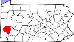
 Location in Allegheny County and state of Pennsylvania | |
| Country | United States |
| State | Pennsylvania |
| County | Allegheny |
| Settled | 1762 |
| Incorporated | 1788 |
| Government | |
| • Type | Board of Commissioners |
| • President | Robert W. Orchowski (R) |
| Area[1] | |
| • Total | 9.83 sq mi (25.45 km2) |
| • Land | 9.82 sq mi (25.43 km2) |
| • Water | 0.01 sq mi (0.02 km2) |
| Population (2010) | |
| • Total | 19,229 |
| • Estimate (2016)[2] | 19,813 |
| • Density | 2,018.03/sq mi (779.15/km2) |
| Time zone | UTC-5 (Eastern (EST)) |
| • Summer (DST) | UTC-4 (EDT) |
| Area code(s) | 412 |
| FIPS code | 42-003-79274 |
| Website | [www.twpusc.org Upper St. Clair Township] |
Upper St. Clair Township is a township with home rule status in Allegheny County, Pennsylvania, United States.
An affluent suburb located about 10 miles (16 km) south of Pittsburgh, Upper St. Clair possesses a nationally recognized school district. The population was 19,229 at the 2010 census.
History
The first European settler in present-day Upper St. Clair was John Fife, who settled near what is now the intersection of Washington and McLaughlin Run roads in 1762.[3]
St. Clair Township was named after General Arthur St. Clair of Revolutionary War fame, the 9th President of the United States in Congress Assembled. Under his administration as President from February 2, 1787 to October 29, 1787, the Northwest Ordinance and United States Constitution of 1787 were passed.[4]
St. Clair was one of the original townships of Allegheny County, Pennsylvania at the county's creation in 1788. In 1836, the St. Clair Township was divided into two separate townships, Upper St. Clair and Lower St. Clair. The residents of Upper St. Clair formed their township to ensure better government service that could be obtained by separating from the more densely populated northern part of the township. Upper St. Clair Township was further subdivided throughout the 19th and 20th centuries as several parts of the original township separated to form new townships and boroughs. In 1973, Upper St. Clair Township adopted a home rule charter that took effect on January 5, 1976, and is no longer governed by the Pennsylvania Township Code.[5]
The Whiskey Rebellion of 1794 had its roots in Upper St. Clair.
Formed as a volunteer militia company in 1844 by residents of the township, the "St. Clair Guards" later became Company H of the 62nd Pennsylvania Infantry.
The community was home to several mines beginning in the late 19th century. Freehold Real Estate Co. built the first major residential development in March 1913 along Washington Road, which at the time was conveniently close to streetcar service.
Today, the community has many fashionable homes and is considered one of the wealthiest suburbs of Pittsburgh.[6]
Geography
According to the United States Census Bureau, the township is located at 40°20′8.2986″N 80°4′46.9956″W / 40.335638500°N 80.079721000°WCoordinates: 40°20′8.2986″N 80°4′46.9956″W / 40.335638500°N 80.079721000°W. It has a total area of 9.8 square miles (25 km2), of which 0.10% is water.[7]
Neighboring communities
Upper St. Clair has six borders, including South Fayette Township to the west, Bridgeville to the northwest, Scott Township and Mt. Lebanon to the north, Bethel Park to the east, and Peters Township in Washington County to the south.
Education
Taxes
School tax millage rate- The Upper Saint Clair School District in 2017 was 25.16. This ranked 8th highest/most expensive out of Allegheny County's 45 school districts [between Woodland Hills SD (7th highest) and Northgate SD (9th highest)].[8]
Demographics
| Historical population | |||
|---|---|---|---|
| Census | Pop. | %± | |
| 1850 | 1,626 | — | |
| 1860 | 1,847 | 13.6% | |
| 1870 | 810 | −56.1% | |
| 1880 | 829 | 2.3% | |
| 1890 | 1,548 | 86.7% | |
| 1900 | 2,693 | 74.0% | |
| 1910 | 1,311 | −51.3% | |
| 1920 | 1,458 | 11.2% | |
| 1930 | 1,947 | 33.5% | |
| 1940 | 2,486 | 27.7% | |
| 1950 | 3,629 | 46.0% | |
| 1960 | 8,287 | 128.4% | |
| 1970 | 15,471 | 86.7% | |
| 1980 | 19,023 | 23.0% | |
| 1990 | 19,692 | 3.5% | |
| 2000 | 20,053 | 1.8% | |
| 2010 | 19,229 | −4.1% | |
| Est. 2016 | 19,813 | [2] | 3.0% |
| Sources:[9][10][11][12][13][14][15][16] | |||
As of the census[15] of 2000, there were 20,053 people, 6,966 households, and 5,823 families residing in the township. The population density was 2,055.7 people per square mile (794.1/km²). There were 7,091 housing units at an average density of 726.9/sq mi (280.8/km²). The racial makeup of the township was 93.79% White, 0.18% African American, 0.02% Native American, 4.02% Asian, 0.02% Pacific Islander, 0.07% from other races, and 0.62% from two or more races. Hispanic or Latino people of any race were 0.78% of the population.
There were 6,966 households, out of which 60.8% had children under the age of 18 living with them, 76.3% were married couples living together, 5.6% had a female householder with no husband present, and 16.4% were non-families. 15.0% of all households were made up of individuals, and 9.0% had someone living alone who was 65 years of age or older. The average household size was 2.81 and the average family size was 3.14.
In the township the population was spread out, with 28.3% under the age of 18, 4.3% from 18 to 24, 22.6% from 25 to 44, 28.3% from 45 to 64, and 16.4% who were 65 years of age or older. The median age was 42 years. For every 100 females there were 93.7 males. For every 100 females age 18 and over, there were 89.1 males.
Government and Politics
| Year | Republican | Democratic | Third Parties |
|---|---|---|---|
| 2016 | 52% 6,064 | 48% 5,618 | .01% 76 |
| 2012 | 62% 7,388 | 38% 4,468 | .01% 87 |
Best places to live in the US
Upper St. Clair was ranked as one of the 10 best places to live in the United States in 2009, according to U.S. News & World Report.[19]
Notable people
- Sean Casey, former Major League Baseball first baseman, current baseball analyst for MLB Network
- Stephen Chbosky, novelist, screenwriter, and film director best known for the coming-of-age novel The Perks of Being a Wallflower
- Dave Giusti, former American Major League baseball player
- Chuck Greenberg, former owner of the Texas Rangers and Altoona Curve; born and raised in Upper St. Clair; raised his family in the township
- Tunch Ilkin, former NFL player, current Steelers broadcaster
- Anthony Jeselnik, stand-up comic
- Sean Lee, NFL linebacker for the Dallas Cowboys[20]
- Grant Lewis, NHL ice hockey player (Nashville Predators)
- Greg Miller, animator and television director[21]
- Ryan Malone, left winger/center for the Tampa Bay Lightning and Olympic athlete[22]
- Dylan Reese (born 1984), defenseman for the Pittsburgh Penguins[23]
- Todd Haley, former head coach of the Kansas City Chiefs and former offensive coordinator of the Pittsburgh Steelers and Arizona Cardinals, and current offensive coordinator of the Cleveland Browns, grew up in Upper St. Clair.
References
- ↑ "2016 U.S. Gazetteer Files". United States Census Bureau. Retrieved Aug 13, 2017.
- 1 2 "Population and Housing Unit Estimates". Retrieved June 9, 2017.
- ↑ "History of Upper St. Clair". Township of Upper St. Clair. Archived from the original on July 14, 2010. Retrieved July 23, 2009.
- ↑
- Klos, Stanley L. (2004). ""Arthur St. Clair"". President Who? Forgotten Founders. Pittsburgh, Pennsylvania: Evisum, Inc. ISBN 0-9752627-5-0.
- ↑ Pennsylvania Code Title 302, Section 25.1–101 et seq.
- ↑ "Top 20 and Bottom 20 Wealthiest Suburbs". ERSI. Retrieved 15 December 2016.
- ↑ "Census 2000 Gazetteer Files". United States Census Bureau. Archived from the original on December 17, 2002. Retrieved July 25, 2009.
- ↑ EL. "Allegheny County Treasurer". Retrieved 1 September 2017.
- ↑ "Population of Civil Divisions Less than Counties" (PDF). 1870 United States Census. U.S. Census Bureau. Retrieved November 25, 2013.
- ↑ "Population of Civil Divisions Less than Counties" (PDF). 1880 United States Census. U.S. Census Bureau. Retrieved November 24, 2013.
- ↑ "Population-Pennsylvania" (PDF). U.S. Census 1910. U.S. Census Bureau. Retrieved November 22, 2013.
- ↑ "Number and Distribution of Inhabitants:Pennsylvania-Tennessee" (PDF). Fifteenth Census. U.S. Census Bureau.
- ↑ "Number of Inhabitants: Pennsylvania" (PDF). 18th Census of the United States. U.S. Census Bureau. Retrieved November 22, 2013.
- ↑ "Pennsylvania: Population and Housing Unit Counts" (PDF). U.S. Census Bureau. Retrieved November 22, 2013.
- 1 2 "American FactFinder". United States Census Bureau. Retrieved January 31, 2008.
- ↑ "Incorporated Places and Minor Civil Divisions Datasets: Subcounty Population Estimates: April 1, 2010 to July 1, 2012". U.S. Census Bureau. Archived from the original on June 17, 2013. Retrieved November 25, 2013.
- ↑ EL. "2012 Allegheny County election". Pittsburgh Tribune-Review. Retrieved 15 October 2017.
- ↑ EL. "2016 Pennsylvani general election..." Pittsburgh Post-Gazette. Retrieved 15 October 2017.
- ↑ "Best Places to Live 2009". U.S. News & World Report. Retrieved July 23, 2009.
- ↑ "45 Sean Lee". Penn State Official Athletic Site – Football. Retrieved July 23, 2009.
- ↑ Owen, Rob (August 25, 2000). "TV Preview: 'Robot' survivor?". Pittsburgh Post-Gazette. Retrieved January 4, 2018.
- ↑ "Ryan Malone". NHL.com -Players. Retrieved July 23, 2009.
- ↑ "Pens sign Upper St. Clair native Reese". Retrieved July 2, 2012.
External links
| Wikivoyage has a travel guide for Upper St. Clair Township. |
| Counties |  Map of the Pittsburgh Tri-State with green counties in the metropolitan area and yellow counties in the combined area. | |
|---|---|---|
| Major cities | ||
| Cities and towns 15k-50k (in 2010) | ||
| Airports | ||
| Topics | ||
| ||