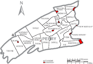
Perry County, Pennsylvania
| Perry County, Pennsylvania | |
|---|---|
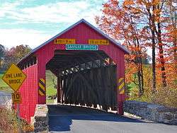 Saville Covered Bridge in Saville Township | |
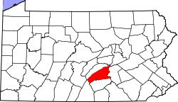 Location in the U.S. state of Pennsylvania | |
 Pennsylvania's location in the U.S. | |
| Founded | March 22, 1820 |
| Named for | Oliver Hazard Perry |
| Seat | New Bloomfield |
| Largest borough | Marysville |
| Area | |
| • Total | 556 sq mi (1,440 km2) |
| • Land | 551 sq mi (1,427 km2) |
| • Water | 4.1 sq mi (11 km2), 0.7% |
| Population (est.) | |
| • (2017) | 46,127 |
| • Density | 83/sq mi (32/km2) |
| Congressional districts | 10th, 11th |
| Time zone | Eastern: UTC−5/−4 |
| Website |
www |
Perry County is a county located in the U.S. state of Pennsylvania. As of the 2010 census, the population was 45,969.[1] The county seat is New Bloomfield.[2] The county was created on March 22, 1820, and was named after Oliver Hazard Perry, a hero of the War of 1812, who had recently died.[3] It was originally part of Cumberland County and was created in part because residents did not want to travel over the mountain to Carlisle (the county seat of Cumberland County), and thus the temporary county seat became Landisburg (before New Bloomfield was chosen.)
Perry County is included in the Harrisburg-Carlisle, PA Metropolitan Statistical Area. The county is served by the 717/223 area codes.
In 2010, the center of population of Pennsylvania was located in the eastern end of Perry County.[4] Green Park, an incorporated village located in northeastern Tyrone Township, serves as Perry County's midpoint between the Conococheague Mountain in the west and the Susquehanna River to the east.[5]
Geography
According to the U.S. Census Bureau, the county has a total area of 556 square miles (1,440 km2), of which 551 square miles (1,430 km2) is land and 4.1 square miles (11 km2) (0.7%) is water.[6] It is drained by the Susquehanna River, which forms almost all of its eastern boundary. The Juniata River enters Perry County from Juniata County near Millerstown. The river flows southeast to its confluence with the Susquehanna River near Duncannon.
Aside from the aforementioned rivers, the county also consists of various creeks,[7] runs, and lakes,[8][9] which provide recreational and fishing[10] opportunities, formerly powered mills throughout the county[11] and served as a means of transportation (via boat.) To this day, canoeing and kayaking are forms of recreation which utilise the Sherman Creek and other bodies of water in the county.[12]
Perry County is situated in the Appalachian mountains, and the Appalachian Trail runs through, including through the town of Duncannon, and through various woodland areas offering scenic vistas. The county is also famous for being the northern head of the Tuscarora Trail.
The hardiness zone is 6B. Like the surrounding region, common trees include red maple,[13] pitch pine,[14] eastern white pine,[15] eastern hemlock,[16] birch, shagbark hickory,[17] and juniper, though American sycamore, ironwood, sugar maple, black walnut, oak, elm, alder, and sassafras are also fairly common.[18] Mosses of various species are common sights, especially on fallen tree logs, along streams, on the trunk of trees,[19] and in sidewalk cracks, usually growing in shaded areas. Ferns also grow along streams and in shaded areas, and are also commonly seen in Perry County woodlands.
Adjacent counties
- Juniata County (north)
- Northumberland County (northeast)
- Dauphin County (east)
- Cumberland County (south)
- Franklin County (southwest)
Major highways
Demographics
| Historical population | |||
|---|---|---|---|
| Census | Pop. | %± | |
| 1820 | 11,342 | — | |
| 1830 | 14,261 | 25.7% | |
| 1840 | 17,096 | 19.9% | |
| 1850 | 20,088 | 17.5% | |
| 1860 | 22,793 | 13.5% | |
| 1870 | 25,447 | 11.6% | |
| 1880 | 27,522 | 8.2% | |
| 1890 | 26,276 | −4.5% | |
| 1900 | 26,263 | 0.0% | |
| 1910 | 24,136 | −8.1% | |
| 1920 | 22,875 | −5.2% | |
| 1930 | 21,744 | −4.9% | |
| 1940 | 23,213 | 6.8% | |
| 1950 | 24,782 | 6.8% | |
| 1960 | 26,582 | 7.3% | |
| 1970 | 28,615 | 7.6% | |
| 1980 | 35,718 | 24.8% | |
| 1990 | 41,172 | 15.3% | |
| 2000 | 43,609 | 5.9% | |
| 2010 | 45,969 | 5.4% | |
| Est. 2017 | 46,127 | [20] | 0.3% |
| U.S. Decennial Census[21] 1790–1960[22] 1900–1990[23] 1990–2000[24] 2010–2017[1] | |||
As of the census[25] of 2000, there were 43,602 people, 16,695 households, and 12,320 families residing in the county. The population density was 79 people per square mile (30/km²). There were 18,941 housing units at an average density of 34 per square mile (13/km²). The racial makeup of the county was 98.54% White, 0.43% Black or African American, 0.12% Native American, 0.15% Asian, 0.01% Pacific Islander, 0.21% from other races, and 0.54% from two or more races. 0.69% of the population were Hispanic or Latino of any race. 45.8% were of German, 16.4% American, 7.8% Irish and 5.0% English ancestry. 96.8% spoke English and 1.2% Spanish as their first language.
There were 16,695 households out of which 33.2% had children under the age of 18 living with them, 61.6% were married couples living together, 7.8% had a female householder with no husband present, and 26.20% were non-families. 21.7% of all households were made up of individuals and 9.30% had someone living alone who was 65 years of age or older. The average household size was 2.58 and the average family size was 3.01. There is also a high population of Anabaptist communities, such as Amish and Mennonites.
In Perry County, the population was spread out with 25.5% under the age of 18, 7.4% from 18 to 24, 29.8% from 25 to 44, 25.1% from 45 to 64, and 12.3% who were 65 years of age or older. The median age was 38 years. For every 100 females, there were 98.4 males. For every 100 females age 18 and over, there were 96.9 males.
Perry County's live birth rate was 609 births in 1990. The County's live birth rate in 2000 had declined sharply to 511 births, while in 2011 it was 555 babies.[26] Over the past 50 years (1960 to 2010), rural Pennsylvania saw a steady decline in both the number and proportion of residents under 18 years old. In 1960, 1.06 million rural residents, or 35 percent of the rural population, were children.
- Birth rate
Perry County's live birth rate was 609 births in 1990.[27] The County's live birth rate in 2000 was 512 births, while in 2011 it rose to 555 babies.[28][29] From 1960 to 2010, rural Pennsylvania has experienced an ongoing decline in the number of residents under 18 years old.[30]
- Teen Pregnancy rate
Perry County had 34 babies born to teens (age 15-19) in 2011. In 2016, the number of teen births in Perry County was 32.[31]
Metropolitan Statistical Area
The United States Office of Management and Budget[32] has designated Perry County as the Harrisburg-Carlisle, PA Metropolitan Statistical Area (MSA). As of the 2010 census[33] the metropolitan area ranked 6th most populous in the State of Pennsylvania and the 96th most populous in the United States with a population of 549,475. Perry County is also a part of the larger Harrisburg-York-Lebanon, PA Combined Statistical Area (CSA), which combines the populations of Perry County as well as Adams, Cumberland, Dauphin, Lebanon and York Counties in Pennsylvania. The Combined Statistical Area ranked 5th in the State of Pennsylvania and 43rd most populous in the United States with a population of 1,219,422.
County Government
Commissioners
- Brenda Benner, Chair (R)
- Stephen Naylor, Vice Chair
- Paul Rudy, Secretary (R)
Sheriff
- Steven Hile, Republican
State Senate[34]
- John DiSanto, Republican, Pennsylvania's 15th Senatorial District
State House of Representatives[34]
United States House of Representatives
United States Senate
Emergency services
Perry County 911, located in the basement of the Perry County Courthouse, is the county's public-safety answering point (PSAP). The 911 center's coverage area includes almost all of Perry County and portions of Juniata and Dauphin County.
Politics
| Year | Republican | Democratic | Third Parties |
|---|---|---|---|
| 2016 | 73.1% 15,616 | 21.7% 4,632 | 5.3% 1,123 |
| 2012 | 68.3% 13,120 | 29.6% 5,685 | 2.1% 410 |
| 2008 | 65.8% 13,058 | 32.2% 6,396 | 2.0% 394 |
| 2004 | 71.7% 13,919 | 27.9% 5,423 | 0.4% 85 |
| 2000 | 69.6% 11,184 | 27.7% 4,459 | 2.7% 436 |
| 1996 | 56.2% 8,156 | 31.8% 4,611 | 12.1% 1,748 |
| 1992 | 51.4% 7,871 | 26.7% 4,086 | 22.0% 3,370 |
| 1988 | 68.2% 8,545 | 31.2% 3,910 | 0.6% 78 |
| 1984 | 71.4% 9,365 | 28.2% 3,692 | 0.4% 56 |
| 1980 | 63.7% 8,026 | 29.2% 3,681 | 7.1% 892 |
| 1976 | 60.5% 7,454 | 37.4% 4,605 | 2.1% 261 |
| 1972 | 73.3% 8,082 | 24.8% 2,731 | 1.9% 212 |
| 1968 | 61.3% 6,655 | 27.1% 2,944 | 11.5% 1,250 |
| 1964 | 46.8% 5,364 | 52.9% 6,054 | 0.3% 34 |
| 1960 | 70.3% 8,134 | 29.5% 3,413 | 0.2% 23 |
| 1956 | 67.6% 7,511 | 32.2% 3,576 | 0.2% 25 |
| 1952 | 68.8% 6,733 | 31.1% 3,042 | 0.2% 17 |
| 1948 | 67.7% 5,444 | 32.3% 2,596 | |
| 1944 | 63.4% 5,722 | 36.2% 3,265 | 0.5% 43 |
| 1940 | 56.0% 5,877 | 43.9% 4,601 | 0.1% 12 |
| 1936 | 49.7% 5,759 | 49.8% 5,780 | 0.5% 61 |
| 1932 | 53.2% 4,402 | 45.1% 3,733 | 1.6% 134 |
| 1928 | 77.7% 6,469 | 21.7% 1,807 | 0.7% 54 |
| 1924 | 57.5% 4,185 | 37.3% 2,710 | 5.2% 381 |
| 1920 | 60.6% 3,787 | 37.1% 2,314 | 2.3% 144 |
| 1916 | 51.5% 2,575 | 46.9% 2,348 | 1.6% 81 |
| 1912 | 23.5% 1,140 | 40.0% 1,941 | 36.5% 1,774 |
| 1908 | 58.8% 3,269 | 39.3% 2,184 | 1.9% 105 |
| 1904 | 60.7% 3,433 | 37.0% 2,094 | 2.3% 127 |
| 1900 | 57.4% 3,400 | 41.2% 2,440 | 1.4% 82 |
| 1896 | 57.2% 3,537 | 40.1% 2,477 | 2.7% 166 |
| 1892 | 52.2% 3,120 | 45.3% 2,705 | 2.6% 152 |
| 1888 | 53.0% 3,168 | 45.8% 2,738 | 1.1% 67 |
In 2016, Donald J. Trump received 73.07% of the presidential vote, compared to 21.67% to Hillary Clinton, and 5.26% for candidates Gary Johnson, write-ins, Jill Stein, and Darrell L. Castle, respectively.[36] The county has voted for the Republican in every presidential election since 1964. In 2006, Lynn Swann received 9,998 votes (69%) to 4,477 votes (31%) for Ed Rendell, making it Swann's strongest county in his defeat. Rick Santorum also received more than 60% of the Perry County vote in his defeat.
Education
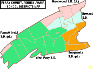
Public School Districts
- Greenwood School District
- While physically located in Perry County, the district also serves some residents of Juniata County.
- Newport School District
- Susquenita School District
- While physically located in Perry County, the district also serves some residents of Dauphin County.
- West Perry School District
- Fannett-Metal School District
- While physically located in Franklin County, the district also serves some residents of Perry County.
Intermediate unit
The Capital Area Intermediate Unit 15 is a state approved education agency that offers: Perry County school districts, charter schools, private schools, and home school students, a variety of services including: a completely developed K-12 curriculum that is mapped and aligned with the Pennsylvania Academic Standards (available online), shared services, a joint purchasing program and a wide variety of special education and special needs services.
Private schools
As reported on EdNA (ED Names and Addresses) by the Pennsylvania Department of Education
- Blue Goose Children's Learning Center, Inc – Newport
- Carson Long Military Institute
- Clarks Run Parochial School – Blain
- Community Christian Academy – Newport
- Farm Lane School – Ickesburg
- Fowlers Hollow School – Blain
- Heritage Christian School – West Perry
- Honeysuckle Ridge School – Elliotsburg
- Kuddly Bear Child Care Center Inc. – Duncannon
- Loysville Youth Development Center – Loysville
- Manassa School – Blain
- Messiah Day Care Center – Elliottsburg
- Mountain View Parochial School – Ickesburg
- Perry View Parochial School – Landisburg
- Raccoon Valley Amish School – Millerstown
- Shermans View School – Loysville
- Stony Point School – Loysville
- Sunset Valley School – Millerstown
Trade schools
- Central Pennsylvania Diesel Institute – Liverpool
Public libraries
- New Bloomfield Public Library
- Community Library of Western Perry County
- Marysville-Rye Public Library
- Newport Public Library
Media
Newspapers
The county is home to four weekly newspapers, three published by Advance Publications of Perry and Juniata Counties, Inc. associated with The Patriot-News of Harrisburg: Duncannon Record, The News-Sun and Perry County Times and the separate Perry County Weekly published by The Sentinel in Carlisle, Cumberland County, by Lee Enterprises of Davenport, Iowa .[38]
Books
There are numerous historical books written about the county, available at the Council of the Arts in Newport as well as other establishments. The books cover various topics of the county's past, including an historical overview of the Blain area; an account of the life of the early settlers along the Shermans Creek in three townships;[39] and an account of a U.S. Civil War battle which occurred on Sterrett's Gap.[40]
Communities
Under Pennsylvania law, there are four types of incorporated municipalities: cities, boroughs, townships, and, in at most two cases, towns. The following boroughs and townships are located in Perry County:
Boroughs
- Blain
- Duncannon
- Landisburg
- Liverpool
- Marysville
- Millerstown
- New Bloomfield (county seat)
- New Buffalo
- Newport
Townships
Unincorporated communities
Population ranking
The population ranking of the following table is based on the 2010 census of Perry County.[33]
† county seat
| Rank | City/Town/etc. | Municipal type | Population (2010 Census)
|
|---|---|---|---|
| 1 | Marysville | Borough | 2,534 |
| 2 | Newport | Borough | 1,574 |
| 3 | Duncannon | Borough | 1,522 |
| 4 | † New Bloomfield | Borough | 1,247 |
| 5 | Liverpool | Borough | 955 |
| 6 | Millerstown | Borough | 673 |
| 7 | Blain | Borough | 263 |
| 8 | Landisburg | Borough | 218 |
| 9 | New Buffalo | Borough | 129 |
Economy
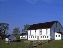
Perry County's economy is primarily agricultural.[41] Various farmers markets,[42] roadside stands, farm produce stands,[43] food festivals,[44] resale farm stands, meat stores, and plant nurseries[45][46] are present throughout the county. Two farms in Perry County are particularly well known, which are Spiral Path Farm and Yeehaw Farm, with the latter receiving national media attention by the Washington Post.[47] By acres, the county is 38.3% farmland, and of that 38.3% of farmland, 11.09% of it (thus 4.24% of all land in the county) is pastureland.[48]
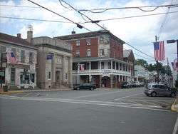
Additionally, a wide range of non-agricultural businesses exist, in and outside of the main areas of human settlement, as is expected of any community. Particular areas of interest include Newport, New Bloomfield, and Shermans Dale.
Historically, mills were a popular business in Perry County, and the county currently has 21 known non-operational mills still standing.[49] Settlement was not allowed until 1755, and when settlement was allowed, it was not safe: in June of that same year, 1755, native Americans chased nearly all of the pioneers out, until it was considered safe to return in 1762. The first mill was taxed in 1763, though the exact date of its completion is not known.[50]
At the basin of nearly every important stream/run was a primitive sawmill (or more than one), which provided the wood to built the early houses, churches, barns, outbuildings, bridges, schoolhouses, and the pre-brick version of the sidewalk —the boardwalk.[50]
Marcellus shale impact fee
Act 13 of 2012,[51] which levied a Marcellus Shale Impact Fee, was signed into law by Governor Tom Corbett on February 14, 2012.[52][53] The top county recipient was Washington County which received $6,512,570.65 in 2014.[54] All 67 of Pennsylvania counties receive a marcellus shale fee disbursement, including those counties that have no shale wells.
- 2013 – no shale wells, impact fee revenues to Perry County – $43,793.65[55]
- 2014 – no shale wells, Perry County received an impact fee disbursement of $43,677.42.[56][57]
- 2015 – no shale wells, impact fee revenues to Perry County – $35,957.82.[58] The funds were used for rehabilitation of greenways.
Recreation
The county has a variety of recreation facilities. All the public schools have playgrounds and/or athletic facilities.
There are three state parks: Fowlers Hollow State Park, Little Buffalo State Park, and Big Spring State Forest Picnic Area. The Hoverter and Sholl Box Huckleberry Natural Area is found near New Bloomfield along Huckleberry Road. Carroll Township Park also offers a wide variety of athletic facilities.[59]
Pools: Liverpool Pool (Jann Deitzler Memorial Pool), Millerstown Pool, New Bloomfield Pool, and Little Buffalo State Park Pool
Trails: Hawk Rock Trail and Iron Horse Trail
State Game Lands: #170 Dellville, #254 New Buffalo, #256-Mecks Corner and #281 Miller Township. Hunting requires licenses from the PA Game Commission.
Gallery
 Duncannon, downtown view showing the Doyle.
.jpg) New Bloomfield in 1913.
New Bloomfield in 1913.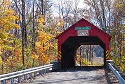 Books Covered Bridge.
.jpg) New Bloomfield.
New Bloomfield.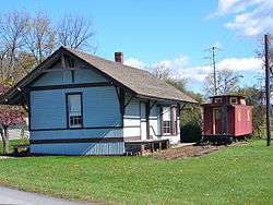 Blain Depot in Blain.
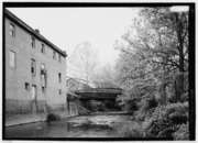 South High Street Bridge, Duncannon.
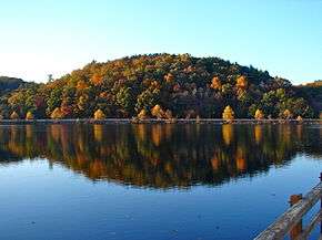 Little Buffalo State Park, near New Bloomfield.
 An old building in Dellville (formerly a store.)
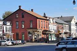 Downtown Newport.
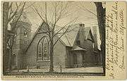 Presbyterian church in Duncannon.
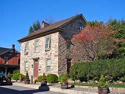 Landisburg.
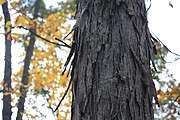 A shagbark hickory tree near Dellville.
See also
References
- 1 2 "State & County QuickFacts". United States Census Bureau. Archived from the original on July 16, 2011. Retrieved November 20, 2013.
- ↑ "Find a County". National Association of Counties. Archived from the original on 2011-05-31. Retrieved 2011-06-07.
- ↑ Early History of Perry County Archived July 26, 2011, at the Wayback Machine.
- ↑ "Centers of Population by State: 2010". United States Census Bureau. Archived from the original on January 3, 2014. Retrieved April 22, 2014.
- ↑ Hain, H. H. "History of Perry County, Pennsylvania". Hain-Moore Company, Publishers. Retrieved October 14, 2011.
- ↑ "2010 Census Gazetteer Files". United States Census Bureau. August 22, 2012. Retrieved March 10, 2015.
- ↑ "Sherman Creek (Pennsylvania)". Wikipedia. 2016-09-11.
- ↑ "Little Buffalo State Park". Wikipedia. 2018-02-20.
- ↑ SusquehannaMan (2018-02-07), English: A lake., archived from the original on 2018-05-10, retrieved 2018-03-10
- ↑ Inc., Fishidy,. "Sherman Creek PA Fishing Reports, Map & Hot Spots". www.fishidy.com. Archived from the original on 2018-03-11. Retrieved 2018-03-10.
- ↑ "Roddy/Waggoner's Mill - Perry Co. - Pennsylvania". millpictures.com. Archived from the original on 2018-03-11. Retrieved 2018-03-10.
- ↑ "Kayaking Shermans Creek, PA". Vimeo. Archived from the original on 2018-05-10. Retrieved 2018-03-10.
- ↑ SusquehannaMan (2017-10-24), English: Maple., archived from the original on 2018-05-10, retrieved 2018-03-10
- ↑ "Dellville, Pennsylvania". Wikipedia. 2018-02-27.
- ↑ SusquehannaMan (2017-11-21), English: Pinus strobus, Pennsylvania., archived from the original on 2018-05-10, retrieved 2018-03-10
- ↑ "A hemlock tree in Perry County, PA".
- ↑ SusquehannaMan (2017-10-26), English: Hickory., archived from the original on 2018-05-10, retrieved 2018-03-10
- ↑ "Table of Contents: Trees of Pennsylvania". www.upenn.edu. Archived from the original on 2018-01-29. Retrieved 2018-03-10.
- ↑ SusquehannaMan (2015-07-02), English: Moss., retrieved 2018-03-10
- ↑ "Population and Housing Unit Estimates". Retrieved October 12, 2018.
- ↑ "U.S. Decennial Census". United States Census Bureau. Archived from the original on May 12, 2015. Retrieved March 10, 2015.
- ↑ "Historical Census Browser". University of Virginia Library. Archived from the original on August 16, 2012. Retrieved March 10, 2015.
- ↑ Forstall, Richard L., ed. (March 24, 1995). "Population of Counties by Decennial Census: 1900 to 1990". United States Census Bureau. Archived from the original on March 20, 2015. Retrieved March 10, 2015.
- ↑ "Census 2000 PHC-T-4. Ranking Tables for Counties: 1990 and 2000" (PDF). United States Census Bureau. April 2, 2001. Archived (PDF) from the original on December 18, 2014. Retrieved March 10, 2015.
- ↑ "American FactFinder". United States Census Bureau. Archived from the original on 2013-09-11. Retrieved 2008-01-31.
- ↑ Pennsylvania Department of Health, Birth Age County Reports 1990 and 2011, 2011
- ↑ Pennsylvania Department of Health, Birth Age County Reports 1990, 1990
- ↑ Pennsylvania Department of Health, Birth Age County Reports 2000, 2000
- ↑ Pennsylvania Department of Health, Birth Age County Reports 2011, 2011
- ↑ Center for Rural Pennsylvania, Number of Children Decreasing in Rural Pennsylvania, 2011
- ↑ Robert Wood Johnson Foundation (2016). "Pennsylvania Teen Births 2015,".
- ↑ "Office of Management and Budget". whitehouse.gov. Archived from the original on 2018-04-29.
- 1 2 CNMP, US Census Bureau,. "This site has been redesigned and relocated. - U.S. Census Bureau". www.census.gov. Archived from the original on 2013-12-21.
- 1 2 Center, Legislativate Data Processing. "Find Your Legislator". The official website for the Pennsylvania General Assembly. Archived from the original on 2017-05-06. Retrieved 2017-05-10.
- ↑ Leip, David. "Dave Leip's Atlas of U.S. Presidential Elections". uselectionatlas.org. Archived from the original on March 23, 2018.
- ↑ "Archived copy". Archived from the original on 2006-04-08. Retrieved 2017-10-15. Navigation to Perry County, Pennsylvania is required due to the design of the website.
- ↑ "Public Libraries of Perry County, Pennsylvania". pecoinfo.org. Archived from the original on 2012-04-02.
- ↑ Archived 2010-03-10 at the Wayback Machine. Perry County Times and "Archived copy". Archived from the original on December 11, 2012. Retrieved December 18, 2012.
- ↑ "Life Along the Shermans". www.perryheritage.com. Archived from the original on 2017-07-06. Retrieved 2018-03-09.
- ↑ "The Wind-Down of Photo Season". Emerging Civil War. 2014-11-20. Archived from the original on 2018-03-10. Retrieved 2018-03-09.
- ↑ "Archived copy". Archived from the original on July 22, 2017. Retrieved January 29, 2018. State Name: Pennsylvania County Name: Perry NASS County Code: 42099: Acres of Land in Farms as Percent of Land Area in Acres: 2012, 38.3%
- ↑ Services, Audra Jon Hoover Creative. "Butcher's Farm Market : Newport, PA : Fresh Produce, Fruits, Vegetables, Baked Goods, Flowers". www.butchersfarmmarket.com. Archived from the original on 2018-01-29. Retrieved 2018-01-29.
- ↑ "Google Maps". Google Maps. Retrieved 2018-01-29.
- ↑ "Home | Sherman's Valley Heritage Days". www.svheritagedays.com. Archived from the original on 2018-04-22. Retrieved 2018-01-29.
- ↑ "Perennial Gardens". perennialgardens.name. Archived from the original on 2018-01-29. Retrieved 2018-01-29.
- ↑ Connect, Garden. "Perennials range of Ashcombe Garden Center in Shermans Dale". www.gardencenterguide.com. Archived from the original on 2018-01-29. Retrieved 2018-01-29.
- ↑ Horton, Emily C. (2013-09-10). "Want your own personal farmer? Try a whole-diet CSA". Washington Post. ISSN 0190-8286. Archived from the original on 2018-01-29. Retrieved 2018-01-29.
- ↑ "Archived copy". Archived from the original on July 22, 2017. Retrieved January 29, 2018. State Name: Pennsylvania County Name: Perry NASS County Code: 42099: "Acres of All Types of Pastureland as Percent of Land in Farms Acreage: 2012 (Text)","11.09"
- ↑ "Looking at mills locted in Pennsylvania". millpictures.com. Archived from the original on 2018-03-11. Retrieved 2018-03-10.
- 1 2 Hain, Harry Harrison (1922). History of Perry County, Pennsylvania, including descriptions of Indians and pioneer life from the time of earliest settlement. The Library of Congress. Harrisburg, Pa., Hain-Moore company. Archived from the original on 2017-06-03.
- ↑ Pennsylvania House of Representatives (February 8, 2012). "HB1950 of Session 2011 OIL AND GAS (58 PA.C.S.) – OMNIBUS AMENDMENTS". Archived from the original on March 20, 2014.
- ↑ Pennsylvania General Assembly, Act 13 of 2012, February 14, 2012.
- ↑ Pennsylvania Utility Commission (2012). "Act 13 (Impact Fee)". Archived from the original on 2016-03-15.
- ↑ Pennsylvania Utility Commission (2015). "Disbursements and Impact Fees 2014". Archived from the original on 2016-11-15.
- ↑ Pennsylvania Utility Commission (2013). "Perry County Total distribution for year 2013". Archived from the original on 2017-11-12.
- ↑ Pennsylvania Utility Commission (2015). "County Well Count Breakdown for 2014". Archived from the original on 2016-11-15.
- ↑ Nick Malawskey (April 3, 2014). "Drilling Across Pennsylvania". Pennlive.com. Archived from the original on April 28, 2016.
- ↑ Pennsylvania Utility Commission (2015). "County Total distribution for year 2015". Archived from the original on 2017-11-12.
- ↑ Perry County Administration, Services available in Perry County, 2015
_tree_in_Pennsylvania.jpg)
_tree_in_Pennsylvania.jpg)
External links
- Perry County (official website)
Municipalities and communities of Perry County, Pennsylvania, United States | ||
|---|---|---|
| Boroughs | | |
| Townships | ||
| Unincorporated communities | ||