Chartiers (Pittsburgh)
| Chartiers Chartiers City | |
|---|---|
| Neighborhood of Pittsburgh | |
 | |
| Coordinates: 40°27′50″N 80°03′22″W / 40.464°N 80.056°W | |
| Country | United States |
| State | Pennsylvania |
| County | Allegheny County |
| City | Pittsburgh |
| Area[1][2] | |
| • Total | 0.132 sq mi (0.34 km2) |
| Population (2010)[1] | |
| • Total | 477 |
| • Density | 3,600/sq mi (1,400/km2) |
Chartiers (sometimes called Chartiers City) is a neighborhood in Pittsburgh, Pennsylvania's west area. It has a zip code of 15204, and has representation on Pittsburgh City Council by the council member for District 2 (West Neighborhoods). The neighborhood was named after Peter Chartier,[3] a trapper of French and Native American parentage who established a trading post at the mouth of Chartiers Creek in 1743.
Surrounding Pittsburgh Neighborhoods
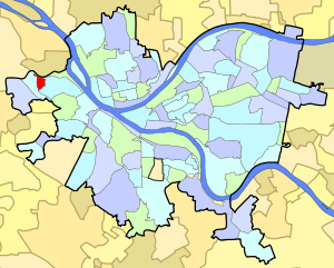
Chartiers City borders Esplen to the north, Sheraden to the east and southeast, and Windgap from the south, west and northwest.
Further reading
- Toker, Franklin (1994) [1986]. Pittsburgh: An Urban Portrait. Pittsburgh: University of Pittsburgh Press. ISBN 0-8229-5434-6.
See also
References
- 1 2 "PGHSNAP 2010 Raw Census Data by Neighborhood". Pittsburgh Department of City Planning. 2012. Retrieved 21 June 2013.
- ↑ "PGHSNAP".
- ↑ Charles Augustus Hanna, The Wilderness Trail: Or, The Ventures and Adventures of the Pennsylvania Traders on the Allegheny Path, Volume 1 The Wilderness Trail: Or, The Ventures and Adventures of the Pennsylvania Traders on the Allegheny Path, Putnam's sons, 1911
External links
This article is issued from
Wikipedia.
The text is licensed under Creative Commons - Attribution - Sharealike.
Additional terms may apply for the media files.