Boyce, Pennsylvania
| Boyce, Pennsylvania | |
|---|---|
| Unincorporated community | |
 Boyce | |
| Coordinates: 40°19′04″N 80°06′36″W / 40.31778°N 80.11000°WCoordinates: 40°19′04″N 80°06′36″W / 40.31778°N 80.11000°W | |
| Country | United States |
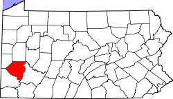
| State | Pennsylvania |
| County | Allegheny |
| Township | Upper St. Clair, South Fayette |
| Elevation | 879 ft (268 m) |
| Time zone | UTC-5 (Eastern (EST)) |
| • Summer (DST) | UTC-4 (EDT) |
| Area code(s) | 412 |
| GNIS feature ID | 1203133[1] |
Boyce is an unincorporated community in South Fayette and Upper St. Clair townships, Allegheny County, Pennsylvania, United States.[1] Boyce is located along Chartiers Run 10.5 miles (16.9 km) southwest of downtown Pittsburgh.[2]
References
- 1 2 "Boyce". Geographic Names Information System. United States Geological Survey.
- ↑ Allegheny County, Pennsylvania General Highway Map (PDF) (Map). Pennsylvania Department of Transportation. 2011. Retrieved August 15, 2012.
| Counties |  Map of the Pittsburgh Tri-State with green counties in the metropolitan area and yellow counties in the combined area. | |
|---|---|---|
| Major cities | ||
| Cities and towns 15k-50k (in 2010) | ||
| Airports | ||
| Topics | ||
| ||
This article is issued from
Wikipedia.
The text is licensed under Creative Commons - Attribution - Sharealike.
Additional terms may apply for the media files.