Lincoln, Pennsylvania
| Lincoln | |
|---|---|
| Borough | |
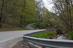 Wylie Run and Lovedale Road | |
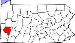
 Location in Allegheny County and the U.S. state of Pennsylvania. | |
| Coordinates: 40°17′27″N 79°51′5″W / 40.29083°N 79.85139°WCoordinates: 40°17′27″N 79°51′5″W / 40.29083°N 79.85139°W | |
| Country | United States |
| State | Pennsylvania |
| County | Allegheny |
| Area[1] | |
| • Total | 5.01 sq mi (12.97 km2) |
| • Land | 4.80 sq mi (12.43 km2) |
| • Water | 0.21 sq mi (0.55 km2) |
| Population (2010) | |
| • Total | 1,072 |
| • Estimate (2016)[2] | 1,051 |
| • Density | 219.05/sq mi (84.57/km2) |
| Time zone | UTC-5 (Eastern (EST)) |
| • Summer (DST) | UTC-4 (EDT) |
| ZIP codes | 15133, 15135, 15037 |
| FIPS code | 42-43408 |
| Website | Borough of Lincoln |
Lincoln is a borough in Allegheny County, Pennsylvania, United States. The population was 1,072 at the 2010 census.[3]
Lincoln does not have its own post office. Three ZIP codes are used in the borough: 15133 for the northern portion of the borough adjacent to Liberty and 15135 for the eastern portion, with mail addressed to the city of McKeesport, and 15037 for the remainder of the borough, with mail addressed to Elizabeth.
History
The borough was named for Abraham Lincoln.[4] Lincoln was incorporated on February 6, 1958. Prior to this date, the borough was known as Lincoln Township. The change in governmental structure came after a portion of the borough attempted to secede from Lincoln Township to annex with Liberty Borough.[5] Dead Man's Hollow is a 450 acre conservation area whose boundary lies within the borough.[6][7]
Geography
Lincoln is located at 40°17′27″N 79°51′5″W / 40.29083°N 79.85139°W (40.291939, -79.851303).[8] It is bounded by Glassport to the northwest, Liberty to the north, Versailles to the northeast, Elizabeth Township and the Youghiogheny River to the east and south, and Jefferson Hills, Clairton, and the Monongahela River to the west.
According to the United States Census Bureau, the borough has a total area of 5.0 square miles (13 km2), of which 4.8 square miles (12 km2) is land and 0.2 square miles (0.52 km2), or 4.57%, is water.
Surrounding neighborhoods
Lincoln has three land borders, including Port Vue to the north, Elizabeth Township to the east and south, and Glassport to the northwest. Across the Monongahela River to the west, Lincoln runs adjacent with Clairton. Across the Youghiogheny River to the east, the borough runs adjacent with Versailles.
Government and politics
As of 2009, the mayor was Nick Vay.[9]
| Year | Republican | Democratic | Third Parties |
|---|---|---|---|
| 2016 | 71% 375 | 26% 137 | 2% 13 |
| 2012 | 58% 272 | 41% 194 | 1% 5 |
Education
Lincoln is part of the South Allegheny School District, along with Liberty, Glassport and Port Vue.
Taxes
School tax millage rate- The South Allegheny SD (shared with three other municipalities) in 2017 was 17.24. This ranked 41st highest/most expensive out of Allegheny County's 45 school districts, between McKeesport SD (40th highest) and Chartiers Valley SD (42nd highest).[12]
Demographics
| Historical population | |||
|---|---|---|---|
| Census | Pop. | %± | |
| 1940 | 1,015 | — | |
| 1950 | 1,467 | 44.5% | |
| 1960 | 1,686 | 14.9% | |
| 1970 | 1,885 | 11.8% | |
| 1980 | 1,428 | −24.2% | |
| 1990 | 1,187 | −16.9% | |
| 2000 | 1,218 | 2.6% | |
| 2010 | 1,072 | −12.0% | |
| Est. 2016 | 1,051 | [2] | −2.0% |
| Sources:[13][14][15][16] | |||
As of the census[15] of 2000, there were 1,218 people, 482 households, and 359 families residing in the borough. The population density was 253.9 people per square mile (98.0/km²). There were 506 housing units at an average density of 105.5 per square mile (40.7/km²). The racial makeup of the borough was 98.77% White, 0.66% African American, 0.08% Native American, 0.33% Asian, and 0.16% from two or more races. Hispanic or Latino of any race were 0.74% of the population.
There were 484 households, out of which 24.8% had children under the age of 18 living with them, 62.4% were married couples living together, 8.9% had a female householder with no husband present, and 25.8% were non-families. 22.1% of all households were made up of individuals, and 9.3% had someone living alone who was 65 years of age or older. The average household size was 2.52 and the average family size was 2.94.
In the borough the population was spread out, with 19.0% under the age of 18, 5.9% from 18 to 24, 27.2% from 25 to 44, 28.1% from 45 to 64, and 19.9% who were 65 years of age or older. The median age was 43 years. For every 100 females, there were 92.1 males. For every 100 females age 18 and over, there were 91.3 males.
The median income for a household in the borough was $37,917, and the median income for a family was $43,333. Males had a median income of $35,852 versus $21,131 for females. The per capita income for the borough was $18,447. About 6.9% of families and 9.1% of the population were below the poverty line, including 8.4% of those under age 18 and 14.2% of those age 65 or over.
Notable people
- Sylvia Williams, museum director, scholar of African art
References
- ↑ "2016 U.S. Gazetteer Files". United States Census Bureau. Retrieved Aug 13, 2017.
- 1 2 "Population and Housing Unit Estimates". Retrieved June 9, 2017.
- ↑ "Race, Hispanic or Latino, Age, and Housing Occupancy: 2010 Census Redistricting Data (Public Law 94-171) Summary File (QT-PL), Lincoln borough, Pennsylvania". U.S. Census Bureau, American FactFinder 2. Retrieved September 20, 2011.
- ↑ Ackerman, Jan (May 10, 1984). "Town names carry bit of history". Pittsburgh Post-Gazette. p. 1. Retrieved 31 October 2015.
- ↑ http://lincolnboro.tripod.com/id14.html
- ↑ "Dead Man's Hollow - Allegheny Land Trust".
- ↑ Flannick, James (March 17, 2017). "New Life For Dead Man's Hollow". Pittsburgh Post Gazette. pp. LX–1, LX–2.
- ↑ "US Gazetteer files: 2010, 2000, and 1990". United States Census Bureau. 2011-02-12. Retrieved 2011-04-23.
- ↑ http://lincolnboro.tripod.com/index.html
- ↑ EL. "2012 Allegheny County election". Pittsburgh Tribune-Review. Retrieved 15 October 2017.
- ↑ EL. "2016 Pennsylvani general election..." Pittsburgh Post-Gazette. Retrieved 15 October 2017.
- ↑ EL. "Allegheny County Treasurer". Retrieved 1 September 2017.
- ↑ "Number of Inhabitants: Pennsylvania" (PDF). 18th Census of the United States. U.S. Census Bureau. Retrieved 22 November 2013.
- ↑ "Pennsylvania: Population and Housing Unit Counts" (PDF). U.S. Census Bureau. Retrieved 22 November 2013.
- 1 2 "American FactFinder". United States Census Bureau. Retrieved 2008-01-31.
- ↑ "Annual Estimates of the Resident Population". U.S. Census Bureau. Archived from the original on 19 October 2013. Retrieved 22 November 2013.
| Counties |  Map of the Pittsburgh Tri-State with green counties in the metropolitan area and yellow counties in the combined area. | |
|---|---|---|
| Major cities | ||
| Cities and towns 15k-50k (in 2010) | ||
| Airports | ||
| Topics | ||
| ||