Peters Township, Washington County, Pennsylvania
| Peters Township, Washington County, Pennsylvania | |
|---|---|
| Township | |
 The Enoch Wright House on Venetia Road | |
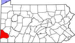
 Map of Washington County, Pennsylvania highlighting Peters Township | |
 Map of Washington County, Pennsylvania | |
| Country | United States |
| State | Pennsylvania |
| County | Washington |
| Established | 1781 |
| Government | |
| • Type | Council |
| • Chairman | James F. Berquist |
| Area[1] | |
| • Total | 19.72 sq mi (51.08 km2) |
| • Land | 19.55 sq mi (50.63 km2) |
| • Water | 0.18 sq mi (0.46 km2) |
| Population (2010) | |
| • Total | 21,213 |
| • Estimate (2016)[2] | 22,143 |
| • Density | 1,132.81/sq mi (437.39/km2) |
| Time zone | UTC-5 (Eastern (EST)) |
| • Summer (DST) | UTC-4 (EDT) |
| Area code(s) | 724 |
| FIPS code | 42-125-59608 |
| Website | http://www.peterstownship.com/ |
| Historical population | |||
|---|---|---|---|
| Census | Pop. | %± | |
| 2000 | 17,566 | — | |
| 2010 | 21,213 | 20.8% | |
| Est. 2016 | 22,143 | [2] | 4.4% |
| U.S. Decennial Census[3] | |||
Peters Township is a township in Washington County, Pennsylvania, United States. The population was 21,213 at the 2010 census. Peters Township is an affluent suburb located 12 miles south of Pittsburgh and possesses a nationally recognized school district.
Geography
According to the United States Census Bureau, the township has a total area of 19.8 square miles (51.2 km²), of which 19.6 square miles (50.7 km²) is land and 0.2 square miles (0.5 km²) is water. The main thoroughfares in Peters Township are U.S. Route 19 heading north and south, and East McMurray Road heading east and west.
Communities
Surrounding neighborhoods
Peters Township has six borders, including Upper St. Clair Township and Bethel Park (both in Allegheny County) to the north, Union Township to the east, Nottingham Township to the south, North Strabane Township to the south and southwest, and Cecil Township to the west.
History
Peters Township was incorporated in 1781 as one of Washington County's thirteen original townships. It had fallen within the area claimed by Virginia as its Yohogania County before the resolution of that state's boundary dispute with Pennsylvania. Over the years, portions of Peters Township were sectioned off to form other municipalities; eventually, leaving the present configuration of 19.5 square miles (51 km2).
Peters Township was named after William "Indian" Peters. There is uncertainty regarding Peters' race, with some sources holding that he was an Indian and others that he was a white man who traded with local Indians. Regardless, the Indian name has long-been associated with Peters Township.
Some of the first settlers were James and Joshua Wright, James Matthews, John Sweringer, Rev. David Phillips, Andrew Dunlevy, Daniel Townsend, William Fife and Robert Bell. Peters was initially a farming community and then later on coal became a major industry that resulted in the development of Hackett, presently a small settlement 1.2 miles (2 km) east of Venetia.
Peters Township remained a sparsely populated rural community until the 1950s. In 1950 the population was 3,004. By the year 2000, this number had increased to 17,556. In 1976, the township's home rule charter became effective. This altered the form of government from the prevalent Second Class Township Supervisor format to the present Council-Manager form.
The township's current arrowhead logo was adopted with the new home rule charter. It was designed by local artist Robert Chamberlain, who used an arrowhead found in Peters Township as the pattern.[4]
Peterswood Park, located in the township, is home to the Peters Township Recreation Center, as well as several football, baseball, softball, and soccer fields. In addition, there is an amphitheater as well as several pavilions.
There is one Country Club located in Peters Township, Valley Brook Country Club, following the closure of Rolling Hills Country Club in 2015.
The Enoch Wright House was listed on the National Register of Historic Places in 2007.[5]
As of today, the community has many fashionable homes and is considered one of the wealthiest suburbs of Pittsburgh.
Demographics
2000 census
As of the census[6] of 2000, there were 17,566 people, 6,026 households, and 5,091 families residing in the township. The population density was 896.6 people per square mile (346.2/km²). There were 6,221 housing units at an average density of 317.5 per square mile (122.6/km²). The racial makeup of the township was 97.81% White, 0.48% African American, 0.03% Native American, 1.09% Asian, 0.03% Pacific Islander, 0.20% from other races, and 0.37% from two or more races. Hispanic or Latino of any race were 0.72% of the population.
There were 6,026 households out of which 41.8% had children under the age of 18 living with them, 77.5% were married couples living together, 5.2% had a female householder with no husband present, and 15.5% were non-families. 13.8% of all households were made up of individuals and 6.1% had someone living alone who was 65 years of age or older. The average household size was 2.87 and the average family size was 3.17.
The population spread consisted of 29.4% under the age of 18, 4.1% from 18 to 24, 25.4% from 25 to 44, 28.2% from 45 to 64, and 13.0% who were 65 years of age or older. The median age was 41 years. For every 100 females there were 94.3 males. For every 100 females age 18 and over, there were 91.6 males.
The median income for a household in the township was $102,320 and the median income for a family was $108,246 (2007 estimate).[7] The per capita income for the township was $36,606. About 1.1% of families and 1.7% of the population were below the poverty line, including 1.1% of those under age 18 and 1.5% of those age 65 or over.
2010 census
As of the census[8] of 2010, there were 21,213 people, 7,292 households, and 6,079 families residing in the township. The population density was 1,071.4 people per square mile (414.9/km²). There were 7,559 housing units at an average density of 381.8 per square mile (148.2/km²). The racial makeup of the township was 96.2% White, 0.5% African American, 0.1% Native American, 2.0% Asian, 0.3% from other races, and 0.9% from two or more races. Hispanic or Latino of any race were 1.5% of the population.
Of the 7,292 total households, 40.7% had children under the age of 18 living with them, 75.3% were married couples living together, 5.4% had a female householder with no husband present, and 16.6% were non-families. 14.2% of all households were made up of individuals and 5.9% had someone living alone who was 65 years of age or older. The average household size was 2.88 and the average family size was 3.20.
The average income per household is $155,752. In the township the population was spread out with 31.1% under the age of 18, 2.7% from 18 to 24, 19.7% from 25 to 44, 33.1% from 45 to 64, and 13.4% who were 65 years of age or older. The median age was 43 years. For every 100 females there were 96.7 males. For every 100 women age 18 and over, there were 93.3 men.
Community Services
Fire Department
The Peters Township Fire Department, originally established in 1937 as an all-volunteer organization, has grown to a combination department with a total of 45 career and volunteer firefighters. The department operates out of two fire stations within the township and maintains a fleet of three engines, one heavy rescue, one 109' aerial quint, and a number of specialized squads. The department provides emergency response for fire, rescue, emergency medical and other requests to Peters Township and surrounding residents. In addition to emergency response, the department also offers many community services such as car seat installation, CPR classes, fire inspections, and fire and life safety education for thousands of participants each year. The department has been steadily and progressively growing over the past 30 years to meet the demand and high standards expected by its residents.
Education
The Peters Township School District has two elementary schools (Bower Hill Elementary School and Pleasant Valley Elementary School) that educate students in grades K-3. The secondary elementary school (McMurray Elementary School) educates students in grades 4-6. The Peters Township Middle School educates students in grades 7-8. The Peters Township High School educates students in grades 9-12. The School District has received several awards and has been consistently ranked as one of the top in the state.
References
- ↑ "2016 U.S. Gazetteer Files". United States Census Bureau. Retrieved Aug 14, 2017.
- 1 2 "Population and Housing Unit Estimates". Retrieved June 9, 2017.
- ↑ "Census of Population and Housing". Census.gov. Retrieved June 4, 2016.
- ↑ History of Peters Township Archived 16 March 2007 at the Wayback Machine.
- ↑ National Park Service (2010-07-09). "National Register Information System". National Register of Historic Places. National Park Service.
- ↑ "American FactFinder". United States Census Bureau. Retrieved 31 January 2008.
- ↑ FactFinder
- ↑ "Profile of General Population and Housing Characteristics: 2010" (PDF). American Fact Finder. United States Census Bureau. Retrieved 5 September 2011.
External links
- Peters Township Fire Department
- Township website
- Peters Township Community Television
- Peters Township Public Library
| Counties |  Map of the Pittsburgh Tri-State with green counties in the metropolitan area and yellow counties in the combined area. | |
|---|---|---|
| Major cities | ||
| Cities and towns 15k-50k (in 2010) | ||
| Airports | ||
| Topics | ||
| ||