Glen Osborne, Pennsylvania
| Glen Osborne, Pennsylvania | ||
|---|---|---|
| Borough | ||
 Neighborhood on Beaver Street | ||
| ||
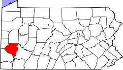
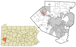 Location in Allegheny County and the U.S. state of Pennsylvania. | ||
| Coordinates: 40°31′51″N 80°10′9″W / 40.53083°N 80.16917°WCoordinates: 40°31′51″N 80°10′9″W / 40.53083°N 80.16917°W | ||
| Country | United States | |
| State | Pennsylvania | |
| County | Allegheny | |
| Incorporated | 1883, as Osborne | |
| Renamed | 2008, as Glen Osborne | |
| Government | ||
| • Mayor | Barbara Carrier (D) | |
| Area[1] | ||
| • Total | 0.56 sq mi (1.46 km2) | |
| • Land | 0.43 sq mi (1.11 km2) | |
| • Water | 0.14 sq mi (0.35 km2) | |
| Population (2010) | ||
| • Total | 547 | |
| • Estimate (2016)[2] | 538 | |
| • Density | 1,257.01/sq mi (484.84/km2) | |
| Time zone | UTC-5 (Eastern (EST)) | |
| • Summer (DST) | UTC-4 (EDT) | |
| FIPS code | 42-29732 | |
| GNIS | 1214815[3] | |
| Website | Borough website | |

Glen Osborne (formerly named Osborne) is a borough in Allegheny County, Pennsylvania, along the Ohio River. The population was 547 at the 2010 census.[4]
History
The area that now comprises the borough was first surveyed by Nathaniel Breading following the Revolutionary War. Early settlers of the area included Henry Pratt in 1786 and James Park in 1805. The area became known as "Glen Osborne," the glen referring to a Scottish term for a valley formed by a stream, and "Osborne" for local landowner Frank Osborne. By 1851, the Pittsburgh, Fort Wayne and Chicago Railroad was built through what was then part of Pitt and Ohio townships and a station opened in the community named "Osborne" to prevent confusion from a similarly-named station. In 1883 following petitioning by local residents, the borough of Osborne was incorporated.[5][6]
In 2008, borough officials led by then-mayor William P. Boswell petitioned the state to allow the renaming of the borough to Glen Osborne to reflect the name residents have been using for over one hundred years.[7] A judge granted the name change on May 21 of that year leading to the immediate replacement of road signs and phasing out of the old name on stationery and welcome signs in the borough.[8]
Geography
Glen Osborne is located at 40°31′51″N 80°10′9″W / 40.53083°N 80.16917°W (40.530892, -80.169248).[9]
According to the United States Census Bureau, the borough has a total area of 0.6 square miles (1.6 km2), of which 0.4 square miles (1.0 km2) is land and 0.1 square miles (0.26 km2), or 21.05%, is water. The borough is located on the north side of the Ohio River.
Government and Politics
| Year | Republican | Democratic | Third Parties |
|---|---|---|---|
| 2016 | 43% 138 | 57% 185 | 0% 1 |
| 2012 | 52% 172 | 47% 154 | 1% 4 |
Surrounding neighborhoods
Glen Osborne has three borders, including the borough of Sewickley to the northwest, Aleppo Township to the north, northeast and east, and the borough of Haysville to the southeast. Across the Ohio River, Glen Osborne is adjacent with the borough of Coraopolis to the south and southeast, and Moon Township to the southwest.[12]
Demographics
| Historical population | |||
|---|---|---|---|
| Census | Pop. | %± | |
| 1890 | 221 | — | |
| 1900 | 362 | 63.8% | |
| 1910 | 425 | 17.4% | |
| 1920 | 358 | −15.8% | |
| 1930 | 506 | 41.3% | |
| 1940 | 529 | 4.5% | |
| 1950 | 496 | −6.2% | |
| 1960 | 609 | 22.8% | |
| 1970 | 579 | −4.9% | |
| 1980 | 529 | −8.6% | |
| 1990 | 565 | 6.8% | |
| 2000 | 566 | 0.2% | |
| 2010 | 547 | −3.4% | |
| Est. 2016 | 538 | [2] | −1.6% |
| Sources:[13][14][15][16][17][18] | |||
As of the census[17] of 2000, there were 566 people, 216 households, and 168 families residing in the borough. The population density was 1,262.9 people per square mile (485.6/km²). There were 222 housing units at an average density of 495.3 per square mile (190.5/km²). The racial makeup of the borough was 98.06% White, 1.59% African American, 0.18% from other races, and 0.18% from two or more races. Hispanic or Latino of any race were 0.35% of the population.
There were 216 households, out of which 37.0% had children under the age of 18 living with them, 67.1% were married couples living together, 7.4% had a female householder with no husband present, and 22.2% were non-families. 19.4% of all households were made up of individuals, and 9.7% had someone living alone who was 65 years of age or older. The average household size was 2.61 and the average family size was 2.97.
In the borough the population was spread out, with 27.7% under the age of 18, 3.2% from 18 to 24, 21.0% from 25 to 44, 32.5% from 45 to 64, and 15.5% who were 65 years of age or older. The median age was 44 years. For every 100 females, there were 90.6 males. For every 100 females age 18 and over, there were 87.6 males.
The median income for a household in the borough was $64,375, and the median income for a family was $71,667. Males had a median income of $65,455 versus $41,875 for females. The per capita income for the borough was $50,169. About 8.0% of families and 10.8% of the population were below the poverty line, including 12.5% of those under age 18 and 16.8% of those age 65 or over.
See also
References
- ↑ "2016 U.S. Gazetteer Files". United States Census Bureau. Retrieved Aug 13, 2017.
- 1 2 "Population and Housing Unit Estimates". Retrieved June 9, 2017.
- ↑ U.S. Geological Survey Geographic Names Information System: Glen Osborne, Pennsylvania
- ↑ "Race, Hispanic or Latino, Age, and Housing Occupancy: 2010 Census Redistricting Data (Public Law 94-171) Summary File (QT-PL), Glen Osborne borough, Pennsylvania". U.S. Census Bureau, American FactFinder 2. Archived from the original on September 11, 2013. Retrieved September 19, 2011.
- ↑ "Pittsburgh Post-Gazette: Osborne". Pittsburgh Post-Gazette. Retrieved October 25, 2015.
- ↑ "About Glen Osborne". Glen Osborne Borough. Retrieved October 25, 2015.
- ↑ Oster, Doug (March 27, 2008). "Osborne wants older name". Pittsburgh Post-Gazette. Retrieved October 25, 2015.
- ↑ Barcousky, Len (July 3, 2008). "Judge approves change of borough name to Glen Osborne". Pittsburgh Post-Gazette. Retrieved October 25, 2015.
- ↑ "US Gazetteer files: 2010, 2000, and 1990". United States Census Bureau. 2011-02-12. Retrieved 2011-04-23.
- ↑ EL. "2012 Allegheny County election". Pittsburgh Tribune-Review. Retrieved 15 October 2017.
- ↑ EL. "2016 Pennsylvani general election..." Pittsburgh Post-Gazette. Retrieved 15 October 2017.
- ↑ Google (October 25, 2015). "Glen Osborne, Pennsylvania" (Map). Google Maps. Google. Retrieved October 25, 2015.
- ↑ "Population-Pennsylvania" (PDF). U.S. Census 1910. U.S. Census Bureau. Retrieved 22 November 2013.
- ↑ "Number and Distribution of Inhabitants:Pennsylvania-Tennessee" (PDF). Fifteenth Census. U.S. Census Bureau.
- ↑ "Number of Inhabitants: Pennsylvania" (PDF). 18th Census of the United States. U.S. Census Bureau. Retrieved 22 November 2013.
- ↑ "Pennsylvania: Population and Housing Unit Counts" (PDF). U.S. Census Bureau. Retrieved 22 November 2013.
- 1 2 "American FactFinder". United States Census Bureau. Archived from the original on 2013-09-11. Retrieved 2008-01-31.
- ↑ "Annual Estimates of the Resident Population". U.S. Census Bureau. Archived from the original on 19 October 2013. Retrieved 22 November 2013.
External links
| Counties |  Map of the Pittsburgh Tri-State with green counties in the metropolitan area and yellow counties in the combined area. | |
|---|---|---|
| Major cities | ||
| Cities and towns 15k-50k (in 2010) | ||
| Airports | ||
| Topics | ||
| ||