Oakland (Pittsburgh)
| Oakland | |
|---|---|
|
Neighborhoods of Pittsburgh Former Borough | |
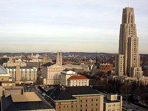
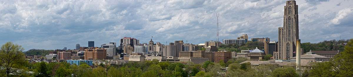
 The University of Pittsburgh's Cathedral of Learning dominates Oakland's skyline. | |
| Country | United States |
| State | Pennsylvania |
| County | Allegheny |
| Population (2017)[1] | |
| • Total | 8,663 |
| • Density | 11,280/sq mi (4,360/km2) |
| Time zone | UTC-5 (Eastern (EST)) |
| • Summer (DST) | UTC-4 (EDT) |
Oakland is the academic and healthcare center of Pittsburgh and one of the city's major cultural centers. The neighborhood is home to three universities, museums, and hospitals, as well as an abundance of shopping, restaurants, and recreational activities. Oakland is home to the Schenley Farms National Historic District which encompasses two city designated historic districts: the mostly residential Schenley Farms Historic District and the predominantly institutional Oakland Civic Center Historic District. It is also home to the locally designated Oakland Square Historic District. The Pittsburgh Bureau of Fire has Fire Station No. 14 on McKee Place and Fire Station No. 10 on Allequippa Street in Oakland.
Neighborhoods
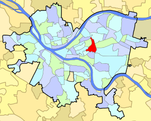
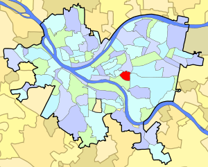
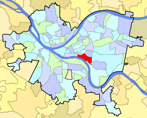

Oakland is officially divided into four neighborhoods: North Oakland, West Oakland, Central Oakland, and South Oakland. Each section has a unique identity, and offers its own flavor of venues and housing. Oakland is Pittsburgh's second most populated neighborhood with 22,210 residents, a majority of these residents being students.
| Historical population | ||
|---|---|---|
| Year | Pop. | ±% |
| 1940 | 25,843 | — |
| 1950 | 28,430 | +10.0% |
| 1960 | 23,806 | −16.3% |
| 1970 | 22,702 | −4.6% |
| 1980 | 21,157 | −6.8% |
| 1990 | 21,548 | +1.8% |
| 2000 | 20,417 | −5.2% |
| 2010 | 22,210 | +8.8% |
| [3][4] Source: | ||
North Oakland
North Oakland can be loosely defined as the area of Oakland between Neville and Bouquet Streets, encompassing all of Craig Street and running north to Polish Hill. The Cathedral of Learning, the engineering or midsection of the University of Pittsburgh campus, and the Craig Street business district are in North Oakland.
RAND's Pittsburgh center is located in North Oakland as well as the long time RIDC business incubator on Henry Street.[6] North Oakland is also home to the Schenley Farms Historic District and many mid-rise condominium and apartment buildings.
Central Oakland
Central Oakland is bordered by Schenley Park, the Boulevard of the Allies, Fifth Avenue, and Halket Street. Many students at the University of Pittsburgh who decide to live off-campus reside in this neighborhood. Many of its homes are historic masonry structures dating from the turn of the century. The area is often mistakenly called South Oakland. Its Main Business District runs along Forbes and Fifth Avenue, and contains a diversity of restaurants, retailers, and financial services. These businesses are organized by the Oakland Business Improvement District (OBID). Smaller business districts in Central Oakland provide additional dining options along Atwood Street and Semple Street. It is also the location of the relatively isolated and historic neighborhood of Panther Hollow which runs along Boundary Street in Junction Hollow as well as the Oakland Square Historic District.
South Oakland
South Oakland runs along the Monongahela River and forms a triangular shape between the Monongahela River, the Boulevard of the Allies, and the western bank of Junction Hollow. Magee-Womens Hospital of UPMC and the Pittsburgh Technology Center are major landmarks of this neighborhood. The neighborhood is split between a riverfront flood plain to the southwest and a plateau to the northeast. The plateau is divided into two primarily residential areas which are separated from one another by Bates Street, which runs up a valley from the flood plain to the plateau. The residents of the neighborhood on the north side of Bates Avenue call their neighborhood Oakcliffe. The flood plain was previously packed with industrial sites such as the Pittsburgh Works Consolidated Gas Co. and the Jones & Laughlin Steel Co.,[7] but presently, the Pittsburgh Technology Center hosts facilities such as the Entertainment Technology Center of Carnegie Mellon University.
Some residents of Central Oakland think of their neighborhood as being part of South Oakland. However, the border between Central Oakland and South Oakland is further south than they believe. The area between Forbes Avenue and Boulevard of the Allies is officially part of Central Oakland. Articles in some news media have made this error; for example, a column about street cleanliness near the University of Pittsburgh used the term "South Oakland" to describe an area entirely within the boundaries of Central Oakland.[8]
South Oakland is reputed to be a student neighborhood, but only 36.9% of its population is between the ages of 18 and 24, compared to Central Oakland's figure of 74.1%.[9] The difference is largely because the area between Forbes Avenue and the Boulevard of the Allies houses many undergraduate students. While it is commonly considered to be in South Oakland, it is actually the heart of Central Oakland.
South Oakland was the childhood home of Andy Warhol, and later the residence of fellow pop artist Keith Haring. Haring had his first art show while living in Oakland. NFL Hall of Fame Quarterback Dan Marino was also born in Oakland, not far from Warhol's home. Dan Marino Field on Frazier Street was named in honor of its native son. Although they were not contemporaries, Warhol and Marino grew up on the same block with their former houses only a few doors apart.
West Oakland
West Oakland, the smallest of the four districts, is bordered by Fifth Avenue in the south, DeSoto Street in the east, the Birmingham Bridge to the west, and Allequippa Street to the north. Carlow University and most of the University of Pittsburgh Medical Center can be found there.
Not Oakland
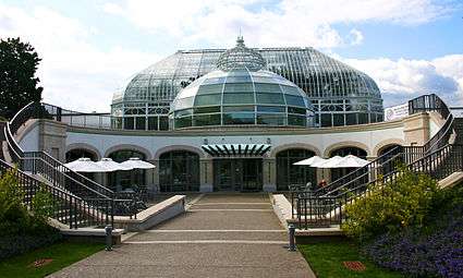
Although the campus of Carnegie Mellon University and parts of Schenley Park, including Phipps Conservatory & Botanical Gardens and Flagstaff Hill are popularly referred to as being in Oakland, and are located with the 15213 zip code, they are actually part of the adjacent neighborhood of Squirrel Hill North. The border between Oakland and Squirrel Hill runs along Junction Hollow.
History
The name first appeared in 1839 in a local paper, Harris' Intelligencer. The area got its name from the abundance of oak trees found on the farm of William Eichenbaum, who settled there in 1840. Oakland developed rapidly following the Great Fire of 1845 in Downtown Pittsburgh, with many people moving out to suburban territory. By 1860, there was considerable commercial development along Fifth Avenue.
In 1868, Oakland Township, just two years after seceding from Pitt Township, was annexed to the City of Pittsburgh.[10] Twenty-one years later, Mary Schenley gave the city 300 acres in Oakland for a park. Officials bought another 100 acres from her for "Schenley Park." And Mary Schenley gave another gift: land for Schenley Plaza. At Schenley Plaza, industrialist Andrew Carnegie built a library, museum and concert hall complex, which opened in 1895.
In 1917, Teddy Roosevelt visited the neighborhood.[11]
Oakland has long been considered Pittsburgh's university center. Carnegie Mellon University is the result of a 1967 merger of the Carnegie Institute of Technology, founded in Oakland in 1900 by Andrew Carnegie, and Mellon Institute, founded in 1913 by Andrew W. and Richard B. Mellon to conduct industrial research. The University of Pittsburgh, which is heir to the Pittsburgh Academy that was incorporated in 1787, relocated to Oakland in 1909 from its campus that was then in Allegheny.
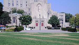
Some of the most impressive architecture in Oakland is on Pitt's campus. In 1925, work began on what was then the world's tallest educational building, the 42-story Cathedral of Learning. Although the Cathedral of Learning is now the fourth-tallest educationally purposed building in the world, it remains the world's second tallest university building, the tallest educational building in the Western Hemisphere,[12] and the second tallest gothic-styled building in the world.[13] Oakland is also home to the university's French-Gothic revival Heinz Memorial Chapel and St. Paul Cathedral, the seat of the Roman Catholic Diocese of Pittsburgh. It is also home of the main branch of the Carnegie Library, the Carnegie Museum, and Phipps Conservatory.
Baseball fans might know Oakland for the beloved Forbes Field, which was built in 1909 as the third home to the Pittsburgh Pirates and first home to the Pittsburgh Steelers. While Forbes Field was closed in 1970, some remnants of the ballpark still stand. Pirates fans gather on the site each year on the anniversary of Bill Mazeroski's World Series winning home run on October 13, 1960.
The Decade nightclub was a staple of the neighborhood in the 1970s and 1980s.[14]
Surrounding neighborhoods
North Oakland has eight borders with the Pittsburgh neighborhoods of Bloomfield to the northeast, Shadyside and Squirrel Hill North to the east, Central Oakland to the south, West Oakland to the southwest, the Terrace Village region of the Hill District to the west, the Upper Hill District to the northwest Polish Hill to the north-northwest. North Oakland also runs catty-corner (without a direct border) with Lower Lawrenceville to the north with its meeting point in the middle of the Bloomfield Bridge.
Central Oakland has five Pittsburgh neighborhood borders, including North Oakland to the north, Squirrel Hill North to the northeast, Squirrel Hill South to the east, South Oakland to the south and southwest, and West Oakland to the northwest.
South Oakland has six land borders, including the Pittsburgh neighborhoods of Central Oakland to the northeast, Squirrel Hill South to the east, Greenfield to the southeast, Hazelwood to the south-southeast, Bluff to the west, and West Oakland to the northwest. Across the Monongahela River, South Oakland runs adjacent with Pittsburgh's South Side Flats neighborhood.
West Oakland has six borders with the Pittsburgh neighborhoods of North Oakland to the northeast, Central Oakland to the southeast, South Oakland to the south and south-southeast, Bluff to the southwest, and the Crawford-Roberts and Terrace Village regions of the Hill District to the west and northwest, respectively.
Sites
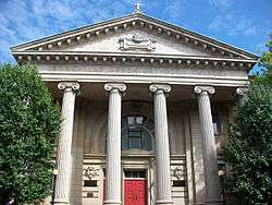
- The neighborhood is the location of the massive Carnegie culture complex, originally funded by Andrew Carnegie, which includes the Carnegie Museum of Natural History, Carnegie Museum of Art, Carnegie Library of Pittsburgh, and Carnegie Music Hall.
- Oakland is home to St. Nicholas Greek Orthodox Cathedral, sponsor of the annual Greek Food Festival, as well as St. Paul Cathedral, mother church of the Diocese of Pittsburgh, and the neighboring Pittsburgh Chinese Church.
- Oakland's University of Pittsburgh Medical Center pioneered modern organ transplant surgery (home of Dr. Thomas Starzl). In 1955, the first effective polio vaccine was developed by Dr. Jonas Salk at the University of Pittsburgh School of Medicine.
- Oakland was, at various points, the home of many professional Pittsburgh sports team, including the hockey Pittsburgh Pirates (NHL), Pittsburgh Steelers and the baseball Pittsburgh Pirates. They played at now-defunct venues such as the Duquesne Gardens, Pitt Stadium, and Forbes Field.
- The Pittsburgh Symphony and many touring plays and musical acts performed at the also now-defunct Syria Mosque. The Pittsburgh Civic Light Opera also called the neighborhood home, performing until 1961 at Pitt Stadium. The Pittsburgh Playhouse was founded in Oakland.
- WQED, Pittsburgh's PBS station and the first community-sponsored television station in the United States, has been located in Oakland since 1954, although it moved from its original building to a new, larger one in 1970. WQED's first building, which had originally been the manse of a neighboring church, is now the Music Building of the University of Pittsburgh's main campus. Mr. Rogers' Neighborhood, the nationally syndicated children's show, was taped at WQED's studios in Oakland.
- WDTV-TV, now KDKA-TV, the region's first television station, went on the air at the Syria Mosque in Oakland on 11 January 1949. The event, aired on all four TV networks of the time DuMont, CBS, NBC, and ABC, was the first to "network" East Coast and Midwest TV stations into a modern "television network" of Pittsburgh and 13 other cities from Boston to St. Louis.
- Oakland is less than 3 miles (4.8 km) from Downtown Pittsburgh, and as a whole is bordered by Shadyside, Squirrel Hill, the Hill District, Greenfield, Bloomfield, and Bluff.
Other attractions
Gallery
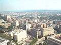 North Oakland seen from near the top of the University of Pittsburgh's Cathedral of Learning.
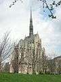

 Hamerschlag Hall at Carnegie Mellon University[nb 1]
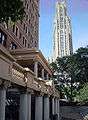

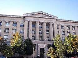
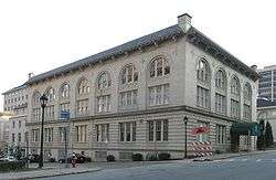
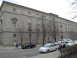 The Pittsburgh Public Schools' Board of Education administration building
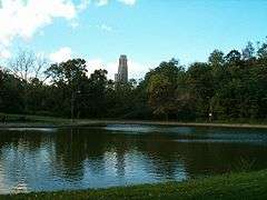 Panther Hollow Lake in Schenley Park[nb 1]
 Aerial view of Pittsburgh Public Schools' historic Schenley High School
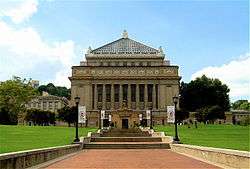 Soldier and Sailors' Memorial on 5th Avenue in North Oakland.
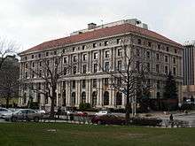 Pittsburgh Athletic Association, built 1909-1911, at the corner of Fifth Avenue and Bigelow Boulevard.
 The former Y.M.H.A., is now Pitt's Bellefield Hall
 The former Schenley Apartments, now Schenley Quadrangle residences at the University of Pittsburgh
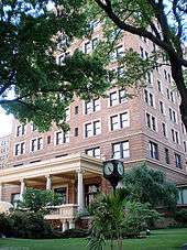

 The former Ruskin Apartments, now the University of Pittsburgh's Ruskin Hall
 The former National Union Fire Insurance Company building, now the University of Pittsburgh's Thackeray Hall
 The Frick Fine Arts Building at the University of Pittsburgh
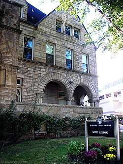
 The University Club, now a building on Pitt's campus

 The Stephen Foster Memorial at the University of Pittsburgh

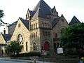 Bellefield Presbyterian Church
See also
Notes
References
- ↑ "Oakland Pittsburgh Demographics".
- 1 2 3 4 5 6 7 8 "PGHSNAP 2010 Raw Census Data by Neighborhood". Pittsburgh Department of City Planning. 2012. Retrieved 21 June 2013.
- ↑ https://docs.google.com/spreadsheet/ccc?key=0Ag0xdSSLPcUHdEo0STlkRVBpcVZEcUtwTG9wWjJTd2c#gid=0
- ↑ "Census:Pittsburgh" (PDF). Archived from the original (PDF) on August 10, 2007. Retrieved 2 September 2012.
- ↑ "Pittsburgh Census Tracts". pitt.libguides.com. Retrieved January 2, 2018.
- ↑ Wilhelm, Kathy (July 25, 1985), "Incubators help hatch new firms", Pittsburgh Post-Gazette, Pittsburgh, PA
- ↑ "Real estate plat-book of the city of Pittsburgh : from official records, private plans and actual surveys, Volume 1. Plate 15". G. M. Hopkins & Co. 1904. Retrieved 19 October 2011.
- ↑ O'Neill, Brian (11 December 2011). "Can Pitt get SOUL (i.e., South Oakland Urban Litter)?". Pittsburgh Post-Gazette. Retrieved 11 December 2011.
- ↑ CITY OF PITTSBURGH NEIGHBORHOOD PROFILES AMERICAN COMMUNITY SURVEY FIVE‐YEAR ESTIMATES 2005‐2009 DATA (PDF). PROGRAM IN URBAN AND REGIONAL ANALYSIS, UNIVERSITY CENTER FOR SOCIAL AND URBAN RESEARCH, UNIVERSITY OF PITTSBURGH. June 2011. Retrieved 11 June 2011.
- ↑ Negley, W. B. (1876). "Allegheny County; its Formation, its Cities, Wards, Boroughs and Townships". Atlas of the County of Allegheny, Penna. Philadelphia: G.M. Hopkins & Co. p. 4.
- ↑ http://bradystewartphoto.photoshelter.com/image/I0000TJ5bDxT9mYY
- ↑ "Moscow State University, Moscow, Russia". Emporis. Retrieved 2 August 2010.
- ↑ "Cathedral of Learning, Pittsburgh". SkyscraperPage.com. Retrieved 2012-12-07.
- ↑ https://news.google.com/newspapers?id=PBkeAAAAIBAJ&sjid=6mEEAAAAIBAJ&pg=5076%2C3190859
- Toker, Franklin (1994) [1986]. Pittsburgh: An Urban Portrait. Pittsburgh: University of Pittsburgh Press. ISBN 0-8229-5434-6.
External links
| Wikimedia Commons has media related to Oakland (Pittsburgh). |