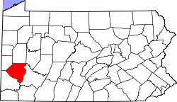
Leet Township, Allegheny County, Pennsylvania

Leet Township is a township in Allegheny County, Pennsylvania, United States. The population was 1,634 at the 2010 census.[1]
Geography
According to the United States Census Bureau, the township has a total area of 1.6 square miles (4.1 km2) and none of the area is covered with water.
Surrounding neighborhoods
Leet Township has five borders, including Bell Acres to the northeast, Edgeworth to the southeast, Leetsdale to the southwest, and the Beaver County neighborhoods of Ambridge and Harmony Township to the northwest.
Government and Politics
| Year | Republican | Democratic | Third Parties |
|---|---|---|---|
| 2016 | 48% 405 | 51% 425 | 1% 9 |
| 2012 | 53% 447 | 46% 390 | 1% 10 |
History
Originally part of Pitt Township and the Depreciation Lands, reserved for Revolutionary War veterans, it was named after Jonathan Leet,[4] a surveyor who laid out the town of Beaver Falls.
Leet's brother, Daniel, also was a surveyor who bought several large lots in the area. Daniel Leet served on George Washington's staff during the Revolutionary War.
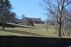
Gen. Alexander Hays, a Pittsburgher who named the Mexican War Streets on the present-day North Side after that conflict, named his Civil War horse "Leet" after the family. One of the Leet descendants, David Shields, served as Hays' personal aide during the Civil War. After Hays died at the Battle of the Wilderness, a family friend gave his wife, Annie, a home and five acres on Big Sewickley Creek, which she named "Fair Oaks" after the battle in which her husband was promoted.
The original boundaries of the township included what are now Edgeworth, Leetsdale and part of Sewickley Heights.
After the Civil War, the residents decided to file a petition to form a separate municipality because they were upset at the level of services they received from Sewickley Township. The votes were counted at the home of Justice of the Peace John Way Jr, grandson of one of original property owners in the area, Caleb Way, a Quaker.
Demographics
| Historical population | |||
|---|---|---|---|
| Census | Pop. | %± | |
| 2010 | 1,634 | — | |
| Est. 2016 | 1,605 | [5] | −1.8% |
| U.S. Decennial Census[6] | |||
As of the census[7] of 2000, there were 1,568 people, 569 households, and 452 families residing in the township. The population density was 983.9 people per square mile (380.8/km²). There were 599 housing units at an average density of 375.9/sq mi (145.5/km²). The racial makeup of the township was 94.83% White, 2.68% African American, 0.96% Asian, 0.32% from other races, and 1.21% from two or more races. Hispanic or Latino of any race were 0.77% of the population.
There were 569 households, out of which 36.0% had children under the age of 18 living with them, 67.7% were married couples living together, 8.1% had a female householder with no husband present, and 20.4% were non-families. 17.8% of all households were made up of individuals, and 8.1% had someone living alone who was 65 years of age or older. The average household size was 2.70 and the average family size was 3.08.
In the township the population was spread out, with 24.7% under the age of 18, 6.6% from 18 to 24, 24.4% from 25 to 44, 29.3% from 45 to 64, and 14.9% who were 65 years of age or older. The median age was 42 years. For every 100 females there were 92.2 males. For every 100 females age 18 and over, there were 93.1 males.
The median income for a household in the township was $54,432, and the median income for a family was $62,292. Males had a median income of $46,635 versus $28,676 for females. The per capita income for the township was $26,415. About 2.8% of families and 3.8% of the population were below the poverty line, including 3.9% of those under age 18 and 6.5% of those age 65 or over.
References
- ↑ "Race, Hispanic or Latino, Age, and Housing Occupancy: 2010 Census Redistricting Data (Public Law 94-171) Summary File (QT-PL), Leet township, Allegheny County, Pennsylvania". U.S. Census Bureau, American FactFinder 2. Retrieved September 27, 2011.
- ↑ EL. "2012 Allegheny County election". Pittsburgh Tribune-Review. Retrieved 15 October 2017.
- ↑ EL. "2016 Pennsylvani general election..." Pittsburgh Post-Gazette. Retrieved 15 October 2017.
- ↑ "What's in a name? For some, a bit of history". Pittsburgh Post-Gazette. May 10, 1984. p. 1. Retrieved 16 May 2015.
- ↑ "Population and Housing Unit Estimates". Retrieved June 9, 2017.
- ↑ "Census of Population and Housing". Census.gov. Retrieved June 4, 2016.
- ↑ "American FactFinder". United States Census Bureau. Retrieved 2008-01-31.
| Counties |  Map of the Pittsburgh Tri-State with green counties in the metropolitan area and yellow counties in the combined area. | |
|---|---|---|
| Major cities | ||
| Cities and towns 15k-50k (in 2010) | ||
| Airports | ||
| Topics | ||
| ||