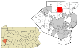
Hampton Township, Allegheny County, Pennsylvania
| Hampton Township, Pennsylvania | |
|---|---|
| Township, Census-designated place | |
| Township of Hampton | |
| Nickname(s): Hampton, Gibsonia | |
| Coordinates: 40°31′35″N 80°1′19″W / 40.52639°N 80.02194°WCoordinates: 40°31′35″N 80°1′19″W / 40.52639°N 80.02194°W | |
| Country | United States |
| State | Pennsylvania |
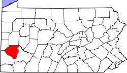
| County | Allegheny |
| Government | |
| • Type | Council |
| • Council President | Michael Peters (D) |
| Time zone | UTC-5 (Eastern (EST)) |
| • Summer (DST) | UTC-4 (EDT) |
| Area code(s) | 412 |
| Website | |
Hampton Township is a township in Allegheny County, Pennsylvania, United States. The population was 18,363 at the 2010 census.[1]
History
The first settlers of present-day Hampton Township in northern Allegheny County arrived in the mid to late 18th century around the time of the Revolutionary War. The town was called Tally Cavey. Hunters and fur trappers moved north of the Allegheny River in search of better game in the forests and more animals to capture and trade fur. In 1794, John McCaslin obtained a large section of land presently known as Oak Hill Farms near the junction of Route 8 and Mt. Royal Boulevard. Many geographical landmarks in the area bear the names of early settlers such as Robert and James Sample, William and Henry McCully, and John McNeal.[2]
In 1861, Moses Hampton, LLD, a judge and member of Congress, signed the documents necessary to make Hampton into a municipality comprising parts of McCandless, Indiana, and West Deer townships. Throughout the late 19th to the 20th centuries, people slowly began to move into this area, eventually creating a bustling community of over 18,000 people.[2]
Geography
Hampton Township is located at 40°34′59″N 79°57′23″W / 40.58306°N 79.95639°W (40.583096, -79.956583).[3]
According to the United States Census Bureau, the township has a total area of 16.0 square miles (41 km2), of which 0.06% is water.
Communities
- Allison Park
- Elfinwild
- Hardy
- Pheasant Creek
- Sample
- Sutter Heights
- Talley Cavey
- Wildwood
- Wyndham Gulch
- Gibsonia
Surrounding neighborhoods
Hampton Township has five borders, including Richland Township to the north, West Deer Township to the northeast, Indiana Township to the east and southeast, Shaler Township to the south and McCandless to the west.
Demographics
| Historical population | |||
|---|---|---|---|
| Census | Pop. | %± | |
| 1870 | 938 | — | |
| 1880 | 1,003 | 6.9% | |
| 1890 | 1,324 | 32.0% | |
| 1900 | 1,513 | 14.3% | |
| 1910 | 1,641 | 8.5% | |
| 1920 | 1,720 | 4.8% | |
| 1930 | 3,333 | 93.8% | |
| 1940 | 3,364 | 0.9% | |
| 1950 | 6,104 | 81.5% | |
| 1960 | 10,641 | 74.3% | |
| 1970 | 12,515 | 17.6% | |
| 1980 | 14,319 | 14.4% | |
| 1990 | 15,568 | 8.7% | |
| 2000 | 17,526 | 12.6% | |
| 2010 | 18,363 | 4.8% | |
| Est. 2016 | 18,440 | [4] | 0.4% |
| Sources:[5][6][7][8][9][10][11] | |||
As of the census[10] of 2000, there were 17,526 people, 6,253 households, and 4,896 families residing in the township. The population density was 1,092.8 people per square mile (421.9/km²). There were 6,627 housing units at an average density of 413.2 per square mile (159.5/km²). The racial makeup of the township was 97.66% White, 0.67% African American, 0.05% Native American, 1.23% Asian, 0.01% Pacific Islander, 0.12% from other races, and 0.27% from two or more races. 0.53% of the population were Hispanic or Latino of any race.
There were 6,253 households, out of which 38.5% had children under the age of 18 living with them, 68.8% were married couples living together, 7.1% had a female householder with no husband present, and 21.7% were non-families. 18.8% of all households were made up of individuals, and 7.3% had someone living alone who was 65 years of age or older. The average household size was 2.76 and the average family size was 3.18.
In the township the population was spread out, with 28.1% under the age of 18, 4.9% from 18 to 24, 27.6% from 25 to 44, 26.3% from 45 to 64, and 13.1% who were 65 years of age or older. The median age was 40 years. For every 100 females there were 95.7 males. For every 100 females age 18 and over, there were 91.9 males.
The median income for a household in the township was $80,911. The per capita income for the township was $41,074. About 0.2% of families and 1.6% of the population were below the poverty line, including 2.5% of those under age 18 and 6.7% of those age 65 or over.
Government and Politics
| Year | Republican | Democratic | Third Parties |
|---|---|---|---|
| 2016 | 54% 5,783 | 42% 4,566 | 4% 399 |
| 2012 | 60% 6,252 | 39% 4,018 | 1% 96 |
Hampton Township is governed by a 5 member Township Council and an elected Controller.
Current elected officials:
- Michael Peters, President
- Carolynn Johnson, Vice-President
- Bethany Blackburn
- Richard Dunlap
- Sherry Neugebauer
- Jerry Speakman, Controller
Education
The five schools (K-12) in the area are managed by the Hampton Township School District.
Elementary(K-5): Wyland Elementary School, Central Elementary School, Poff Elementary School
Middle(6-8): Hampton Middle School
High(9-12): Hampton High School
Taxes
School tax millage rate- The Hampton Township School District in 2017 was 18.77. This ranked 32nd highest/most expensive out of Allegheny County's 45 school districts [between Keystone Oaks SD (31st highest) and Avonworth SD (33rd highest)].[14]
References
- ↑ "Race, Hispanic or Latino, Age, and Housing Occupancy: 2010 Census Redistricting Data (Public Law 94-171) Summary File (QT-PL), Hampton township, Allegheny County, Pennsylvania". U.S. Census Bureau, American FactFinder 2. Retrieved September 27, 2011.
- 1 2 Hampton Township History
- ↑ "US Gazetteer files: 2010, 2000, and 1990". United States Census Bureau. 2011-02-12. Retrieved 2011-04-23.
- ↑ "Population and Housing Unit Estimates". Retrieved June 9, 2017.
- ↑ "Population of Civil Divisions Less than Counties" (PDF). 1880 United States Census. U.S. Census Bureau. Retrieved 24 November 2013.
- ↑ "Population-Pennsylvania" (PDF). U.S. Census 1910. U.S. Census Bureau. Retrieved 22 November 2013.
- ↑ "Number and Distribution of Inhabitants:Pennsylvania-Tennessee" (PDF). Fifteenth Census. U.S. Census Bureau.
- ↑ "Number of Inhabitants: Pennsylvania" (PDF). 18th Census of the United States. U.S. Census Bureau. Retrieved 22 November 2013.
- ↑ "Pennsylvania: Population and Housing Unit Counts" (PDF). U.S. Census Bureau. Retrieved 22 November 2013.
- 1 2 "American FactFinder". United States Census Bureau. Retrieved 2008-01-31.
- ↑ "Incorporated Places and Minor Civil Divisions Datasets: Subcounty Population Estimates: April 1, 2010 to July 1, 2012". U.S. Census Bureau. Retrieved 25 November 2013.
- ↑ EL. "2012 Allegheny County election". Pittsburgh Tribune-Review. Retrieved 15 October 2017.
- ↑ EL. "2016 Pennsylvani general election..." Pittsburgh Post-Gazette. Retrieved 15 October 2017.
- ↑ EL. "Allegheny County Treasurer". Retrieved 1 September 2017.
| Counties |  Map of the Pittsburgh Tri-State with green counties in the metropolitan area and yellow counties in the combined area. | |
|---|---|---|
| Major cities | ||
| Cities and towns 15k-50k (in 2010) | ||
| Airports | ||
| Topics | ||
| ||