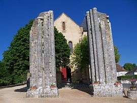
Saint-Raphaël, Dordogne
| Saint-Raphaël | |
|---|---|
| Commune | |
 | |
 Saint-Raphaël Location within Nouvelle-Aquitaine region  Saint-Raphaël | |
| Coordinates: 45°18′18″N 1°04′32″E / 45.305°N 1.0756°ECoordinates: 45°18′18″N 1°04′32″E / 45.305°N 1.0756°E | |
| Country | France |
| Region | Nouvelle-Aquitaine |
| Department | Dordogne |
| Arrondissement | Nontron |
| Canton | Isle-Loue-Auvézère |
| Government | |
| • Mayor (2008–2014) | Jean-Claude Coustillas |
| Area1 | 7.13 km2 (2.75 sq mi) |
| Population (2008)2 | 103 |
| • Density | 14/km2 (37/sq mi) |
| Time zone | UTC+1 (CET) |
| • Summer (DST) | UTC+2 (CEST) |
| INSEE/Postal code | 24493 /24160 |
| Elevation |
161–296 m (528–971 ft) (avg. 288 m or 945 ft) |
|
1 French Land Register data, which excludes lakes, ponds, glaciers > 1 km2 (0.386 sq mi or 247 acres) and river estuaries. 2 Population without double counting: residents of multiple communes (e.g., students and military personnel) only counted once. | |
Saint-Raphaël is a commune in the Dordogne department in Nouvelle-Aquitaine in southwestern France.
Population
| Historical population | ||
|---|---|---|
| Year | Pop. | ±% |
| 1962 | 104 | — |
| 1968 | 112 | +7.7% |
| 1975 | 89 | −20.5% |
| 1982 | 93 | +4.5% |
| 1990 | 109 | +17.2% |
| 1999 | 93 | −14.7% |
| 2008 | 103 | +10.8% |
See also
References
External links
| Wikimedia Commons has media related to Saint-Raphaël (Dordogne). |
This article is issued from
Wikipedia.
The text is licensed under Creative Commons - Attribution - Sharealike.
Additional terms may apply for the media files.