Tocane-Saint-Apre
| Tocane-Saint-Apre | |
|---|---|
| Commune | |
 | |
 Tocane-Saint-Apre Location within Nouvelle-Aquitaine region  Tocane-Saint-Apre | |
| Coordinates: 45°15′19″N 0°29′50″E / 45.2553°N 0.4972°ECoordinates: 45°15′19″N 0°29′50″E / 45.2553°N 0.4972°E | |
| Country | France |
| Region | Nouvelle-Aquitaine |
| Department | Dordogne |
| Arrondissement | Périgueux |
| Canton | Brantôme |
| Intercommunality | Val de Dronne |
| Government | |
| • Mayor (2008–2014) | Gérard Senrent |
| Area1 | 32.35 km2 (12.49 sq mi) |
| Population (2008)2 | 1,633 |
| • Density | 50/km2 (130/sq mi) |
| Time zone | UTC+1 (CET) |
| • Summer (DST) | UTC+2 (CEST) |
| INSEE/Postal code | 24553 /24350 |
| Elevation |
68–232 m (223–761 ft) (avg. 85 m or 279 ft) |
|
1 French Land Register data, which excludes lakes, ponds, glaciers > 1 km2 (0.386 sq mi or 247 acres) and river estuaries. 2 Population without double counting: residents of multiple communes (e.g., students and military personnel) only counted once. | |
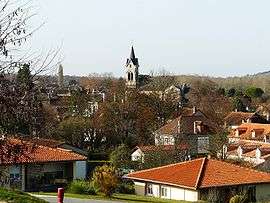
Tocane-Saint-Apre is a commune in the Dordogne department in Nouvelle-Aquitaine in southwestern France.
Population
| Historical population | ||
|---|---|---|
| Year | Pop. | ±% |
| 1856 | 2,140 | — |
| 1861 | 2,040 | −4.7% |
| 1866 | 2,098 | +2.8% |
| 1872 | 2,016 | −3.9% |
| 1876 | 2,171 | +7.7% |
| 1881 | 2,145 | −1.2% |
| 1886 | 2,061 | −3.9% |
| 1891 | 2,044 | −0.8% |
| 1896 | 1,893 | −7.4% |
| 1901 | 1,848 | −2.4% |
| 1906 | 1,794 | −2.9% |
| 1911 | 1,731 | −3.5% |
| 1921 | 1,573 | −9.1% |
| 1926 | 1,575 | +0.1% |
| 1931 | 1,535 | −2.5% |
| 1936 | 1,517 | −1.2% |
| 1946 | 1,475 | −2.8% |
| 1954 | 1,371 | −7.1% |
| 1962 | 1,413 | +3.1% |
| 1968 | 1,359 | −3.8% |
| 1975 | 1,318 | −3.0% |
| 1982 | 1,376 | +4.4% |
| 1990 | 1,377 | +0.1% |
| 1999 | 1,486 | +7.9% |
| 2008 | 1,633 | +9.9% |
See also
References
| Wikimedia Commons has media related to Tocane-Saint-Apre. |
This article is issued from
Wikipedia.
The text is licensed under Creative Commons - Attribution - Sharealike.
Additional terms may apply for the media files.