Gaugeac
| Gaugeac | |
|---|---|
| Commune | |
 | |
 Gaugeac Location within Nouvelle-Aquitaine region  Gaugeac | |
| Coordinates: 44°39′36″N 0°52′54″E / 44.66°N 0.8817°ECoordinates: 44°39′36″N 0°52′54″E / 44.66°N 0.8817°E | |
| Country | France |
| Region | Nouvelle-Aquitaine |
| Department | Dordogne |
| Arrondissement | Bergerac |
| Canton | Lalinde |
| Intercommunality | Monpaziérois |
| Government | |
| • Mayor (2008–2014) | Robert Rougier |
| Area1 | 10.17 km2 (3.93 sq mi) |
| Population (2008)2 | 114 |
| • Density | 11/km2 (29/sq mi) |
| Time zone | UTC+1 (CET) |
| • Summer (DST) | UTC+2 (CEST) |
| INSEE/Postal code | 24195 /24540 |
| Elevation |
120–231 m (394–758 ft) (avg. 200 m or 660 ft) |
|
1 French Land Register data, which excludes lakes, ponds, glaciers > 1 km2 (0.386 sq mi or 247 acres) and river estuaries. 2 Population without double counting: residents of multiple communes (e.g., students and military personnel) only counted once. | |
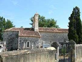
Gaugeac is a commune in the Dordogne department in Nouvelle-Aquitaine in southwestern France.
Population
| Historical population | ||
|---|---|---|
| Year | Pop. | ±% |
| 1962 | 131 | — |
| 1968 | 125 | −4.6% |
| 1975 | 122 | −2.4% |
| 1982 | 121 | −0.8% |
| 1990 | 123 | +1.7% |
| 1999 | 118 | −4.1% |
| 2008 | 114 | −3.4% |
Geography
Gaugeac borders eight other communes including one, Parranquet, in the department of Lot-et-Garonne. To the north, the communal territory is about fifty meters from that of Lavalade.
Communes Bordering Gaugeac | |
|---|---|
See also
References
| Wikimedia Commons has media related to Gaugeac. |
This article is issued from
Wikipedia.
The text is licensed under Creative Commons - Attribution - Sharealike.
Additional terms may apply for the media files.