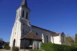
Champs-Romain
| Champs-Romain | |
|---|---|
| Commune | |
 | |
 Champs-Romain Location within Nouvelle-Aquitaine region  Champs-Romain | |
| Coordinates: 45°31′55″N 0°46′34″E / 45.5319°N 0.7761°ECoordinates: 45°31′55″N 0°46′34″E / 45.5319°N 0.7761°E | |
| Country | France |
| Region | Nouvelle-Aquitaine |
| Department | Dordogne |
| Arrondissement | Nontron |
| Canton | Périgord Vert Nontronnais |
| Intercommunality | Périgord vert |
| Government | |
| • Mayor (2008–2014) | Guy Lastère |
| Area1 | 20.33 km2 (7.85 sq mi) |
| Population (2008)2 | 313 |
| • Density | 15/km2 (40/sq mi) |
| Time zone | UTC+1 (CET) |
| • Summer (DST) | UTC+2 (CEST) |
| INSEE/Postal code | 24101 /24470 |
| Elevation |
155–344 m (509–1,129 ft) (avg. 304 m or 997 ft) |
|
1 French Land Register data, which excludes lakes, ponds, glaciers > 1 km2 (0.386 sq mi or 247 acres) and river estuaries. 2 Population without double counting: residents of multiple communes (e.g., students and military personnel) only counted once. | |
Champs-Romain is a commune in the Dordogne department in Nouvelle-Aquitaine in southwestern France.
Population
| Historical population | ||
|---|---|---|
| Year | Pop. | ±% |
| 1962 | 433 | — |
| 1968 | 410 | −5.3% |
| 1975 | 373 | −9.0% |
| 1982 | 332 | −11.0% |
| 1990 | 331 | −0.3% |
| 1999 | 328 | −0.9% |
| 2008 | 313 | −4.6% |
See also
References
| Wikimedia Commons has media related to Champs-Romain. |
This article is issued from
Wikipedia.
The text is licensed under Creative Commons - Attribution - Sharealike.
Additional terms may apply for the media files.