Azerat
| Azerat | |
|---|---|
| Commune | |
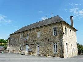 The town hall in Azerat | |
 Azerat Location within Nouvelle-Aquitaine region  Azerat | |
| Coordinates: 45°09′03″N 1°07′27″E / 45.1508°N 1.1242°ECoordinates: 45°09′03″N 1°07′27″E / 45.1508°N 1.1242°E | |
| Country | France |
| Region | Nouvelle-Aquitaine |
| Department | Dordogne |
| Arrondissement | Sarlat-la-Canéda |
| Canton | Haut-Périgord Noir |
| Intercommunality | CC Terrassonnais Périgord Noir Thenon Hautefort |
| Government | |
| • Mayor (2014-2020) | Josiane Léviski |
| Area1 | 20.05 km2 (7.74 sq mi) |
| Population (2014)2 | 446 |
| • Density | 22/km2 (58/sq mi) |
| Time zone | UTC+1 (CET) |
| • Summer (DST) | UTC+2 (CEST) |
| INSEE/Postal code | 24019 /24210 |
| Elevation | 128–317 m (420–1,040 ft) |
|
1 French Land Register data, which excludes lakes, ponds, glaciers > 1 km2 (0.386 sq mi or 247 acres) and river estuaries. 2 Population without double counting: residents of multiple communes (e.g., students and military personnel) only counted once. | |
Azerat is a commune in the Dordogne department in Nouvelle-Aquitaine in southwestern France. The A89 motorway passes by the village.
Population
| Historical population | ||
|---|---|---|
| Year | Pop. | ±% |
| 1962 | 481 | — |
| 1968 | 495 | +2.9% |
| 1975 | 454 | −8.3% |
| 1982 | 419 | −7.7% |
| 1990 | 407 | −2.9% |
| 1999 | 409 | +0.5% |
| 2008 | 416 | +1.7% |
| 2014 | 446 | +7.2% |
Personalities
- Robert Lacoste
- Maurice Faure
- Outside the chapel is the house of the socialist Suzanne Lacore, first female undersecretary of state in the first government of Léon Blum and former schoolteacher.[1]
See also
References
- ↑ "Archived copy". Archived from the original on 2012-04-28. Retrieved 2013-09-18.
External links
| Wikimedia Commons has media related to Azerat. |
This article is issued from
Wikipedia.
The text is licensed under Creative Commons - Attribution - Sharealike.
Additional terms may apply for the media files.