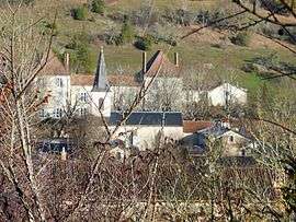
Saint-Paul-de-Serre
| Saint-Paul-de-Serre | |
|---|---|
| Commune | |
 | |
 Saint-Paul-de-Serre Location within Nouvelle-Aquitaine region  Saint-Paul-de-Serre | |
| Coordinates: 45°05′21″N 0°38′04″E / 45.0892°N 0.6344°ECoordinates: 45°05′21″N 0°38′04″E / 45.0892°N 0.6344°E | |
| Country | France |
| Region | Nouvelle-Aquitaine |
| Department | Dordogne |
| Arrondissement | Périgueux |
| Canton | Périgord Central |
| Intercommunality | Pays Vernois |
| Government | |
| • Mayor (2008–2014) | Jean-Paul Virol |
| Area1 | 10.44 km2 (4.03 sq mi) |
| Population (2008)2 | 260 |
| • Density | 25/km2 (65/sq mi) |
| Time zone | UTC+1 (CET) |
| • Summer (DST) | UTC+2 (CEST) |
| INSEE/Postal code | 24480 /24380 |
| Elevation |
91–214 m (299–702 ft) (avg. 100 m or 330 ft) |
|
1 French Land Register data, which excludes lakes, ponds, glaciers > 1 km2 (0.386 sq mi or 247 acres) and river estuaries. 2 Population without double counting: residents of multiple communes (e.g., students and military personnel) only counted once. | |
Saint-Paul-de-Serre is a commune in the Dordogne department in Nouvelle-Aquitaine in southwestern France.
Population
| Historical population | ||
|---|---|---|
| Year | Pop. | ±% |
| 1962 | 167 | — |
| 1968 | 199 | +19.2% |
| 1975 | 187 | −6.0% |
| 1982 | 155 | −17.1% |
| 1990 | 208 | +34.2% |
| 1999 | 236 | +13.5% |
| 2008 | 260 | +10.2% |
See also
References
| Wikimedia Commons has media related to Saint-Paul-de-Serre. |
This article is issued from
Wikipedia.
The text is licensed under Creative Commons - Attribution - Sharealike.
Additional terms may apply for the media files.