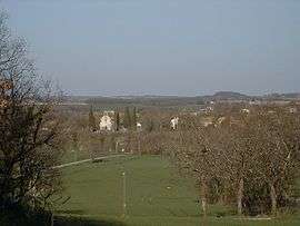
Monsaguel
| Monsaguel | |
|---|---|
| Commune | |
 | |
 Monsaguel Location within Nouvelle-Aquitaine region  Monsaguel | |
| Coordinates: 44°44′18″N 0°34′52″E / 44.7383°N 0.5811°ECoordinates: 44°44′18″N 0°34′52″E / 44.7383°N 0.5811°E | |
| Country | France |
| Region | Nouvelle-Aquitaine |
| Department | Dordogne |
| Arrondissement | Bergerac |
| Canton | Sud-Bergeracois |
| Government | |
| • Mayor (2008–2014) | Jean-Paul Guiraud |
| Area1 | 11.57 km2 (4.47 sq mi) |
| Population (2008)2 | 153 |
| • Density | 13/km2 (34/sq mi) |
| Time zone | UTC+1 (CET) |
| • Summer (DST) | UTC+2 (CEST) |
| INSEE/Postal code | 24282 /24560 |
| Elevation |
62–173 m (203–568 ft) (avg. 111 m or 364 ft) |
|
1 French Land Register data, which excludes lakes, ponds, glaciers > 1 km2 (0.386 sq mi or 247 acres) and river estuaries. 2 Population without double counting: residents of multiple communes (e.g., students and military personnel) only counted once. | |
Monsaguel is a commune in the Dordogne department in Nouvelle-Aquitaine in southwestern France.
Population
| Historical population | ||
|---|---|---|
| Year | Pop. | ±% |
| 1962 | 155 | — |
| 1968 | 114 | −26.5% |
| 1975 | 92 | −19.3% |
| 1982 | 113 | +22.8% |
| 1990 | 125 | +10.6% |
| 1999 | 134 | +7.2% |
| 2008 | 153 | +14.2% |
See also
References
| Wikimedia Commons has media related to Monsaguel. |
This article is issued from
Wikipedia.
The text is licensed under Creative Commons - Attribution - Sharealike.
Additional terms may apply for the media files.