Fraisse
| Fraisse | |
|---|---|
| Commune | |
 | |
 Fraisse Location within Nouvelle-Aquitaine region  Fraisse | |
| Coordinates: 44°55′50″N 0°18′30″E / 44.9306°N 0.3083°ECoordinates: 44°55′50″N 0°18′30″E / 44.9306°N 0.3083°E | |
| Country | France |
| Region | Nouvelle-Aquitaine |
| Department | Dordogne |
| Arrondissement | Bergerac |
| Canton | Pays de la Force |
| Government | |
| • Mayor (2008–2014) | Régie Lajonie |
| Area1 | 21.5 km2 (8.3 sq mi) |
| Population (2008)2 | 151 |
| • Density | 7.0/km2 (18/sq mi) |
| Time zone | UTC+1 (CET) |
| • Summer (DST) | UTC+2 (CEST) |
| INSEE/Postal code | 24191 /24130 |
| Elevation |
39–135 m (128–443 ft) (avg. 100 m or 330 ft) |
|
1 French Land Register data, which excludes lakes, ponds, glaciers > 1 km2 (0.386 sq mi or 247 acres) and river estuaries. 2 Population without double counting: residents of multiple communes (e.g., students and military personnel) only counted once. | |
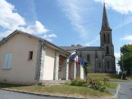
Fraisse is a commune in the Dordogne department in Nouvelle-Aquitaine in southwestern France.
Population
| Historical population | ||
|---|---|---|
| Year | Pop. | ±% |
| 1962 | 190 | — |
| 1968 | 170 | −10.5% |
| 1975 | 140 | −17.6% |
| 1982 | 129 | −7.9% |
| 1990 | 120 | −7.0% |
| 1999 | 157 | +30.8% |
| 2008 | 151 | −3.8% |
See also
References
External links
| Wikimedia Commons has media related to Fraisse. |
This article is issued from
Wikipedia.
The text is licensed under Creative Commons - Attribution - Sharealike.
Additional terms may apply for the media files.