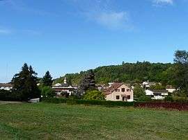
Vergt
| Vergt | ||
|---|---|---|
| Commune | ||
 | ||
| ||
 Vergt Location within Nouvelle-Aquitaine region  Vergt | ||
| Coordinates: 45°01′41″N 0°43′09″E / 45.0281°N 0.7192°ECoordinates: 45°01′41″N 0°43′09″E / 45.0281°N 0.7192°E | ||
| Country | France | |
| Region | Nouvelle-Aquitaine | |
| Department | Dordogne | |
| Arrondissement | Périgueux | |
| Canton | Périgord Central | |
| Intercommunality | Pays Vernois | |
| Government | ||
| • Mayor (2008–2014) | Raymond Cacan | |
| Area1 | 32.52 km2 (12.56 sq mi) | |
| Population (2008)2 | 1,748 | |
| • Density | 54/km2 (140/sq mi) | |
| Time zone | UTC+1 (CET) | |
| • Summer (DST) | UTC+2 (CEST) | |
| INSEE/Postal code | 24571 /24380 | |
| Elevation |
112–246 m (367–807 ft) (avg. 126 m or 413 ft) | |
|
1 French Land Register data, which excludes lakes, ponds, glaciers > 1 km2 (0.386 sq mi or 247 acres) and river estuaries. 2 Population without double counting: residents of multiple communes (e.g., students and military personnel) only counted once. | ||
.svg.png)
Vergt (Occitan: Vern) is a commune in the Dordogne department in Nouvelle-Aquitaine in southwestern France.
Population
| Historical population | ||
|---|---|---|
| Year | Pop. | ±% |
| 1962 | 1,190 | — |
| 1968 | 1,224 | +2.9% |
| 1975 | 1,369 | +11.8% |
| 1982 | 1,419 | +3.7% |
| 1990 | 1,422 | +0.2% |
| 1999 | 1,514 | +6.5% |
| 2008 | 1,748 | +15.5% |
See also
References
| Wikimedia Commons has media related to Vergt. |
| Authority control |
|---|
This article is issued from
Wikipedia.
The text is licensed under Creative Commons - Attribution - Sharealike.
Additional terms may apply for the media files.